Geirangerfjord Guide: UNESCO World Heritage Fjord Complete Guide
Geirangerfjord ranks among Earth’s most spectacular natural landscapes, earning UNESCO World Heritage status in 2005 for its exceptional beauty and pristine fjord environment. This 15-kilometer waterway carved through western Norway’s mountains showcases dramatic waterfalls including the famous Seven Sisters, vertical rock walls rising 1,700 meters above sea level, and historic farms clinging impossibly to cliff faces, creating the archetypal fjord landscape against which all others are measured.
Key Takeaways
- UNESCO Recognition: Geirangerfjord shares World Heritage designation with Nærøyfjord as “West Norwegian Fjords,” inscribed in 2005 for outstanding natural beauty and geological significance representing Earth’s finest fjord landscapes
- Iconic Waterfalls: Seven Sisters waterfall cascades 410 meters down sheer cliffs with the tallest stream’s free fall reaching 250 meters, facing The Suitor waterfall at 275 meters across the fjord in legendary romantic tableau
- Dramatic Proportions: The fjord extends 15 kilometers from Hellesylt to Geiranger village, reaching depths of 260 meters while surrounding mountains tower 1,600-1,700 meters above sea level, creating extraordinary vertical relief
- Historic Cliff Farms: Abandoned mountain farms including Skageflå and Knivsflå perch 250 meters above the fjord, representing centuries of agricultural adaptation to extreme terrain accessible only by rope ladders and steep mountain paths
- Scenic Roads: Eagle Road (Ørnevegen) climbs 620 meters through 11 hairpin bends while County Road 63 connects to the dramatic Trollstigen route, creating Norway’s most spectacular driving experiences
- Panoramic Viewpoints: Flydalsjuvet, Dalsnibba, and Eagle Road Bend offer breathtaking perspectives from elevations reaching 1,500 meters, revealing the fjord’s full length and surrounding mountain landscapes
People Also Ask About Geirangerfjord
How does Geirangerfjord compare to Nærøyfjord?
Geirangerfjord and Nærøyfjord share UNESCO World Heritage designation while offering distinctly different landscapes and visitor experiences. Geirangerfjord extends 15 kilometers with widths ranging from 250 meters to 1.5 kilometers, creating more spacious perspectives than Nærøyfjord’s extreme narrowness at 500 meters. Geirangerfjord showcases more dramatic waterfalls including the famous Seven Sisters and The Suitor, while Nærøyfjord emphasizes pristine preservation with no road access. Geirangerfjord’s surrounding mountains reach 1,600-1,700 meters compared to Nærøyfjord’s 1,400-meter peaks, though both demonstrate exceptional vertical relief. Geirangerfjord attracts larger cruise ships and higher visitor numbers due to excellent road access and developed infrastructure, while Nærøyfjord maintains quieter, more intimate atmospheres. Both fjords represent archetypal examples earning their joint UNESCO recognition, with visitors seeking spectacular waterfalls and accessible viewpoints preferring Geirangerfjord, while those prioritizing pristine wilderness and extreme narrowness favor Nærøyfjord.
What is the legend of the Seven Sisters and The Suitor waterfalls?
Norwegian folklore explains Geirangerfjord’s famous waterfalls through a romantic tale of seven unmarried sisters playfully dancing down the mountainside on the fjord’s north side. A persistent suitor on the opposite south shore repeatedly proposed marriage to all seven sisters but faced rejection each time. Heartbroken by their refusals, the suitor developed a drinking problem to cope with his romantic failure. The waterfalls eternally commemorate this story, with the Seven Sisters continuing their playful dance while The Suitor (Friaren) watches from across the fjord, its distinctive shape resembling a bottle referencing the drinking theme. Some versions suggest the suitor’s inability to reach the sisters despite proximity mirrors the fjord’s width separating them permanently. The legend adds cultural depth to the natural spectacle, connecting visitors with Norwegian storytelling traditions while explaining the waterfalls’ names and spatial relationship. This romantic narrative has inspired artists, photographers, and storytellers for generations, transforming geological features into characters in an eternal drama playing out across the fjord’s waters.
Why are there abandoned farms on Geirangerfjord’s cliffs?
Historic cliff farms including Skageflå and Knivsflå occupy precarious locations 250 meters above Geirangerfjord because limited flat land forced poor peasant families during the 1700s-1800s to exploit every available piece of terrain. The mountainous topography provided almost no valley-bottom farmland, compelling farmers to establish homesteads on narrow cliff ledges and steep slopes where small patches of soil permitted minimal cultivation. These extreme locations offered advantages including excellent goat pasture on mountain slopes, protection from avalanches affecting lower areas, and microclimate benefits from altitude and sun exposure. Farmers accessed these isolated farms through steep mountain paths and rope ladders, carrying all supplies manually since animals and carts couldn’t navigate the terrain. The farms’ abandonment during the 20th century reflects mechanization’s impossibility on such slopes, rural depopulation as younger generations sought easier livelihoods, and modern safety standards making continued habitation impractical. However, these abandoned farms gained new significance as cultural heritage sites demonstrating extraordinary human adaptation, attracting hikers and history enthusiasts while preserving evidence of traditional Norwegian mountain farming practices.
Can you drive to Geirangerfjord year-round?
Road access to Geirangerfjord varies substantially by season and route. The road from Ålesund via Eidsdal and Eagle Road (Ørnevegen) operates year-round, providing reliable winter access though requiring winter tires and chains during snow conditions. The ferry between Hellesylt and Geiranger also runs throughout the year, enabling continuous connection between these fjord villages. However, mountain roads including the route over Grotli from Lom or Stryn close during winter months typically from October through May due to heavy snow accumulation, avalanche danger, and impossible maintenance conditions. County Road 63 connecting to Trollstigen similarly closes seasonally, with opening dates depending on snow clearance progress each spring. Winter driving requires serious preparation including proper tires, emergency supplies, and checking current road conditions before departure. Some visitors prefer winter access via cruise ships operating from Ålesund to Geiranger, avoiding driving challenges while experiencing the fjord’s dramatic winter atmosphere. Summer provides unrestricted access across all routes, though popular roads experience heavy traffic during peak July-August periods.
Extended multi-day tours – 5+ days
Featured Norway Multi-Day Tour Packages
3 days
Norway 3-Day Discovery Tour
- ✓ Comprehensive Norway experience
- ✓ Expert local guides included
- ✓ All accommodation included
- ✓ Transportation provided
5 days
Norway 5-Day Highlights Experience
- ✓ Comprehensive Norway experience
- ✓ Expert local guides included
- ✓ All accommodation included
- ✓ Transportation provided
7 days
Norway 7-Day Cultural Journey
- ✓ Comprehensive Norway experience
- ✓ Expert local guides included
- ✓ All accommodation included
- ✓ Transportation provided
10 days
Norway 10-Day Complete Adventure
- ✓ Comprehensive Norway experience
- ✓ Expert local guides included
- ✓ All accommodation included
- ✓ Transportation provided
Multi-day tour packages powered by TourRadar. Prices and availability subject to change.
Introduction: Norway’s Crown Jewel of Fjord Landscapes
Geirangerfjord cuts through the heart of Møre og Romsdal county in western Norway, creating a 15-kilometer corridor of extraordinary natural beauty that has captivated visitors since the 19th century when European travelers discovered Norway’s dramatic landscapes. This fjord represents the easternmost branch of a larger fjord system extending from the Norwegian Sea through Storfjorden and Sunnylvsfjorden, penetrating deep into mountain regions that reach elevations exceeding 1,800 meters just kilometers from sea level.
The fjord’s UNESCO World Heritage inscription in 2005 acknowledged its status as an archetypal fjord landscape demonstrating exceptional natural beauty and geological significance. The designation paired Geirangerfjord with Nærøyfjord, 120 kilometers to the south, recognizing both fjords as the finest examples of their type globally. UNESCO evaluators emphasized the landscape’s pristine character, spectacular waterfalls, and ongoing geological processes shaping the terrain, noting that Geirangerfjord represents the type locality for fjord landscapes worldwide.
The fjord stretches from Hellesylt village in the west to Geiranger in the east, with the classic ferry route between these communities providing comprehensive viewing of the landscape’s most impressive features. The journey reveals numerous waterfalls cascading from hanging valleys high above the fjord, traditional farms occupying improbable cliff-side locations, and vertical rock walls rising directly from water to cloud-covered peaks. The fjord’s width varies from approximately 250 meters at its narrowest sections to 1.5 kilometers at wider points, while depths reach 260 meters below sea level.
Geiranger village occupies the fjord’s eastern terminus where flat delta land from the Geirangelva River provides rare extensive ground for settlement. This small community of several hundred permanent residents swells with tens of thousands of visitors during summer cruise season, when large ships navigate the fjord daily. The village serves as the primary base for exploring surrounding attractions including famous viewpoints, hiking trails to abandoned farms, and scenic drives through mountain passes.
The surrounding mountains create exceptional vertical relief, with peaks reaching 1,600-1,700 meters above sea level within 2-3 kilometers of the fjord. This compressed elevation change creates dramatic visual impact while generating diverse ecosystems spanning from maritime fjord environments to alpine tundra within short horizontal distances. The highest nearby peak, Torvløysa at 1,850 meters, towers north of Geiranger, visible from the village on clear days.
Geological Formation and Landscape Evolution
Geirangerfjord’s creation spans millions of years through repeated glacial advances carving progressively deeper into pre-existing river valleys. During successive ice ages, glaciers thousands of meters thick covered Scandinavia, flowing from high plateau regions toward the coast following valleys determined by underlying bedrock structure. These massive ice rivers possessed enormous erosive power derived from their weight, movement, embedded rock particles, and subglacial meltwater streams.
The valley that became Geirangerfjord channeled significant ice flow because surrounding topography funneled glaciers toward this corridor. The concentration of ice movement increased erosion rates, enabling glaciers to carve deeper into bedrock than less constrained flows achieved. The underlying geology also influenced fjord formation, as harder crystalline rocks resisted erosion while softer zones eroded more rapidly, creating the irregular profile visible today with deep basins alternating with shallower threshold areas.
Glacial erosion occurred through several simultaneous mechanisms. The glacier’s immense weight created tremendous pressure at its base, enabling it to grind through solid rock. Ice moved continuously downslope, carrying rock fragments that abraded valley floors and walls like geological sandpaper. Meltwater flowing beneath glaciers exploited cracks and weaknesses in bedrock, loosening material subsequently removed by ice movement. Freeze-thaw cycles in rocks exposed at the surface further fractured stone, facilitating glacial removal of loosened material.
The fjord’s characteristic U-shaped cross-section demonstrates glacial carving’s distinctive signature contrasting sharply with V-shaped river valleys. Glaciers eroded valley floors and lower walls more intensively than upper walls due to ice concentration and pressure distribution, creating flat bottoms and steep sides. This profile remains clearly visible where rock walls descend almost vertically to waterline before continuing at similar angles beneath the surface to the fjord bottom at 260 meters depth.
When the last ice age ended approximately 10,000 years ago, retreating glaciers left behind deeply carved valleys extending far below contemporary sea level. Rising ocean levels following ice sheet melting flooded these valleys rapidly in geological terms, transforming glacial valleys into seawater-filled fjords. The speed of this transition preserved glacial landscape features with minimal modification, creating the dramatic scenery visible today.
Hanging valleys high above Geirangerfjord’s current water level demonstrate differential erosion between the main glacier and smaller tributary ice flows. Tributary glaciers lacked sufficient mass and erosive power to carve as deeply as the primary ice stream, leaving their valleys suspended high above the main fjord bottom when ice retreated. Waterfalls now plunge from these hanging valleys, creating spectacular cascades including the Seven Sisters and other famous falls characterizing the fjord landscape.
Ongoing geological processes continue shaping Geirangerfjord’s landscape. Rockfall and landslides modify cliff faces, with some slopes showing active instability requiring monitoring. The Åknes mountain slope contains approximately 54 million cubic meters of unstable rock moving at 8 centimeters annually, posing potential tsunami risks if sudden collapse occurs. This instability resulted from glacial oversteepening creating slopes exceeding long-term stability angles, though actual catastrophic failure remains uncertain.
Submarine features beneath Geirangerfjord’s surface reveal additional geological complexity. Terminal moraines at 140 meters depth mark former glacier positions, while thick glaciomarine sediment layers up to 350 meters document post-glacial sedimentation. Bedrock thresholds create underwater barriers separating deeper basins, influencing water circulation patterns and marine ecosystem distributions. These submarine features demonstrate that the visible landscape represents only part of the geological story, with equally dramatic formations hidden beneath dark waters.
The Seven Sisters and Famous Waterfalls
Seven Sisters waterfall (De Syv Søstrene) cascades down Geirangerfjord’s north side approximately 7 kilometers west of Geiranger village, creating the fjord’s most photographed natural feature. The waterfall consists of seven distinct streams plunging from elevations around 410 meters down sheer rock faces directly into the fjord. The tallest stream achieves a free fall of 250 meters, creating spectacular visual impact as water appears to leap from the mountain into empty space before crashing into the fjord below.
The seven streams originate from snowmelt and two major parent flows fed by water sources at approximately 1,400 meters elevation. Flow volumes vary dramatically by season, with spring snowmelt from May through July producing maximum flow creating thunderous cascades visible and audible from great distances. During this peak period, all seven streams flow strongly, creating the classic appearance that inspired the waterfall’s name. Late summer and autumn see reduced flows as snow reserves deplete, with some streams reducing to thin ribbons or disappearing entirely until the following spring.
The waterfall’s positioning on the north-facing slope ensures it receives minimal direct sunlight during much of the year, keeping the drainage basin cooler and extending the snowmelt season compared to south-facing slopes. This orientation contributes to more sustained flows through summer months, though even Seven Sisters shows substantial flow reduction by September. Photographers seeking maximum flow drama should visit during May-June when snowmelt peaks, while those preferring quieter contemplation may appreciate late summer’s reduced but still impressive displays.
The Suitor waterfall (Friaren) plunges 275 meters down the south side of Geirangerfjord directly opposite Seven Sisters, creating the legendary romantic tableau central to fjord folklore. This single powerful cascade shows distinctive characteristics including a dry section in its middle course that resembles a bottle when viewed from the water, supporting the legend that the rejected suitor developed drinking problems. The waterfall maintains more consistent flow than Seven Sisters throughout the season, fed by different drainage patterns and water sources.
Bridal Veil waterfall (Brudesløret) contributes additional spectacle to Geirangerfjord’s waterfall collection, though distinct from The Suitor despite occasional name confusion. This elegant cascade features thin, flowing water creating a translucent veil-like appearance, particularly impressive when backlit by sun. The delicate appearance contrasts with Seven Sisters’ powerful multiple streams and The Suitor’s single thunderous plunge, demonstrating the variety of waterfall types present along relatively short fjord lengths.
Numerous smaller waterfalls and seasonal cascades supplement the famous falls, with water draping cliffs throughout Geirangerfjord’s length. Gjerdefossen, visible near Eagle Road early in the typical cruise route, drops approximately 200 meters in multiple tiers. Though less famous than Seven Sisters, Gjerdefossen demonstrates impressive scale and provides appetizer views for the main attractions ahead. Other unnamed waterfalls appear seasonally following heavy rainfall or during peak snowmelt, creating temporary displays lasting days or weeks before disappearing as water sources deplete.
Viewing waterfall displays from boats provides optimal perspectives, as water-level vantage points reveal full heights impossible to appreciate from elevated viewpoints. Cruise vessels and ferries deliberately slow or pause near Seven Sisters, enabling passengers to experience the falls’ power and photograph from optimal positions. The acoustic properties of water crashing from tremendous heights create substantial noise audible across the fjord width, adding dramatic sound to visual spectacle.
Spray from major waterfalls during high flow periods can drift across substantial portions of the fjord width, potentially soaking outdoor deck passengers on passing vessels. This mist creates rainbow effects when sunlight penetrates from appropriate angles, adding ephemeral beauty to permanent landscape features. Some visitors deliberately position themselves to experience the spray, accepting temporary discomfort for intimate waterfall encounters impossible from dry viewpoints.
Historic Mountain Farms and Cultural Heritage
Skageflå farm perches on a narrow cliff ledge 250 meters above Geirangerfjord’s north shore, representing one of Norway’s most dramatically situated agricultural settlements. Established during the 18th century when population pressure forced poor families to exploit every viable piece of terrain, this farm complex consists of multiple timber buildings occupying a small relatively flat area surrounded by vertical cliffs. Access required climbing steep mountain paths and rope ladders, making all supply transport dependent on human portage since pack animals couldn’t navigate the terrain.
The farm’s extreme location provided advantages offsetting its challenges. The elevated position offered excellent summer pasture for goats on surrounding mountain slopes, enabling families to maintain substantial herds despite limited valley access. The altitude and south-facing exposure created microclimate benefits including earlier snowmelt and warmer summer temperatures than valley bottoms. Protection from avalanches threatening lower elevations provided safety during winter months when snow accumulation created dangerous conditions on steeper slopes above and below the farm.
Farmers cultivated small hay meadows on any available soil, manually harvesting grass using scythes carried up mountain paths. The harvested hay required careful storage in specialized sheds (låve) built on stilts to prevent moisture damage while enabling air circulation. These distinctive storage structures remain visible architectural features at abandoned farm sites, their practical design demonstrating adaptation to challenging environmental conditions.
Knivsflå farm occupies similar cliff-side terrain on Geirangerfjord’s south shore directly across from Skageflå, founded during the 17th century under comparable circumstances driving settlement of marginal lands. This farm complex demonstrates slightly different architectural arrangements while facing identical challenges of access, supply transport, and agricultural production on impossibly steep terrain. The positioning of both farms on opposite fjord shores creates visual symmetry visible from boats, with each farm’s red-painted buildings standing out dramatically against gray rock backgrounds.
Homlongsætra represents another historic mountain farm accessible via hiking trails from Skageflå, positioned even higher on mountain slopes where summer pasture quality justified seasonal occupation. Farmers moved livestock to these high-elevation farms (sæter) during summer months, taking advantage of mountain grazing while preserving valley meadows for hay production. This transhumant system maximized limited agricultural resources through seasonal mobility, though requiring tremendous labor maintaining multiple farm locations.
Farm abandonment occurred during the 20th century as mechanized agriculture proved impossible on vertical terrain and younger generations sought easier livelihoods in towns and cities. The farms’ isolation from schools, medical services, and social connections became increasingly unacceptable as modern expectations for lifestyle quality evolved. However, these abandoned complexes gained new significance as cultural heritage sites demonstrating extraordinary human adaptation and preserving evidence of traditional practices.
Contemporary visitors access Skageflå via boat from Geiranger followed by steep hiking trails secured with ropes in dangerous sections. The approximately 6-kilometer round-trip hike gains substantial elevation while offering spectacular fjord views and intimate encounters with historic farm buildings. Some structures maintain weathertight conditions enabling use as emergency shelters, while others show advancing deterioration requiring preservation efforts. The trail’s popularity creates both opportunities for heritage appreciation and challenges managing visitor impacts on fragile historic structures.
Interpretive programs explain farm life’s realities including daily water carrying from distant springs, manual transportation of all supplies, isolation during winter months when weather prevented travel, and the intensive labor required for subsistence agriculture. These programs help visitors understand that romantic cliff-side views represented extremely difficult living conditions for families who occupied these farms, balancing appreciation for human resilience with recognition of hardship driving eventual abandonment.
Spectacular Scenic Routes and Viewpoints
Eagle Road (Ørnevegen) climbs 620 meters from Geiranger village to Eirik Pass through 11 dramatic hairpin bends carved into the mountainside, creating Norway’s most famous serpentine mountain road. Completed in 1955, this engineering achievement transformed access to Geiranger while creating spectacular driving and cycling experiences. The road’s name derives from its high elevation and the eagles frequently spotted soaring along surrounding cliffs, though the dramatic bends suggest an eagle’s swooping flight pattern.
Eagle Road Bend (Ørnesvingen) provides the route’s most photographed viewpoint at approximately 620 meters elevation, offering panoramic vistas across Geirangerfjord’s full length toward distant mountains. The viewpoint platform accommodates dozens of visitors simultaneously while providing unobstructed photography toward the fjord below. From this elevation, the fjord appears as a narrow blue ribbon winding through gray mountains, with Geiranger village visible as a tiny settlement at the valley bottom. The Seven Sisters waterfall becomes visible across the fjord, though distance reduces it to thin white lines against dark rock.
The road surface maintains excellent condition enabling comfortable driving, though the tight switchbacks require careful navigation, particularly for larger vehicles and vehicles with trailers. Summer traffic can create congestion during peak hours when cruise ships disgorge thousands of passengers pursuing the same scenic routes. Early morning or evening driving avoids the worst crowding while often providing better lighting conditions for photography. Winter closure typically extends from October through May depending on snow conditions and avalanche danger.
Cyclists seeking extreme challenges tackle Eagle Road as one of Norway’s classic mountain climbs, though the continuous steep gradients and tight switchbacks demand excellent fitness and bike-handling skills. The 620-meter elevation gain over approximately 6 kilometers creates average gradients around 10% with steeper sections approaching 15%. Support vehicles prove essential for transporting luggage and providing safety backup, as the exposed mountainside offers limited facilities.
County Road 63 connects Geiranger with other regions through mountain passes including the famous Trollstigen (Troll’s Ladder) route to the north. This designated Norwegian Scenic Route provides continuous spectacular views across varied landscapes including mountains, valleys, and waterfalls. The combination of Eagle Road and Trollstigen creates one of Norway’s classic driving circuits, though requiring full days to complete while allowing time for stops at viewpoints and attractions.
Flydalsjuvet viewpoint sits approximately 4 kilometers from Geiranger center at moderate elevation, offering relatively easy access to stunning fjord perspectives. Two large platforms connected by walkways enable visitors to photograph the fjord from slightly different angles while accommodating substantial crowds. The viewpoint’s accessibility makes it Geiranger’s most visited lookout, though this popularity creates parking challenges during peak hours. The classic photograph from Flydalsjuvet shows the fjord winding westward with mountains rising on both sides, creating idealized fjord landscape compositions.
Dalsnibba mountain reaches 1,476 meters elevation with road access via a toll road branching from County Road 63. The mountain summit provides Geirangerfjord region’s highest accessible viewpoint, revealing landscapes extending to the Norwegian Sea on clear days. The Dalsnibba Skywalk consists of stone steps leading to a wooden viewing platform extending over a precipice, creating dramatic viewing experiences for visitors comfortable with heights. The platform’s transparent sections enable looking directly down the cliff face, though solid portions accommodate those preferring opaque surfaces beneath their feet.
The summit area includes the Nibbevegen viewpoint and café facilities, though weather conditions at this elevation prove significantly more challenging than valley locations. Wind, cloud, and precipitation occur frequently even when Geiranger enjoys pleasant conditions, requiring visitors to bring warm clothing regardless of lowland weather. However, achieving the summit during clear conditions provides unmatched perspectives across western Norway’s mountain and fjord landscapes, justifying the toll road fee and potential weather disappointments.
Fjord Cruises and Ferry Routes
The classic Hellesylt-Geiranger ferry covers 15 kilometers during approximately 90-minute crossings, providing comprehensive viewing of Geirangerfjord’s most impressive features. This car ferry operates year-round though with reduced frequency during winter months, enabling both vehicle transport and passenger sightseeing. The route passes Seven Sisters waterfall at close range, providing optimal photography angles and opportunities to experience the falls’ power through sound and occasionally spray when flow rates run high.
Multiple deck levels on ferry vessels enable passengers to choose viewing heights and protection levels appropriate to weather conditions. Upper outdoor decks provide unobstructed photography but expose passengers to wind, cold, and potential precipitation. Lower decks offer protected viewing through large windows, sacrificing some photographic quality for comfort. Many passengers alternate between indoor and outdoor positions during crossings, warming inside between outdoor photography sessions.
Ferry commentary in Norwegian and English explains landscape features, waterfall names, farm histories, and geological processes, transforming simple transportation into educational experiences. Crew members familiar with the route for years or decades share knowledge and stories unavailable in guidebooks, adding cultural context to natural spectacle. However, commentary quality varies between vessels and crew members, with some providing minimal information while others deliver detailed narratives.
Dedicated sightseeing cruises operate from both Geiranger and Hellesylt during summer months, offering longer durations and enhanced commentary compared to working ferries. These cruises may include closer approaches to waterfalls, slower speeds enabling better photography, and more detailed explanation of features. Some premium services provide onboard refreshments, multilingual audio guides, and expert naturalist guides. However, these enhanced services come with substantially higher prices than standard ferry crossings providing similar viewing opportunities.
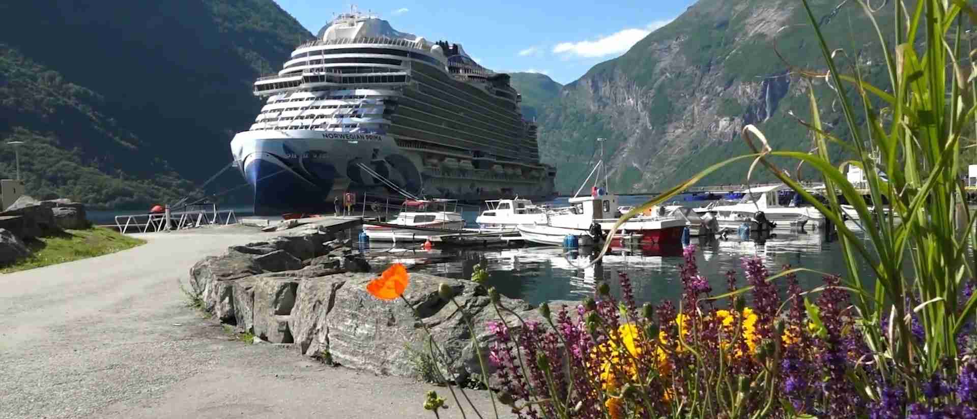
Large ocean cruise ships enter Geirangerfjord regularly during summer season, bringing thousands of passengers to Geiranger in single visits. These massive vessels navigate the fjord’s narrow confines with minimal clearance, creating impressive spectacles as they maneuver toward the village. However, their size limits mobility, preventing close approaches to features that smaller ferries and tour boats access easily. Environmental concerns regarding cruise ship emissions and impacts led to regulations requiring zero-emission operations, with deadlines phased based on vessel size.
Kayaking tours provide intimate fjord experiences impossible from larger vessels, enabling silent paddling close to shorelines, waterfalls, and seal haul-outs. The human-powered movement creates minimal environmental impact while offering unique perspectives at water level. However, kayaking demands physical capability and accepts weather exposure, as paddlers face wind, waves, and potential precipitation with less protection than boat passengers enjoy. Guided tours provide necessary safety oversight and local knowledge, though limiting flexibility compared to independent exploration.
RIB (Rigid Inflatable Boat) tours offer high-speed adventures combining close waterfall approaches with thrilling rides across open water. These tours appeal to visitors seeking excitement beyond contemplative sightseeing, though the focus on speed reduces time for photography and detailed observation. The open boat design guarantees weather exposure, requiring waterproof clothing and accepting potential discomfort in exchange for adrenaline and different perspectives.
Wildlife and Natural Ecosystems
Geirangerfjord’s marine environment supports diverse fish populations including cod, haddock, saithe, and various flatfish species. These fish populations sustain both commercial fishing and recreational angling, though fishing pressure remains moderate compared to more accessible coastal waters. Salmon and sea trout migrate through the fjord to spawn in tributary rivers including the protected Geirangelva, supporting traditional fishing practices and modern sport fishing. The fjord’s depth provides habitat for deep-water species rarely encountered in shallower waters, with some species typically found in much deeper offshore environments occurring here at unusual depths.
Harbor seal colonies maintain established populations along Geirangerfjord’s shores, with 15-30 individuals using protected haul-out sites on rocky shorelines. These seals show moderate tolerance of boat traffic, often remaining on rocks as vessels pass at respectful distances though sliding into water when boats approach too closely. Seal viewing proves most reliable during low tide when more rocks emerge above water providing preferred haul-out locations. The seals feed primarily on fish within the fjord, diving to substantial depths pursuing prey.
Harbor porpoises frequent Geirangerfjord waters, particularly during periods when fish migrations bring abundant prey into the fjord system. These small cetaceans surface briefly to breathe before diving again, making observations fleeting and unpredictable. White-beaked dolphins, sperm whales, minke whales, and killer whales visit occasionally when pursuing fish schools or during broader migration patterns, though sightings remain uncommon and unpredictable compared to seal observations.
Terrestrial wildlife adapts to the steep terrain and vertical habitat zonation characteristic of fjord environments. Red deer populations graze in valley bottoms and forested slopes where terrain permits, representing the region’s largest wild land mammals. Mountain goats descended from domestic stock inhabit cliff faces too steep for other grazers, demonstrating remarkable climbing abilities on seemingly vertical terrain. These feral populations maintain themselves without human intervention, providing occasional viewing opportunities for observers patient enough to scan cliff faces with binoculars.
Bird populations reflect both marine and terrestrial influences across elevation zones. Seabirds including various gull species, cormorants, and black guillemots patrol fjord waters seeking fish. White-tailed sea eagles, Europe’s largest eagle species, nest in tall trees along the fjord and hunt fish from the water surface using spectacular dives. The dipper, Norway’s national bird, achieves its highest population densities in rivers entering Geirangerfjord, feeding on aquatic insects in fast-flowing streams. Alpine and subalpine zones host specialized mountain bird species including ptarmigan and snow bunting adapted to harsh high-elevation conditions.
Vegetation patterns demonstrate clear zonation by elevation and exposure. Mixed deciduous-coniferous forests cover lower slopes where maritime influences moderate climate, dominated by birch, rowan, and various conifer species. Moving upward, pure coniferous stands transition to birch-dominated subalpine forests before vegetation reaches the tree line around 1,000-1,200 meters elevation. Above this boundary, alpine vegetation including dwarf shrubs, grasses, mosses, and specialized flowering plants creates colorful summer displays before transitioning to bare rock and permanent snowfields at highest elevations.
The compressed elevation change from sea level to alpine zones within 2-3 kilometers horizontal distance creates exceptional biodiversity, as multiple climate zones exist within small geographic areas. This vertical stratification enables observing ecosystem transitions impossible across such short distances in flatter regions, though accessing different zones requires significant climbing or driving mountain roads connecting different elevations.
Seasonal Variations and Visiting Conditions
Summer months from June through August provide warmest temperatures, longest daylight hours, and most reliable weather for Geirangerfjord visits. Average temperatures reach 15-20 degrees Celsius at fjord level, creating comfortable conditions for outdoor activities though requiring layers for variable conditions. Waterfall flows peak during early summer as mountain snowmelt achieves maximum rates, creating spectacular cascades though sometimes obscuring rock walls behind sheets of falling water. Vegetation displays full green coverage creating vibrant color contrasts against gray rock and blue water.
Cruise ship arrivals during summer bring thousands of daily visitors to Geiranger, creating substantial crowding at popular viewpoints and on ferry crossings. The village’s infrastructure strains under visitor loads far exceeding permanent population, though commercial services expand to meet summer demand. Advance booking becomes essential for accommodations, ferry crossings at preferred times, and popular tours. However, the guaranteed access to all roads, reliable weather, and full service availability justify accepting crowds for many visitors.
Spring arrives gradually from April through May as temperatures increase and snow melts from lower elevations upward. Waterfalls achieve tremendous flows as accumulated winter snow releases meltwater simultaneously across large areas, creating thunderous cascades potentially surpassing summer volumes. However, mountain roads remain closed until snow clearance completes, typically during May though varying by winter severity and spring weather patterns. Spring weather proves highly variable, with warm sunny periods alternating with cold snaps bringing fresh snow to mountains.
Visitor numbers during spring remain substantially lower than summer peaks, enabling more peaceful experiences at viewpoints and during ferry crossings. This shoulder season provides excellent value for travelers prioritizing landscape appreciation over guaranteed comfortable weather and full access to all routes. The landscape’s raw power shows most dramatically during spring conditions, as high water flows and dynamic weather create more active environments than summer’s relative calm.
Autumn transforms vegetation colors during September and October as deciduous trees turn golden yellow and orange. These warm tones contrast beautifully with dark evergreen forests and gray rock, creating especially photogenic conditions appealing to photographers. Temperatures cool substantially though remaining comfortable with appropriate clothing. Waterfall flows decrease compared to spring and early summer levels but maintain sufficient volume for impressive displays through most of autumn.
Early autumn weather proves unpredictable, with stable high-pressure systems creating beautiful conditions alternating with Atlantic storms bringing wind, rain, and dramatic cloud formations. This variability requires flexible scheduling and weather monitoring, though potential rewards include stunning lighting conditions and dynamic atmospheres impossible during calmer periods. Mountain roads begin closing during October as first major snowfalls arrive, with exact closure dates varying by conditions.
Winter transforms Geirangerfjord into dramatically different landscape from November through March. Snow covers mountains to relatively low elevations, creating stark black-and-white compositions of rock and snow. Many waterfalls freeze partially or completely, forming ice sculptures ranging from delicate icicle curtains to massive frozen cascades. Reduced daylight limits activity hours, with December bringing just 5-6 hours of daylight though long twilight periods extend usable light.
Winter access relies primarily on the Ålesund road and ferry routes, as mountain passes close under snow. Cruise ships operate limited winter schedules from Ålesund, providing seasonal visitors opportunities to experience the fjord’s winter majesty. The dramatic reduction in visitor numbers creates opportunities for solitude and contemplation impossible during busy summer months. However, weather conditions prove substantially more challenging, with temperatures regularly below freezing, strong winds, and frequent precipitation as snow or freezing rain.
Photography Techniques and Optimal Conditions
Geirangerfjord’s dramatic vertical landscape creates exceptional photography opportunities while presenting technical challenges requiring specific approaches for optimal results. The extreme elevation differences from sea level to mountain peaks enable compositions showing multiple landscape layers in single frames, though achieving proper exposure across such dynamic ranges challenges even experienced photographers’ skills and equipment capabilities.
Wide-angle lenses in the 14-24mm range (full-frame equivalent) prove essential for compositions showing full height from water surface to mountain peaks while including foreground fjord waters. These focal lengths enable dramatic perspective emphasizing the landscape’s vertical proportions, though wide-angle distortion requires careful composition maintaining vertical lines and including scale references helping viewers comprehend massive dimensions. Boats, buildings, or waterfalls provide effective scale indicators translating abstract landscapes into comprehensible dimensions.
Telephoto lenses from 70-200mm excel for isolating waterfalls, compressing distant landscape layers, and photographing wildlife at respectful distances. The perspective compression created by long focal lengths emphasizes layered landscapes, stacking successive ridges and valleys demonstrating depth. Seven Sisters waterfall photographs particularly well with moderate telephoto focal lengths enabling tight compositions showing waterfall details while maintaining enough context revealing the cliff face from which water plunges.
Lighting challenges arise from deep valleys and varying slope aspects creating dramatic shadows contrasting with brightly illuminated peaks. Midday sun illuminates mountain peaks while leaving lower walls and water in deep shadow, often exceeding camera sensors’ dynamic range capabilities. Graduated neutral density filters help balance exposure between bright sky and darker foreground, though digital blending from multiple exposures provides greater control and flexibility in challenging lighting situations.
Overcast conditions frequently produce superior results compared to bright sun in Geirangerfjord’s confined environment. Diffused light reduces contrast, enabling balanced exposures showing detail throughout the tonal range from darkest shadows to brightest highlights. Waterfalls photograph particularly well under overcast skies, with soft light preventing blown highlights in white water while maintaining detail in surrounding rock. The moody atmosphere many associate with Norwegian fjords typically occurs under these cloud-covered conditions rather than brilliant sunshine.
Early morning and evening golden hours provide directional light revealing texture in rock walls while creating warm color temperatures contrasting with blue-tinted shadows. However, the deep valley configuration means direct sunlight may reach water level only during midday hours when sun angles permit penetration between vertical walls. Understanding sun paths and timing based on season enables positioning for optimal light when it occurs, though this may require flexibility in shooting schedules.
Boat-based photography from ferries and cruise vessels presents challenges including movement, changing positions, and crowds competing for deck space. Fast shutter speeds exceeding 1/500 second minimize blur from boat movement and enable sharp images despite unstable platforms. Image stabilization helps but cannot completely eliminate movement effects, particularly when shooting from upper decks experiencing greater motion than lower levels. Timing shots between wave impacts reduces vibration, though requires patience and multiple attempts for critical compositions.
Composition approaches specific to vertical landscapes include emphasizing leading lines created by rock walls, waterfalls, or boat wakes guiding viewers’ eyes through frame depth. Including foreground elements like boat railings, other passengers, or water patterns establishes depth preventing flat-appearing images failing to convey three-dimensional landscape structure. Vertical frame orientations often work better than horizontal formats for fjord photography, matching landscape proportions and emphasizing dramatic height differences defining these environments.
Frequently Asked Questions
How long should I spend in Geirangerfjord?
Minimum recommended time for Geirangerfjord visits ranges from half-day ferry crossings to multi-day stays depending on interests and available time. A basic ferry crossing between Hellesylt and Geiranger requires 90 minutes, providing essential waterfall viewing and fjord perspectives suitable for travelers with limited time or pursuing broader Norway itineraries. However, this rushed approach misses viewpoint visits, hiking opportunities, and deeper appreciation of the landscape’s complexity. Full-day visits enable ferry crossings combined with drives to Eagle Road viewpoint, Flydalsjuvet, or other accessible attractions, providing more comprehensive experiences. Two to three-day stays permit hiking to abandoned farms, visiting Dalsnibba summit, exploring multiple viewpoints, and experiencing the fjord during different lighting and weather conditions. Extended visits reward travelers with opportunities for weather-dependent activities, as inevitable poor-weather periods become less critical when multiple days allow waiting for optimal conditions.
Are there hiking trails accessible without boat transport?
Multiple hiking trails accessible directly from Geiranger village provide options for visitors without boats or preferring land-based exploration. The trail to Storseterfossen waterfall enables walking behind the cascade, reaching the falls within 1-2 hours from village center. Vesteråsfjellet hiking routes climb mountains behind Geiranger, offering progressively better viewpoints as elevation increases though requiring strong fitness for serious ascents. The trail toward Homlong and connections to abandoned farms start from accessible trailheads, though reaching the most dramatic cliff farms typically requires boat transport to optimal starting points. Norwegian Fjord Centre in Geiranger provides trail information, maps, and current condition updates. Most trails show clear marking with Norwegian hiking association standards, though alpine sections require navigation skills and appropriate equipment. Trail difficulty varies from easy valley walks suitable for most fitness levels to challenging mountain ascents demanding experience and proper preparation.
What wildlife viewing opportunities exist beyond marine mammals?
Terrestrial wildlife viewing opportunities focus primarily on bird species and occasional mammal sightings along fjord shores and mountain slopes. White-tailed sea eagles patrol the fjord regularly, their massive wingspans unmistakable when soaring along cliffs or diving for fish. Dipper populations reach high densities in rivers entering the fjord, providing reliable sightings for observers watching stream sections. Forest birds including various woodpecker species, thrushes, and warblers inhabit wooded slopes, though sightings require patient observation and some identification skills. Mountain goats descended from domestic stock inhabit vertical cliffs, visible to observers scanning rock faces with binoculars though sightings remain unpredictable. Red deer graze in valley bottoms and forested areas, most visible during early morning and evening hours when they feed in open areas. Alpine zones host specialized species including ptarmigan, though accessing these elevations requires serious hiking or driving mountain roads. Weather conditions significantly impact wildlife activity and visibility, with clear calm days generally providing better viewing opportunities than stormy periods.
Can I visit Geirangerfjord’s abandoned farms independently?
Independent visits to abandoned cliff farms including Skageflå require boat transport from Geiranger to trailhead locations followed by challenging hikes up steep mountain paths. Boat services to Skageflå operate during summer months with advance booking required, as limited capacity creates demand exceeding supply during peak periods. The approximately 6-kilometer round-trip hike gains substantial elevation while traversing exposed sections secured with fixed ropes, requiring reasonable fitness and comfort with heights. Trail conditions vary by season and recent weather, with spring snowmelt and autumn rains creating muddy, slippery sections demanding careful footing. Visitors should bring appropriate hiking boots, weather protection, food, and water, as no facilities exist at abandoned farm sites. The farms themselves remain fragile historic structures where visitors must respect preservation efforts by avoiding climbing on buildings or removing artifacts. Some farm buildings offer emergency shelter though regular habitation ceased decades ago. Independent visits require self-sufficiency and basic navigation skills, as trails may show limited marking in some sections and weather changes rapidly in mountain environments.
What makes Geirangerfjord suitable for photography compared to other fjords?
Geirangerfjord offers exceptional photography opportunities combining dramatic waterfalls, accessible viewpoints at varied elevations, relatively compact dimensions enabling comprehensive coverage, and excellent infrastructure supporting photography activities. The concentration of famous waterfalls including Seven Sisters provides instantly recognizable subjects appealing to photographers seeking iconic Norwegian imagery. Multiple viewpoints at elevations from sea level to 1,500 meters enable varied perspectives showing the fjord from dramatically different angles, creating composition diversity impossible from single viewing positions. The fjord’s 15-kilometer length permits covering most major features within single days, unlike longer fjords requiring multi-day commitments for comprehensive photography. Ferry routes provide moving platforms accessing optimal waterfall viewing positions while roads reach elevated viewpoints offering panoramic compositions. The vertical relief compresses multiple landscape zones into small areas, enabling photographs showing fjord, forest, alpine, and snow zones in single frames. However, the same accessibility attracting photographers creates crowds at popular locations during peak season, requiring early morning or evening visits for solitary compositions. Weather variability common to all Norwegian fjords demands flexibility and patience, as conditions change rapidly and optimal lighting occurs unpredictably.
How does cruise ship traffic affect the fjord experience?
Large cruise ships entering Geirangerfjord during summer season bring thousands of daily visitors creating substantial impacts on both infrastructure and visitor experiences. The massive vessels dominate the fjord visually when present, creating impressive spectacles as they navigate narrow waters though potentially diminishing wilderness feelings some visitors seek. Shore excursion buses from cruise ships create traffic congestion on narrow mountain roads, particularly Eagle Road where passing large vehicles in opposite directions proves challenging. Popular viewpoints experience severe crowding when multiple ships disgorge passengers simultaneously, making photography difficult and contemplative appreciation nearly impossible. However, cruise schedules follow predictable patterns enabling independent travelers to time activities avoiding peak crowding periods. Early morning and evening hours typically show minimal cruise impact, as shore excursions concentrate during midday periods. Environmental regulations requiring zero-emission cruise operations address air quality and climate concerns, though visual impacts and crowding persist. Some travelers deliberately avoid Geirangerfjord during peak cruise season, visiting during shoulder periods when fewer ships operate though weather proves less reliable and some services reduce operations.
Are there accommodations options beyond Geiranger village?
Accommodation options concentrate primarily in Geiranger village though alternatives exist in nearby communities and isolated mountain locations. Hellesylt at the fjord’s western end offers hotels and guesthouses providing quieter alternatives to busy Geiranger, though with fewer dining and activity options. Mountain hotels and farms scattered through surrounding valleys provide remote accommodations appealing to visitors seeking solitude, though requiring vehicles for access and accepting limited amenities. Camping facilities near Geiranger enable budget accommodation with basic facilities, though summer demand creates crowding at established campgrounds. Some visitors base in Ålesund, approximately 100 kilometers from Geiranger, accessing the fjord via day trips while enjoying larger town amenities and avoiding accommodation scarcity during peak periods. Wild camping remains legal in Norway under specific conditions, enabling self-sufficient visitors to camp in undeveloped areas though requiring appropriate equipment and environmental awareness. Advance booking proves essential during summer months regardless of accommodation type, as limited capacity fills quickly during peak season. Shoulder season visits show greater availability and lower prices, though some facilities close outside summer operating periods.
What are the best months for reduced crowds while maintaining good weather?
Late May through mid-June and September provide optimal balances between reduced crowds and reasonable weather probability, though without summer’s guaranteed conditions. Late spring shows increasing temperatures, opening mountain roads, and spectacular waterfall flows from snowmelt while cruise season remains limited. However, weather proves highly variable with cold periods possible and some facilities maintaining limited operations before full summer schedules begin. September delivers autumn colors, comfortable temperatures, and substantially reduced visitor numbers as cruise season winds down, though approaching autumn storms increase precipitation probability. These shoulder periods sacrifice summer’s reliable conditions and full service availability for more peaceful experiences at viewpoints, easier accommodation booking, and lower prices. Visitors during these periods should maintain schedule flexibility, bring comprehensive weather protection, verify current road conditions before mountain drives, and accept that some services may operate limited hours or close entirely. The trade-offs appeal to travelers prioritizing solitude and authentic experiences over convenience and guaranteed access.
Can I kayak Geirangerfjord independently or must I join guided tours?
Independent kayaking on Geirangerfjord requires experience, appropriate equipment, and understanding of fjord-specific challenges including wind patterns, boat traffic, and limited landing opportunities along vertical shores. Several kayak rental operations in Geiranger provide equipment to experienced paddlers comfortable with self-guided adventures, though requiring demonstration of basic skills and acceptance of responsibility for safety. Independent kayakers must monitor weather forecasts closely, as conditions change rapidly and wind funneling through the fjord creates challenging paddling situations. Landing opportunities prove limited along most shorelines where vertical cliffs descend directly into deep water, requiring careful route planning identifying viable beaches and rest points. Large ferry and cruise ship traffic creates substantial wakes potentially capsizing inexperienced paddlers, demanding awareness and ability to handle boat wakes safely. Guided tours provide necessary safety oversight for less experienced paddlers while offering local knowledge about optimal routes, wildlife viewing locations, and hazards. These tours typically accommodate varying skill levels though requiring basic paddling ability and reasonable fitness. Multi-day expeditions enable exploring larger distances while camping at designated sites, though demanding comprehensive wilderness skills and complete self-sufficiency.
How accessible is Geirangerfjord for visitors with mobility limitations?
Accessibility for visitors with mobility limitations varies substantially by specific attractions and transportation methods. The Hellesylt-Geiranger ferry provides wheelchair access via ramps, enabling mobility-impaired visitors to experience the essential fjord cruise viewing waterfalls and landscapes. However, outdoor deck access may prove challenging depending on vessel configuration and weather conditions creating slippery surfaces. Major viewpoints including Flydalsjuvet offer wheelchair-accessible platforms though parking areas may involve uneven surfaces requiring assistance. Dalsnibba summit road provides vehicle access to high elevations, though the Skywalk viewing platform involves steps potentially limiting wheelchair users. Eagle Road Bend viewpoint accommodates wheelchairs though steep parking area gradients may require assistance. Hiking trails to abandoned farms and mountain routes prove generally inaccessible for wheelchair users or visitors with significant mobility limitations, as steep grades, rough surfaces, and fixed rope sections require full mobility. Geiranger village maintains relatively flat terrain along waterfront areas, though many buildings predate accessibility requirements. Visitors should contact specific accommodations and tour operators in advance verifying accessibility features rather than assuming standard accommodations, as Norway’s rugged terrain creates inherent accessibility challenges even with modern facilities.