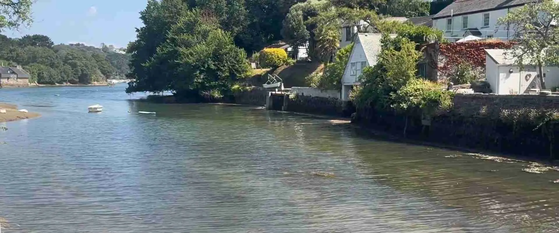
Earthworks of the Estuary: Iron Age Promontory Forts and Hydraulic Ingress at Tremough and Helford in Cornwall
The Helford River and the Fal estuary represent two of the most strategically complex tidal systems on Britain’s Atlantic coast. In the Iron Age, communities along these branching rias exploited cliff-edged headlands and tidal rhythms to produce earthwork fortifications of remarkable engineering sophistication. This guide examines the construction logic of Cornish promontory forts — their timber-reinforced ramparts, drystone revetments, and tidal landscape settings — with particular attention to the Late Iron Age enclosure at , the cliff castle at Dennis Head on the Helford, and independently evolved parallels in the high-altitude hillforts of the pre-Inca Andes.
Key Takeaways
- Cornish promontory forts, known locally as cliff castles, are Iron Age earthwork enclosures built across the necks of coastal headlands, using one or more rampart-and-ditch systems to isolate the cliff-edged interior from the mainland — a form of topographic economy in which the sea provides three walls and human labor constructs the fourth.
- Construction techniques ranged from simple dump earthworks to stone-revetted banks, box ramparts with timber framing, and fully drystone inner walls; at Kenidjack Castle in west Cornwall, the inner rampart is documented as almost wholly built of stone, demonstrating the granite revetment tradition at its most complete.
- The Helford River is a ria — a post-glacial drowned valley — whose branching wooded creeks created a tidal landscape that Iron Age communities appear to have incorporated into their defensive and communicative strategies, with Dennis Head at the estuary mouth identified as the site of a promontory fort.
- At Tremough near Penryn, excavations by the Cornwall Archaeological Unit revealed a multi-period landscape whose Late Iron Age to early Romano-British rectilinear enclosure occupied a plateau commanding the Carrick Roads — one of the most significant estuarine communication corridors in southwestern Britain.
- The function of Cornish cliff castles remains actively debated: current scholarship tends to interpret them as prestige sites for ceremony, trade, and administration rather than primarily as defensive strongholds, with sparse habitation evidence suggesting periodic rather than continuous occupation.
- The drystone terraced hillforts of the pre-Inca Andes — the pucarás of the Titicaca Basin and Quebrada de Humahuaca — share structural logic with Cornish cliff castles through convergent independent development: both traditions exploit natural topography and organize access through earthwork sequences, but arose in entirely separate cultural contexts across an oceanic divide.
People Also Ask About Iron Age Promontory Forts at Helford and Tremough
What distinguishes a promontory fort from other Iron Age earthwork types?
A promontory fort differs from an inland hillfort in its exploitation of natural coastal topography rather than the construction of an all-round earthwork enclosure. The form uses the cliff face on three sides as its perimeter — relying on sheer drops to the sea that no adversary could easily scale — and installs one or more artificial rampart-and-ditch barriers across the narrow neck of a headland to complete the circuit. This minimal-intervention strategy allowed Iron Age builders to maximize the defensible perimeter relative to the labor invested: the sea provides the overwhelming majority of the boundary, and the earthwork completes the remaining fraction where the headland joins the mainland.
In Cornwall, where granite headlands project into the Atlantic at regular intervals along hundreds of miles of coastline, this formula repeated itself across dozens of documented sites, ranging from the massive seven-rampart complex at Trevelgue Head near Newquay to single-bank enclosures such as Lankidden on the Lizard Peninsula. Unlike inland hillforts, which typically show evidence of continuous or long-term settlement including roundhouse platforms, storage pits, and dense artifact assemblages, Cornish cliff castles were occupied sparsely if at all on a permanent basis. This contrast has led current interpretation to favor a model of periodic, ceremonially or economically driven use — gatherings for exchange, tribute, or seasonal ritual — rather than year-round habitation.
The Cornish tradition also differs from the more substantial inland enclosures known as rounds, which are smaller rectangular or sub-circular enclosures associated with farmstead settlement and, unlike cliff castles, show consistent evidence of domestic occupation. Promontory forts occupy a distinct ecological and functional niche: they are interface sites positioned between the land and the sea, between the productive interior and the maritime world of trade and movement.
How did tidal estuaries function as defensive landscape features in Iron Age Cornwall?
The rias of southwestern Cornwall — drowned post-glacial river valleys flooding and draining with every tide — created a natural defensive architecture that Iron Age communities appear to have recognized. At high tide, branching creek systems converted headlands and elevated plateaux into temporary islands, restricting overland approach to narrow, predictable corridors. This tidal variability — what this article terms hydraulic ingress — is the penetration of tidal water deeply inland to create a landscape of shifting passage and selective access.
Dennis Head, at the seaward mouth of the Helford, illustrates the principle directly. The headland is defined by tidal water on multiple sides; the only practical overland approach narrows precisely at the point where the earthwork ramparts were placed. The Carrick Roads — the broad tidal basin into which the Fal discharges — operated analogously, creating a water-dominated corridor that any community controlling its shores could monitor across considerable distances.
This interpretation warrants appropriate caution. Tidal water is a landscape feature, not a piece of architecture; whether Iron Age builders consciously exploited tidal rhythms or simply chose defensible headlands that happened to be tidal cannot be resolved from the surviving evidence. What the landscape record does show is that community after community positioned their earthworks at the exact topographic points where tidal water was most likely to restrict uninvited overland movement — a pattern at minimum consistent with deliberate estuarine siting.
What are drystone revetments, and why were they integral to Iron Age rampart engineering?
A revetment is a retaining face — a structural skin placed against an earthwork core to maintain the bank profile and prevent slumping. In drystone construction, carefully laid courses of stone without mortar provide this face, exploiting friction, the batter (inward lean) of the wall, and the mass of the stone to transfer vertical load into the earth bank behind rather than allowing it to fall away at the base. Iron Age builders in Cornwall had ready access to granite, which cleaves naturally along crystalline planes to produce flat-faced blocks well suited to horizontal coursed construction. The result, at its most developed, is a wall that holds the earthen core in position while simultaneously presenting a near-vertical outer face to anyone approaching from landward.
Drystone revetments offered distinct advantages in the wet, salt-laden Atlantic environment. Stone does not rot, swell, or become combustible. It drains freely through its joints rather than holding water against the earthen core — a critical advantage where saturated earthworks risk flow failure. A drystone revetment that survives its construction phase tends to remain coherent for centuries, which is why facing stones at several Cornish cliff castles, including Kenidjack Castle, have survived in legible form long after every timber element at comparable sites has vanished. The trade-off is labor: drystone construction requires skilled placement that dump or rough timber revetment does not, making it a more resource-intensive choice within the available constructional repertoire.
How do Cornish cliff castles compare to pre-Inca Andean hillforts as systems of defensive architecture?
On a planet where the Iron Age communities of Atlantic Cornwall and the Late Intermediate Period communities of the Andean highlands had no conceivable contact, the two traditions produced strikingly similar structural responses to the same fundamental challenge: how to use elevated or topographically constrained terrain to create defensible enclosures with limited construction resources. This is convergent independent development — analogous reasoning arriving at analogous solutions in separate cultural environments — and it is worth examining precisely because the parallels illuminate the underlying engineering logic that both traditions were working through.
Cornish cliff castles and Andean pucarás both exploit natural landforms as structural components, concentrating human-built earthwork or masonry at the weakest natural points and allowing topography to serve as the dominant perimeter. Both rely primarily on drystone construction, and in the Andean tradition this reaches an elaborate sophistication at sites such as the Pucará de Tilcara in present-day Argentina and the fortified towns of the Titicaca Basin, where drystone walls define terraced residential zones, storage areas, and ceremonial spaces stacked across the contours of rocky hillsides. Both traditions organize access through constrained corridors defined by earthwork sequences, creating what modern defense theory would call a channeling effect — the approach is narrowed and forced past the point of maximum structural control.
The differences are equally instructive and underline the distinct social contexts in which formally similar architecture emerged. Cornish cliff castles were typically small to medium enclosures with sparse habitation evidence, suggesting periodic rather than permanent occupation; Andean pucarás functioned as dense fortified towns capable of housing substantial resident populations during the period of inter-polity conflict that followed the collapse of the Tiwanaku state around AD 1000. Cornish sites occupy coastal promontories at sea level; Andean sites occupy inland ridge and hilltop positions at altitudes frequently exceeding 3,500 meters. The Cornish tradition emerged broadly from around 500 to 600 BC; the peak Andean hillfort building period falls roughly fifteen centuries later. The two traditions are separated by an ocean, a millennium and a half, and every conceivable cultural intermediary — yet their builders arrived at structurally comparable answers because the problem they were solving had a limited set of rational solutions available to communities working with stone, earth, and timber on defensible elevated terrain.
Extended multi-day tours – 5+ days
Featured Cornwall Multi-Day Tour Packages

3 days
Cornwall 3-Day Discovery Tour
- ✓ Comprehensive Cornwall experience
- ✓ Expert local guides included
- ✓ All accommodation included
- ✓ Transportation provided

5 days
Cornwall 5-Day Highlights Experience
- ✓ Comprehensive Cornwall experience
- ✓ Expert local guides included
- ✓ All accommodation included
- ✓ Transportation provided

7 days
Cornwall 7-Day Cultural Journey
- ✓ Comprehensive Cornwall experience
- ✓ Expert local guides included
- ✓ All accommodation included
- ✓ Transportation provided

10 days
Cornwall 10-Day Complete Adventure
- ✓ Comprehensive Cornwall experience
- ✓ Expert local guides included
- ✓ All accommodation included
- ✓ Transportation provided
Multi-day tour packages powered by TourRadar. Prices and availability subject to change.
An Engineering Grammar Written in Earthwork and Stone
The southwestern tip of the British Isles narrows as it approaches the Atlantic to a peninsula barely thirty miles wide at the Tamar and tapering further to the granitic toe of Penwith. Along this narrowing, the coastline fractures into an extraordinary density of headlands, coves, cliffs, and estuarine inlets — a topography that is simultaneously a navigational challenge and an architectural resource. For communities living on and by this coastline during the centuries before and after 500 BC, the landscape offered ready-made enclosures requiring only modest human modification to serve as gathering points, trade stations, administrative nodes, or last-resort refuges. Dozens of these modifications survive, in varying states of legibility, as the earthwork circuits of the Cornish cliff castle tradition.
Understanding how Iron Age builders worked this landscape requires attention to three intersecting scales. At the smallest scale is the rampart itself: the section of bank, ditch, and facing that provides the single engineered element in an otherwise natural circuit. At the intermediate scale is the headland: the topographic unit that the earthwork completes, determining what the enclosed space looks like, how it is approached, and what it commands visually and logistically. At the largest scale is the regional landscape: the ria systems, estuarine corridors, and coastal sight-lines that position each headland within a network of maritime communication and movement.
The Helford and Fal estuaries operate together as that largest scale for the sites discussed here. The Helford, draining the northern Lizard Peninsula to its mouth between Rosemullion Head and Nare Point, is a classic ria: a valley carved in an earlier, drier geological period and subsequently drowned by the post-glacial rise in sea level. Its tributary creeks — Gillan, Frenchman’s Creek, Porth Navas Creek — penetrate deeply inland, branching into wooded corridors whose tidal rise and fall transform the surrounding headlands from peninsulas into near-islands twice each day. A community familiar with tidal rhythms, as any estuarine Iron Age community by necessity would be, inhabited a landscape that changed its geometry every six hours: accessible at low water across exposed mud and shingle, isolated at high water to anyone not traveling by boat. The earthwork at Dennis Head, the named site of an Iron Age promontory fort at the seaward limit of the Helford estuary, occupied exactly the position where that tidal rhythm was most pronounced — the final land barrier before open water.
The Fal estuary, feeding into the Carrick Roads — one of the deepest natural harbors in northwestern Europe — presented a different but complementary landscape. Here the scale is broader: the Carrick Roads is a wide tidal basin rather than a narrow creek system, providing a natural anchorage and meeting point for maritime traffic from the western approaches. The plateau at Tremough, excavated by archaeologists from the Cornwall Archaeological Unit between 2000 and 2006, commands this basin from a height of between 80 and 120 meters above sea level, overlooking the full sweep of the estuary and the waterway that was historically one of the busiest in Cornwall. The late Iron Age enclosure at Tremough is not a cliff castle — it is a plateau settlement of a different morphological type — but it is positioned in the same logic: elevated enough to see across the estuarine corridor, placed on a plateau whose edges command the approaches, and situated at the head of a waterway whose navigability extended far inland along the Fal and its tributaries.
This article examines the engineering grammar that ties these sites together: the earthwork techniques, structural materials, and landscape principles that Iron Age builders in this corner of the Atlantic world shared across dozens of sites, and that they shared — through convergent independent invention — with communities in the Andean highlands working through the same structural problem on entirely different terrain half a world away.
The Estuarine Landscape: Rias, Creeks, and the Tidal Grid
Both the Helford and the Fal belong to a geological category that shapes their character more decisively than any human intervention: they are rias. A ria — the term derives from the Galician-Portuguese word for estuary — is a river valley that was carved during a period of lower sea level, then drowned as meltwater from retreating ice sheets raised the global ocean across the millennia following the last glacial maximum. In Cornwall, this drowning produced coastal valleys of unusual depth and penetration, their mouths broad where they meet the sea and their upper reaches narrowing into tidal creeks whose wooded banks give no visual indication that the water is salt.
At very low spring tides along the Helford, the silted margins of submerged forest are occasionally visible — the compressed roots of trees that grew on what is now the estuary floor, preserved by the same anaerobic mud that stifles bacterial decomposition. These remnants are not just atmospheric curiosities; they are physical evidence that the landscape the first Iron Age communities on the Helford inhabited was measurably different from the one visible today. The estuary was somewhat less deep, somewhat less broad, and the creek heads extended less far inland. The tidal transformation of the landscape was, however, already the dominant fact of estuarine life: the rhythmic occupation and drainage of the creek systems, the twice-daily creation and disappearance of passable ground, the fluctuating navigability of the upper reaches.
For Iron Age communities, this tidal rhythmicity was not an inconvenience but a resource. It created a landscape of selectively permeable access: at certain states of the tide, boats of modest draft could penetrate far up the creek system; at other states, those same creeks were impassable mud channels. A community positioned at a creek head or on a commanding headland possessed forewarning of any seaborne approach — a boat working up the estuary on a rising tide would be visible from a suitable vantage for a considerable period before arriving — and the same tide that delivered traders or messengers would strand them temporarily at low water, preventing rapid departure with goods or hostages. The tidal grid was a form of temporal control over movement that required no engineering to function; it needed only recognition and deliberate siting to be incorporated into a landscape of power.
The Helford’s specific geography amplifies this effect. Its main channel runs roughly east to west for approximately four miles inland from its mouth, but the tidal creeks draining into it from north and south — Frenchman’s Creek, Porth Navas Creek, and others — multiply the total length of tidally active waterway considerably. The northern shore carries a scatter of historic trading quays at Gweek, Porth Navas, and other creek heads whose silted approaches speak to a long history of modest-scale maritime commerce. This trading activity has medieval documentation, but the landscape logic that made these creek heads attractive — sheltered, accessible by small craft, close to agricultural hinterland — was equally applicable in the Iron Age.
Dennis Head, at the seaward mouth of the Helford, takes its name from the Cornish word dinas, meaning castle or fortified place. The toponym is post-Iron Age in its linguistic form but reflects a community memory of a real earthwork: the headland was the site of an Iron Age promontory fort positioned at exactly the point where the open sea meets the sheltered estuary. Whoever controlled Dennis Head controlled the visual and physical gateway to the entire Helford system. At high water, the flanking tidal water reduced the approach to the headland neck to a narrow corridor of land; any movement across that corridor passed within direct sight — and, if the earthwork was manned, within striking range — of the rampart crest. At low water, the exposed mud on either side of the headland provided a different kind of barrier: not impassable, but difficult and noisy, its surface betraying any movement across it.
The Fal estuary, feeding the Carrick Roads, operated at a different scale. The Carrick Roads is a broad tidal basin — approximately four miles long — whose depth made it navigable by larger vessels than the narrow Helford creeks could accommodate. In the Iron Age, a sheltered, deep-water basin accessible from the western approaches and connected inland by the Fal, Truro, and Kenwyn rivers made the Carrick Roads a natural focus for maritime activity and for the authority structures that organized it.
It is in this context that the Tremough plateau acquires its significance. A flat-topped promontory rising 80 to 120 meters above sea level on the east side of the Penryn River — itself a tributary of the Carrick Roads — the Tremough plateau commands a panoramic view across the estuary basin to the south and east. Any craft working up from the open sea toward the Carrick Roads anchorage would have been visible from the plateau edge. Any movement along the tidal network of the Penryn River below would have been equally readable from above. This commanding position, combined with the plateau’s multi-period archaeological record stretching from Mesolithic flints to a Late Iron Age enclosure and a Romano-British settlement, suggests that Tremough was recognized over a very long span as a place of significance in the estuarine landscape — a high point commanding a low waterway, a fixed reference in a landscape of tidal flux.
Promontory Fort Morphology: Ramparts, Ditches, and Enclosed Headlands
The basic morphology of a Cornish cliff castle is deceptively simple: a promontory, typically of granite or metamorphic rock, that extends into the sea; a narrow neck where the headland joins the mainland; and one or more earthwork barriers cutting across that neck to isolate the seaward portion. The resulting enclosure has, in most cases, cliffs on three sides — some vertical, some steeply sloping, but all effectively impassable — and a single engineered face where the land approach occurs. This is the topographic economy of the promontory fort: the landscape does the majority of the structural work, and human labor is concentrated at the single point where the landscape fails to close the circuit.
A promontory fort cut off by a single rampart-and-ditch is described as univallate; one with two or more circuits is multivallate. The distinction matters both constructionally and interpretively. A univallate site such as Lankidden on the Lizard Peninsula — a single rampart 100 meters long and up to four meters high, with a shallow ditch to its landward side — represents the minimal intervention: one curtain of earthwork, one line of control. A multivallate site such as Trevelgue Head near Newquay, with seven documented rampart lines and associated ditches, represents a repeated investment of labor over what was likely a considerable span of time, since the sequential addition of rampart circuits at most excavated British hillforts reflects multiple phases of construction and reinforcement rather than a single building campaign.
At Trevelgue Head, the rampart sequence is not merely an accumulation of defensive layers but a record of changing priorities and perhaps changing communities. The site shows evidence of occupation from the Mesolithic period onward, roundhouse foundations of the second century BC, and evidence for bronze and iron smelting alongside finds of tin, copper, and worked stone. The multiple ramparts — separated by ditches, some cutting into the headland’s natural rock, one of which appears to have contributed accidentally to the formation of a sea-separated island when a ditch crossed an area of iron ore — speak to successive episodes of modification by communities for whom the site retained significance across generations. A notable crevice in the landscape at Trevelgue now separates what was once a connected headland into what appears as an island: a reminder that the relationship between earthwork engineering and coastal erosion is dynamic and irreversible.
Gurnard’s Head in west Cornwall, one of only three Cornish cliff castles to have been excavated under controlled conditions, offers a more typical morphology: a multivallate headland with an inner rampart described as over five meters wide at the base and up to two meters high, fronted by an earthen bank with ditches on either side. Sixteen hut platforms identified on the eastern, wind-sheltered interior indicate more substantial habitation than at many comparable sites, and finds — an iron knife, an iron buckle, spindle whorls, rubbing stone, and pottery — suggest occupation broadly around the middle of the second century BC. The artifact assemblage is modest by settlement standards, consistent with the periodic rather than intensive occupation model that current scholarship favors for most cliff castle sites.
At the other end of the structural spectrum, Treryn Dinas near Treen on the Penwith peninsula presents a rampart sequence of considerable visual drama: an innermost curtain up to two meters high crossing the narrowest part of the neck, followed by two low curving ramparts, and then a massive outer earthwork up to six meters high with a ditch on its northern side and a causewayed entrance. The Logan Rock — a celebrated naturally balanced boulder — sits within the enclosed headland, seaward of all the earthworks, and there has been longstanding speculation, though no documentary evidence, that the site may have originated as a place of ceremonial significance before its earthwork phase, with the famous stone serving as a focus for community ritual. Archaeologists have cautiously noted that Treryn Dinas may have developed from a Bronze Age site that was later modified into a promontory fort, a developmental sequence that has parallels at other Cornish sites and suggests that the cliff castle tradition was not a sudden cultural innovation but a transformation and formalization of existing landscape practices.
In the Helford and Lizard area, the morphological range contracts somewhat: the sites are fewer, less intensively excavated, and in some cases tentatively identified rather than confirmed. Lankidden, the most clearly documented Lizard cliff castle, is a simple univallate enclosure — the minimum structural expression of the type. The possible cliff castle at the Herra near Gillan, in a creek off the main Helford channel, may represent a creek-head rather than open-coast variant of the form: positioned not on an ocean-facing headland but at the terminal point of a tidal inlet, where the surrounding water is shallower and the approach more obviously controlled by creek topography than by cliff. If confirmed, this would be a valuable illustration of how the promontory fort concept adapted to the specific geometry of a ria system — a creek-head headland rather than an exposed Atlantic promontory, still exploiting topographic enclosure but within the estuary rather than at its mouth.
Timber-Reinforced Ramparts: Structural Engineering in Wood and Earth
The earthwork remains that survive in the Cornish landscape today — banks of turf-covered rubble and stone, ditches partly silted and rounded by centuries of erosion — give a misleading impression of how promontory fort ramparts originally looked and performed. What is visible now is the degraded skeleton of structures that, at their construction and for some years afterward, incorporated substantial quantities of timber. The timber is almost entirely gone: consumed by rot, fire, and the recycling of useful material by later communities. What survives of the timber story is told by voids in the earthwork fill where timber once occupied space, carbonized fragments where fire has preserved organic material in a mineralized form, and the characteristic structural signatures of different construction techniques that excavation can read in section.
The simplest timber element in rampart construction is the revetment: closely spaced upright posts inserted in a trench at the front of the earthwork to retain the earthen core against forward pressure. A revetted rampart with posts on one face only — what Iron Age builders and their modern interpreters call a front-revetted bank — is more stable than an unreveted dump but still subject to the structural weakness of an unsupported rear face. A box rampart, with post rows on both the front and back faces of the earthen core and horizontal timbers connecting them, creates a rigid three-dimensional cage of wood and earth that is far more resistant to the slumping, creep, and rotational failure that eventually destroy dump ramparts and single-face revetments. The box rampart is structurally superior but much more demanding of timber resources, requiring both the vertical posts and the transverse connecting members that give the form its name.
Timber lacing is a related but distinct technique in which the facing stones — or, in stone-free environments, the earthen faces — of a rampart are connected by horizontal timbers running through the body of the bank at intervals. The transverse ties bind the two revetment faces together against the lateral pressure of the earthen fill, which, if poorly drained or saturated, would otherwise push the faces outward and collapse the structure. The catastrophic consequence of timber-laced construction — if the timber burns, the intense heat fuses the surrounding stone into a vitrified mass — is documented at over sixty Scottish hillforts, where the resulting vitrified stone has attracted investigation for over two centuries. Cornish granite is less susceptible to vitrification than certain Scottish stones, and there is no documented vitrified fort in Cornwall; however, the structural principle of timber lacing — using transverse members to resist the outward pressure of the earthen fill — is recognizable in the construction logic of several Cornish sites, where excavation sections show patterns of void and compressed material consistent with decayed timbers running through the bank.
The temporal trajectory of British rampart construction during the Iron Age runs, broadly, from timber-dominated early forms toward stone-revetted and ultimately glacis construction as the period progresses. The glacis — an angled outer slope of compacted earth derived from the adjacent ditch, forming a continuous bed of material that attackers must scramble up rather than a near-vertical wall they can assault — appears in Britain from approximately the fourth century BC onward. Its advantage over timber revetment is obvious in a marine environment: it requires no organic material, it cannot be burned, and its maintenance consists simply of recutting the ditch and repacking the slope. Its disadvantage is that it consumes more space on the landward approach than a vertical-faced revetted bank, and it is less visually impressive at a distance — a consideration that may have mattered in the prestige economy of headland occupation.
In the Cornish context, the distinction between construction types reflects available local materials. West Cornwall, where granite outcrops throughout the Penwith and Kerrier landscapes, naturally favored stone revetment — the material was underfoot during any ditch excavation. The mixed geology of the Helford and Fal hinterlands — gabbro and schist in the Lizard complex, granite to the west, softer metasedimentary rocks in the Meneage — means the surviving earthworks of the area reflect construction approaches determined partly by whatever the ditch happened to cut through. A rampart face built of ditch spoil is the simplest construction; selected stone facing or carefully prepared timber lacing represents a greater investment of planning and specialized labor.
Evidence for timber in rampart construction comes primarily from sections cut through bank deposits during excavation. Carbonized roundwood — the preserved charred remains of circular-section branches or poles — has been found in rampart contexts at British sites of this type where fire has occurred, either as deliberate destruction, accidental burning, or ritualized closure of a site. Voids of consistent size and spacing in compacted earthen fills indicate the positions of timber posts that have completely rotted away, leaving negative impressions. At Crane Castle near Portreath, excavation in 2012 provided a clear section through the earthwork defenses, revealing the inner ditch base some 5.5 meters below the contemporary top of the rampart and the outer ditch cut 1.5 meters into bedrock — scale indicators of the original construction investment that the eroded surface profile could not communicate. The narrow area between the ditches was interpreted as a potential killing zone, where attackers who overran the outer bank could be trapped; the only datable find from the excavation was the rim of a Roman-period vessel imported from Gaul, suggesting at least some activity at the site during or after the Roman period.
Drystone Revetments: Material, Method, and Longevity
Of all the construction elements deployed in Cornish cliff castle engineering, the drystone revetment has the best survival record, the clearest material evidence, and the most direct relationship to the specific geology of the southwestern peninsula. Where timber elements rot and earthen faces erode, stone endures — not indefinitely, and not without change, but across spans of time that far exceed any organic component of the same structure. The revetment stones visible at Kenidjack Castle in west Cornwall, at Bosigran Castle, and in fragmentary form at other sites along the Cornish coast, are in all probability the original Iron Age stones, moved from their precise original positions by frost and gravity and the disturbances of intervening centuries, but still identifiable as Iron Age stonework by their relationship to the earthwork they retained.
The fundamental engineering principle of a drystone revetment is the transfer of load. The earthen core behind a rampart face is subject to two destabilizing forces: gravity, which tends to spread the bank downslope over time, and hydrostatic pressure from water accumulating in the fill during wet weather. A vertical or near-vertical stone face resists the gravitational spreading by providing a rigid surface that the earthen core compresses against rather than flows over. The drainage advantage of drystone over mortared construction is equally significant: mortar joints seal the wall face, trapping water in the fill and building hydrostatic pressure that can eventually burst the face from behind. Drystone joints allow water to drain continuously through the wall from the fill to the outer face, preventing pressure accumulation and maintaining the long-term mechanical stability of the earthen core.
The physical character of Cornish granite makes it well suited to drystone revetment construction. Granite cleaves along crystalline planes — while not as clean as sedimentary bedding planes, these produce usable flat-faced blocks with moderate effort. Natural weathering of granite outcrops produces moorstone: frost-detached blocks lying loose on the surface, available without quarrying, which are the standard material for surface-gathered drystone structures across the region. In a revetment, the skill lies in selecting and placing blocks whose faces are approximately parallel, achieving a battered (slightly inward-leaning) alignment without mortar, and incorporating through-stones — long blocks set perpendicular to the face — to bond the outer course to the inner courses against the tendency of unconnected courses to separate.
At Kenidjack Castle, the inner rampart is documented as almost wholly built of stone, representing the full drystone tradition rather than the more common hybrid of earthen core with stone facing. The outer rampart shows stone revetment at the inner face, with the outer face lost to erosion, and the associated triple-circuit earthworks provide a complex sequence of construction phases. At Bosigran Castle, adjacent to Kenidjack in the Zennor parish, the headland is cut off by a stone wall up to 1.6 meters high with a blocked central entrance; there is no associated ditch and no evidence of hut circles, suggesting a construction focused almost entirely on the wall as the defining element rather than the rampart-and-ditch sequence typical of more elaborate sites.
The question of revetment maintenance is rarely asked but has substantial implications for understanding how cliff castle sites functioned over time. A drystone face requires no replacement of organic material, but it does require periodic re-setting of displaced stones — blocks pushed out by frost, undermined by water erosion, or dislodged by root action. Without periodic attention, drystone facing gradually loses its coherence as blocks shift and gaps open, eventually allowing the earthen core to flow around and between the facing stones. Sites that were in periodic use — visited seasonally for exchange or ceremony — may have undergone routine maintenance as part of the preparation for each episode of activity. Sites abandoned or visited only sporadically would have shown progressive degradation, with the earthen core slumping outward as the facing lost its coherence. The current profile of most Cornish cliff castle ramparts — gentle slopes of turf-covered rubble with occasional protrusions of facing stone — reflects this long process of degradation from sharply profiled earthworks to the rounded, blurred forms that now occupy the landscape.
In the specific geology of the Helford and Lizard area, gabbro — the dark intrusive rock of the Lizard complex — provides an alternative drystone material with different mechanical properties from granite. Gabbro splits less cleanly along crystalline planes than granite but produces dense, heavy blocks with high compressive strength. Earthwork contexts in the Lizard area would have drawn on whatever local stone the ditch excavation produced, which could include gabbro, serpentinite, or the metamorphic schists of the Meneage, each with its own behavioral characteristics in wet Atlantic conditions. The diversity of available stone in this geologically complex area means that generalizations about “Cornish drystone construction” should always be understood as shorthand for a range of practices shaped by highly local material availability.
Hydraulic Ingress: The Tidal Dimension of Estuarine Defense
The concept of hydraulic ingress — as this article applies it to the Iron Age estuarine landscape — is an interpretive framework rather than an established term of archaeological practice. It describes the way in which tidal water penetrates inland through ria systems, reaching creek heads and plateau bases that are miles from the open sea, and in doing so creates a daily-cycling landscape of selective access and selective isolation. The term is used here to focus attention on a dimension of cliff castle and estuarine enclosure siting that is frequently acknowledged but rarely examined in structural detail: the relationship between the earthwork and the water, not as a scenic backdrop but as a functional component of the defensive and communicative system.
The tidal cycle on the Helford and Fal systems runs approximately six hours from low water to high water and back, with a tidal range along this section of the Cornish coast that typically reaches four to five meters on a spring tide. This range is sufficient to inundate substantial areas of creek-head mud and low-lying shoreline, transforming the navigability and accessibility of the estuarine landscape twice each day. At low water, creek heads are accessible on foot across exposed mud and shingle, allowing overland movement between sites on opposite banks and reducing the tidal barrier to a minor inconvenience for a walker prepared to accept muddy footwear. At high water, those same crossing points disappear under a meter or more of water, and anyone wishing to move between the creek’s northern and southern banks faces either a boat crossing or a long circuit around the upper reaches of the tidal channel.
For a community in possession of a small fleet of hide-covered boats or plank-built vessels of the types known from the Atlantic Bronze Age and later Iron Age — the Ferriby-style plank boats of the Humber estuary and the hide-covered curraghs of the Irish tradition both offer plausible models — the tidal cycle was not primarily a defensive resource but a scheduling tool. The timing of arrival and departure, the choice of creek heads as loading points, the reading of tidal windows for passage across shoal areas — all of these were routine components of estuarine life, as natural and unremarkable as the timing of field work by daylight. The defensive implications of tidal access are perhaps best understood as a secondary benefit of estuarine siting, operating alongside the primary advantages of shelter, fresh water, fishing resources, and agricultural hinterland, rather than as the primary motivation for choosing estuarine locations.
What makes the Dennis Head position at the Helford mouth specifically interesting in tidal terms is its location at the interface between the open-sea approach and the sheltered estuarine interior. A vessel approaching the Helford from the west on the flood tide would pass directly under Dennis Head — close enough, on a calm sea and at moderate tidal range, for the headland to be within visual and vocal range of anyone standing on its crown. The earthwork that occupied that crown in the Iron Age therefore occupied a point of genuine surveillance value: not just a position from which the interior of the estuary could be monitored, but a position visible to anyone approaching from seaward. Whether this visibility was intended as a deterrent, a landmark, or a signal location — or all three simultaneously — cannot be determined from the archaeological evidence, but the communicative possibilities of the location are clear from the geography alone.
The Helford’s creek system multiplied these effects deeper into the estuarine interior. Frenchman’s Creek and the Gillan inlet on the southern shore, Porth Navas Creek on the northern — each of these tidal arms penetrates far enough inland to reach agricultural land and to serve as natural barriers against overland movement. The possible cliff castle site at the Herra near Gillan, if confirmed, would occupy the head of one such lateral inlet, positioned where the creek becomes too shallow for navigation and where overland movement from the creek’s opposite side would require either a wet crossing or a significant detour. This creek-head positioning is morphologically distinct from the open-coast cliff castle tradition — there is no dramatic cliff face, no Atlantic exposure — but it shares the essential structural logic: exploit a water body as a perimeter element, and concentrate the earthwork at the single gap the water does not close.
The limits of the hydraulic ingress concept are as important as its applications. Tidal barriers are temporary: the same low water that allows easy overland movement to a creek-head site also allows a determined attacker to approach across exposed mud. The six-hour cycle creates windows of vulnerability as reliably as windows of isolation, and any defensive strategy relying primarily on tidal isolation would face the regular problem of low-water periods. The earthwork was the fixed element that the tidal system supplemented rather than replaced: the rampart stood guard at all states of the tide, while the tide reduced the directions from which threat could arrive and extended the warning time available for a response. This combination — permanent earthwork and periodic natural barrier — is what makes the estuarine cliff castle position structurally distinct from either an inland hillfort or an open-coast headland fort.
Tremough: The Plateau Overlooking the Carrick Roads
Tremough is not a cliff castle. It has no ocean-facing rampart, no dramatic headland profile, and no ditch cut across a coastal neck. It is instead a plateau — a triangular expanse of elevated ground some sixteen hectares in area, lying between 80 and 120 meters above sea level above the town of Penryn — whose relationship to the estuarine landscape is determined not by a proximity that creates isolation but by an elevation that creates visibility. What Tremough and the Helford cliff castles share is not a construction type but a landscape logic: the deliberate occupation of ground that affords command over an estuarine waterway.
The archaeological sequence at Tremough is one of the richest and longest in the county. Mesolithic flint scatters attest to hunter-gatherer activity on the plateau. Grooved Ware pit groups of the late Neolithic — a pottery tradition dating broadly to 3000–2500 BC — indicate that the plateau served as a focus for ceremonial or communal activity before the Bronze Age. Early to middle Bronze Age timber post-rings, interpreted as non-domestic ritual monuments, continue the sequence of formalized landscape use into the second millennium BC. A small enclosed Romano-British settlement occupies the plateau in the early centuries AD. And spanning the transition between Iron Age and Roman period, the rectilinear enclosure confirmed by evaluation trenching at the east end of the plateau in 2006 represents the latest prehistoric phase of deliberate, bounded occupation on the high ground above the estuary.
The rectilinear form of the Late Iron Age enclosure at Tremough distinguishes it from the circular and subcircular plans of most Cornish Iron Age rounds and from the headland morphology of cliff castles. Rectilinear enclosures appear in the Late Iron Age across southwestern Britain and are associated with a range of uses including high-status farmsteads, administrative centers, and transitional settlements adopting construction conventions that became more widespread under Roman influence. The east-end plateau position — the highest part of the Tremough plateau, commanding the widest panoramic view — suggests that visibility and the command of sight-lines over the Carrick Roads and the Penryn River below may have been a factor in the enclosure’s placement, though this is interpretation rather than demonstrated intent.
The Carrick Roads estuary, which Tremough overlooks, was understood by its Iron Age and Romano-British communities as one of the busiest waterways in Cornwall. The Fal tributaries — the Truro River, the Tresillian River, the Kenwyn — extended navigable waterway far into the agricultural interior. Tin from the Cornish mineral belt, moving toward Mediterranean markets via Atlantic sea routes, is the most frequently cited traded commodity in discussions of Iron Age southwestern maritime activity; the evidence for this trade includes classical references (Diodorus Siculus and Strabo mention British tin exported through Brittany) and exotic objects at southwestern sites.
The relationship between Tremough’s plateau enclosure and this estuarine trade — whether the enclosure’s inhabitants organized, taxed, stored, or simply observed the traffic below — cannot be recovered from the available excavated evidence. What is clear is that the plateau offers exceptional visibility over the approach to the Carrick Roads from the sea, and that the waterway below was a significant artery of movement in the period when the Late Iron Age enclosure was in use. The combination of a long record of formal landscape occupation at Tremough and a commanding position over a major maritime corridor is consistent with the interpretation advanced in the excavation reports: that “access to a significant means of communication extending inland as well as out to sea may have led to Tremough becoming a significant place in prehistory.” Whether that significance was expressed through formal enclosure, through the accumulation of wealth and prestige, through the exercise of administrative or redistributive functions, or through some combination of these, the plateau’s relationship to the water below it was in all likelihood a central component of its meaning and value.
Material Culture, Dating, and the Evidence Record
The dating of Cornish cliff castle sites rests on a combination of evidence types, none of which is individually conclusive but which, in aggregate, allow reasonably confident assignment of construction and occupation to the broad Iron Age span, roughly from 700 or 600 BC to the early centuries of the Roman period in the southwest. The most immediately useful dating evidence comes from pottery: the southwestern British Iron Age is characterized by a sequence of ceramic traditions whose decorative and fabric conventions changed over time in ways that archaeologists have calibrated against sites where absolute dating techniques are available.
Early Iron Age pottery in the southwest includes the distinctive Trevisker fabrics — vessels with finger-tip decoration and applied cordons that have a long ancestry in the Bronze Age tradition — alongside plain and more elaborately decorated wares associated with the early hillfort period. Middle and Late Iron Age assemblages are dominated by cordoned and decorated wares in the fine gabbroic clay tradition characteristic of the Lizard and Helford area, where the distinctive black clay of the Lizard gabbro outcrops was exploited as a potting material whose distinctive fabric geologists and archaeologists can identify in hand specimen. At Maen Castle near Land’s End, one of the earliest cliff castles on current dating evidence, excavations in 1939 and 1948–49 recovered approximately 300 pottery sherds dated to the period between roughly 800 and 400 BC — placing the site’s occupation squarely in the Early to Middle Iron Age. At Gurnard’s Head, the finds of an iron knife, an iron buckle, spindle whorls, and pottery sherds suggest occupation broadly around the middle of the second century BC, placing that site in the Middle Iron Age.
At Trevelgue Head, the ceramic and metalworking evidence paints a picture of a site with a more complex and economically specialized occupation than a simple defensive reading would predict. Evidence for bronze and iron smelting, finds of tin and copper alongside iron-working debris, and the presence of decorated pottery in multiple styles spanning a considerable period suggest a site that was not merely defensive but economically active — engaged in metal production, possibly for redistribution or exchange through the maritime networks accessible from its headland position. The roundhouse foundations of the second century BC, some fourteen meters in diameter with a central hearth and ring of postholes, indicate at least periodic residential occupation of a comfortable scale. And the discovery of a Roman-period vessel rim from Gaul during the 2012 Crane Castle excavation is a reminder that activity at these sites did not necessarily cease at the Roman conquest — for the far southwest, whose romanization proceeded more slowly and less completely than the zones closer to the conquest frontier, the Iron Age and Romano-British periods overlap in ways that make sharp chronological boundaries misleading.
At Tremough, the pottery assemblage recovered by the Cornwall Archaeological Unit excavations provides a valuable window into the multi-period sequence. Late Neolithic Grooved Ware — a nationally significant pottery type that marks the plateau’s place in the wider Neolithic monument network — appears in the earliest pit contexts. Trevisker fabrics link Tremough to the Bronze Age ceramic tradition shared across the southwestern region. Roman-period wares and a small early medieval group, including amphora sherds and grass-marked pottery, carry the occupational sequence into the post-conquest centuries. The Late Iron Age enclosure at the east end of the plateau sits within this long sequence as one phase of formal landscape use among several, distinguished from its predecessors by its rectilinear form and from its successors by the scale of the Romano-British settlement that developed in the same area.
Radiocarbon dating — the measurement of residual carbon-14 in organic materials to estimate their age — has been applied at a number of Cornish Iron Age sites where suitable organic material (carbonized grain, charcoal, bone) has been recovered. The dating of specific organic episodes such as the construction burning of a timber rampart or the deposition of food remains in an enclosure ditch provides absolute age estimates that can anchor the ceramic sequence. At sites where organic material is scarce — as it often is in the seasonally wet, aerobic conditions of the Cornish coast, which are unfavorable to the long-term preservation of most organic materials — the ceramic and structural evidence must carry the dating argument without radiocarbon support. This limitation affects the precision of dating for many Cornish cliff castles, where broad Iron Age attribution is secure but phased construction sequences within that period remain uncertain.
The Atlantic Iron Age: Cornwall in a Seaboard Tradition
Cornish cliff castles are not a local peculiarity. They are expressions of a construction type distributed along the entire Atlantic seaboard of Europe, from Portugal and Galicia through Brittany, Wales, Ireland, and Scotland to the northern archipelagos of Orkney and Shetland. This distribution reflects a pattern of maritime contact and shared cultural practice that archaeologists often describe as the Atlantic Iron Age — a loose term for the web of connections linking the communities living on and by the western European coastline during the first millennium BC.
The Breton promontory fort tradition is perhaps the closest parallel to the Cornish one. In Brittany — geologically and archaeologically a close relative of Cornwall, separated by the Channel but linked by a shared granite geology, a shared maritime landscape, and a documented history of cross-Channel contact — promontory forts occur at comparable coastal positions along the Finistère and Côtes-d’Armor coast. The forms are broadly similar: headland enclosures cut off by one or more earthwork circuits, exploiting cliff faces as natural perimeters and positioning the earthwork at the headland neck. The social and economic functions assigned to these Breton sites in current interpretation — periodic assembly, maritime trade, prestige display — parallel those proposed for the Cornish examples, and the cross-Channel similarity is itself evidence for the degree to which the communities on both sides of what is now the English Channel shared not just construction techniques but social forms and landscape values.
In Wales, coastal promontory forts are documented along the Pembrokeshire coast and on the Lleyn Peninsula, often with structural features — multiple rampart circuits, ditch-flanked entries — that echo the Cornish repertoire. In Ireland, similar headland enclosures appear along the western and southern coasts, sometimes in the form of promontories cut off by multiple banks and known locally as dúns or coastal ringforts, though the Irish tradition is more complex and less cleanly separated from inland earthwork types than the Cornish one. In Scotland, the dun tradition — small drystone-walled enclosures, usually sub-circular, often on coastal promontories or rocky outcrops — occupies a related but distinct position in the typological repertoire, representing a tradition of enclosed stone building that extends back into the Bronze Age and forward into the early medieval period.
What links these diverse traditions is not a centralized cultural authority but a shared material logic: the Atlantic coastline offers similar challenges and similar resources to communities living on it, and the solutions that made sense on a Cornish granite headland made sense on a Breton or Welsh or Irish one. The distribution of exotic objects and traded materials at these sites — Mediterranean amphorae containing wine or olive oil, continental iron-working techniques, animal bones from non-local species — provides direct evidence for the maritime exchanges that connected them. Tin from Cornwall, moving toward the Mediterranean via the Atlantic sea route documented by the classical geographers, is the most frequently cited export; the imported goods that came in exchange included prestige objects, presumably textiles and perishables that do not survive, and the technical knowledge that transformed local craft traditions over the course of the Iron Age.
Cornwall’s position in this network was geographically privileged and geographically precarious in equal measure. As the southwesternmost peninsula of Britain, it occupied the nearest British landfall to Brittany — a crossing of approximately 120 miles across the Channel approaches, manageable in the vessel types available to the period — and stood directly on the sea route connecting the Atlantic communities from the Bay of Biscay northward. The Fal estuary’s deep-water anchorage, sheltered from westerly weather by the headlands of the Roseland Peninsula, was a natural stopping point for maritime traffic moving along this coast. The headland forts that guarded its approaches, and the plateau enclosure at Tremough that overlooked its basin, were not isolated curiosities but nodes in a network whose full extent is only partially visible in the archaeological record.
Convergent Fortification: Cornish Cliff Castles and Andean Pucarás
The pre-Inca communities of the central and southern Andean highlands and the Iron Age communities of Atlantic Cornwall had nothing to do with each other. The ocean between them is the widest on the planet; the cultural traditions in which each operated were entirely self-contained; and the specific period in which Andean hillfort construction reached its peak — the Late Intermediate Period, broadly from about AD 1000 to 1450 — falls more than a thousand years after the peak of Cornish cliff castle construction. The architectural parallels between Cornish promontory forts and Andean pucarás are therefore not a mystery requiring cultural transmission to explain. They are a demonstration of a simpler and ultimately more interesting principle: that independent communities, facing similar problems on similar terrain with similar resources, tend to converge on similar structural solutions.
The Andean pucará — the word is Quechua for fortress or fortified place — is a drystone-walled hilltop or ridgetop settlement whose physical form is shaped by three interacting constraints: the natural topography of the site, the drystone construction technology available to the builders, and the defensive requirement of creating a settlement that could withstand sustained siege or assault. These constraints, operating independently in a highland landscape characterized by rocky ridges, steep valley flanks, and a climate too cold for timber-based construction on many sites, produced a characteristic architectural vocabulary: terraced platforms retained by drystone walls, access controlled through narrow gateways at structurally enforced constrictions, settlement zones organized on the upper portions of the ridge where the surrounding slopes provided the defensive perimeter that Cornish cliff castles derived from cliff faces and tidal water.
The Pucará de Tilcara in the Quebrada de Humahuaca, a steep-sided valley in present-day northwestern Argentina, is one of the best-documented pre-Inca hillforts. Built originally by the Omaguaca people, who occupied the Quebrada before the Inca expansion of the late fifteenth century, Tilcara is a densely settled hilltop site whose drystone walls, terraced residential zones, and ceremonial structures cover a rocky hill above the confluence of the Tilcara and Humahuaca rivers. The site was declared a National Monument of Argentina and, within the Quebrada de Humahuaca, forms part of a UNESCO World Heritage landscape. Its structural form — high walls of selected drystone retained against steep natural slopes, access channeled through narrow defined entries — shares with the Cornish tradition the essential principle of concentrating human-built defense at the weakest natural point of an otherwise topographically constrained enclosure.
In the Titicaca Basin of Peru and Bolivia, the pucarás reach their largest and most architecturally elaborate expression. Sites such as Pucarani in the northwestern Titicaca Basin, identified as the largest known hillfort of its region, were genuine fortified towns whose resident populations constructed and maintained massive drystone defensive walls of considerable complexity. Archaeological investigations at sites in the Titicaca Basin have documented elaborate wall construction sequences, multiple phases of modification, and a labor organization consistent with a significant communal investment — comparable in organizational scale, if not in specific form, to the multi-phase rampart sequences at Trevelgue Head or Treryn Dinas. The Andean tradition was stimulated by a period of widespread inter-community conflict following the collapse of the Tiwanaku state around AD 1000, which left the highlands without the stabilizing authority of a regional polity and exposed individual communities to the threat of raiding and displacement. The hillfort was the architectural response to this threat, and the Late Intermediate Period saw an extraordinary proliferation of fortified sites across the altiplano.
The differences between the two traditions are as instructive as the similarities. In scale, most Cornish cliff castles are small enclosures with sparse habitation evidence, while Andean pucarás were genuinely inhabited fortified communities, sometimes sheltering hundreds or thousands of residents. In location, the Cornish tradition is coastal and sea-level; the Andean tradition is inland and high-altitude, frequently above 3,000 meters. In constructional elaboration, the Andean sites typically show far more complex internal organization — terraced residential zones, storage structures, ceremonial platforms — than most Cornish cliff castles, which are interpreted as periodically rather than continuously occupied. In function, the Andean pucará is unambiguously defensive in the scholarly consensus, while the Cornish cliff castle is now more commonly interpreted as a prestige or multifunctional site for which defense was one consideration among several.
Yet the structural parallels remain significant: both traditions use drystone construction as the primary building medium; both exploit natural topographic constraints to minimize the engineered perimeter; both organize access through narrow earthwork-defined corridors; and both show evidence of multiple construction phases, suggesting sites that were invested in repeatedly across generations. These parallels are the product of rational engineering reasoning applied to similar constraint sets — high ground, drystone material, the need for defensible enclosure — by communities that were entirely unaware of each other’s existence. The Cornish cliff castle and the Andean pucará are not distant cousins; they are proof of concept — two separate demonstrations of the same structural argument arriving at analogous answers because those answers were the right ones for the problem.
Conservation, Threat, and the Limits of the Archaeological Record
The Cornish cliff castle tradition survives today in a highly variable state of preservation. Some sites — Treryn Dinas, Gurnard’s Head — retain earthwork profiles of considerable legibility, their rampart banks still rising to one or two meters above the surrounding ground surface, their ditch lines still visible as elongated depressions running across the headland necks. Others have been reduced to faint traces visible primarily on aerial photographs or through LiDAR (light detection and ranging) survey, where the shallow relief of eroded earthworks registers in the filtered point cloud data as patterning that is invisible to ground-level observation. A number of cliff castle sites have been partially or entirely destroyed by coastal erosion — cliff collapse taking banks and ditches incrementally as the sea undercuts the headland edge — and for these the photographic and survey record of the twentieth century represents the last available documentation of earthwork features now permanently lost.
Historic England, the statutory body responsible for protecting and managing the historic environment of England, has scheduled many of the major Cornish cliff castle sites as Scheduled Monuments — a designation that provides legal protection against unauthorized damage or modification. Scheduled monument status does not, however, protect against natural processes of erosion, and the most persistent long-term threat to coastal sites is the one that statutory protection cannot address: the progressive recession of the cliff line under wave action, particularly during storm events of the kind that have increased in frequency and intensity across the North Atlantic in recent decades. For sites positioned on actively eroding headlands — and many Cornish cliff castles are, by their nature, on exactly such headlands — this erosion is irreversible and ongoing.
The South West Coast Path, which passes close to or directly through many cliff castle sites, brings visitor access with both positive and negative dimensions. The path has increased public awareness of Cornish archaeology, supporting monitoring programs such as the watching brief maintained by volunteers at Trevelgue Head. Concentrated foot traffic along rampart crests and earthwork ditches at heavily visited sites causes compaction that accelerates erosion, requiring management measures to balance public engagement with preservation requirements.
The interpretive challenges posed by the cliff castle record are as significant as the physical threats. The sparse excavation record — only three Cornish promontory forts have been excavated under modern controlled conditions — means that most of what is understood about the type rests on typological reasoning from the well-documented sites, supplemented by finds from uncontrolled nineteenth-century investigations and the structural inferences that can be drawn from surface earthwork surveys. The result is an interpretation that is confident at the level of general function and construction type but uncertain at the level of specific site biography: the number of construction phases, the precise duration of occupation, the social composition of the communities using any given site, and the specific activities that took place within the enclosures remain largely unknown for the majority of Cornish cliff castles.
Non-invasive survey techniques have expanded the evidence base substantially. Aerial photography provides baseline documentation of earthwork extents; LiDAR survey reveals earthwork features beneath dense vegetation that would be invisible at ground level; geophysical survey detects buried pit fills, ditch fills, and structural post-settings without excavation. These techniques have collectively transformed documentation of Cornish prehistoric sites, identifying earthwork features at several cliff castle sites that were not visible on older survey records.
The major interpretive shift of the past generation — away from a primarily defensive reading toward a model emphasizing ceremony, trade, and prestige — reflects the absence at most cliff castle sites of the expected defensive assemblages (weapons, conflict-related human remains, structural evidence of burning) alongside artifact patterns suggesting episodic gathering rather than permanent residence. This shift does not eliminate defensive function; the earthworks clearly had the capacity to restrict access, and communities in a period of regional competition would not have invested in elaborate earthwork sequences that served no protective role. The current interpretation is best understood as a widening of the functional model — from “fortification” to “multifunctional prestige site in which defense is one element” — rather than a replacement of one reading by another.
Visiting the Helford and Tremough Landscapes
The Helford estuary and its surrounding landscape sit within the Cornwall Area of Outstanding Natural Beauty, an extensive protected landscape designation that covers much of the Cornish coastline and hinterland. The estuary itself is a designated Special Area of Conservation for its marine habitats, including seagrass beds and native oyster populations, and the woodland-fringed creek system is among the most botanically and ecologically significant of any coastal landscape in the southwest. Access to the estuary shores is partly via the network of public footpaths that cross the agricultural land on both the northern and southern banks, and partly via the narrow roads that connect the scattered hamlets of the Meneage — the Cornish name for the southern Helford shore — to the main road network.
Dennis Head, the confirmed Iron Age promontory fort at the mouth of the Helford, is accessible from the coastal footpath network on the north bank of the estuary, from Mawnan Smith and through the National Trust’s Rosemullion Head land toward the headland. The earthwork remains on the headland are visible as low banks crossing the neck of the promontory; the headland itself commands extensive views across the Helford mouth to the Lizard Peninsula on the south and toward the open sea to the west. Visitors should be aware that the site is a scheduled ancient monument, and that walking directly on the earthwork banks causes surface compaction and erosion; the earthworks are best appreciated from the path, which passes close to the rampart lines without crossing them.
The Helford Passage, on the north bank, provides access to a seasonal foot ferry crossing to the village of Helford on the south bank, from which footpaths lead eastward along the southern shore toward Gillan Creek and the Herra headland. The area around Manaccan and Gillan, in the eastern part of the Helford estuary, is among the quieter sections of the south shore, accessible primarily on foot or by small boat. The possible cliff castle site at the Herra is on National Trust land, though its earthwork evidence is less prominent than at more clearly defined sites.
Tremough is now the Penryn Campus of the University of Exeter and Falmouth University. The campus grounds incorporate the plateau over which the prehistoric and Romano-British landscape extends, and parts of the archaeological landscape have been preserved within the campus’s landscaped areas. The plateau’s views across the Carrick Roads to the south can be appreciated from the southwestern perimeter, where the drop to the Penryn River valley and the open estuary beyond provide a direct experience of the visual command that made the site significant in the Iron Age. The Royal Cornwall Museum in Truro holds collections from across the Cornish prehistoric sequence and is the most accessible entry point for engaging with Iron Age material culture from this landscape; the museum’s reference library also holds primary publication of the Tremough excavations.
For visitors interested in the wider Cornish cliff castle tradition, Treryn Dinas and Gurnard’s Head — both in National Trust ownership on the Penwith Peninsula and accessible via the South West Coast Path — offer the most legible examples of the type. Gurnard’s Head provides the most archaeological detail, with excavated interior hut platforms and a documented artifact assemblage; Treryn Dinas conveys most powerfully the visual drama of massive outer earthworks on a granite headland. Together they frame the tradition of which the Helford and Tremough landscape is a quieter but no less significant expression.
Frequently Asked Questions
What is the difference between a univallate and a multivallate promontory fort?
A univallate promontory fort has a single rampart-and-ditch barrier cutting across the headland neck, providing one engineered line of defense to complement the natural cliff perimeter on the remaining sides. Lankidden on the Lizard Peninsula is a clear Cornish example: its single rampart, 100 meters long and up to four meters high, is the sole earthwork element. A multivallate site has two or more circuits, forcing any approach through several successive obstacles. Trevelgue Head, with seven documented rampart lines, is among the most multivallate in Cornwall. Multiple circuits generally reflect successive phases of construction over time rather than a single campaign — each circuit may represent a different generation’s investment in the site. The widest multivallate sites tend also to be the most artifact-rich, suggesting sustained multi-generational use.
How do archaeologists date Cornish Iron Age cliff castles without visible standing structures?
Dating relies primarily on pottery typology — the established relationships between ceramic form, fabric, and decoration and the chronological periods in which specific pottery traditions were current. Southwestern British Iron Age pottery has been studied for well over a century, and the characteristic Trevisker fabrics of the earlier period and the cordoned, decorated wares of the middle and later Iron Age can be assigned to broad date ranges when recovered in stratified excavation contexts. Where excavation has occurred, radiocarbon dating of organic material — carbonized grain, charcoal from construction events, animal bone from occupation deposits — provides absolute date estimates that anchor the ceramic sequence. Artifact finds such as the iron knife and buckle from Gurnard’s Head add further precision, suggesting initial occupation around the second century BC. In many cases, however, the available evidence supports only a broad Iron Age attribution — roughly 600 BC to AD 100 — without the resolution to identify construction phases within that span.
What evidence survives for timber construction in earthwork ramparts?
Timber evidence survives primarily as carbonized material where fire has transformed wood into mineralized charcoal resistant to decay, and as voids or compressed soil lenses where timber occupied space before rotting away. Carbonized roundwood — charred remains of circular-section poles — has been found at a number of British hillfort sites where fire occurred during or after occupation. Carbonized timbers at right angles to each other provide clear evidence for timber-laced or box-rampart construction. In Scotland, where the stonework of more than sixty hillforts has been fused by intense heat from burning timber lacing, vitrified masses provide direct proof of large-scale timber incorporation. Cornish granite is less prone to vitrification, so fire evidence is less dramatic at southwestern sites; however, excavation sections at Cornish cliff castles have in several cases revealed patterns of organic-rich fill and void distribution consistent with decayed timber elements, even where the specific form of the timber component cannot be confidently identified.
How did Iron Age communities at Tremough interact with the Fal estuary?
The relationship between the Tremough plateau community and the Fal estuary below is not directly documented by the excavated evidence, which records physical remains — pits, enclosure boundaries, pottery — rather than the economic or social transactions that connected the plateau to the waterway. The excavation reports note that the plateau’s commanding position over the Carrick Roads, combined with the sustained multi-period occupation of the site, suggests that access to one of the busiest waterways in Cornwall was a significant factor in Tremough’s long-term significance. The Penryn River below provided a tidal communication route to the open estuary and the maritime networks of the Carrick Roads; tin and agricultural produce may have moved through the system, and goods arriving by sea may have been redistributed inland. The rectilinear form of the Late Iron Age enclosure is consistent with a site holding administrative or redistributive functions, though this interpretation goes beyond what the physical evidence alone demonstrates.
What trade goods moved through Iron Age estuarine sites in southwestern Britain?
The most extensively discussed commodity is Cornish tin, which ancient sources indicate was exported through Atlantic sea routes and eventually reached Mediterranean markets. The Cornish mineral belt was one of the few reliable sources of tin in the ancient world accessible without crossing the Mediterranean, and its exploitation in the Iron Age is documented by smelting debris at coastal sites such as Trevelgue Head, which yielded evidence of bronze and iron smelting alongside finds of tin and copper. Imported goods arriving in exchange included continental pottery — Gaulish amphorae appear at southwestern British sites — iron-working technology, and presumably a range of perishable goods that do not survive archaeologically. Alongside long-distance trade, short-distance exchange of locally produced goods — pottery in Lizard gabbroic clay, salt, marine protein from the Helford and Fal fisheries, agricultural produce — moved through the estuarine network as a constant background to the more documented long-distance commerce.
How many promontory forts are documented along the Cornish coastline?
The total count depends partly on what level of identification confidence is included. The Wikipedia list of promontory forts of Cornwall names approximately twenty clearly identified sites running from the Devon border around the full Cornish coastline to Cremyll overlooking Plymouth Sound, with a number of additional uncertain or possible sites noted separately. Other surveys of Cornish Iron Age archaeology have suggested that the total number of hillfort and cliff castle sites across the county — including inland hillforts and the smaller rounds — may reach or exceed 80 sites of various types, though this figure covers the full range of Iron Age enclosure types rather than promontory forts specifically. The Isles of Scilly, though technically beyond the Cornish mainland, have also yielded two identified promontory fort sites, extending the distribution into the open Atlantic. Many potential sites remain unconfirmed because surface earthwork evidence is ambiguous — a bank crossing a headland neck might represent an Iron Age rampart, a later field boundary, a coastal erosion protection structure, or simply a natural geological feature. The application of LiDAR survey and systematic field recording has identified possible additional sites in recent decades, but these await the investigation needed to confirm their prehistoric character.
What is the Atlantic Iron Age, and how do Cornish sites fit within it?
The Atlantic Iron Age is a loose term used by archaeologists and historians to describe the web of shared material culture, construction practices, and exchange connections that linked communities living on and by the Atlantic coastline of Europe during the first millennium BC. The communities involved extended from Portugal and northwestern Spain northward through Brittany, Wales, southwestern England, Ireland, Scotland, and the northern archipelagos — a chain of maritime societies whose principal communication routes ran along the coast rather than inland. The connections between them are visible archaeologically in the distribution of shared ceramic types across considerable distances, in the appearance of continental imported goods at coastal sites, and in the similarity of architectural traditions — including the promontory fort — across the whole Atlantic seaboard. Cornish communities occupied a position of particular strategic and economic importance within this network as producers of tin, one of the most sought-after commodities of the Bronze Age and early Iron Age. The Fal estuary’s deep-water anchorage and the Helford’s sheltered creek system made the Cornish coastline a natural stopping point for maritime traffic moving between the Iberian Atlantic coast, Brittany, and the English Channel; the community at Tremough, overlooking the Carrick Roads, and the community at Dennis Head, controlling the Helford entrance, both occupied positions on the maritime routes that defined the Atlantic Iron Age network.
Why do modern archaeologists question the purely defensive interpretation of cliff castles?
The reinterpretation of cliff castles away from a primary defensive function rests on several convergent lines of evidence. The occupational evidence from excavated sites is sparse in ways inconsistent with permanent garrison-type use: hut platforms and artifact assemblages at sites such as Gurnard’s Head suggest seasonal or episodic visitation rather than year-round residence. A permanently held defensive site requires continuous maintenance, regular food supply, and a resident population large enough to man the defenses; most Cornish cliff castles show no evidence of the storage infrastructure or artifact density that continuous occupation would require. The locations of many sites — exposed, wind-blasted headlands with no freshwater source and no direct access to agricultural land — make permanent residence implausible. And the elaborateness of earthwork architecture at sites such as Treryn Dinas appears disproportionate to purely defensive need, suggesting prestige display — the demonstration of the community’s capacity to mobilize labor — as a function in its own right. Modern interpretation holds that defense, ceremony, trade, and prestige display were intertwined rather than neatly separable.
How do Andean pucarás differ from Cornish cliff castles in their construction and landscape setting?
The structural convergences are genuine but should not obscure substantial differences in context and scale. Andean pucarás are inland, high-altitude sites at elevations frequently exceeding 3,000 meters — a landscape defined by frost and the absence of reliable timber, making drystone the only practical building medium. Cornish cliff castles are sea-level coastal sites in a temperate, wooded landscape supporting mixed farming and maritime activity. In scale, the major Andean hillforts were genuine fortified towns housing hundreds or thousands of residents; most Cornish cliff castles enclosed areas of a hectare or less with no evidence of the storage infrastructure needed for a large resident population. In construction elaboration, Andean sites such as Pucarani feature massive walls, terraced residential sectors, and formally defined access points of considerable complexity; Cornish earthworks, even at their most multivallate, are more modest and rely more heavily on the natural cliff perimeter. Both traditions share drystone construction and the exploitation of natural topographic enclosure — parallels meaningful precisely because they were arrived at independently in entirely different environments.
What threats face surviving Cornish promontory fort earthworks today?
Coastal erosion is the most significant and least controllable threat. The cliff-edge location that defines a promontory fort also places it on the erosion front: as the sea undercuts the headland, banks and ditches fall progressively into the sea and the earthwork record is permanently lost. Scheduled monument status provides legal protection against unauthorized modification but cannot protect against natural coastal processes, and storm events of increased frequency and severity along the North Atlantic coast have accelerated erosion at vulnerable sites. Agricultural activity — particularly plowing of interior areas — has caused historical damage where interiors are accessible to machinery, and current legislation restricts but cannot eliminate all agricultural risk. Visitor pressure from the South West Coast Path brings compaction to heavily used earthwork paths and rampart crests, requiring path management measures. Changes to vegetation cover — particularly bracken and dense scrub spreading in the absence of grazing — encourage root penetration and moisture retention that destabilize earthwork deposits over time.