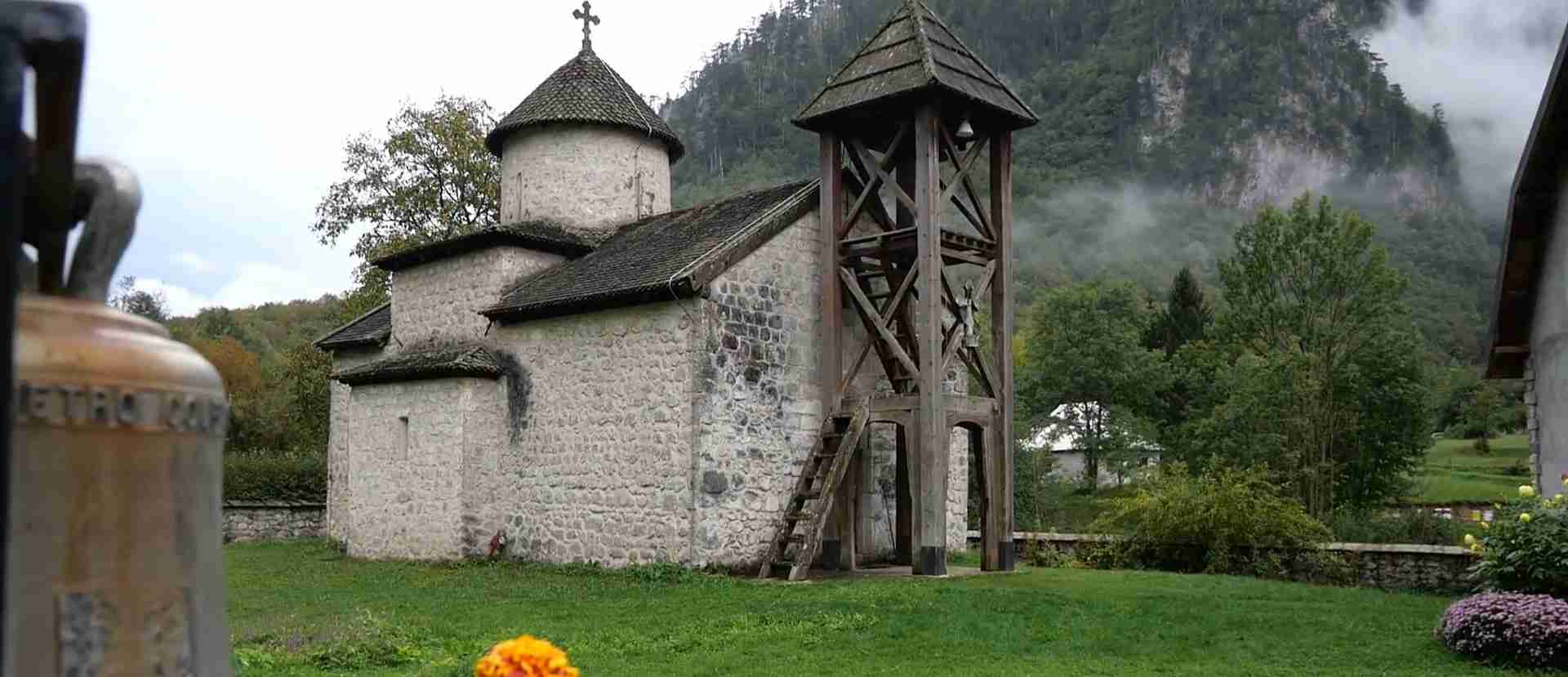
Durmitor National Park Montenegro: UNESCO Mountain Hiking Guide
Durmitor National Park stands among Europe’s most dramatic alpine landscapes, where 48 limestone peaks pierce the sky above glacial lakes and the continent’s deepest river canyon. This UNESCO World Heritage Site protects 32,100 hectares of wilderness shaped by ancient glaciers, where hiking trails wind through terrain that ranges from gentle lakeside strolls to technical summit climbs requiring cables and scrambling skills.
Key Takeaways:
- UNESCO Recognition: Inscribed in 1980 under criteria (vii)(viii)(x) for exceptional scenic beauty, geological significance, and biodiversity across altitudinal zones spanning 450 to 2,523 meters elevation
- Alpine Landscape Features: 48 peaks exceeding 2,000 meters, 18 glacial lakes locally called “mountain eyes,” and the Tara River Canyon reaching 1,300 meters depth
- Premier Hiking Destination: Bobotov Kuk summit at 2,523 meters offers Montenegro’s most challenging day hike with exposed scrambling sections secured by steel cables
- Glacial Lake Circuit: Black Lake provides accessible 3.5-kilometer lakeside walking suitable for all fitness levels with crystal-clear waters reflecting surrounding massifs
- Seasonal Hiking Windows: June through September offers optimal trail conditions with snow-free high routes, while shoulder seasons present technical challenges from lingering snowfields
- Gateway Infrastructure: Žabljak at 1,456 meters elevation serves as the Balkans’ highest town and primary trailhead access point with accommodation, supplies, and park services
People Also Ask About Durmitor National Park Hiking
What Makes Durmitor National Park a UNESCO World Heritage Site?
Durmitor National Park earned UNESCO World Heritage designation in 1980 based on three criteria recognizing its exceptional universal value. The park’s outstanding natural beauty results from glacial sculpting that created dramatic contrasts between jagged limestone peaks, serene glacial lakes, and dense coniferous forests interspersed with alpine meadows. The Tara River Canyon stands as Europe’s deepest gorge and one of the continent’s few remaining undammed river canyons, presenting vertical limestone walls that expose geological formations spanning the Middle Triassic through Upper Cretaceous periods. The property encompasses remarkable biodiversity across altitudinal zones from 450 to 2,523 meters, supporting endemic flora including Pinus heldreichii forests exceeding 450 years old and providing habitat for bears, wolves, chamois, and golden eagles within intact ecosystems that demonstrate ongoing ecological processes.
Which Hiking Trails in Durmitor Are Best for First-Time Visitors?
The Black Lake circuit presents the ideal introduction to Durmitor’s hiking landscape, offering a 3.5-kilometer loop around the park’s largest and most accessible glacial lake with 130 meters of gentle elevation gain completed in 1.5 hours. The trail follows well-maintained paths through pine forests before emerging at lake viewpoints where the surrounding massif reflects in crystal-clear waters, requiring no technical skills or specialized equipment beyond comfortable walking shoes. For visitors seeking moderate challenges, the Ice Cave trail extends 14 kilometers through alpine meadows and rocky terrain to reach Montenegro’s deepest cave featuring year-round ice stalactites, though this route demands proper hiking boots, navigation skills, and 6-7 hours for the complete circuit from Black Lake.
How Difficult Is the Bobotov Kuk Summit Hike?
Bobotov Kuk at 2,523 meters requires good fitness, comfort with exposure, and basic scrambling ability to navigate the final approach secured with fixed steel cables and ropes. The standard route from Sedlo Pass covers 12 kilometers return with 760 meters elevation gain, typically demanding 5-6 hours including summit time, though the altitude approaching 2,500 meters affects some hikers unaccustomed to reduced oxygen levels. The trail begins across gentle alpine meadows before ascending increasingly technical terrain where loose scree, polished limestone, and narrow exposed ridges require careful foot placement and steady nerves, particularly during the final hour climbing to the rocky summit block. Steel cables installed on the most exposed sections provide handholds but do not eliminate the need for mountain experience, and the route becomes dangerous in wet conditions when limestone surfaces turn slippery, restricting safe attempts to stable weather windows with clear visibility.
What Are the “Mountain Eyes” of Durmitor National Park?
The “mountain eyes” (planinska očka) are 18 glacial lakes scattered across Durmitor’s high plateaus and valleys, formed when retreating Ice Age glaciers carved depressions that filled with snowmelt and spring water. Black Lake at 1,416 meters elevation stands as the largest and most visited, actually comprising two connected basins that separate when summer water levels drop, while Zminje Lake nestled in dense forest requires a two-hour hike from Black Lake to reach its remote shores. These glacial tarns maintain frigid temperatures year-round, fed by underground streams and snowmelt that create the distinctive blue-green coloration that gives each lake its jewel-like appearance against the surrounding gray limestone peaks. Devil’s Lake, Barno Lake, and Vražje Lake represent more remote destinations requiring navigation skills and full-day commitments, rewarding advanced hikers with pristine alpine environments where chamois graze the surrounding slopes and golden eagles soar overhead.
Extended multi-day tours – 5+ days
Featured Montenegro Multi-Day Tour Packages
1 days
Semi-Private Day Tour of Montenegro: Budva & Kotor from Tirana
- ✓ Comprehensive Montenegro tour
- ✓ Expert local guides included
- ✓ All accommodation arranged
- ✓ Transportation provided
8 days
8 Days Montenegro Sailing Tour
- ✓ Comprehensive Montenegro tour
- ✓ Expert local guides included
- ✓ All accommodation arranged
- ✓ Transportation provided
8 days
Highlights of Montenegro; Semi – Private tour with dedicated Tour Leader & Car
- ✓ Booking needs min. 2 travelers
7 days
Comfortable Heartland of Montenegro Trip
- ✓ Comprehensive Montenegro tour
- ✓ Expert local guides included
- ✓ All accommodation arranged
- ✓ Transportation provided
Multi-day tour packages powered by TourRadar. Prices and availability subject to change.
Understanding Durmitor National Park’s UNESCO Significance
The World Heritage Committee inscribed Durmitor National Park in 1980 recognizing a landscape of exceptional natural beauty shaped by glacial forces and carved by rivers into one of Europe’s most dramatic mountain environments. The property extends across 32,100 hectares of the Dinaric Alps, expanded in 2005 to align with national park boundaries and strengthen protection for the complete ecosystem. UNESCO criteria (vii) acknowledges the superlative scenic qualities where alpine meadows on smooth plateaus contrast sharply with numerous rugged peaks, dense forests, and glacial lakes, all dominated by the spectacular Tara River Gorge plunging more than 1,300 meters as Europe’s deepest canyon unaffected by dams or roads.
Criterion (viii) recognizes geological and geomorphological features of major scientific interest, including thick limestone formations from Middle Triassic through Upper Cretaceous periods often contorted into dramatic angles by tectonic forces, with the Tara Canyon’s sheer walls exposing magnificent rock sequences spanning millions of years. The property contains Montenegro’s deepest cave system, subterranean rivers draining glacial lakes, and the Ice Cave preserving rare relict features from past glaciation including year-round ice stalactites and stalagmites. Criterion (x) encompasses diverse mountain landscapes across altitudinal zones from 450 to 2,523 meters, supporting a broad array of ecosystems and habitats that harbor Tertiary-age relict plant species, endemic Balkan flora including Pinus heldreichii forests exceeding 450 years old, and fauna including brown bears, gray wolves, chamois, and over 130 bird species.
The park forms the core of the larger Tara River Basin Biosphere Reserve designated in 1977 under UNESCO’s Man and Biosphere Programme, adding international recognition for ecosystems that demonstrate exceptional ecological integrity. Management authority rests with the Public Enterprise “Nacionalni Parkovi Crne Gore” implementing conservation strategies governed by Montenegro’s Law on Nature Protection, Law on National Parks, and comprehensive environmental legislation covering forests, water, soils, hunting, and fishing. The property maintains high integrity with minimal infrastructure development beyond the gateway town of Žabljak, preserving wilderness qualities that allow natural processes to continue largely undisturbed across the altitudinal gradient from warm lowland valleys to alpine peaks experiencing Arctic-like conditions.
Geographical Setting and Alpine Landscape Formation
Durmitor constitutes a massive limestone platform belonging to the Dinaric Alps, a mountain system extending along the eastern Adriatic coast from Slovenia through Albania. The massif rises in northwestern Montenegro near the border with Bosnia and Herzegovina, positioned between the Tara River to the north, the Piva River to the south, and the Sušica River valley to the east. This isolated mountain block reaches its apex at Bobotov Kuk’s 2,523-meter summit, surrounded by 47 additional peaks exceeding 2,000 meters that form a distinctive skyline of sharp crests, pyramidal summits, and serrated ridges visible from surrounding lowlands.
Quaternary glaciation sculpted the current landscape over repeated ice advances and retreats spanning the past two million years. Valley glaciers gouged deep troughs radiating from the central massif, while cirque glaciers carved amphitheater-shaped basins into peak flanks, leaving moraines marking ice extent and creating the 18 glacial lakes filling depressions where ice once pooled. The Ice Age legacy appears in U-shaped valleys with flat floors and steep walls, hanging valleys where tributary glaciers met larger trunk glaciers, polished rock surfaces bearing glacial striations, and erratic boulders transported far from their origin by flowing ice. Modern geomorphological processes continue shaping the landscape through freeze-thaw cycles fracturing limestone, rockfalls depositing talus slopes below cliffs, and spring snowmelt feeding streams that gradually dissolve soluble carbonate bedrock.
Limestone bedrock dominates geological composition, deposited in warm shallow seas covering the region during Mesozoic times 250 to 65 million years ago. Thick sequences of Middle and Upper Triassic, Upper Jurassic, and Upper Cretaceous limestones often display intense folding and faulting from tectonic collision between African and Eurasian continental plates that uplifted the Dinaric Alps. The so-called “Durmitor Flysch” represents tectonic layers tilted to 90-degree angles, creating spectacular exposed strata visible in canyon walls. Karst processes dissolve limestone through slightly acidic precipitation and snowmelt, creating surface features including sinkholes, disappearing streams, and closed depressions, while underground dissolution forms extensive cave systems draining water through subterranean passages toward distant springs.
River erosion carved three major canyons cutting deeply into the limestone platform. The Tara River Canyon extends 82 kilometers with depths reaching 1,300 meters, making it Europe’s deepest river gorge and among the world’s most spectacular. Vertical limestone cliffs tower above the turquoise river where rapids alternate with calm pools, creating dramatic scenery unmatched elsewhere in Europe. The Sušica and Draga canyons present similarly impressive dimensions though smaller scale, their vertical walls exposing layered sedimentary sequences that reveal the region’s geological history. These canyons remain undammed, preserving natural river dynamics and supporting endemic aquatic species including the endangered huchen salmon.
Flora and Fauna Across Altitudinal Zones
Vegetation distribution follows distinct altitudinal belts determined by temperature, precipitation, and snow duration. Warm lowland valleys between 450 and 800 meters support mixed deciduous forests dominated by beech, oak, hornbeam, and birch, creating autumn displays of gold and crimson foliage. The montane belt from 800 to 1,500 meters contains dense coniferous forests where spruce and fir form continuous canopy, their shade suppressing understory growth but allowing moss and lichen to carpet rocks and tree trunks. Black pine forests appear on dry limestone slopes, particularly in the Crna Poda complex where individual trees exceed 50 meters height and 450 years age, representing rare old-growth stands preserved through protected status and difficult access limiting historical logging.
Alpine meadows dominate the landscape above 1,500 meters, transforming from green carpets in spring to wildflower displays through summer as snow gradually retreats. Endemic Balkan species including Durmitor bellflower, saxifrages, gentians, and edelweiss bloom in June and July, creating colorful mosaics against gray limestone. Dwarf mountain pine forms krummholz zones at treeline, its twisted growth reflecting harsh winter conditions with hurricane-force winds, deep snow accumulation, and temperatures plunging below minus 30 Celsius. Above 2,200 meters, vegetation becomes sparse, limited to cushion plants, lichens, and occasional flowering species that complete their life cycles during brief summer windows between snowmelt and autumn’s first snowfall.
Large mammals roaming the park include brown bears, gray wolves, wild boar, red foxes, European badgers, and pine martens, though these secretive species rarely reveal themselves to casual hikers. Chamois inhabit rocky slopes and alpine meadows, their agility on vertical terrain allowing escape from predators, while their tan summer coats turn darker brown in winter. Red deer and roe deer browse forest edges at dawn and dusk, their presence indicated by tracks in mud and browsed vegetation even when the animals remain hidden. Small mammals including marmots, dormice, and various vole species form the prey base supporting carnivore populations, while bats occupy cave systems and forest areas, emerging at twilight to hunt insects.
Avian diversity reaches 130 species benefiting from habitat variety spanning warm valleys to alpine tundra. Golden eagles soar above peaks scanning for marmots and ptarmigan, their two-meter wingspans allowing effortless gliding on thermal currents. Griffon vultures patrol canyons searching for carrion, while peregrine falcons nest on cliff faces and hunt other birds with spectacular high-speed dives. Forest species including capercaillie, hazel grouse, and various woodpeckers occupy coniferous zones, their presence indicated by drumming sounds echoing through quiet woods. Alpine species such as alpine chough, snow finch, and alpine accentor inhabit high elevations, adapted to harsh conditions through specialized behaviors and physiology allowing survival where temperatures rarely exceed comfortable levels even in summer.
Aquatic ecosystems in the Tara River support endemic fish species found nowhere else, including subspecies of trout and grayling adapted to cold, oxygen-rich waters. The huchen, Europe’s largest salmonid reaching 1.5 meters length, spawns in Tara tributaries, making the river system one of the continent’s most important refuges for this critically endangered species. Crystal-clear spring waters maintain constant cold temperatures ideal for these cold-water species, while strict fishing regulations and protected status help preserve remaining populations despite historical overfishing and habitat degradation affecting rivers throughout the Balkans.
Hiking Trails Overview and Classification
Durmitor’s trail network encompasses routes ranging from paved lakeside promenades suitable for families to technical alpine ascents demanding mountain experience and specialized equipment. Trail difficulty classifications help hikers select appropriate objectives matching their fitness, skills, and available time, though weather conditions and seasonal snow levels significantly affect route difficulty regardless of nominal rating. Most trails display Knafelc waymarks consisting of red circles with white centers, supplemented by red paint stripes on rocks marking the route, though signage quality varies and many remote trails require navigation skills using maps and GPS devices.
Easy trails include the Black Lake circuit, Zminje Lake approach, and valley walks along rivers where well-maintained paths follow gentle grades through forests and meadows. These routes require no technical skills, accommodate casual footwear, and allow turnaround at any point without committing to exposed terrain. Moderate trails ascending to viewpoints, connecting glacial lakes, and traversing alpine plateaus demand hiking boots for ankle support on uneven terrain, reasonable fitness for sustained climbing, and 4-6 hours for completion. Difficult trails tackling major peaks involve sustained steep climbing, route-finding through boulder fields and scree, exposure to cliff edges, and potential use of fixed cables or ropes on the most challenging sections.
The Bobotov Kuk ascent represents Durmitor’s premier challenge, classified as difficult due to 760 meters elevation gain, technical scrambling on the final approach, and exposure requiring comfort with heights. Alternative summit routes include Šljeme at 2,455 meters offering similar panoramas with slightly less technical demands, and Savin Kuk at 2,313 meters accessible via ski lift infrastructure reducing climbing distance. Multi-day hiking routes crossing the entire massif connect Žabljak with surrounding valleys, requiring wilderness camping skills, food and water carrying capacity, and experience navigating unmarked terrain where trails fade on rocky surfaces.
Seasonal considerations dramatically affect trail accessibility and safety. June through September provides optimal conditions after spring snowmelt opens high routes and before autumn storms deposit new snow, though afternoon thunderstorms remain common requiring early starts to reach exposed summits before clouds build. May and October present transitional periods when lower trails remain accessible but high routes may harbor dangerous snowfields, icy surfaces, and reduced visibility from lingering winter conditions or early autumn storms. Winter transforms the landscape into an advanced mountaineering environment requiring crampons, ice axes, avalanche assessment skills, and experience in severe alpine conditions.
Black Lake Circuit: Accessible Introduction to Durmitor
Black Lake sits 3 kilometers west of Žabljak at 1,416 meters elevation, positioned at the eastern entrance to Durmitor National Park where a visitor center, parking areas, and restaurants cluster around Montenegro’s most famous glacial lake. The lake actually comprises two basins connected by a shallow channel that appears when spring snowmelt raises water levels, separating into Great Lake and Small Lake as summer evaporation lowers the surface. Dark pine forests surrounding the shoreline create the mirror-like reflections giving the lake its name, with limestone peaks forming a dramatic backdrop particularly at dawn when still conditions produce perfect symmetry between reality and reflection.
The 3.5-kilometer circuit trail follows the shoreline on a well-maintained path combining boardwalks across marshy sections, gravel paths through forest, and stone steps climbing low viewpoint promontories. Elevation gain totals only 130 meters distributed gradually around the loop, allowing comfortable completion in 1.5 hours including photo stops and rest breaks. The route begins from the main parking area near the visitor center, initially following the lake’s eastern shore through dense pine forest where the path remains shaded and cool even on hot summer afternoons. Benches positioned at scenic viewpoints invite lingering to watch light play across the water surface, observe trout in shallow areas, and scan surrounding cliffs for chamois grazing alpine meadows.
The western shore section emerges from forest onto open terrain providing unobstructed views toward Bobotov Kuk and neighboring peaks. Small beaches allow wading in the frigid glacial water, though temperatures rarely exceed 15 Celsius even in July. The trail passes Titova Pećina, a small cave accessible via short spur path, where partisan fighters sheltered during World War II resistance operations. Continuing around Small Lake completes the circuit, returning through forest to the starting point. Boat and kayak rentals operate from the visitor center, allowing paddling exploration of both basins while enjoying the perspective from water level.
Accessibility features make Black Lake suitable for elderly visitors, families with young children, and individuals with limited mobility willing to accept uneven natural trail surfaces. The first 500 meters from the parking area follow wide, relatively smooth paths accommodating wheelchairs and strollers with assistance, though completing the full circuit requires navigating steps, roots, and rocky sections. Numerous exit points allow abbreviated walks for those unable or unwilling to complete the entire loop. Facilities at the trailhead include public restrooms, restaurants serving traditional Montenegrin cuisine, gift shops, and the national park information center staffed by rangers who provide current trail conditions, weather forecasts, and hiking recommendations.
Best times to visit the lake circuit span morning hours from 7:00 to 10:00 AM when calm conditions produce optimal reflections, fewer crowds allow peaceful enjoyment, and cooler temperatures make walking comfortable. Summer afternoons bring busloads of tour groups creating congestion particularly around the most photographed viewpoints, though dispersal around the circuit prevents overcrowding. Early autumn delivers spectacular foliage when deciduous trees surrounding the lake transform into gold, orange, and red displays contrasting with dark evergreen forests and gray limestone peaks. Winter access remains possible when snow depth allows walking, creating a magical frozen landscape though facilities close and services become unavailable.
Bobotov Kuk Summit: Montenegro’s Premier Alpine Challenge
Bobotov Kuk towers at 2,523 meters as Durmitor’s highest peak and Montenegro’s most prominent summit, excluding the Kolata peaks on the Albanian border partially lying outside national territory. The pyramidal massif dominates views from Žabljak and surrounding valleys, its limestone flanks streaked with snow cornices lingering into July, challenging hikers to test their mountain skills on routes that rank among the Balkans’ finest day climbs. Three distinct approach routes provide options matching different skill levels and time commitments, though all converge at the final exposed ridge requiring scrambling ability and comfort with significant drop-offs on both sides.
The Sedlo Pass route represents the standard ascent, starting from the mountain pass at 1,907 meters elevation reached via 15-minute drive from Žabljak on the P14 Durmitor Ring Road. A wooden sign reading “Šurutka Bobotov Kuk” marks the trailhead where a ranger station collects the €5 park entrance fee before hikers begin. The initial section crosses gentle alpine meadows dotted with wildflowers in summer, gradually climbing northwest toward the massif with views expanding across the plateau. After 2 kilometers the trail descends slightly into a valley before beginning serious climbing toward the rocky ridge system leading to the summit.
The final approach demands the greatest effort and concentration, ascending 300 vertical meters over one hour across increasingly steep and technical terrain. Loose scree requires careful foot placement to avoid sending rocks sliding toward hikers below, while polished limestone surfaces become treacherously slippery when wet. Fixed steel cables appear at the most exposed sections, providing handholds for balance though not eliminating the need for basic scrambling ability. The ultimate challenge arrives at the summit block, where climbers navigate a narrow, airy ridge with 500-meter vertical drops on both sides, protected by rubber-coated cables bolted into the rock. The scramble remains non-technical in dry conditions with proper three-point contact maintained, but becomes dangerous when wet, icy, or obscured by fog.
From the summit cairn, panoramic views extend across the entire Durmitor massif, down into the Tara Canyon, and on clear days to peaks in Bosnia and Herzegovina, Serbia, and Albania. Škrčka Lakes shimmer in cirques below, their turquoise water contrasting with gray limestone. Neighboring peaks including Šljeme, Savin Kuk, Stožina, and Prutaš form a dramatic skyline of sharp crests and pyramidal summits. The summit register preserved in a waterproof container documents climbers from dozens of countries, their entries reflecting the peak’s international reputation. Allow 30 minutes summit time for photos, rest, and panorama absorption before beginning the descent.
The return follows the ascent route, demanding equal care on descents where loose rock and steep angles challenge tired legs. Total round-trip distance measures 12 kilometers with 760 meters elevation gain, typically requiring 5-6 hours including summit time. Strong hikers complete the route in 4 hours while those stopping frequently for photos and rest may need 7 hours. Starting early proves essential, with 7:00 to 8:00 AM departures allowing summit arrival before afternoon thunderstorms build. Carry 2 liters of water per person as no sources exist along the route, pack layers for summit conditions potentially 15 degrees colder than the trailhead, and bring snacks providing sustained energy for the demanding climb.
The Žabljak route offers an alternative approach starting from Black Lake at 1,416 meters, adding distance and elevation gain but creating a through-hike ending at Sedlo Pass. This 14.5-kilometer route gains 1,100 meters elevation over 6-7 hours climbing, rewarding endurance with greater landscape variety including the Ice Cave and multiple glacial lakes. The route initially follows the Zminje Lake trail before branching toward the Bobotov Kuk massif, ascending through forest and alpine meadows before joining the standard route at the base of the final scramble. Completing this as a through-hike requires arranging transportation from Sedlo Pass back to Žabljak, though some hikers retrace their steps for a demanding 10-hour day.
Essential equipment includes sturdy hiking boots with ankle support and aggressive tread for traction on loose rock and scree, hiking poles aiding balance and reducing knee strain on descents, waterproof jacket for sudden weather changes, warm layers for summit temperatures, sun protection including hat and sunscreen for high-altitude exposure, first aid supplies, headlamp for emergency situations, and map plus compass or GPS device. Though the route appears straightforward in good conditions, fog can reduce visibility to meters, making navigation difficult without proper equipment and skills. Do not attempt the climb in wet conditions when limestone becomes slippery, avoid afternoons when thunderstorms develop, and turn back without hesitation if weather deteriorates or exhaustion sets in before the summit.
Ice Cave Trail: Alpine Meadows to Underground Wonders
The Ice Cave trail extends 14 kilometers through some of Durmitor’s most varied terrain, connecting Black Lake with Montenegro’s deepest cave system featuring year-round ice formations despite surface temperatures exceeding 20 Celsius in summer. The route presents moderate difficulty requiring good fitness, navigation skills, and 6-7 hours for the complete round trip from Black Lake, rewarding determined hikers with dramatic mountain scenery, remote alpine solitude, and the rare experience of descending into permanent ice formations at relatively low altitude.
Trail access begins from Black Lake’s northern shore, following the lake circuit clockwise before branching onto the Zminje Lake trail where wooden signs indicate directions at junctions. The initial 2 kilometers ascend gradually through coniferous forest, emerging into open alpine meadows carpeted with wildflowers from June through August. Navigation becomes more challenging in this section as the trail crosses rocky terrain where cairns and occasional red paint marks indicate the route, though some paths fade on bare limestone requiring careful attention to waymarking and map reference to avoid wandering onto dead-end sheep trails.
The landscape opens dramatically after forest zone transition, presenting views across the central Durmitor plateau where the massif’s highest peaks form a serrated horizon. The trail climbs steadily toward a high col at approximately 1,900 meters elevation, passing through boulder fields deposited by ancient rockfalls and crossing snowfields that persist into July in sheltered gullies. The descent from the col leads through a landscape of karst features including sinkholes, disappearing streams, and limestone pavement eroded into intricate patterns, before arriving at the Ice Cave entrance marked by a change in temperature and the appearance of permanent snow patches even in August.
The Ice Cave entrance drops steeply into darkness, accessible via installed guide rope though the descent remains challenging on slippery snow and ice covering rock surfaces. Temperature plunges 15 degrees upon entering, creating stark contrast with the warm summer air above. Ice stalactites hang from the ceiling while stalagmites rise from the floor, some columns spanning floor to ceiling where formations have merged over centuries. The cave extends deeper into the mountain, though most hikers explore only the entrance chamber as continuing requires technical caving equipment and skills. The permanent ice results from cold air drainage collecting in the cave’s lowest points combined with minimal summer warming, preserving relict conditions from the last Ice Age.
Return follows the outbound route, though the descent to Black Lake flows more quickly than the ascent. Total distance measures 14 kilometers with approximately 600 meters elevation gain distributed across multiple climbs and descents. Carry the Mapy.cz Montenegro offline map downloaded to your smartphone, as GPS coverage remains reliable throughout Durmitor and the detailed trail overlay helps navigate sections where ground markers become sparse. The trail sees significantly fewer hikers than the Bobotov Kuk route, providing wilderness solitude and reduced crowding at the ice cave destination. Afternoon storms pose serious hazards in the exposed high meadows, making early starts essential for completing the route before clouds build.
Weather conditions change rapidly at high elevation, with morning sunshine transforming into afternoon thunderstorms featuring lightning, hail, and temperature drops within 30 minutes. Monitor sky conditions throughout the hike, noting growing cumulus clouds that indicate developing instability. Retreat from exposed high terrain when the first thunder sounds, as lightning strikes alpine areas with little warning. The route remains snow-covered until mid-June in typical years, with lingering snowfields creating avalanche hazards and obscuring trail markers until melt progresses. September offers ideal conditions with stable weather, fewer crowds, and stunning autumn colors transforming high meadows into rust and gold displays.
Zminje Lake and Additional Glacial Lake Trails
Zminje Lake nestles in dense forest 2 hours hiking from Black Lake, representing one of Durmitor’s more accessible remote glacial basins while maintaining wilderness character distinct from the developed tourism zone around the park’s most famous water body. The 4-kilometer one-way trail gains 200 meters elevation through mixed forest, following a well-marked path that occasionally emerges into meadows providing views toward surrounding peaks. The lake sits at 1,520 meters elevation in a natural amphitheater where limestone cliffs rise directly from the shoreline, creating dramatic setting enhanced by the mirror-like water surface reflecting the encircling massif.
Autumn transforms the Zminje Lake trail into a golden tunnel as deciduous trees lining the route turn brilliant yellow and orange, contrasting with dark evergreen forest and gray rock. The lake freezes solid in winter, its surface supporting hikers and creating an eerie frozen landscape where ice cracks echo across the silent basin. Summer brings wildflowers to surrounding meadows, while the lake’s cold waters support trout visible in shallow areas where clarity allows observation of the rocky bottom. The trail continues past Zminje Lake toward higher elevation lakes for hikers seeking more remote destinations, though route-finding becomes increasingly difficult as formal trails fade into wilderness paths marked only by occasional cairns.
Barno Lake at 1,442 meters represents another moderate hiking objective, reached via 3-hour approach from the village of Međeđ on Durmitor’s southern flank. The trail ascends through shepherd’s meadows where traditional seasonal dwellings called katuns dot the landscape, many still in use during summer months when herders bring sheep and cattle to high pastures. The lake occupies a shallow depression where water levels fluctuate dramatically between spring highs and autumn lows, sometimes receding to expose muddy margins by September. Barno’s accessibility makes it popular with local hikers from Žabljak, though international visitors rarely venture this far from the main tourist circuit.
Devil’s Lake sits at 1,652 meters in one of Durmitor’s most remote and mystical settings, requiring 5-6 hours hiking from Black Lake through trackless alpine terrain where navigation skills become essential. Legend holds that the lake’s dark waters never reflect sunlight, creating an ominous appearance that spawned supernatural associations and the forbidding name. The reality involves dark waters stained by tannins from surrounding vegetation combined with deep basins preventing light penetration, creating dramatic contrast with the bright turquoise typical of most Durmitor glacial lakes. Few hikers reach Devil’s Lake due to navigation challenges and lack of maintained trail, making it a destination for experienced mountain travelers seeking genuine wilderness solitude.
Vražje Lake, Jablan Lake, and numerous smaller unnamed tarns scattered across Durmitor’s high plateaus offer exploration opportunities for multi-day backpacking trips. Wild camping remains permitted throughout the park except in the immediate vicinity of Žabljak and Black Lake, allowing wilderness travelers to establish base camps at remote lakes and spend multiple days exploring surrounding terrain. Water sources appear frequently in the form of streams and springs, though all surface water should be filtered or chemically treated before consumption. Navigation via map and compass becomes essential in remote areas where trails disappear and cell phone coverage vanishes, while weather awareness and emergency self-sufficiency separate prepared adventurers from those requiring rescue.
Durmitor Ring Road: Scenic Circuit and Trail Access
The Durmitor Ring Road encircles the central massif, providing 76 kilometers of spectacular driving connecting major trailheads, viewpoints, and access points to the park’s most dramatic features. The route splits into northern and southern sections marked as Panoramic Route P2, following narrow asphalt roads that climb to 1,907 meters elevation at Sedlo Pass while offering continuous views of jagged peaks, glacial valleys, and the Tara Canyon. Completing the full circuit requires 3-4 hours driving time excluding stops, though most visitors spend 6-8 hours incorporating hikes, photo stops, and meals at traditional mountain restaurants scattered along the route.
Starting from Žabljak, the southern route climbs through forest before emerging onto open plateau where the landscape transitions to alpine meadows dotted with traditional katun shepherds’ huts. Sedlo Pass marks the circuit’s high point and primary trailhead for the Bobotov Kuk ascent, where multiple parking areas accommodate hikers and viewing platforms frame the massif’s southern flank. Continuing west, the road descends through Todorov Do valley where mountain springs provide fresh drinking water and scattered benches invite picnic stops. Dramatic “picture frame” metal installations at scenic viewpoints help tourists position cameras for optimal photos, though natural scenery needs no enhancement.
The western section traverses remote terrain where traditional agriculture persists in patterns unchanged for centuries. Fields carved from mountain slopes produce hay cut and dried on wooden racks, while cattle and sheep graze unfenced meadows watched by shepherds continuing ancestral traditions. The road becomes particularly narrow in sections, requiring slow speeds and careful attention when meeting oncoming traffic, with dramatic drop-offs emphasizing the importance of defensive driving. Rangers stationed at the Sušica Canyon control point collect the €5 park entrance fee from drivers passing through this checkpoint.
The northern route drops toward the Tara River, offering spectacular canyon viewpoints from roadside pullouts where the gorge appears as a deep scar cutting through limestone cliffs. The Ćurevac viewpoint at 1,625 meters provides perhaps the most dramatic perspective, looking directly down into the canyon where the river appears as a turquoise ribbon 1,300 meters below. The Đurđevića Tara Bridge spans the canyon 172 meters above the river, its five concrete arches creating an engineering marvel originally constructed in 1940, destroyed during World War II, and rebuilt in 1946. Viewing platforms on both sides allow photos of the bridge and canyon, while a zipline operation offers the opportunity to cross the gorge suspended from cables.
Multiple hiking trails branch from the Ring Road at signed trailheads, providing access to remote peaks, glacial lakes, and wilderness areas. The Prutas trail to 2,393-meter summit departs from a parking area on the southern section, offering an alternative to Bobotov Kuk with less crowding and similar spectacular views. The Valovito Jezero trail reaches a high glacial lake favored by fishermen targeting endemic trout. Numerous informal parking areas at meadows and forest clearings invite spontaneous exploration, though hikers venturing beyond visible trails should carry maps, inform someone of their plans, and possess navigation skills adequate for wilderness travel.
Driving the Ring Road counterclockwise places vehicles on the mountain side rather than canyon edge when navigating the narrowest single-lane sections near Sušica Canyon, providing psychological comfort and physical safety margin when meeting oncoming traffic. Morning light illuminates the massif’s southern faces optimally for photography, while afternoon sun angles favor the northern sections. Spring drives encounter snowdrifts blocking the highest sections into May, while autumn brings spectacular foliage and reduced traffic creating peaceful driving conditions. Winter closure affects the highest passes, limiting access to only the lower elevations until spring snowmelt reopens the complete circuit.
Practical Hiking Information and Trail Preparation
Access to Durmitor National Park centers on Žabljak, a mountain town of 2,000 residents positioned at 1,456 meters elevation as the Balkans’ highest settled municipality. The town provides accommodation ranging from budget guesthouses to mid-range hotels, plus supermarkets stocking hiking supplies, restaurants serving traditional Montenegrin mountain cuisine, equipment rental shops, and guiding services for technical routes. ATMs dispense euros though many establishments accept only cash, making advance withdrawal advisable. The national park visitor center operates near Black Lake, offering trail maps, current conditions, and ranger advice.
Transportation to Žabljak requires private vehicle or bus service from larger cities. From Podgorica, Montenegro’s capital, the 140-kilometer drive via Nikšić requires 2.5 hours on good roads winding through mountain passes. Kotor and Budva on the coast lie 3.5 hours distant via the Piva Canyon route, a spectacular drive through gorges and along reservoir shorelines. Direct bus service connects Žabljak with Podgorica multiple times daily, costing approximately €10 one-way, while seasonal services operate from coastal cities during summer months. Rental cars provide maximum flexibility for exploring trailheads scattered across the Ring Road, though drivers unfamiliar with mountain roads should exercise caution on narrow sections with limited guardrails.
The park entrance fee costs €5 per person per day, collected at ranger stations positioned at Black Lake, Sedlo Pass, and the Sušica Canyon control point along the Ring Road. Payment supports trail maintenance, ranger services, and conservation programs protecting the park’s natural heritage. An annual pass covering all five of Montenegro’s national parks costs €13.50, becoming economical for visits exceeding two days or travelers planning to explore multiple protected areas. Rangers check permits at trailheads and may stop hikers on trails, though enforcement remains friendly with educational rather than punitive emphasis. Parking at Black Lake costs €2 for vehicles, while other trailheads offer free parking in informal pullouts along roads.
Optimal hiking season spans June through September when snowmelt opens high trails and weather conditions favor safe mountain travel. July and August deliver warmest temperatures with daytime highs reaching 25 Celsius in valleys and 15 Celsius at 2,000 meters elevation, though nights remain cool requiring warm sleeping bags for camping. June presents transitional conditions with lingering snow on north-facing slopes and high passes, creating spectacular combinations of spring wildflowers and snow-capped peaks but requiring assessment of snowfield stability. September offers ideal conditions with stable weather, reduced crowds, autumn foliage transforming deciduous forests, and cooler temperatures making climbing comfortable. October brings increasing storm frequency and early season snow closing high routes, while May sees gradually melting snowpack exposing trails at progressively higher elevations.
Weather patterns feature morning stability transitioning to afternoon thunderstorm development, particularly in July and August when solar heating triggers convective storms producing lightning, heavy rain, hail, and rapid temperature drops. Starting hikes at dawn allows summit arrival before clouds build, providing safer conditions and better visibility for enjoying panoramic views. Monitor developing weather throughout the day, noting cumulus clouds growing vertically as indication of increasing instability. Retreat from exposed ridges and summits when thunder sounds, as lightning strikes high terrain with little warning. Temperature drops 6-7 degrees Celsius per 1,000 meters elevation gain, meaning summit conditions 15 degrees cooler than trailheads, requiring layered clothing systems allowing adjustment as conditions change.
Essential equipment for day hiking includes sturdy boots providing ankle support on uneven terrain, hiking poles reducing knee strain particularly on descents, waterproof rain jacket and pants for sudden storms, insulating layer for summit cold, sun protection including wide-brimmed hat and sunscreen for high-altitude exposure, 2 liters water capacity per person, high-energy snacks, basic first aid supplies, headlamp for emergencies, map and compass or GPS device, and emergency whistle. Technical routes adding scrambling sections require climbing gloves protecting hands when using cables and ropes, helmet protecting from rockfall, and potentially rope for belaying exposed moves depending on comfort level and conditions.
Mobile phone coverage remains reliable near Žabljak and along the Ring Road, though remote valleys and high peaks lose signal requiring self-sufficiency for navigation and emergency response. Download offline maps before departure, with the Mapy.cz app providing excellent trail detail for Montenegro including Durmitor National Park. Paper maps remain valuable backup despite electronic navigation advantages, particularly if phone batteries deplete or devices fail in cold or wet conditions. Share hiking plans with accommodation hosts or park rangers, providing expected return time and route details allowing search initiation if overdue.
Wilderness Safety and Mountain Hazards
Alpine environments present hazards requiring awareness, preparation, and sound judgment to manage safely. Weather constitutes the primary danger, with rapidly developing thunderstorms producing lightning strikes that kill or injure hikers on exposed ridges with unfortunate regularity across mountain ranges worldwide. Monitor weather forecasts before departure, start early allowing summit arrival before afternoon storm development, and retreat immediately when thunder sounds regardless of proximity to objectives. Lightning seeks the highest object in an area, meaning ridge lines, summits, and isolated peaks become dangerous during electrical activity. Move to lower elevations and avoid proximity to metal objects including climbing cables during storms, accepting that summits remain accessible another day while lightning injuries prove permanent or fatal.
Terrain hazards include loose rock creating unstable footing, polished limestone surfaces becoming slippery when wet, exposure to vertical drops requiring careful movement, and steep scree slopes that slide underfoot. Test holds before trusting weight to suspect rocks, maintain three-point contact when scrambling with one hand and two feet or two hands and one foot always secured, and avoid walking directly below other hikers who might dislodge rocks. Fixed cables assist on exposed sections but don’t eliminate the need for mountain skills and steady nerves. Rockfall danger increases in afternoon when freeze-thaw cycles release stones from cliff faces, making morning starts safer beyond weather considerations.
Navigation errors strand hikers who wander off-trail into difficult terrain requiring technical skills to escape or forcing bivouacs when darkness prevents safe travel. Stay on marked routes unless possessing navigation skills and equipment for cross-country travel. When uncertain of direction, retrace steps to the last known position rather than pushing forward hoping trails reconnect. Phone GPS works even without signal coverage, allowing location verification against downloaded maps. In emergencies, dial 112 for mountain rescue services, though response times increase in remote areas requiring self-sufficiency until help arrives.
Altitude effects become noticeable above 2,000 meters for individuals living at sea level, manifesting as headaches, nausea, fatigue, and reduced exercise capacity from lower oxygen pressure. Durmitor’s highest peaks at 2,500 meters rarely cause serious altitude sickness, though some hikers experience symptoms particularly when ascending rapidly without acclimatization. Ascend gradually, maintain hydration, recognize symptoms, and descend if conditions worsen. Most symptoms resolve with rest at lower elevation without requiring medical treatment.
Wildlife encounters remain rare due to animal wariness of humans, though bears and wolves inhabit the park’s remote sections. Make noise while hiking to avoid surprising animals, store food securely at campsites, and maintain distance if spotting large mammals. Bears avoid confrontation when given escape routes and become aggressive only when startled at close range or protecting cubs. Snakes including vipers inhabit lower elevations, basking on sunny rocks and trails, though bites prove rare given these reptiles’ tendency to flee from vibrations. Watch foot placement in rocky areas, avoid reaching into crevices, and seek medical attention immediately after any bite even if uncertain whether the snake carried venom.
Photography and Landscape Documentation
Durmitor’s dramatic landscapes provide exceptional photography opportunities ranging from grand vistas encompassing entire mountain ranges to intimate details of wildflowers, rock formations, and glacial lakes. Morning light from 6:00 to 9:00 AM produces soft illumination enhancing landscape textures while minimizing harsh shadows, with low sun angles creating dramatic side-lighting that reveals terrain contours. Golden hour in the hour before sunset bathes limestone cliffs in warm tones contrasting beautifully with deep blue shadows, though afternoon storms frequently obscure this optimal light requiring flexibility and patience.
Black Lake reflections occur only during calm conditions typically found at dawn before wind develops, making 6:00 AM arrival essential for mirror-like images. Position cameras on the western shore shooting east to capture the massif reflected in the water, using polarizing filters to enhance clarity and reduce glare. The lake’s northern shore provides compositions including foreground trees framing distant peaks, adding depth and context to images. Autumn foliage surrounding the lake creates colorful foreground elements contrasting with gray limestone, while winter snow transforms the scene into monochrome studies emphasizing form and texture.
Summit photography from Bobotov Kuk requires carrying camera gear up technical terrain where hands may be needed for scrambling, making lightweight equipment preferable to heavy professional systems. Wide-angle lenses capture panoramic views encompassing multiple peaks, valleys, and the distant Tara Canyon, while telephoto lenses isolate neighboring summits and glacial lakes. Include human figures for scale, showing the massif’s true dimensions that disappear in pure landscape compositions. Protect equipment from high winds, cold temperatures, and sudden storms by packing cameras in protective cases carried in backpacks rather than dangling from neck straps.
Tara Canyon viewpoints along the Ring Road allow roadside photography without hiking requirements, making these accessible to all visitors regardless of physical ability. The Ćurevac viewpoint provides the most dramatic perspective looking directly into the gorge, best captured with wide-angle lenses emphasizing the canyon’s depth and the river’s serpentine path. Morning side-lighting illuminates the canyon’s eastern wall while leaving the western side in shadow, creating dramatic contrast. The Đurđevića Tara Bridge photographs well from both sides, with eastern viewpoints allowing morning shots against the sun and western positions favoring afternoon light.
Wildlife photography requires patience, long lenses, and willingness to remain motionless in uncomfortable positions waiting for animals to appear. Chamois inhabit rocky slopes above treeline, often visible at dawn and dusk when they venture into open meadows to graze. Golden eagles soar along ridge lines, requiring fast shutter speeds to freeze motion and telephoto lenses reaching at least 400mm focal length for frame-filling images. Wildflower photography benefits from macro lenses capturing intricate detail, combined with diffusers softening harsh mountain sunlight for even illumination.
Cultural Connections and Mountain Traditions
Human presence in the Durmitor region extends thousands of years, with archaeological evidence indicating seasonal use by shepherds moving livestock to high pastures during summer months while wintering in lower valleys. Medieval fortifications occupied strategic positions controlling mountain passes, their ruins visible near Žabljak and along the Tara Canyon where defensive locations allowed small forces to control larger territories. Ottoman rule brought Islam to surrounding lowlands while mountain communities maintained Orthodox Christian traditions, creating cultural boundaries reinforced by terrain barriers that persisted into modern times.
World War II resistance fighters used Durmitor’s caves and forests as bases for partisan operations against Axis occupation forces. Titova Pećina near Black Lake sheltered Josip Broz Tito’s headquarters during a critical phase of the liberation struggle, its remote position providing security while proximity to valleys allowed communication with surrounding populations. The Đurđevića Tara Bridge became a strategic target, destroyed by Yugoslav forces in 1942 to prevent Axis advance, requiring reconstruction after war’s end. Monuments commemorating resistance fighters appear at sites across the park, marking battles where mountain defenders leveraged terrain knowledge against better-equipped invaders.
Traditional mountain culture continues in pastoral practices where shepherds bring flocks to high meadows each June, constructing temporary settlements called katuns that serve as summer residences. Stone and wood structures provide shelter while sheep and cattle graze surrounding pastures, their milk transformed into cheese and other dairy products using centuries-old techniques. Visitors hiking remote trails may encounter shepherds tending flocks, offering opportunities to observe traditional lifestyles persisting despite modern changes in surrounding societies. Respect for private property, livestock, and herding dogs remains important when passing through these working landscapes.
Local cuisine reflects mountain resources and preservation needs, emphasizing dairy products, preserved meats, hearty breads, and seasonal vegetables adapted to short growing seasons. Kačamak, a polenta-like dish made from cornmeal, serves as traditional staple, often mixed with cheese and cream for added richness. Ćevapi, grilled meat sausages, appear on restaurant menus throughout Žabljak, while pršut, air-dried ham cured in mountain air, demonstrates preservation techniques allowing meat storage without refrigeration. Mountain streams provide trout prepared simply by grilling to highlight the fish’s delicate flavor enhanced by pristine water quality. Restaurants around Black Lake serve these traditional dishes in settings overlooking the glacial lake, creating memorable dining experiences combining gastronomy with scenery.
Conservation Challenges and Management Priorities
Tourism growth presents both economic benefits and environmental pressures requiring careful management to prevent degradation of the values justifying UNESCO World Heritage designation. Visitor numbers increased substantially since Durmitor gained international recognition, with crowding concentrated around Black Lake and the Bobotov Kuk trail while remote areas receive minimal use. Trail erosion accelerates with heavy foot traffic, particularly on steep sections where shortcutting creates gullies channeling runoff and washing away soil. Waste accumulation at popular viewpoints and campsites mars pristine environments when visitors fail to pack out trash, requiring regular cleanup operations by park staff and volunteers.
Infrastructure development pressures accompany tourism growth, with proposals for expanded parking, additional facilities, and improved road access conflicting with wilderness preservation goals. The management plan balances legitimate visitor needs for basic services against the imperative to maintain natural conditions and minimize built environment intrusion. Concentrating facilities at Žabljak and Black Lake keeps infrastructure confined to already-developed areas while preserving wilderness character throughout remaining park sections. Restrictions on commercial development prevent hotel construction outside designated zones, limiting accommodation capacity and potentially constraining visitor numbers through market mechanisms.
Climate change impacts appear in retreating snowfields, altered precipitation patterns, and shifting vegetation zones as temperatures increase and growing seasons lengthen. Glacial relict species adapted to cold conditions face habitat loss as warmer-adapted plants colonize higher elevations, potentially displacing endemic species unable to shift further upslope. Reduced snowpack affects stream flows and lake levels, stressing aquatic ecosystems dependent on cold, oxygen-rich waters. Monitoring programs track changes in temperature, precipitation, snow depth, vegetation distribution, and wildlife populations, providing data for adaptive management responses.
Proposed hydroelectric development on the Tara River and its tributaries threatens the canyon ecosystem despite protected status. Dam construction would flood canyon sections, alter downstream flows, block fish migrations, and fragment the continuous natural corridor currently preserved. International advocacy from conservation organizations highlights the Tara’s significance as one of Europe’s last free-flowing mountain rivers supporting endemic species found nowhere else. Balancing energy development needs against conservation priorities remains contentious, with debate reflecting larger questions about economic development versus environmental protection affecting protected areas globally.
Frequently Asked Questions About Hiking Durmitor National Park
Do I Need Hiking Experience to Visit Durmitor National Park?
Durmitor accommodates all experience levels from beginners on the Black Lake circuit to expert mountaineers tackling technical peaks. The 3.5-kilometer Black Lake trail follows well-maintained paths requiring no special skills, comfortable with athletic shoes and suitable for families with children. Moderate trails to Zminje Lake and along the Ring Road viewpoints demand hiking boots and reasonable fitness but remain accessible to active individuals without mountain experience. Technical routes including the Bobotov Kuk summit require comfort with exposure, basic scrambling ability, and fitness for sustained climbing with significant elevation gain, making them appropriate only for experienced hikers comfortable with alpine conditions. Assess your abilities honestly and select objectives matching your skills rather than attempting routes beyond your comfort level.
What Should I Wear and Pack for Day Hiking in Durmitor?
Layered clothing systems work best for mountain environments where temperatures vary dramatically with elevation and weather changes. Start with moisture-wicking base layers that dry quickly if you sweat during climbing, add insulating mid-layers like fleece or lightweight down for warmth, and top with waterproof, breathable shell jacket and pants for weather protection. Hiking boots with ankle support and aggressive tread provide stability on uneven terrain, while wool or synthetic socks prevent blisters better than cotton. Pack sun protection including wide-brimmed hat, sunglasses, and high-SPF sunscreen for high-altitude exposure, carry 2 liters water per person in hydration reservoirs or bottles, bring high-energy snacks like nuts and dried fruit, include basic first aid supplies with blister treatment, and carry headlamp with extra batteries for emergencies. Technical routes require climbing gloves, helmet for rockfall protection, and possibly rope depending on conditions and comfort level.
Can I Hike Durmitor Independently or Should I Hire a Guide?
Most standard trails including Black Lake, Bobotov Kuk from Sedlo Pass, and marked routes along the Ring Road can be completed independently by hikers comfortable with mountain navigation and wilderness travel. Trails display Knafelc waymarks and red paint blazes marking routes, though signage quality varies and some sections require map reading and terrain assessment. Download offline GPS maps on the Mapy.cz app before departure, share plans with accommodation hosts, and start early allowing plenty of daylight margin. Hiring guides becomes advisable for multi-day wilderness routes, winter ascents requiring mountaineering skills, technical climbs beyond standard hiking routes, or when lacking mountain experience and preferring professional safety oversight. Local guiding services based in Žabljak offer day trips and multi-day expeditions, providing expertise in route-finding, weather assessment, emergency response, and cultural interpretation that enhances the experience beyond simple navigation assistance.
When Is the Best Time to Hike Durmitor’s High Mountain Trails?
July through mid-September provides optimal conditions when snowmelt has cleared high passes and trails remain accessible without technical winter skills. July and August deliver warmest temperatures but also peak crowding on popular routes like Bobotov Kuk, while September offers excellent weather with reduced crowds, cooler temperatures making climbing comfortable, and autumn foliage coloring deciduous forests. June presents transitional conditions with lingering snowfields creating avalanche hazards and obscuring trail markers on north-facing slopes, though lower elevation trails become accessible and spring wildflowers create stunning displays. October sees increasing storm frequency and early season snowfall closing high routes, while May remains too snowy for most high-altitude hiking. Winter transforms Durmitor into advanced mountaineering terrain requiring crampons, ice axes, avalanche assessment skills, and experience in severe alpine conditions.
Are There Dangerous Animals I Should Worry About While Hiking?
Large mammals including brown bears, gray wolves, and wild boar inhabit remote park sections, though encounters remain rare due to these animals’ wariness of humans and avoidance of popular trails. Make noise while hiking to alert animals to your presence, preventing surprise encounters that trigger defensive reactions. Store food securely at campsites and avoid approaching or feeding any wildlife. Bears become aggressive only when startled at close range or protecting cubs, fleeing from humans given warning and escape routes. Wolves pose negligible danger to hikers, preferring to remain unseen and hunting wild prey rather than approaching humans. Snakes including vipers inhabit lower elevations, though bites prove rare when hikers watch foot placement and avoid reaching into rock crevices. More dangerous than wildlife are falling rocks, lightning strikes during storms, and poor judgment leading hikers onto terrain beyond their skills.
Can I Camp in Durmitor National Park?
Wild camping remains permitted throughout most of the park except in the immediate vicinity of Žabljak and Black Lake where development and high visitation demand concentrated use. Pitch tents at least 100 meters from trails, lakes, and streams to minimize environmental impact and avoid visible intrusion into other visitors’ experiences. Practice Leave No Trace principles by packing out all trash, burning no fires, using established sites when available, and leaving no evidence of your presence when departing. Water sources appear frequently in the form of streams and springs, though all surface water should be filtered or chemically treated before consumption to eliminate microorganisms causing gastrointestinal illness. Bears inhabit remote areas requiring food storage in bear-resistant containers or hung from trees away from sleeping areas. Winter camping demands four-season tents, insulated sleeping pads, cold-rated sleeping bags, and experience in severe weather conditions.
How Much Does It Cost to Enter Durmitor National Park?
The park entrance fee costs €5 per person per day, collected at ranger stations positioned at Black Lake, Sedlo Pass, and the Sušica Canyon control point along the Ring Road. An annual pass covering unlimited visits to all five of Montenegro’s national parks costs €13.50, becoming economical for stays exceeding two days or travelers planning to explore multiple protected areas. Parking at Black Lake costs €2 for vehicles, while other trailheads offer free parking in informal pullouts along roads. The entrance fee supports trail maintenance, ranger services, conservation programs, and facilities development, with funds dedicated to protecting the natural heritage that attracted UNESCO recognition. Rangers check permits at trailheads and may stop hikers on trails, though enforcement remains friendly with educational emphasis rather than punitive approach.
Is Durmitor Suitable for Hiking with Children?
The Black Lake circuit provides ideal family hiking with 3.5 kilometers of maintained trail following gentle grades through forest and along the shoreline, completing in 1.5 hours at a pace allowing frequent stops. Children enjoy watching trout in shallow water, exploring Titova Pećina cave, and experiencing the mountain environment in a safe, accessible setting. The lake circuit becomes crowded on summer afternoons when tour buses arrive, making early morning starts preferable for family outings seeking peaceful conditions. Longer trails including Zminje Lake and the Ice Cave route prove challenging for children under 10 due to distance, elevation gain, and navigation requirements, while technical peaks including Bobotov Kuk remain inappropriate for anyone lacking comfort with exposure and scrambling regardless of age. Family-friendly activities beyond hiking include boat rentals at Black Lake, wildlife watching from Ring Road viewpoints, and visiting traditional shepherd settlements where children can observe working pastoral lifestyles.
What Happens If I Get Injured or Lost While Hiking?
Call 112 for emergency services, providing your location as precisely as possible using GPS coordinates, trail name, or distinctive landmarks. Mobile phone coverage remains reliable near Žabljak and along the Ring Road, though remote valleys and high peaks lose signal requiring self-sufficiency until reaching areas with service. Mountain rescue teams based in Žabljak respond to emergencies, though reaching remote locations requires time and may depend on helicopter evacuation if injuries prevent walking. Carry basic first aid supplies allowing treatment of common hiking injuries including blisters, cuts, sprains, and minor burns, while serious injuries require professional medical attention. Prevention proves far preferable to rescue, demanding honest assessment of abilities, proper equipment, weather awareness, and conservative decision-making turning back when conditions deteriorate or exhaustion sets in regardless of proximity to objectives.
Can I Bring My Dog Hiking in Durmitor National Park?
Dogs accompany hikers on Durmitor trails, though owners must maintain control preventing wildlife disturbance, pack out all waste, and keep pets leashed in developed areas around Žabljak and Black Lake. Dogs disturb nesting birds, chase wildlife, and create conflicts with other hikers when running off-leash, making responsible ownership essential for maintaining positive relationships between dog owners and other park users. Assess your dog’s fitness honestly before attempting long or technical routes, as some trails prove challenging for dogs unused to mountain terrain. Carry adequate water for your dog in addition to your own requirements, as dehydration affects animals as severely as humans. Summer heat creates additional concerns on exposed trails where dogs overheat more easily than humans, requiring early starts, frequent rest in shade, and careful monitoring for signs of distress.