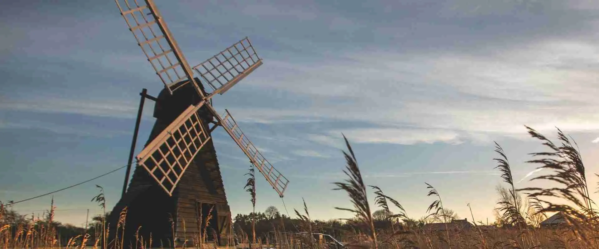
Draining the Basin: 17th-Century Dutch Hydraulics, Cambridge’s Influence, and the Altered Topography of the Fens
Lying in places more than four meters below the surrounding tidal rivers, the English Fenland is as much a human creation as a natural one — a reclaimed basin reshaped over four centuries of drainage engineering. This article traces the hydraulic works that transformed the Great Level from a seasonally flooded wilderness into productive agricultural land, from Sir Cornelius Vermuyden’s 17th-century canalization to the Victorian steam-driven scoop-wheels at Stretham, while also examining how the same marshy landscape served as a formidable military barrier in the centuries before the drainage schemes began.
Key Takeaways
- Vermuyden’s drainage of the Great Level involved cutting two parallel straight channels — the Old Bedford River (completed 1637) and the New Bedford River (completed 1652), together known as the two Bedford Rivers — plus a tidal exclusion sluice at Denver, establishing the fundamental geometry of the modern Fenland waterscape.
- The Bedford Level Corporation, formed in 1634 by Francis Russell, 4th Earl of Bedford, and thirteen co-investors known as “Adventurers,” financed the drainage in exchange for rights to the reclaimed land, tying the hydraulic transformation of the landscape to a private commercial model from its inception.
- Drainage of peat-rich fenland triggers irreversible soil subsidence: once the water table falls, peat oxidizes, compacts, and shrinks, pulling the land surface progressively below sea level. The Holme Fen post, first installed in 1848 and replaced by a cast iron column in 1851, has since recorded approximately four meters of cumulative land loss.
- Before the drainage works, the seasonal flooding of the pre-drainage Fens made the Isle of Ely a strategically formidable refuge; the Anglo-Saxon rebel Hereward’s stand there against William the Conqueror in 1071 is documented in the Anglo-Saxon Chronicle, the Liber Eliensis, and the Gesta Herewardi, though much of the detailed narrative carries significant medieval literary elaboration.
- The Stretham Old Engine (1831), a Butterley Company double-acting beam engine driving a scoop-wheel progressively enlarged to 37 feet 2 inches (11.33 meters), mechanized Fenland water lifting until 1925, capable of shifting 120 to 150 tons of water per minute — a capacity utterly beyond the windmills it replaced.
- The hydraulic infrastructure of the Aztec Basin of Mexico — chinampas, canal networks, and the Dike of Nezahualcoyotl — represents a convergent, independently developed solution to the challenge of managing wetland agriculture, arising from wholly separate cultural and historical conditions than those that shaped the Fenland drainage works.
People Also Ask About Fenland Drainage and Dutch Hydraulics
Who was Sir Cornelius Vermuyden and why was he engaged to drain the Fens?
Sir Cornelius Vermuyden (c. 1595–1677) was a Dutch engineer from Sint-Maartensdijk in Zeeland who became the pre-eminent hydraulic practitioner of his era in England. He was engaged to drain the Bedford Level primarily because of his earlier success at Hatfield Chase in the Isle of Axholme, Lincolnshire — work for which Charles I knighted him in 1629 — which had already demonstrated the applicability of Dutch polder drainage methods to English peatland. Vermuyden brought to the project a mature tradition of low-country hydraulic engineering: the principle of cutting straight, gravity-fed channels across flat terrain, using tidal exclusion sluices at critical outfall points, and managing the resulting drainage levels through a coordinated authority. His appointment was a natural consequence of that record. The Company of Adventurers, led by Francis Russell, 4th Earl of Bedford, needed an engineer with command of the full scope of a major drainage scheme, and Vermuyden’s reputation and prior English experience made him the obvious candidate. He supplemented his own expertise with a workforce that included Dutch laborers experienced in the specific techniques of the Low Countries, whose familiarity with saturated peat and silt conditions proved as valuable as the engineering design itself.
What causes drained peatland to sink progressively below sea level?
When peatland is drained, the lowered water table exposes previously saturated organic material to the atmosphere, triggering three linked and effectively irreversible processes. First, oxidation: peat is decomposed organic matter preserved in an oxygen-poor, waterlogged state; once aerated, aerobic microbial activity accelerates its decomposition, releasing carbon dioxide and consuming the material. Second, compaction: with the supporting water pressure removed, the peat matrix collapses inward under its own weight and under loading from agricultural machinery. Third, shrinkage: the peat physically contracts as moisture evaporates from its structure. None of these processes can be reversed by re-wetting alone, since the organic material that has been consumed cannot be reconstituted. In the Fens, the consequence of sustained peat loss is that much of the land surface has dropped so far below the level of the adjacent rivers and sea that gravity drainage alone is no longer possible — requiring continuous mechanical pumping to prevent re-inundation. The Holme Fen post records approximately four meters of land loss since 1851, and subsidence continues at a slower but measurable pace wherever peat remains aerated under arable cultivation.
How did the Fenland marshes provide a military defense before drainage?
The pre-drainage Fens formed a belt of seasonally flooded, waterlogged terrain that was effectively impassable for organized military forces, especially those equipped with the heavy cavalry armor that characterized Norman warfare in the 11th century. The only routes across the marsh were narrow natural causeways or elevated gravel ridges, easily defended or deliberately flooded. The Isle of Ely, surrounded on all sides by deep peat fen, reed swamp, and open water, was accessible only via a small number of such routes, making it highly resistant to the frontal assault that Norman forces could mount on firmer ground. The historical sources — the Anglo-Saxon Chronicle, the Liber Eliensis, and the Gesta Herewardi — all record that the Norman siege of Ely in 1071 required the construction of special causeway infrastructure simply to approach the island, underscoring how effectively the landscape neutralized the Normans’ principal military advantages. In this sense, the pre-drainage marsh performed a defensive function that no constructed fortification of the period would have needed to duplicate: the water table itself was the rampart.
How does the Fenland drainage system compare to wetland reclamation in other civilizations?
Fenland drainage and wetland reclamation represent a challenge that different cultures have encountered and solved independently, producing convergent hydraulic solutions shaped by analogous environmental conditions rather than any shared technical tradition. The most instructive parallel in the pre-Columbian Americas is the chinampa system of the Basin of Mexico, where engineers created raised agricultural platforms in shallow lake beds, separated by canal networks and regulated by dikes and floodgates — most notably the Dike of Nezahualcoyotl, constructed around 1449 to separate the freshwater and saltwater zones of Lake Texcoco. Where Vermuyden’s approach was essentially subtractive (removing water from the land through drainage channels and sluices), the chinampa approach was additive (building land up into the water to create raised planting surfaces). Both, however, required mechanisms to regulate the movement of water between distinct zones, and both produced highly productive agricultural landscapes from previously difficult wetland terrain. These traditions arose independently, separated by geography, more than a century of time, and fundamentally different ecological and social contexts — a convergence of technical logic rather than shared heritage.
Extended multi-day tours – 5+ days
Featured South East England Multi-Day Tour Packages
3 days
South East England 3-Day Discovery Tour
- ✓ Comprehensive South East England experience
- ✓ Expert local guides included
- ✓ All accommodation included
- ✓ Transportation provided

5 days
South East England 5-Day Highlights Experience
- ✓ Comprehensive South East England experience
- ✓ Expert local guides included
- ✓ All accommodation included
- ✓ Transportation provided
7 days
South East England 7-Day Cultural Journey
- ✓ Comprehensive South East England experience
- ✓ Expert local guides included
- ✓ All accommodation included
- ✓ Transportation provided
10 days
South East England 10-Day Complete Adventure
- ✓ Comprehensive South East England experience
- ✓ Expert local guides included
- ✓ All accommodation included
- ✓ Transportation provided
Multi-day tour packages powered by TourRadar. Prices and availability subject to change.
The Fenland Landscape: Peat, Flood, and the Historical Imperative of Drainage
Before the great drainage works of the 17th century, the landscape that is now the agricultural heartland of East Anglia was something altogether different: a vast, low-lying basin of peat fen, reed marsh, shallow meres, and seasonally flooded woodland stretching from the upland margins of Cambridge and Peterborough northward to the tidal estuary of the Wash. This terrain, known collectively as the Great Level, was defined by its intimate relationship with water — not as an enemy to be repelled but as the organizing principle of an entire ecological and social world. Local communities had exploited the fen’s resources for centuries: fishing, wildfowling, cutting reeds for thatch, digging peat for fuel, and grazing livestock on the summer grounds that briefly emerged above the flood line each year.
The hydrology of the Great Level was shaped by two interacting systems. From the south and west, several rivers — the Ouse, the Nene, the Welland, and their tributaries — drained sluggishly across the peat basin toward the Wash, barely able to carry the volume of upland water they collected. From the east, tidal incursion drove saltwater inland at high water, depositing silt in the lower reaches of these rivers and progressively raising their beds, reducing their capacity to discharge the flood waters feeding them from above. The result was a landscape perpetually close to saturation: one that flooded deeply each winter and retained standing water across large areas well into spring. Only elevated islands of ancient clay or silt — Ely, Ramsey, Thorney, and others — stood reliably above the maximum flood level, becoming the nuclei of settlement and monastic life precisely because of their exceptional dryness.
The persistent wetness was not simply an inconvenience. The fen was productive on its own terms, supporting a specialized and largely self-sufficient rural economy. But it also resisted the agricultural intensification that landowners increasingly sought from the late 16th century onward. The peat basin covered hundreds of thousands of acres of potentially fertile soil, held back from productivity by the water that saturated it for most of the year. The aspiration to convert this resource into reliably cultivable arable land was not new — there had been medieval and late medieval attempts at local drainage and embanking — but the scale and ambition of what was contemplated in the 1620s and 1630s was of a different order: the systematic drainage of the entire Great Level as a coordinated engineering enterprise.
The peat of the Fens accumulated over roughly five millennia in the wetland conditions that followed the post-glacial rise in sea level. It is the compressed and partially decomposed residue of marsh vegetation — reeds, sedges, mosses — preserved by waterlogging in an oxygen-poor environment. Its engineering properties are intimately linked to that saturated state: saturated peat supports itself in equilibrium; aerated peat shrinks, compacts, and oxidizes. The decision to drain it was therefore not simply a hydraulic intervention but a commitment to a new and permanent relationship with the peat’s physical properties — a relationship whose full implications would take generations to become apparent.
The social and ecological character of the pre-drainage Fens was complex. Commoners’ rights to fish, fowl, cut reeds, and graze livestock were legally established and economically vital to the communities of the fen edge. These rights were held in common and could not, in principle, be extinguished by the acts of individual landowners. The drainage scheme threatened them directly: to drain and enclose the fen was to convert common resource into private agricultural property, transferring the benefits of the reclaimed land to the Adventurers and their successors while stripping the commoners of their livelihoods. The Fen Tigers — the organized communities of commoners who sabotaged drainage works throughout the 17th century — were defending not abstract principle but concrete material existence, and their resistance should be read in that light.
Sir Cornelius Vermuyden and the Adventurers: Dutch Expertise in an English Fen
The decision to drain the Great Level was, in the first instance, a speculative commercial venture rather than a state project or a scientific enterprise. The mechanism that initiated the transformation of the Fenland landscape was the promise of profit: specifically, the promise that anyone who could bring the flooded basin into cultivation would be entitled to a share of the reclaimed land in proportion to their investment. This framework, adapted from Dutch practice, was the engine that mobilized both capital and expertise for the largest drainage project England had attempted.
Cornelius Vermuyden arrived in England in the 1620s, already experienced in the drainage works that had remade the coastline and river basins of the Low Countries over the preceding two centuries. The Netherlands had by that period developed a mature repertoire of hydraulic techniques: the cutting of straight poldervaart channels to drain saturated ground by gravity; the use of wind-driven scoop-wheels to lift water when gravity alone was insufficient; the construction of sluice gates to exclude tidal saltwater from freshwater drainage systems; and the organization of drainage authorities to coordinate maintenance across large areas. Vermuyden carried this technical tradition directly into English practice, adapting it — not always without difficulty — to the specific soils, tides, and topography of the Fenland basin.
His first major English commission had been the drainage of Hatfield Chase in the Isle of Axholme, Lincolnshire, which began in the mid-1620s. The work there was technically successful enough to earn him a knighthood from Charles I in 1629, though the social and economic disruption it caused — displacing Fenland commoners who depended on the wetland resource — generated riots and legal challenges that foreshadowed the resistance he would encounter at a larger scale in the Bedford Level.
The Company of Adventurers and the Politics of the Bedford Level
The Bedford Level drainage was organized under a framework that merged drainage authority with land speculation. In 1630, Francis Russell, the 4th Earl of Bedford, who held large landholdings in and around the Fens, agreed with the Crown to drain the Great Level in exchange for rights to 95,000 acres of the reclaimed land. He was joined by thirteen other “Adventurers” — investors who formed a corporation and obtained a formal charter from Parliament in 1634 authorizing them to proceed. Vermuyden was engaged as principal engineer.
By 12 October 1637, when the Court of Sewers met at St Ives, Cambridgeshire, the work was declared substantially complete and the Great Level pronounceable as drained for “summer lands” — meaning cultivable in the drier months, though winter flooding still occurred. This partial verdict attracted immediate criticism: the Adventurers had expected year-round drainage, and critics argued the work had not met that standard. King Charles I, drawn into the dispute, revoked the original contract in 1638, declared himself chief undertaker of the drainage, and restructured the land allocation so that the Crown received 52,000 acres and the Adventurers were left with only 40,000.
Civil War then interrupted the project entirely. Through the turbulent 1640s, much of the drainage infrastructure was damaged or abandoned, and the organizational structures supporting it collapsed. It was not until 1649, under a Parliamentary act authorizing what Vermuyden’s opponents sardonically called the “Pretended Act,” that the 5th Earl of Bedford and the surviving Adventurers were able to resume. Vermuyden again took charge. Work on the New Bedford River commenced under conditions of continuing social unrest — the Adventurers employed armed guards to protect their workers from the Fen Tigers, who attacked drainage infrastructure, burned reed beds, and organized systematic resistance to the enclosure of their common resources throughout the early 1650s.
The Old and New Bedford Rivers: Straight-Line Canalization Across the Peat Basin
Vermuyden’s engineering approach departed significantly from how drainage had previously been attempted in the region. Rather than working with existing meandering river channels — deepening, widening, and straightening them incrementally — he imposed straight-line artificial channels across the landscape, prioritizing maximum hydraulic gradient and minimum travel distance. The principle was to give the accumulated water of the basin the most direct possible route to the tidal outfall, using gravity to carry it across the level plain and sluice gates to prevent the tide from driving it back.
The Old Bedford River, completed in 1637, ran approximately 21 miles in a nearly straight line from Earith in Huntingdonshire to Salter’s Lode near Denver in Norfolk — a cut so deliberately direct that it was immediately legible as an artifact of engineered geometry imposed on a landscape accustomed to the gentle meanders of natural watercourses. Several subsidiary channels were also cut or improved in the same phase of work, and Vermuyden published a “Discourse Touching the Draining of the Great Fennes” in 1642 setting out his design rationale, though it attracted significant technical and political criticism from rival engineers and from those whose interests the scheme threatened.
The New Bedford River, completed in 1652, ran parallel to the Old Bedford River at a separation of roughly a mile across the peat basin, connected at either end by sluice structures. Between the two parallel rivers, Vermuyden left a strip of low-lying ground — the Ouse Washes — deliberately unfenced and unfarmed, to serve as a controlled flood reservoir when the volume of water coming down from the upland catchments exceeded the channels’ carrying capacity. This was not a design compromise but an intentional washland management strategy: a linear buffer absorbing excess water without inundating the improved farmland on either side. Vermuyden also cut the Forty Foot Drain — also called Vermuyden’s Drain — as a further element in the drainage geometry of the second-phase works.
Gravity-Fed Sluice Architecture and the Problem of Tidal Backflow
The single greatest hydraulic challenge of any low-gradient drainage system discharging into a tidal river is preventing the tide from running back up the outfall channel. In the Fenland, the Great Ouse between Ely and the Wash was subject to strong tidal fluctuation: at high tide, the river level rose appreciably above the level of the Fenland drainage channels feeding into it, and without a controlling structure at the junction point, saltwater would have entered the fresh drainage system, raised water levels across the basin, and rendered the drainage ineffective. The solution was architectural: a sluice gate at the critical confluence, operated by the tide itself.
Denver Sluice and Tidal Exclusion on the Great Ouse
Denver Sluice, established by Vermuyden at the confluence of the drainage channels with the tidal Great Ouse at Denver in Norfolk, operated on a straightforwardly elegant principle: a gate that opens on the ebb tide, when the river level falls below that of the drainage channel, allowing the accumulated fresh water to discharge freely, and closes on the flood tide, when the rising saltwater would otherwise push upstream. The sluice converts what would otherwise be a continuous hydraulic connection between the sea and the Fenland into an intermittent one, governed entirely by tidal timing and differential head. No power source is required; the weight of water on each side of the gate provides all the motive force needed for operation.
The original Vermuyden sluice at Denver has been substantially rebuilt and modified since the 17th century — the current structure incorporates elements from the 18th century and later improvements — but the function and location remain precisely as he established them. Denver Sluice continues to serve as the tidal exclusion point for a drainage catchment covering approximately 3,700 square miles, one of the most extensive gravity-drainage systems in Britain.
The gravity-fed model was elegant as long as the land surface remained above the level of the main river at low tide. But this condition was not permanent. As the peat shrank following drainage — a process discussed in detail below — the hydraulic gradient that gravity drainage depended upon diminished progressively. The ultimate consequence of this dynamic is that much of the lowest-lying Fenland now lies below the level of the rivers into which it once drained by gravity alone, requiring powered pumps to lift drainage water upward into channels that flow perceptibly above the surrounding fields. The logic of Vermuyden’s system has not failed; it has simply been overtaken by the physical consequences of its own success.
The Ouse Washes: Managed Flooding Between the Parallel Drains
The strip of low-lying ground between the Old and New Bedford Rivers — a corridor approximately 20 miles long and averaging about a mile in width — represents one of the more sophisticated design elements in Vermuyden’s overall scheme. The Ouse Washes, as this area is known, were intentionally left as managed washland: terrain that floods in winter and early spring, absorbing surplus water from the upland catchment and releasing it gradually rather than transmitting flood peaks directly and instantly into the downstream tidal river. The Washes do not drain the Fens; they buffer them, protecting the surrounding improved farmland from events that would otherwise overtop the channel banks and inundate much larger areas.
Flooding of the Ouse Washes in winter is not a system failure but its intended operation. Depth of inundation can reach several feet, covering the entire corridor for extended periods between autumn and early spring. The hydraulic logic is that controlled temporary flooding of a relatively small, designated area is preferable to uncontrolled flooding of a much larger surrounding agricultural zone.
An unanticipated long-term consequence of this regime is that the Ouse Washes have become one of the most ecologically significant wetland habitats in lowland England — a managed remnant of something approaching the pre-drainage Fenland landscape, preserved not by ecological intention but by the hydraulic requirements of the drainage scheme. The Washes are now a Site of Special Scientific Interest and a Ramsar Wetland of International Importance, supporting large numbers of wintering wildfowl and breeding wading birds that have largely disappeared from the surrounding drained farmland. The ecological value of the managed flooding is, in this case, a direct product of 17th-century hydraulic engineering logic applied without any conservation purpose whatever.
Peat Soil Subsidence and the Paradox of Successful Drainage
The most counter-intuitive consequence of the Fenland drainage is that it has produced a landscape more vulnerable in important respects than the one it replaced. The seasonally flooded pre-drainage fen was wet, but stable: the peat surface, perpetually saturated, neither oxidized nor compacted significantly, and the land level remained approximately constant over centuries. Once drainage removed the water, the peat began an irreversible process of change that the 17th-century engineers did not anticipate and could not have arrested even had they recognized it.
Oxidation, Compaction, and the Mechanics of Peat Shrinkage
Peat is formed by the accumulation of partially decomposed plant material in permanently waterlogged, oxygen-poor conditions. The organic matter is preserved because the absence of oxygen prevents the aerobic microbial processes that would otherwise decompose it. When drainage lowers the water table and exposes the upper peat layers to the atmosphere, two destructive processes are simultaneously activated.
The first is oxidation: aerobic bacteria and fungi colonize the newly aerated peat, breaking down the organic compounds and releasing their carbon as carbon dioxide. This is the same process as composting, operating over decades rather than weeks. As the organic material decomposes, the peat mass diminishes and the land surface descends. The second process is physical compaction: with the supporting water pressure removed, the peat matrix collapses inward under its own weight and under loading from agricultural machinery, livestock, and structures. The two processes reinforce each other — as the surface drops, the water table management required to keep the peat dry becomes more demanding, drawing the table down further and exposing still deeper peat layers to oxidation.
A third process, wind erosion, further amplifies the loss across the flat, exposed Fenland landscape. Dry peat in summer is light enough to be lifted by wind and carried considerable distances, and the removal of hedgerows and trees to accommodate large-scale mechanized farming has dramatically increased the Fenland’s exposure to this form of soil loss. The combined effect of oxidation, compaction, and erosion has caused the peat surface in parts of the central Fens to descend at rates that remain striking today, generations after the primary drainage was completed.
The paradox built into the drainage system is now plain. The engineering that made the Fens agriculturally productive committed the landscape to an indefinite future of managed subsidence and continuously escalating flood defense infrastructure. There is no natural equilibrium to settle into: the lower the land sinks, the more aggressively it must be pumped; the more aggressively it is pumped, the faster the peat oxidizes; the faster the peat oxidizes, the lower the land sinks. The loop is closed and self-reinforcing.
The Holme Fen Post: Measuring Land Loss Since 1851
The most direct and legible record of Fenland peat subsidence is the Holme Fen post, located at Holme Fen National Nature Reserve near Peterborough. The instrument is disarmingly simple: a vertical column whose base is driven into the stable clay substratum beneath the peat, with its top initially set exactly level with the ground surface. As the peat shrinks, the land drops around the column while the column remains stationary in the clay; the proportion of the column exposed above the surface is a direct measure of cumulative land loss.
The post was installed in 1848 by William Wells, the landowner, as a wooden stake, in anticipation of the peat subsidence he expected would follow the drainage and enclosure of the adjacent Whittlesey Mere. The wooden post was replaced in 1851 by a cast iron column reportedly sourced from the Crystal Palace structure built for the Great Exhibition of that year, embedded on oak piles driven into the underlying clay, with the top at the same level as the original post. When installed, the column top was flush with the ground surface. Today, approximately four meters of the column protrudes above the ground.
The rate of subsidence has not been uniform. In the decades immediately following drainage, measurements recorded a subsidence rate of approximately nine inches per year — a figure reflecting the explosive initial oxidation that followed the first sustained drop in the water table, when the largest reserves of previously saturated organic material were suddenly exposed to aerobic decay. The rate has since slowed considerably as the most readily oxidizable upper layers of peat have been consumed, but subsidence continues wherever arable farming and drainage maintenance keep the water table artificially depressed.
The Holme Fen post is now a Grade II listed structure — a piece of measuring equipment that has itself become a heritage monument. The data it has accumulated over more than 170 years is among the most extensive continuous records of peat subsidence available anywhere in Europe, and it is routinely cited in discussions of Fenland management, climate change mitigation, and the future of peat-based agriculture. Parts of the central Fens now lie at or below mean sea level, held above flood level only by the continuous operation of pumping stations and the structural integrity of river embankments that are themselves built on the shrinking peat — a situation whose long-term stability cannot be taken for granted as climate change raises the tidal baseline against which the drainage system must operate.
Defensive Isolation: The Pre-Modern Water Enclosure of Hereward the Wake’s Stronghold
Long before Vermuyden cut his first drainage channel through the peat, the same saturated landscape that frustrated agricultural ambition served the very different purpose of military defense. The insular topography of the Isle of Ely — a low ridge of firmer ground standing above the peat basin and accessible in the undrained medieval landscape only via narrow, seasonally impassable routes — created a natural stronghold that no constructed fortification of the 11th century could easily replicate or overcome from the outside. The events of 1071 demonstrated this with unusual clarity.
The historical basis for the Ely stand rests on primary documentation. The annal for 1071 in the Anglo-Saxon Chronicle records that Hereward — a figure who also appears in Domesday Book, holding land in Lincolnshire and Warwickshire, and whose existence as a historical individual is not in serious scholarly doubt — made a stand on the Isle of Ely against William the Conqueror’s forces alongside Morcar, the deposed Saxon Earl of Northumbria. The more detailed accounts in the Liber Eliensis, a 12th-century Latin history of the abbey of Ely, and in the Gesta Herewardi, a Latin narrative surviving in a 13th-century manuscript that is thought to reflect an early 12th-century original, elaborate this record into a sustained siege narrative. Historians treat the Gesta in particular with considerable caution: it incorporates demonstrably fantastical elements, was written in explicit praise of its subject, and reflects a milieu in which Hereward’s exploits had already been absorbed into developing regional legend. The later appellation “the Wake” — conventionally glossed as “the watchful” — has no 11th-century documentation and appears to be a medieval addition.
Peat Bogs as Natural Ballistic Barriers in Anglo-Norman Siege Craft
The Fenland’s defensive function in the 11th century derived from its physical properties as a medium for military movement. The peat basin surrounding the Isle of Ely was not simply wet: it was a mosaic of open water, saturated bog, reed swamp, and soft silt through which organized forces could advance only where the substrate could bear their weight. Norman military power of the period rested heavily on armored cavalry — the mounted knight in mail coat, whose effectiveness depended on firm ground and sufficient space for maneuver. In the Fenland, the ground conditions that cavalry required were absent across the overwhelming majority of the approach routes to Ely.
The boggy terrain imposed further constraints that the historical sources only implicitly acknowledge. From a modern tactical analytical perspective, the saturated peat could be understood as functioning as a natural ballistic barrier: a zone that degraded the attacker’s capacity to direct and concentrate projectile fire from a stable platform, and simultaneously prevented the rapid movement that active defense against archers would otherwise require of exposed troops. Bowmen wading through knee-deep silt or negotiating channels on improvised rafts could neither draw reliably nor hold a firing position; the mechanical leverage needed to operate heavier ballistic siege equipment — mangonels, trebuchets — was equally impractical on unstable, yielding ground. Defenders on the higher island terrain, by contrast, retained the advantages of stable footing and elevation. It should be noted that this interpretive framing draws on inference from the physical geography and from general knowledge of Anglo-Norman military capabilities, rather than on explicit tactical analysis in the primary sources themselves, which focus on narrative rather than on systematic military commentary.
What the sources do record directly is that the Normans experienced exceptional difficulty approaching and assaulting Ely, that multiple attempts were necessary, and that the terrain was a central factor in those difficulties. The physical barrier of the fen amplified the defensive value of the island’s elevation and the relatively small size of the garrison holding it, producing a defensive advantage out of all proportion to any conventional military strength Hereward’s forces could have mustered against the Norman king’s resources.
Medieval Causeways: Timber Pile Construction Across Silt Beds
The Gesta Herewardi and the Liber Eliensis both describe the principal Norman attempt to assault Ely as involving the construction of a large timber causeway — the Gesta specifies it as approximately a mile in length — built to carry the attacking force across the marsh to the island’s edge. The World History Encyclopedia, summarizing the medieval sources, notes that William’s forces used timber and stones brought specifically for the purpose; the Gesta adds the detail of inflated sheepskins placed under the timbers to provide buoyancy on the more water-covered sections. According to these accounts, the causeway collapsed on its first crossing attempt under the combined weight of armored horses and men, drowning a significant number of the attacking force. The Normans subsequently employed a witch to attempt psychological intimidation — an element of the narrative that illustrates the hagiographic character of the source and reminds readers that the siege story as the Gesta tells it is a mixture of what may be historical memory and what is certainly literary elaboration.
The Aldreth Causeway — a route from the southwest that crosses the marshy approaches to the Isle of Ely — is the traditionally identified approach route for the Norman assault. An earthwork known as Belsar’s Hill, sitting astride the route, is associated by some researchers with the Norman encampment during the siege, though this identification remains uncertain in the scholarly literature.
The physical reality of building a major timber causeway across a silt-bed marsh in the 11th century is, however, well within the documented capabilities of Norman military engineering. Timber-pile bridge and causeway construction was a standard skill, deployed in river crossings and siege operations across northern Europe. The Fenland, with its firm clay substratum beneath the peat and silt, offered a stable driving layer for vertical timber piles, which would have been connected by horizontal timbers and decking to create a load-bearing surface extending across the marsh. The instability of the saturated peat and silt immediately above the clay — materials that flow, consolidate unevenly, and shift under concentrated dynamic loading — makes the collapse of a rapidly constructed causeway plausible without requiring any embellishment, even if the Gesta’s narrative details cannot be verified against independent sources. The Normans ultimately captured Ely not by engineering their way across the marsh but by obtaining from local monks knowledge of a navigable route through it — a reminder that even formidable natural defenses are susceptible to the social vulnerabilities of besieged communities.
Stretham Old Engine: Steam-Driven Scoop-Wheels and Victorian Land Reclamation
The transition from wind-driven to steam-driven drainage in the Fens proceeded piecemeal through the early decades of the 19th century, as the calculus of maintenance cost and operational reliability shifted in favor of coal-burning engines over the windmills that had managed the drainage for more than a century. The first Fenland steam pumping engine was installed at Soham in 1817; several others followed through the 1820s. The Stretham installation of 1831 belongs to this pioneering generation, and it survives as the most complete and instructive example of its type remaining in England.
The Stretham Old Engine was built by the Butterley Company of Derbyshire at a contract cost of £4,950, replacing four windmills that had previously lifted drainage water from the Waterbeach Level — the internal drainage district served by the station — into the Old West River. The site rests on an unusual geological formation: a bed of hard gravel beneath the peat, which meant that no pile-driving was needed for the engine house foundations — a significant construction advantage in a landscape where most drainage buildings required extensive groundwork to deal with the compressible peat and silt. The engine house, constructed in Gault brick in Flemish bond with slate roofs, remains largely intact, together with the adjoining boiler house and scoop-wheel house, all built in 1831. The site is Grade II* listed and designated as a Scheduled Ancient Monument.
Mechanical Displacement of Water in Low-Lying Silt Basins
The mechanical principle of the scoop-wheel is conceptually straightforward and operationally robust. A large paddle-wheel, mounted on a horizontal shaft and rotating within a partially submerged curved trough, carries water upward from the low-side drainage channel through the arc of its rotation and deposits it over a sill into the high-side main drain or river. The height through which the water is lifted — the “lift” — determines the energy the engine must supply: at Stretham, the scoop-wheel lifted Fenland drainage water approximately 1.7 meters into the Old West River.
The rotative beam engine driving the scoop-wheel was a double-acting type: steam was applied to the piston on both the upstroke and the downstroke, delivering continuous rotational force via a connecting rod to the flywheel, and through a gear train to the scoop-wheel shaft. The beam itself measured 24 feet 8 inches (7.52 meters) and the flywheel 24 feet (7.3 meters) in diameter. Steam was supplied initially by wagon boilers, later replaced by three Lancashire boilers operating at 8 pounds per square inch, which proved more efficient at the sustained demands of continuous drainage operation. The engine consumed approximately one ton of coal every four hours, delivered by barge along the adjacent waterway, and required the stoker and superintendent on 24-hour call during peak drainage periods.
The scoop-wheel itself was progressively enlarged at intervals as Fenland peat subsidence lowered the drainage channels and increased the required lift — a direct and measurable consequence of the ongoing land loss that the drainage had itself initiated. The original wheel, 29 feet (8.8 meters) in diameter, was enlarged to 33 feet (10 meters) in 1850 and again to 37 feet 2 inches (11.33 meters) in 1896. At this final dimension, operating at its designed speed, the engine and scoop-wheel combination could lift between 120 and 150 tons of water per minute — a throughput capacity far beyond anything achievable by the windmills it had replaced, and one that made continuous rather than intermittent drainage possible regardless of wind conditions.
The engine was superseded in 1925 by a 200-horsepower Mirrlees diesel engine driving a centrifugal pump, which took over primary drainage duties with far lower fuel consumption and staffing requirements. The steam engine operated for the last time in 1941, briefly reactivated to assist with flood emergency drainage. It is now preserved in near-working order under the stewardship of the Stretham Engine Preservation Trust, which opens the site to the public on selected Sundays between April and October, with volunteer-led tours providing access to the engine house, boiler house, and scoop-wheel housing. The Stretham Old Engine is one of only three surviving beam-engine drainage stations in East Anglia, and the only one to retain its scoop-wheel complete and in situ — making it the most complete surviving artifact of the Fenland’s mechanical drainage era.
Chinampa Agriculture and the Hydraulic Infrastructure of the Aztec Basin: A Cross-Cultural Parallel
Among the most instructive comparisons for understanding the Fenland drainage — not as an isolated European achievement but as one instance of a recurring human response to the challenge of productive wetland management — is the hydraulic system of the Basin of Mexico. The comparison requires careful framing and a frank acknowledgment of its limits. These two traditions arose independently, in entirely separate geographic, cultural, and historical contexts; there is no suggestion of contact, knowledge exchange, or transmission of technique between them. The resemblance, where it is real, reflects convergent problem-solving in response to analogous environmental conditions, not a shared engineering lineage or any form of cultural connection across the Atlantic.
Raised-Field Agriculture, Canal Networks, and the Dike of Nezahualcoyotl
The Basin of Mexico in pre-Columbian times contained a network of interconnected shallow lakes — Texcoco, Xaltocan, Xochimilco, and Chalco among them — whose margins and shallow floors supported one of the most intensive agricultural developments in the pre-industrial world. The chinampa, a raised planting platform constructed in the shallow water of a lake, was not an Aztec invention. Chinampa agriculture had been practiced across several Mesoamerican cultures in the Basin of Mexico for many centuries before the Aztec Empire consolidated its political dominance, and the landscape that the Aztecs inherited was already an extensively managed mosaic of raised fields, canals, and open water.
The construction of a chinampa begins with the staking of a rectangular frame in shallow water, followed by successive layers of aquatic vegetation, lake mud, and organic material dredged from the canal beds. Over time, this built-up platform rises above the water surface, creating a permanently elevated planting area whose root zone retains access to lake moisture while the cultivated surface stays dry. The canals between adjacent chinampas serve simultaneously as transport routes for canoes, as drainage channels for excess surface water, and as sources of irrigation water and fertilizing silt. The resulting system is both highly productive — historical accounts suggest multiple harvests per year — and self-sustaining in its original water-managed form, since the periodic dredging of canal mud to dress the planting beds both clears the channels and continuously fertilizes the platforms.
Managing the wider lake system at the scale required to protect the island capital of Tenochtitlan was a more ambitious engineering challenge. The interconnected lakes of the Basin of Mexico occupied a closed catchment: unlike the Fenland, which ultimately discharged through the Great Ouse into the tidal Wash, the basin had no natural outflow to the sea. Seasonal flooding during the wet season was therefore both more severe and harder to manage hydraulically, since excess water could not be gravity-drained away — it had to be held back by structural barriers.
The Dike of Nezahualcoyotl, the most consequential hydraulic structure in the basin, was constructed around 1449, following a devastating flood in that year, under the joint commission of Moctezuma I, the Mexica ruler of Tenochtitlan, and Nezahualcoyotl, the tlatoani (leader) of the allied city of Texcoco — a figure renowned in the historical record for engineering expertise as well as military and political leadership. Stretching approximately 16 kilometers across Lake Texcoco, the dike divided the basin into a freshwater western zone adjacent to Tenochtitlan and a more saline eastern zone, protecting the city from flood surges driven by wind and runoff across the open lake. Its construction involved timber piles, stone, clay, and mortar, and it incorporated openings functionally analogous to sluice gates, which could be adjusted to regulate the flow of water between the two separated sections of the lake. Multiple contemporary and historical sources confirm the presence of these controlled openings as a deliberate water management feature of the structure. The dike remained in use through the Spanish conquest of 1521 and continued to influence the basin’s hydrology for generations afterward; its eventual destruction contributed significantly to the catastrophic flooding that plagued colonial Mexico City through the 17th and 18th centuries.
Convergent Hydraulic Engineering: Independent Solutions to Shared Wetland Challenges
The parallel between the Fenland and the Basin of Mexico is illuminating precisely because the two systems address different variants of the same underlying challenge: managing the relationship between human agriculture and a landscape defined by the presence and movement of water. In the Fens, the problem was excess surface water in a peat basin that drained slowly to a tidal estuary; the solution was to accelerate drainage through straight channels and to exclude tidal backflow through sluice architecture, with the unintended consequence of triggering peat subsidence. In the Basin of Mexico, the problem was a closed lake system subject to seasonal flooding and intrusion of saline water across the open lake; the solution was to build a dike separating water bodies of different character and to regulate flow between them through controlled openings.
In both cases, the engineering involved the creation of a physical barrier between two water bodies of different quality; the use of gate-like structures to control when and how water moved between them; and the development of institutional mechanisms — the Bedford Level Corporation in one case, the tribute and labor-mobilization systems of the Aztec state in the other — to sustain the ongoing maintenance that any large hydraulic system requires. These parallels are notable precisely because they were not produced by contact or diffusion. The Fenland engineers of the 17th century had no knowledge of chinampa agriculture or the Aztec dike system; the hydraulic engineers of 15th-century Mesoamerica had no foreknowledge of the Dutch polder tradition. Each set of solutions was developed from first principles in response to local environmental conditions and social imperatives specific to its own time and place.
Where the two traditions diverge is as instructive as where they converge. The chinampa approach was fundamentally additive — creating elevated land within the water environment, while leaving the lake system intact as the matrix in which agriculture was embedded. The Fenland approach was fundamentally subtractive — removing the water from the landscape entirely, replacing a wetland ecosystem with a dry-land agricultural one. The chinampa system maintained the lake; the Fenland system sought to eliminate it. This difference in fundamental strategy carries profound ecological consequences: the chinampa landscape maintained high biodiversity and ecological complexity within its agricultural fabric; the drained Fenland eliminated the wetland ecosystem, leaving only fragments as conservation relics. The convergent technical logic of water management thus conceals a profound divergence in ecological outcome — a divergence that the 21st century is now, belatedly, beginning to reckon with.
The Ecological Legacy of Fenland Drainage and the Contemporary Debate
The transformation of the Great Level was not accomplished without conflict or cost, and its long-term consequences are still accumulating. The Fen Tigers — the organized commoner communities who sabotaged the 17th-century drainage works — understood something that the Adventurers did not fully reckon with: that the conversion of common wetland to enclosed arable land was a dispossession as much as an improvement, and that the ecological fabric of the pre-drainage fen was also a productive resource with its own legitimate claimants. Their attacks on drainage infrastructure were expressions of economic grievance rather than mere vandalism, and they continued in periodic waves through the 1650s and beyond.
The ecological consequences of the drainage are now measured in terms of habitat loss of extraordinary scale. The pre-drainage Fens supported one of the largest and most diverse wetland ecosystems in lowland Britain — a mosaic of open water, reed marsh, wet grassland, and carr woodland sustaining species now drastically reduced or locally extinct across the region: the bittern, the marsh harrier, the common crane, the large copper butterfly, and many others. The drainage converted the overwhelming majority of this habitat to arable farmland within a relatively short period, leaving only isolated fragments — Wicken Fen, Holme Fen National Nature Reserve, the Ouse Washes — as witnesses to what the pre-drainage landscape had been.
Today the Fenland faces a cluster of converging long-term pressures. Peat oxidation continues, releasing carbon dioxide from decomposing organic matter at rates that make the drained Fens a net contributor to greenhouse gas emissions — an environmental liability becoming increasingly significant as carbon accounting moves toward the center of agricultural policy debates. The land surface continues to sink in the most intensively cultivated areas. Climate change introduces further complications: higher sea levels raise the tidal baseline against which the drainage system operates, while altered precipitation patterns increase the frequency of both droughts (which accelerate peat oxidation) and heavy rainfall events (which test drainage infrastructure capacity).
The response to these pressures is actively contested. Large-scale rewetting projects — most notably the Great Fen initiative in Cambridgeshire, which aims to restore extensive areas of cultivated Fenland to managed wetland — seek to halt peat oxidation by raising water tables across the restored zone. The ecological and carbon-storage benefits of such projects are significant; the implications for agricultural output and land tenure are complex and locally contentious. The Fenland remains, by most measures, one of the most productive agricultural landscapes in Britain, and the tension between that productivity and the long-term stability of the peat that underlies it is the central unresolved question of Fenland management in the 21st century. The hydraulic decisions made in the 1630s and 1650s have set in motion a trajectory whose full reckoning is still unfolding.
Visiting the Fenland Drainage Heritage
The sites associated with the history of Fenland drainage are distributed across a broad area of Cambridgeshire, Norfolk, and Lincolnshire, ranging from operational engineering infrastructure to preserved industrial monuments and managed nature reserves.
Stretham Old Engine, located just south of the village of Stretham on the Old West River, is the most complete surviving example of a Fenland steam drainage engine and the only one to preserve its scoop-wheel complete and in situ. The site opens on selected Sundays between April and October, managed by the Stretham Engine Preservation Trust with volunteer-led tours providing access to the engine house, boiler house, and scoop-wheel housing. The Grade II* listed engine house and its complement of original machinery — beam engine, Lancashire boilers, and the final 37-foot-2-inch scoop-wheel — are in near-working order and are operated electrically for demonstration. The riverbank walks adjacent to the site offer a ground-level perspective on the relationship between the drainage channel and the surrounding flat farmland.
Holme Fen National Nature Reserve, managed by Natural England near Peterborough, contains the Holme Fen post in situ within a setting that is itself instructive: one of only four surviving fragments of the ancient wild fen, its silver birch woodland having colonized the former peatland after drainage and the cessation of commercial peat cutting. The two iron posts — the original 1851 cast iron column and the supplementary post added in 1957 — stand in a clearing within the reserve and are accessible on foot. The juxtaposition of the measuring instrument with the regenerating semi-natural habitat that has grown up around it gives the site an unusual interpretive depth.
Denver Sluice, in the Norfolk village of Denver near Downham Market, is the operational descendant of Vermuyden’s original tidal exclusion structure and is publicly accessible on foot from the adjacent picnic area. The current complex of sluices, pumping stations, and relief channels represents the accumulated hydraulic infrastructure managing the outfall of the entire Fenland drainage system, and visiting it provides a ground-level sense of the engineering scale involved in sustaining the drained landscape. Ely Cathedral, whose Romanesque tower dominates the flat Fenland skyline for many miles in every direction, was begun in 1083 — shortly after the Norman capture of the Isle of Ely in 1071 — and illustrates how rapidly a military stronghold was converted into an ecclesiastical and administrative center once the siege was resolved. The Cathedral’s site on the elevated island ground remains the most distinctive topographic feature in the region and conveys more forcefully than any description the extent to which the “island” genuinely was an island in the pre-drainage landscape.
Wicken Fen, managed by the National Trust approximately ten miles south of Stretham, is the oldest nature reserve in England and one of the most important surviving areas of undrained fenland in Britain. It maintains pre-drainage wetland conditions through active water-level management, and it operates a restored wind-driven scoop-wheel of the traditional pre-steam type. The contrast between Wicken Fen’s managed wetland and the intensively drained farmland surrounding it on every side is one of the most immediate visual illustrations available of what the Fenland drainage achieved and what it extinguished.
Frequently Asked Questions
What is the Bedford Level and how was it created?
The Bedford Level is the name given to the large peat fenland basin of East Anglia — centered on Cambridgeshire, Norfolk, and parts of Lincolnshire — that was drained principally through the engineering works of Cornelius Vermuyden between 1634 and 1652. The name derives from Francis Russell, the 4th Earl of Bedford, who led the consortium of “Adventurers” who financed the drainage in exchange for rights to the reclaimed land. The physical creation of the Bedford Level involved cutting two major straight drainage channels — the Old Bedford River and the New Bedford River — across the flat peat basin, together with subsidiary drains including the Forty Foot Drain, using gravity to carry accumulated water toward a tidal exclusion sluice at Denver on the Great Ouse. The Bedford Level Corporation was the administrative authority established to govern and maintain the drainage works, and it is regarded as one of the most ambitious hydraulic engineering undertakings in British history, both in its scale and in the long-term physical transformation of the landscape it produced.
Why was Cornelius Vermuyden chosen to drain the Fens?
Vermuyden was chosen primarily because he had already demonstrated his ability to apply Dutch polder drainage techniques to English conditions at Hatfield Chase in Lincolnshire — work for which he was knighted in 1629. He brought to the Bedford Level a well-established Dutch hydraulic tradition: straight channels to maximize gravity drainage, tidal exclusion sluices at outfall points, and the organizational concept of a drainage authority to sustain ongoing maintenance. His earlier English experience also gave him access to a workforce experienced in Dutch drainage practice, including laborers familiar with the specific challenges of saturated peat and silt. No contemporary English engineer had a comparable combination of technical background, prior English large-scale experience, and organizational capacity. There were critics of his specific design choices — most notably rival engineers who argued that his straight-line channels would not deliver the year-round drainage promised — but his appointment was never seriously contested on grounds of competence.
What is the Hundred Foot Drain and how does it relate to the New Bedford River?
The Hundred Foot Drain and the New Bedford River are different names for the same channel. The New Bedford River was cut between 1649 and 1652, running parallel to the Old Bedford River for approximately 20 miles from Earith in Cambridgeshire to Denver Sluice in Norfolk. Its common alternative name, the Hundred Foot Drain, derives from its intended width of one hundred feet — a dimension chosen to maximize hydraulic carrying capacity. Together with the Old Bedford River and the Ouse Washes washland between them, it forms the central structural element of the Bedford Level drainage system as Vermuyden designed it. Both rivers were designed and constructed under his superintendence: the Old Bedford River in the first phase of works (1634–1637) and the New Bedford River in the second phase authorized by Parliament in 1649.
Why did the Norman army need to build a causeway to attack the Isle of Ely?
In the undrained medieval Fenland, the Isle of Ely was surrounded on all sides by deep peat fen, reed swamp, and open water, with no reliable overland routes available to a large military force. The terrain was effectively impassable for armored cavalry — the backbone of Norman military power — whose effectiveness depended on firm, load-bearing ground. Without the drainage that had not yet been initiated, the Normans could not simply march across the marsh; they had to construct temporary infrastructure to create an approach. The Gesta Herewardi and the Liber Eliensis both describe a large timber causeway, reportedly about a mile in length, built to carry the attacking force across the wetland to the island’s edge. According to these sources — which carry elements of literary elaboration and should be read with historiographical caution — the causeway collapsed on its first crossing attempt under the combined weight of armored horses and men. The Normans ultimately succeeded in capturing Ely in 1071 by obtaining knowledge of a navigable route through the marsh from local monks, rather than by completing the causeway engineering.
What is peat oxidation and how does it cause land to sink after drainage?
Peat is the partially decomposed residue of wetland vegetation, preserved in a permanently waterlogged, oxygen-poor state over thousands of years. When drainage lowers the water table below the peat surface, the newly aerated organic material is exposed to aerobic microbial activity — bacteria and fungi — which begin decomposing it. This oxidation converts the organic compounds in the peat to carbon dioxide and water, consuming the material and reducing the mass of the peat layer. Simultaneously, with the supporting water pressure removed, the peat matrix physically compacts under its own weight and under agricultural loading. Both processes reduce the depth and mass of the peat, causing the land surface to descend. The process is irreversible: once peat has been oxidized, it cannot be reconstituted simply by re-wetting, though raising the water table can halt further loss. In the Fens, the Holme Fen post records approximately four meters of cumulative surface loss since 1851 — and subsidence continues wherever arable cultivation and drainage management keep the water table artificially depressed below the peat layer.
How does the Stretham Old Engine work mechanically?
The Stretham Old Engine combines a coal-fired rotative beam engine with a scoop-wheel pump. The beam engine burns coal to produce steam, which drives a piston in a double-acting cylinder — meaning steam is applied on both the upward and downward strokes, delivering continuous rotational force via a connecting rod to the flywheel, 24 feet in diameter. The flywheel smooths the rotary motion and delivers it through a gear train to the horizontal shaft of the scoop-wheel. The scoop-wheel — a large paddle-wheel rotating within a curved masonry or cast-iron trough — lifts water from the low-side drainage channel upward through the arc of its rotation and deposits it over a sill into the higher-level Old West River. At its final dimension of 37 feet 2 inches, the scoop-wheel lifted 120 to 150 tons of water per minute through a vertical lift of approximately 1.7 meters. The wheel was progressively enlarged over the engine’s working life as Fenland land subsidence lowered the drainage channels and increased the required lift height — each enlargement a direct physical record of the ongoing peat loss the drainage had initiated.
What was the Holme Fen post designed to measure?
The Holme Fen post was installed by landowner William Wells in 1848 — initially as a wooden stake, replaced in 1851 by a cast iron column reportedly sourced from the Crystal Palace exhibition structure — to measure the peat subsidence he anticipated would follow the drainage and enclosure of the adjacent Whittlesey Mere. The principle is simple: the base of the column is anchored in the stable clay substratum beneath the peat, and its top was set exactly level with the ground surface at installation. As the peat oxidizes and compacts, the land surface drops around the column while the column remains stationary in the clay, so the height of column exposed above the ground directly measures the cumulative subsidence since installation. When first installed, the top was flush with the ground. Today, approximately four meters of column protrudes above the surface — a measure of the total land loss at the site since 1851. The post is now a Grade II listed structure, and the dataset it has accumulated constitutes one of the longest continuous records of peat subsidence in Europe.
What is a chinampa and where were they built?
A chinampa is a type of raised agricultural platform constructed in the shallow waters of a lake or lagoon by building up successive layers of aquatic vegetation, lake mud, and organic material within a staked rectangular frame, creating a permanently elevated planting surface surrounded by water-filled canals. Chinampas were developed across several pre-Columbian cultures in the Basin of Mexico — the high-altitude closed valley containing the lakes of Texcoco, Xochimilco, Chalco, and others, in what is now central Mexico City and its surroundings. The system predates the Aztec Empire and was inherited, maintained, and significantly expanded by the Aztecs from the 14th century onward, eventually covering an estimated 9,000 hectares in the most intensively cultivated zones. The canals between adjacent chinampas served as transport routes and irrigation channels, and periodic dredging of canal mud to dress the platforms provided continuous fertility. The chinampa system was integral to the agricultural productivity that sustained the large urban population of Tenochtitlan, the Aztec capital.
Why does the Fenland landscape continue to sink today?
The Fenland continues to sink because the agricultural management practices that make it productive also sustain the conditions that drive peat oxidation. Maintaining arable farmland on peat requires keeping the water table artificially low — typically 0.5 to 1 meter below the surface — by continuous pumping. This depressed water table keeps the upper peat layers aerated, fueling ongoing aerobic decomposition, physical compaction, and wind erosion. The process is self-reinforcing: as the land sinks, the pumping requirement increases; as pumping increases, the peat oxidizes faster; as peat oxidizes, the land sinks further. The most intensively cultivated areas of the central Fens are estimated to be sinking at rates of 1 to 2 centimeters per year, and some zones now lie more than three meters below mean sea level. The cycle can be halted by raising the water table — which means converting arable land back to wetland — but not otherwise reversed. Large-scale rewetting initiatives such as the Great Fen project address parts of this challenge, but the area under active restoration remains a small fraction of the total drained peat surface.
Who were the Fen Tigers and why did they resist the drainage works?
The Fen Tigers is the collective name for the communities of Fenland commoners who organized systematic resistance — sometimes violent — against the 17th-century drainage schemes. Their opposition was primarily economic. The pre-drainage Fens supported a way of life built on established common rights: fishing, wildfowling, reed-cutting, peat-digging, and seasonal grazing on the summer fen. When the Adventurers drained and enclosed the reclaimed land as private property, these common rights were extinguished, and the communities dependent on them were effectively dispossessed. The Fen Tigers responded by destroying drainage ditches, breaking sluice gates, burning reed beds, and attacking drainage workers — sustained, organized acts of economic resistance that required the Adventurers to employ armed guards to protect their workforce. Resistance continued periodically through the 1650s and into later decades. The Fen Tigers are now recognized as a significant early instance of popular organized resistance to enclosure and the privatization of common resources, and their actions illustrate that the hydraulic transformation of the Fenland was socially as well as physically contested.