Cliffside Thermodynamic Engineering: The Storehouses of Pinkuylluna vs. World Citadel Granaries
Above the ancient Inca town of Ollantaytambo, a long row of stone storehouses occupies the sheer cliff face of Pinkuylluna — positioned not for ease of construction, but because the cliff itself is a thermal instrument. These qollqas deployed cliff-face elevation, directed wall perforations, and stone-floored terraces as a passive climate-control system capable of preserving grain and goods for multiple years at altitude. The same engineering insight — that natural topography can be recruited as a preservation technology — appears independently in the barrel-vaulted ksar granaries of Southern Tunisia and in the subterranean storage systems of ancient Mesopotamian citadels.
Key Takeaways
- The Pinkuylluna storehouses exploit cliff-face elevation to harness altitude-driven cooling, prevailing valley wind, and buoyancy-driven natural convection — creating a passive ventilation system that evacuates moisture and stabilizes interior temperatures without any mechanical input.
- Wall perforations in Inca qollqa construction are oriented to intercept prevailing wind direction, generating inlet-to-outlet pressure differentials that drive sustained cross-draft airflow through storage chambers and prevent the humidity buildup that destroys stored organic material.
- Stone-flagged floors raised above ground contact interrupt the capillary pathway for ground moisture, addressing humidity at the structural level independently of, and prior to, the airflow system above.
- Cliff-face positioning serves an explicit strategic purpose alongside the thermal one: storehouses on an inaccessible cliff above a fortified town are logistically impractical to assault while remaining visually prominent — simultaneously securing the supply reserve and broadcasting the state’s provisioning capacity.
- The Ghorfas of Southern Tunisia’s ksour and the subterranean granaries of Mesopotamian citadels reflect independent, convergent engineering responses to the same universal challenge — each tradition adapting available physics to its specific climate and topography without any cultural transmission between them.
- The Battle of Ollantaytambo in 1537 revealed the full integration of Pinkuylluna’s design concept: fortified terraces, a cavalry-hostile urban grid, and the tactical hydraulic inundation of the Urubamba plain combined into a defense that validated the strategic logic of the cliff-face storehouse position.
People Also Ask About Pinkuylluna Thermodynamic Engineering
What engineering principles governed the design of the Pinkuylluna storehouses?
The Pinkuylluna qollqas exploit three interconnected physical principles simultaneously. First, cliff-face elevation places the structures within a cooler ambient microclimate: air temperature decreases with altitude at roughly 0.6°C per 100 meters under standard atmospheric conditions, and the Pinkuylluna cliff face sits several hundred meters above the valley floor, producing a measurable cooling differential relative to the agricultural terraces below. Second, wall perforations oriented toward the prevailing valley wind generate cross-draft airflow through the storage chambers — a pressure-driven mechanism that continuously evacuates moisture-laden interior air and replaces it with drier moving air. Third, stone-flagged floors break the capillary contact through which ground moisture migrates into storage spaces, removing a humidity source at the structural boundary before the airflow system engages. Together, these three principles function as a layered passive climate-control system in which the site itself — cliff, wind corridor, rock floor — performs most of the environmental regulation.
How did the Inca use wall perforations to regulate temperature and humidity in their storehouses?
Inca qollqa walls incorporated recessed openings and through-holes at specific positions in the wall plane, allowing outside air to enter, traverse the storage chamber, and exit through an opposing aperture or elevated vent. Their placement corresponds to prevailing wind direction, and their sizing — narrow enough to deter rodent entry, wide enough to sustain continuous airflow — reflects a calibration to local thermal conditions. Incoming air, accelerated through the restricted opening, drops in pressure on entering the chamber, facilitating evaporative drying of stored goods at the surface level. The steady replacement of interior air prevents the humidity accumulation, mold growth, and fermentation gas buildup that degrade organic material over time. In the Pinkuylluna context, the cliff rock adds a thermal mass effect: the stone absorbs daytime solar energy and releases it slowly at night, moderating temperature swings that would otherwise stress stored goods through repeated cycles of cellular moisture expansion and contraction.
What role did the Pinkuylluna storehouses play in Ollantaytambo’s strategic defense?
The cliff-face positioning of the Pinkuylluna qollqas was not incidentally defensible — it was structurally so. Any attacking force seeking to reach the storehouses would need to ascend a steep, exposed cliff face under observation, without cover, before gaining access. Meanwhile, the same elevation that makes the storehouses thermally advantageous makes them visually prominent from every approach to the valley — broadcasting the town’s supply resilience to potential adversaries. During the Battle of Ollantaytambo in 1537, this logic extended to the active defense of the valley itself: Manco Inca’s forces used Ollantaytambo’s hydraulic infrastructure to flood the Urubamba plain and deny Hernando Pizarro’s cavalry the open ground it needed to operate. The storehouses and the hydraulic system were complementary instruments of the same concept — protect the supply reserve and deny the adversary freedom of movement.
How do Inca cliff-face granaries compare with equivalent structures in North Africa and the ancient Near East?
The comparison is one of convergent engineering logic, not cultural transmission. The Ghorfas of Southern Tunisia’s ksour — multi-story stone-vaulted granary chambers aggregated into fortified courtyard complexes — occupy elevated or enclosed positions for the same fundamental reason: perishable goods deteriorate faster at ground-level heat and humidity. The Ghorfa achieves thermal stability through thick barrel-vaulted walls that buffer temperature oscillation; the Inca qollqa achieves it through cliff-face elevation and continuous passive airflow. In ancient Mesopotamia, a third independent solution appears: sinking granaries below ground exploits the thermal stability of subsurface soil, which maintains a more constant temperature than surface air through the same thermal-mass principle applied vertically downward rather than upward. Each strategy addresses the same thermodynamic problem through different architectural means, developed entirely independently within its own cultural and environmental context. The convergence is defined by the physics of the problem — not by shared knowledge.
Extended multi-day tours – 5+ days
Featured Machu Picchu Cusco Multi-Day Tour Packages
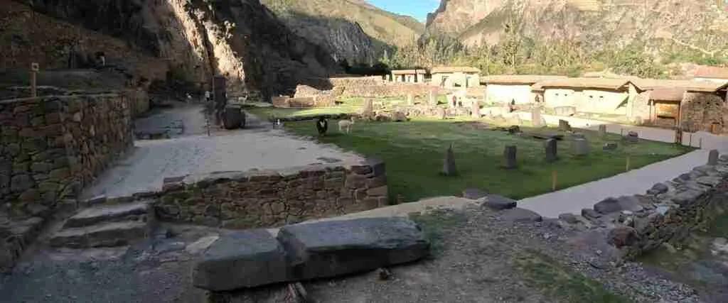
3 days
Machu Picchu Cusco 3-Day Discovery Tour
- ✓ Comprehensive Machu Picchu Cusco experience
- ✓ Expert local guides included
- ✓ All accommodation included
- ✓ Transportation provided
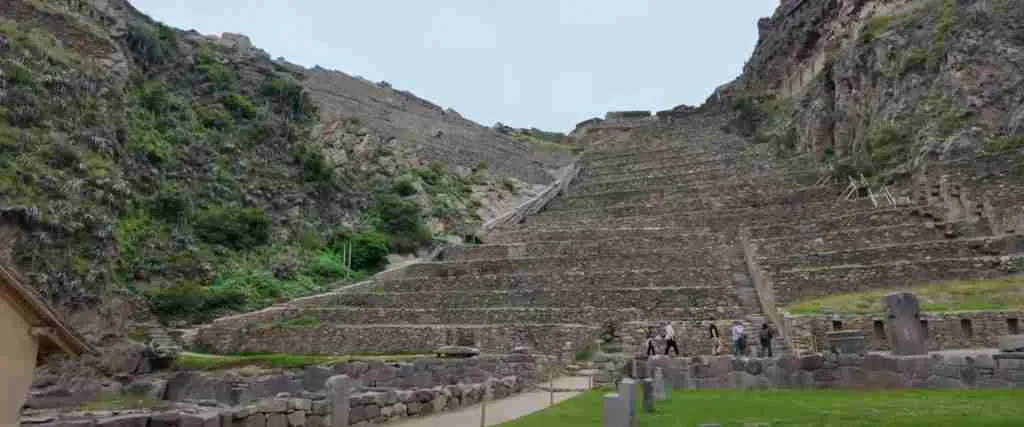
5 days
Machu Picchu Cusco 5-Day Highlights Experience
- ✓ Comprehensive Machu Picchu Cusco experience
- ✓ Expert local guides included
- ✓ All accommodation included
- ✓ Transportation provided
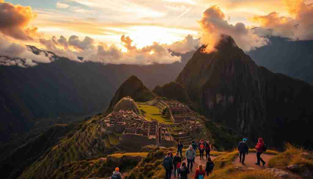
7 days
Machu Picchu Cusco 7-Day Cultural Journey
- ✓ Comprehensive Machu Picchu Cusco experience
- ✓ Expert local guides included
- ✓ All accommodation included
- ✓ Transportation provided
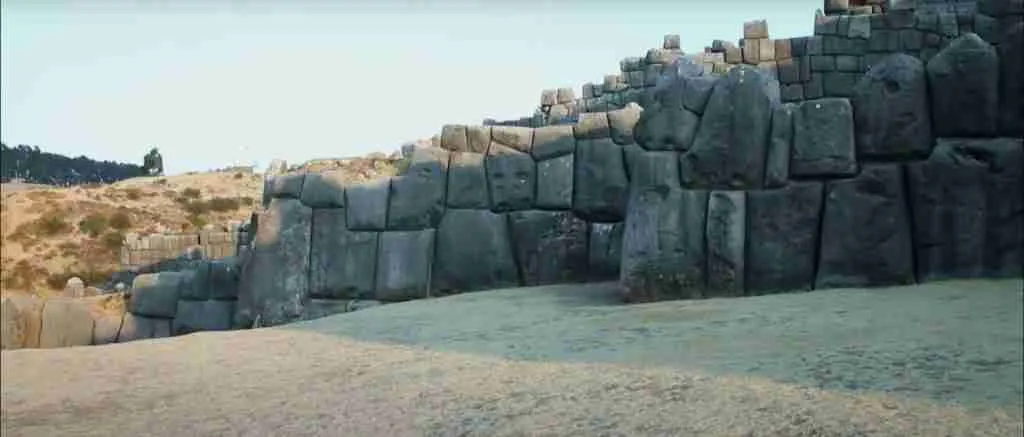
10 days
Machu Picchu Cusco 10-Day Complete Adventure
- ✓ Comprehensive Machu Picchu Cusco experience
- ✓ Expert local guides included
- ✓ All accommodation included
- ✓ Transportation provided
Multi-day tour packages powered by TourRadar. Prices and availability subject to change.
The Sacred Valley and the Inca Qollqa System
Ollantaytambo occupies a critical node in the Urubamba valley, approximately 72 kilometers northwest of Cusco along the Sacred Valley corridor. The site served concurrently as a royal estate associated with the Inca ruler Pachacuti, a ceremonial and administrative center, and a military stronghold controlling access to the forested lowland territories to the north. Its orthogonal urban grid — among the few surviving examples of Inca town planning still inhabited continuously since the imperial period — reflects the comprehensive functional planning characteristic of major Inca administrative centers, in which every spatial decision served overlapping strategic, logistical, ceremonial, and residential functions simultaneously.
The Inca Empire, known in Quechua as Tawantinsuyu, operated one of the ancient world’s most elaborately documented non-market redistributive economies. The governing principle was the mit’a: obligatory labor contribution by subject populations to the state, compensated through state provisioning of food, cloth, tools, and other goods drawn from centrally managed reserves. The material infrastructure of this system was the empire-wide qollqa network — thousands of storehouses distributed at regular intervals along the Inca road system (qhapaq ñan), calibrated in capacity to the provisioning requirements of the population and military forces they served.
Understanding what the qollqa represented in this economic context is essential for understanding why Pinkuylluna was built where it was. A qollqa was not simply a barn. It was simultaneously a state financial instrument (the physical embodiment of surplus extracted from agricultural production), a welfare reserve (the material resource deployed to support populations during crop failures, floods, and other disruptions), a military logistics depot (the source of provisions for armies on campaign along the road network), and a political statement (the visible demonstration of the sovereign’s capacity to mobilize and protect resources across an empire spanning more than four thousand kilometers of Pacific coastline and Andean highland).
The Andean environment imposed severe technical constraints on this system. The Sacred Valley at Ollantaytambo sits at roughly 2,800 meters above sea level, with temperature differentials between day and night that can be pronounced during the dry season, and with a wet season from approximately October through April that brings high humidity and precipitation. Grain stored under these conditions without appropriate environmental management would rapidly succumb to mold, fungal contamination, insect infestation, and fermentation — losses that would have directly undermined the state’s provisioning capacity and therefore its political legitimacy. The qollqa engineering tradition was the Inca response to this challenge: systematic exploitation of altitude, wind, and stone to create preservation conditions that the lowland environment could not offer.
The distribution of qollqas at major Inca sites follows a consistent logic. Storehouses are placed at elevation above the settlement or administrative center they serve — on terraced hillsides, cliff ledges, and elevated plateaus — rather than on the valley floors where settlements and agriculture are concentrated. This pattern reflects the convergence of thermodynamic advantage and defensive advantage: elevation provides both cooler temperatures and an inaccessible defensive position. At Ollantaytambo, the Pinkuylluna cliff to the northeast of the main complex represents the most developed expression of this logic in the Sacred Valley, with storehouses distributed across multiple elevation bands to maximize both thermal benefit and the visual prominence that communicated state capacity to the valley below.
Pinkuylluna: Site Configuration, Orientation, and Surviving Architecture
The Pinkuylluna cliff rises steeply to the northeast of Ollantaytambo’s main plaza, presenting a series of natural rock terraces and ledges that the Inca construction teams exploited systematically rather than leveling or reshaping beyond necessity. The surviving storehousestructures — scholarly assessments of the original extent vary, with the complex encompassing multiple distinct storehouse buildings across several elevation bands — are distributed vertically up the cliff face, connected by a network of narrow paths cut into the rock or constructed from masonry retaining walls built against the cliff.
Each structure is roughly rectangular in plan, built from the polygonal coursed stone construction characteristic of Inca utilitarian architecture: irregular blocks of local stone, typically andesite quarried from outcrops in the immediate vicinity, fitted stone-to-stone without mortar through the precise shaping of contact surfaces. The absence of mortar is not a limitation of Inca masonry — the empire’s ceremonial architecture demonstrates sophisticated mortar-free precision work in monumental stone — but a functional choice for storehouse construction: dry-laid polygonal masonry is slightly flexible under seismic loading, able to absorb lateral displacement without catastrophic joint failure, while the absence of organic mortar eliminates a potential pathway for biological infiltration into the wall structure.
The walls of the surviving Pinkuylluna structures are thick relative to their interior volumes. This proportional relationship is a deliberate engineering decision: mass-wall construction provides thermal mass — the capacity of a material to absorb thermal energy during periods of high ambient temperature and release it slowly during cooler periods, buffering the interior temperature against rapid external fluctuations. A thick stone wall exposed to afternoon sun absorbs solar energy without passing it rapidly to the interior; as temperature drops at night, the wall releases that stored energy, moderating the overnight temperature drop inside the chamber. The result is a damped interior temperature oscillation relative to the external environment — warmer than outside on cold nights, cooler than outside on warm afternoons — that reduces the stress on stored organic material from repeated temperature cycling.
The orientation of the structures on the cliff face shows consistent alignment with the prevailing wind pattern of the Urubamba valley. The valley runs roughly along a northwest-to-southeast axis, and thermally driven valley winds — heated air rising from the valley floor during daylight hours — flow consistently along this corridor. The storehouse walls with perforation apertures face the windward side of this flow, positioned to intercept moving air and channel it through the chamber interior. This is the physical prerequisite for wind-driven cross-ventilation: inlet apertures on the windward face, outlet apertures on the leeward face or through elevated vents, and a pressure differential between the two that drives directional airflow.
The floors of the surviving structures are stone-flagged, set directly onto prepared rock terraces cut into or built out from the cliff face. The rock terrace foundation serves multiple purposes: it provides a stable, level construction platform on an inherently uneven cliff face; it creates direct thermal contact between the storehouse floor and the bedrock of the cliff, adding the cliff’s substantial thermal mass to the building’s own wall mass; and it eliminates the soil layer that would otherwise provide a capillary pathway for ground moisture infiltration. The stone flag surface itself adds a final capillary break at the floor plane, preventing the upward migration of any moisture that penetrates to the terrace surface through runoff or humidity condensation on the rock.
Access paths between storehouse levels are narrow, typically wide enough for a single person carrying a load — a constraint that is simultaneously a structural economy (wide paths on steep cliff faces require expensive rock cutting or retaining wall construction) and a security feature (a path that admits only one person at a time, under observation from above, requires minimal guarding resources to make defensible). The path network is not a secondary add-on to the storehouse complex; it is structurally and strategically integral to it, defining both the logistics of deposit and withdrawal and the chokepoint geometry that made the complex defensible by small numbers.
Natural Convection Engineering: The Physics of the Stack Effect at Altitude
The thermodynamic principle underlying the Pinkuylluna ventilation system is buoyancy-driven natural convection — the spontaneous movement of air driven by differences in density between air volumes at different temperatures. This phenomenon, sometimes described in building physics as the stack effect, operates without mechanical input: it requires only a temperature differential between connected air volumes, a pathway for the denser (cooler) air to descend and the less dense (warmer) air to rise, and apertures through which interior and exterior air can exchange.
In a storehouse with wall perforations at different heights or facing different wind exposures, the mechanism functions as follows. If interior air is cooler than exterior air — as it often is during daylight hours in a thick-walled storehouse shaded by its cliff position — the cooler, denser interior air sits below the warmer exterior air pressing against the inlet apertures. This density differential creates a pressure gradient that draws exterior air through the lower inlet apertures and pushes interior air out through elevated outlet apertures or through the leeward-face openings where the wind creates negative pressure. The result is a continuous, self-sustaining circulation: fresh exterior air enters, moisture-laden interior air exits, and the driving force (the temperature differential) is continuously re-established as long as the external sun-cliff geometry maintains the interior-exterior temperature relationship.
At the altitude of Ollantaytambo’s cliff face — approximately 2,800 to 3,100 meters above sea level across the vertical range of the Pinkuylluna complex — the stack effect operates under specific atmospheric conditions that differ from sea-level contexts in ways relevant to storehouse engineering. Atmospheric pressure decreases with altitude: at approximately 3,000 meters, atmospheric pressure is roughly 70 percent of sea-level pressure. This reduced pressure means reduced air density — the same volume of air at altitude contains less mass than at sea level. For the buoyancy-driven stack effect, this matters in two ways: the absolute mass of air circulated per unit of time through a given aperture is reduced, but the temperature differential required to drive a given air exchange rate is also reduced, because the density contrast between warm and cool air is maintained proportionally even at reduced absolute pressure.
The net result is that natural convection remains an effective ventilation mechanism at the altitudes characteristic of Inca qollqa sites, provided apertures are correctly sized for the reduced air mass. The observed consistency of the perforation design across multiple Inca qollqa complexes at comparable altitudes suggests that the builders arrived empirically at aperture dimensions appropriate to the altitude-specific airflow conditions — an inference consistent with the broader Inca pattern of systematically applying and refining successful architectural solutions across repeated construction programs rather than redesigning each facility from first principles.
The prevailing wind component of the Urubamba valley ventilation system adds a second, complementary driving mechanism. Valley winds — thermally generated by the differential heating of valley floor and mountain slopes across the day-night cycle — flow predictably along the valley corridor during daylight hours. When this wind strikes the windward face of a storehouse, it creates a zone of positive pressure at the inlet apertures: the air velocity approaching the face is converted to pressure energy at the wall, actively pushing air into the interior. Simultaneously, on the leeward face, the wind creates a zone of negative pressure (suction) where the flow separates from the wall surface, actively drawing air out of the outlet apertures. The combination of these wind-driven pressure forces with the buoyancy-driven stack effect produces a total airflow through the chamber substantially greater than either mechanism alone would generate — the two forces are additive in their contribution to interior air exchange when the storehouse orientation aligns correctly with the prevailing wind.
An important interpretive note applies here. The Inca did not possess the formal vocabulary of modern thermodynamic engineering — concepts like stack effect, Venturi acceleration, or pressure coefficient were not available to builders working in the fifteenth century. What they possessed was systematic empirical knowledge: accumulated observations, across generations of qollqa construction and operation, of which design configurations produced viable multi-year storage and which produced spoilage. The convergence between the Pinkuylluna design features and the prescriptions that a modern building engineer would derive from thermodynamic theory is not a coincidence or a projection — it is the expected result of systematic optimization toward an observed outcome, a process that reliably converges on physically correct solutions regardless of whether the practitioners can articulate the underlying physics.
Draft-Vector Wall Perforations: Airflow Mechanics and Preservation Function
The wall perforations of Inca qollqa architecture are among the most archaeologically consistent features of the storehouse type across the full north-south extent of the Inca Empire. They appear in storehouse complexes from Ollantaytambo and Chinchero in the south to Huánuco Pampa and beyond in the north, suggesting that the perforation system was a standardized engineering element of the qollqa building tradition — a solved solution distributed across the road network rather than a local improvisation at any particular site.
The perforations take several documented forms in the Andean archaeological record: simple cylindrical through-holes in the wall plane, stepped or recessed openings with battered inner sides, and in some complexes compound apertures that incorporate interior baffles directing airflow along specific paths within the chamber while restricting direct line-of-sight access. The simplest form — the cylindrical through-hole — is the most common in utilitarian qollqa construction and the form most prevalent in the surviving Pinkuylluna structures. Its simplicity should not obscure its functional precision: the diameter, placement height, and wall-face orientation of each hole collectively determine the airflow velocity, the air entry angle, and the cross-chamber path that the incoming air follows before exiting.
The sizing of the perforations serves multiple functions simultaneously. A hole small enough to prevent rodent entry — the diameter of a rat’s body being the practical upper limit for pest exclusion — is also small enough to create a constricted orifice through which air passing under the wind-driven pressure differential is accelerated. This acceleration is a direct consequence of fluid continuity: the same volume of air that approaches the wall under ambient pressure must pass through the restricted aperture cross-section, so its velocity increases in proportion to the ratio of approach area to aperture area. The accelerated airstream enters the chamber at higher velocity than the ambient wind, creating a turbulent jet that disperses through the interior space and carries moisture-laden air with it toward the outlet apertures. This is the mechanism that makes small, well-placed perforations more effective at interior drying than large openings that allow slow, laminar air exchange.
The positioning of inlet and outlet perforations on opposing faces of the chamber creates a cross-ventilation path — air traversing the full interior width — rather than a short-circuit path where air enters and exits through adjacent openings without crossing the storage volume. Cross-ventilation is significantly more effective at interior drying than short-circuit ventilation: it ensures that all portions of the chamber interior are exposed to moving air, rather than leaving stagnant zones where humidity accumulates. The chamber geometry at Pinkuylluna — roughly rectangular, with perforations on the principal exposed faces — is consistent with cross-ventilation design, though the precise internal airflow patterns depend on chamber proportions and perforation positioning in ways that have not been measured in situ for the surviving structures.
The functional outcome of effective cross-ventilation for grain storage is significant and quantifiable in principle, though specific measurements for the Pinkuylluna chambers themselves are not available in the published archaeological record. Grain deteriorates through several biological pathways, all of which are humidity-dependent: mold growth accelerates above approximately 70 percent relative humidity; insect reproduction rates increase sharply with humidity above 60 percent; grain’s own respiratory processes generate heat and carbon dioxide that further degrade storage conditions when interior humidity is high. By maintaining continuous airflow that keeps interior relative humidity below these biological thresholds, the perforation system directly extends the viable storage duration from the months achievable in unstirred ambient conditions to the multi-year periods described in several Spanish colonial chronicles of Inca administration. The connection between the engineering feature (the perforations) and the documented outcome (multi-year storage) is straightforward in its physical logic, even in the absence of direct measurement data from the specific Pinkuylluna complex.
Humidity Control Through Stone-Floored Elevation
Airflow through the Pinkuylluna storehouses addresses one critical vector of moisture infiltration — the ambient humidity of air circulating inside the chamber. A second, equally important vector operates independently of airflow: ground moisture, present in soil and rock beneath any structure, migrates upward through capillary action and evaporates into the interior air at floor level. A storehouse with excellent cross-ventilation but a permeable earth floor will still develop elevated humidity at the base of the storage volume, precisely where goods in contact with the floor are most vulnerable to mold and fermentation damage.
The Inca solution to ground-moisture infiltration is structural rather than airflow-based: the stone-flagged floor. Dense stone — the andesite and granite that dominate Inca construction in the Ollantaytambo region — has a very low capillary transport coefficient for water. Moisture does not migrate through dense, close-fitted stone at the rate it migrates through packed earth, consolidated rubble, or porous lime plaster. By covering the floor entirely with fitted stone flags, the Inca created a physical capillary break at the floor plane: ground moisture that would otherwise evaporate into the chamber is blocked at the stone surface, leaving the air above the floor substantially drier than it would be over an earth floor under the same external humidity conditions.
Archaeological surveys of Inca qollqa complexes across the Andean region have consistently noted the stone floor as a standard design element of the storehouse type, appearing across diverse geographic settings at comparable altitudes. The regularity with which this feature appears — from the Sacred Valley qollqas to high-altitude storehouse complexes in other regions of the former empire — indicates that it was a recognized technical requirement embedded in the design tradition, not a site-specific improvisation dictated by local stone availability.
At Pinkuylluna, the stone-floor capillary break is reinforced by the cliff-face foundation itself. The storehouse structures sit on prepared terraces cut from or built against the cliff’s bedrock, which means the effective floor substrate is not soil but exposed mountain rock. Bedrock is even less permeable to capillary moisture transport than fitted masonry, because it lacks the inter-block joint pathways along which water can slowly migrate through a masonry surface. Where the storehouse floor rests on bedrock rather than on constructed stone paving, the capillary barrier is absolute rather than merely low-resistance — ground moisture has no pathway to the interior at all.
The altitude-driven humidity gradient of the Sacred Valley adds a third, landscape-scale layer to the moisture management system. Ground-level air in the Urubamba valley carries significant moisture evaporated from the river, irrigated terrace agriculture, and the dense vegetative cover of the valley floor and lower slopes. As this moisture-laden air rises with altitude, it cools adiabatically, and a portion of its water vapor condenses and precipitates as clouds or light rainfall before reaching the altitude of the Pinkuylluna cliff face. The air arriving at the cliff face is therefore somewhat drier on average than the air at valley-floor level where the crops themselves are grown and harvested — a passive humidity reduction that the cliff site provides as a byproduct of its elevation, without any constructed feature required.
The three humidity-control mechanisms — stone floor capillary break, bedrock foundation, and altitude humidity gradient — operate at different spatial scales and address different aspects of the problem. The stone floor operates at the material level, blocking moisture migration across a boundary measured in millimeters. The cliff terrace foundation operates at the site level, positioning the structure above the water table and soil-moisture zone of the valley floor. The altitude gradient operates at the landscape level, delivering inherently drier air to the cliff site than the valley provides at ground level. No single mechanism would be sufficient in isolation: together they create the sustained low-humidity interior conditions that early colonial Spanish accounts describe as the physical basis for the Inca storage system’s legendary multi-year provisioning capacity.
Cliff-Face Anchoring: Structural Strategy and Topographic Security
The decision to build the Pinkuylluna storehouses on a cliff face rather than on valley-floor level ground was not a compromise forced by a shortage of flat construction area — Ollantaytambo’s surrounding valley provides ample level terrain for construction, as demonstrated by the extensive terrace agriculture immediately below the cliff. It was a positive strategic choice driven by the simultaneous advantages of cliff-face positioning across thermal, defensive, visual, and logistical dimensions. The convergence of these advantages in a single site decision reflects the characteristic Inca planning philosophy of designing architecture to serve multiple functions concurrently rather than optimizing for a single purpose at the cost of others.
The defensive logic of cliff-face anchoring is grounded in the same principles that made cliff-top or cliff-face positions attractive to military engineers across the ancient world. An elevated position offers three tactical advantages that reinforce each other: observation (defenders at elevation can monitor all approaches to the site across a larger field of view than observers at ground level), gravity (projectiles, materials, and defenders themselves move downhill with gravitational assistance, while attackers must overcome it), and topographic denial (the cliff face itself is an obstacle that attackers must surmount before reaching the defended position, requiring specialized equipment and exposing them to observation and counteraction during the approach). Any one of these advantages would make an elevated position preferable to flat ground for storing a militarily significant resource; all three together make a cliff face the strongest available defensive site in a valley environment.
The visual prominence of the Pinkuylluna storehouses from the valley below served a communicative function that was integral to the Inca redistributive economy’s political logic. In a system where the state’s legitimacy depended on its demonstrated capacity to provision military campaigns, support labor obligations, and sustain dependent populations through agricultural failure, the physical visibility of filled storehouses at major administrative centers was a form of state credibility advertising. An observer on the valley floor below Ollantaytambo — a traveler, a subject population member, a potential military opponent — could see directly that the state’s storage capacity was intact, prominent, and evidently well-supplied. No account books, no official proclamations, and no intermediaries were needed: the cliff face performed the political communication directly and continuously.
The structural engineering challenges of building on a steep cliff face required systematic solutions that themselves reflect sophisticated spatial planning. Level platforms for individual storehouse buildings were created by a combination of two techniques: cutting into the cliff where the rock face was too steep for freestanding construction, and building masonry retaining walls out from the cliff where the natural ledge was insufficient in width. The resulting constructed terraces are essentially artificial ground planes anchored to the cliff face, each capable of bearing the load of a complete storehouse structure. The masonry retaining walls that create these platforms must resist not only the downslope weight of the terrace fill they retain but also the horizontal pressure of the terrace material behind them and, under seismic loading, the additional lateral forces that earthquakes generate. The Inca solution — thick polygonal masonry with slightly battered (inward-sloping) outer faces and interlocking irregular stones that resist separation — is mechanically appropriate for all three load conditions.
The narrowness of the access paths between storehouse levels, discussed earlier as a security feature, also reflects structural engineering realities. On a steep cliff face, a path wide enough for two people to pass simultaneously would require either substantial rock cutting into the cliff or a wide constructed retaining platform — both significantly more labor-intensive than a single-file path that follows the natural cliff ledge. The Inca path network at Pinkuylluna achieves the minimum functional width (adequate for a loaded porter) with the minimum construction intervention (supplements to natural ledges only where the ledge is insufficient). The structural economy and the strategic chokepoint geometry are consistent, making the narrow path simultaneously the cheapest adequate solution and the most defensible one.
Defense in Depth: The Terraced Chokepoints and Inundation Canals of Manco Inca
The full strategic logic embedded in Ollantaytambo’s design became operational during the Inca resistance campaigns of 1536 and 1537, when Manco Inca Yupanqui — initially installed as a Spanish-aligned puppet ruler after Francisco Pizarro’s capture of Cusco in 1533 — broke with the Spanish colonial administration and led a major coordinated uprising. Manco Inca’s initial campaign included a sustained siege of Cusco itself, which came close to reversing the Spanish conquest before the arrival of reinforcements and the defection of allied indigenous forces turned the military situation. Retreating to Ollantaytambo, Manco Inca established his headquarters at a site whose physical design offered defensive advantages unavailable anywhere in the open Cusco basin.
Ollantaytambo’s defensive concept is organized around the principle of layered resistance — what military planners call defense in depth. An attacking force that penetrates one defensive line encounters another, and then another, each requiring fresh resources, time, and momentum that the attacker cannot easily replace while the defender, on interior lines, can concentrate forces and supplies from the protected rear. The terraced hillside above the town’s main complex represents the outermost of these layers in the vertical dimension: a series of broad agricultural and ceremonial terraces ascending to the main temple platform at the summit creates a staircase defense in which each terrace wall is both an obstacle for an ascending assault column and a fighting platform for defenders above. The terrace walls — built from massive fitted stone blocks, in the case of the principal ceremonial terraces weighing many tons each — are not merely agricultural infrastructure repurposed for defense; their dimensions and the angles of the terrace faces suggest a design that consciously integrated defensive function alongside agricultural and ceremonial use.
The town itself constitutes a second defensive layer below the terraced hillside. Ollantaytambo’s urban grid — a regular orthogonal layout of walled residential compounds (canchas) divided by narrow canalized streets — creates an environment profoundly hostile to cavalry movement. A Spanish cavalry force on the Urubamba plain is most effective in open ground where horses can maintain speed and formation; within a dense grid of narrow stone-walled streets, horses cannot maneuver, cannot charge, and cannot bring their speed advantage to bear. Each cancha block in the urban grid becomes a potential strong point for infantry defenders, and the canal channels that divide the streets — originally components of the town’s irrigation and water management system — add additional physical obstacles to movement within the grid.
Hydraulic Diversion Engineering: Flooding the Plain During the Battle of Ollantaytambo (1537)
The most consequential element of the 1537 defense — and the one that most directly reveals the engineering intelligence embedded in Ollantaytambo’s design as a whole — was Manco Inca’s use of the site’s hydraulic infrastructure to flood the plain between the town’s approaches and Hernando Pizarro’s advancing Spanish force. According to accounts including those of Pedro de Cieza de León, the sixteenth-century Spanish soldier and chronicler who compiled testimonies from participants and witnesses in the years following the event, Manco Inca’s forces diverted river water across the flat terrain south and west of the town that the Spanish cavalry required to approach the fortified complex. The flooding rendered this ground impassable or severely difficult for mounted troops, neutralizing the primary tactical advantage of the Spanish force and halting its advance.
The specific hydraulic mechanism described in the chronicles — diversion of the Patacancha River, a tributary that joins the Urubamba near the base of the Ollantaytambo complex — would have required engineering knowledge of several practical elements: the gradient of the existing channel system relative to the terrain to be flooded, the locations of control points in the irrigation network where flow could be redirected, the volume of water required to achieve effective flooding depth, and the rate at which the plain could be inundated to the depth that prevents cavalry movement. These are not simple calculations even for a modern hydraulic engineer with survey data; they require intimate familiarity with the specific terrain and water behavior of the site, built up through direct operational experience of the irrigation system over extended periods.
The most archaeologically plausible interpretation of the flooding tactic, given the evidence currently available, is that existing irrigation infrastructure was redirected rather than purpose-built military hydraulic works constructed specifically for the 1537 engagement. This interpretation is grounded in two observations: first, the time constraints of a military engagement — with Hernando Pizarro’s force advancing — would have made the rapid construction of new hydraulic works impractical; and second, the existing irrigation system at Ollantaytambo was by design capable of distributing large volumes of water across broad areas of the valley floor, which is precisely the functional requirement for tactical inundation. A well-designed irrigation system must be capable of controlled flooding (for field saturation) and controlled drainage (for field preparation), with channel routes covering the cultivated areas broadly. A military commander who understood both the hydraulics and the terrain could redirect this capability with relatively modest interventions at existing control points.
The strategic implication of this interpretation extends beyond the specific 1537 engagement. It suggests that the Ollantaytambo irrigation system was designed, or at minimum maintained, with sufficient flexibility that its water-management capability could be redirected under military command. Whether this dual-use capability was planned from the original design of the hydraulic infrastructure — a provocative possibility consistent with the integrated multi-function planning evident in every other aspect of Ollantaytambo’s design — or emerged from operational experience by a commander who recognized the tactical potential of existing infrastructure, the Battle of Ollantaytambo demonstrates that storage, hydraulics, and defense were not separate domains in the Inca conception of the site. They were components of a single strategic system, and Manco Inca’s successful defense — one of the few early military defeats inflicted on mounted Spanish forces by an indigenous Andean commander — validated that system’s design.
The Pinkuylluna storehouses figure directly in this strategic integration. A besieged force that successfully holds the valley floor against cavalry assault can sustain a prolonged defense only if its food reserves are secure. The cliff-face position of the Pinkuylluna qollqas meant that even if the valley floor was contested or temporarily breached, the stored goods remained protected at elevation above the tactical engagement zone, accessible to the defending force via the cliff-path network and inaccessible to an attacking force preoccupied with ground-level combat. Storage security and terrain control were not independent objectives; they were the two halves of the same military logic.
Structural Load Analysis of Cantilevered Cliff Pathways and Defensive Gateways
The structural engineering challenges at the Pinkuylluna cliff complex extend beyond the storehouses themselves to the pathway and gateway systems that controlled movement between the valley floor and the elevated storage and defensive zones. These access elements — narrow paths cut into or built from the cliff face, periodic gateways controlling transition between path sections, and the occasional cantilevered or corbeled path extensions that bridge gaps in natural ledges — required structural analysis of the specific load conditions at each point along the access route.
Cantilevered construction in Inca architecture typically relied on the progressive extension of stone courses from a main wall or cliff anchor, each course extending slightly further than the one below — the technique known as corbeling. Unlike arch construction, which distributes loads through compressive forces in a curved structural member, corbeling distributes the load of each extending course as a cantilever moment resisted by the mass of the masonry or cliff face behind the corbel’s support point. The structural limit of a corbeled cantilever in stone is governed by the tensile strength of the material at the support interface, the weight of the extending element, and the counterweight provided by the mass bearing on the supported end of the extending course behind the fulcrum.
Stone — and specifically the andesite characteristic of Inca construction in the Ollantaytambo region — has substantially higher compressive strength than tensile strength, as is true of all crystalline and granular masonry materials. A stone course extending unsupported over a gap will fail in tension at the point where the bending moment exceeds the material’s tensile capacity, which limits practical corbeled cantilever spans to relatively modest horizontal extensions. The cliff pathway extensions at Pinkuylluna are accordingly not large-scale cantilevered engineering works — they are incremental ledge extensions, typically supplementing a natural rock ledge insufficient in width with a masonry ledge built against the cliff face, achieving adequate path width through the addition of a relatively thin constructed element rather than through freestanding cantilever construction.
The defensive gateways along the access paths merit separate structural and strategic analysis. Inca gateways (punkus) are consistently trapezoidal in section — wider at the base than at the lintel — a shape that distributes the lintel load to the splayed sides of the opening rather than bearing it entirely on the lintel stone as a concentrated bending load. Under the seismic conditions characteristic of the central Andes — the subduction of the Nazca plate beneath the South American plate generates significant seismic activity across the region — a trapezoidal opening is structurally advantageous relative to a rectangular one: the splayed sides convert lintel compression into compressive axial forces in the jamb stones, which are far more resistant to seismic lateral loading than the bending-dominated failure mode of a flat-lintel rectangular opening. The same battered wall design used in Inca buildings generally — walls that taper toward the top — lowers the center of mass and increases the base-to-height ratio, making the structure more resistant to seismic overturning in addition to the trapezoidal opening benefits at individual apertures.
In the defensive access context, the trapezoidal gateways at points along the Pinkuylluna path serve the same chokepoint control function as any gate in a fortified passage: a defending party positioned above and beyond the gateway can observe, challenge, and if necessary neutralize any approaching individual or small group. The narrowness of the path leading to each gateway prevents the attacking force from deploying more than one or two individuals through the chokepoint at a time, negating numerical advantages that would be decisive on open ground. The combination of narrow path, periodic gateway, and elevated observer positions makes the Pinkuylluna access system a defensible control network requiring minimal manpower — a resource-efficient security solution consistent with the broader Inca approach of designing infrastructure to achieve multiple objectives at minimum labor cost.
The Ghorfas of Southern Tunisia: Convergent Cliff-Face Preservation
In the arid uplands of Southern Tunisia, particularly across the Dahar plateau and in the Tataouine and Medenine regions, a distinct and highly developed tradition of elevated stone granary architecture evolved among Berber and Arab communities over many centuries. The fundamental storage unit in this tradition is the Ghorfa: an elongated, barrel-vaulted chamber of stone or lime-mortared rubble construction, typically occupying a single or double story, with a narrow doorway, minimal window openings, and walls of substantial thickness designed primarily to achieve thermal isolation from the extreme summer heat of the North African interior. Individual Ghorfas are aggregated into larger complexes called ksour (singular: ksar), which range from modest hilltop groupings of a dozen chambers to major fortified complexes containing hundreds of individual storage units arranged around a central courtyard or built against a hillside or cliff face in multi-story configurations.
The parallel with the Pinkuylluna qollqa complex is structural and functional, not historical or cultural. There is no evidence of any direct connection between Andean qollqa builders and the builders of Southern Tunisia’s ksour; the two traditions were separated by an ocean, are documented across different centuries, and developed within entirely different social, religious, and environmental contexts. What they share is the engineering logic that converges when communities with access to stone, practical experience of what storage conditions preserve perishables over multi-year periods, and strategic requirements for defended reserve storage are given the problem of maintaining a major food supply. The convergence is in the output — elevated stone storage with thermal mass, controlled access, and visual prominence — not in the input (knowledge or technique transmitted from one tradition to the other).
The thermal engineering of the Ghorfa follows a path distinct from but parallel to the Inca qollqa. The barrel vault — a semicircular arch extended along the horizontal axis — creates a roof form whose curved geometry minimizes the surface area exposed to direct solar radiation relative to the interior volume it encloses. A flat roof of the same interior floor area would expose a larger surface to the midday sun; the barrel vault’s curved form reduces peak solar gain while also distributing thermal stress more evenly through the vault structure. The thick stone walls — typically 60 to 80 centimeters in the best-preserved ksour — provide substantial thermal mass: they absorb solar energy during the day without rapidly transmitting it to the interior, then release that stored energy slowly at night, moderating the interior temperature oscillation across the desert’s extreme diurnal temperature range.
Ventilation strategy in the Ghorfa tradition differs substantially from the Inca perforated-wall approach, and the difference reflects accurately the different climatic challenges of the respective environments. In the dry heat of the Tataouine region, where peak summer temperatures can exceed 40°C and ambient relative humidity is very low, sustained continuous airflow through an open perforation system would allow hot dry air to enter the chamber during the hottest daylight hours — potentially raising interior temperatures rather than lowering them, since the incoming air is hotter than the thermally buffered interior. The Ghorfa solution is accordingly a predominantly sealed storage system: narrow doorways limit air exchange to the periods when individual chambers are opened for deposit or withdrawal, maintaining essentially static interior conditions during closed periods. The thick vault and walls buffer these conditions against the external temperature extremes, creating a thermally stable interior that, while not mechanically cooled, is substantially more moderate than the exterior environment.
This contrasts directly with the Pinkuylluna approach of continuous passive ventilation through perforated walls. The contrast is not a failure of design in either tradition — it is each tradition’s accurate adaptation to its specific climate. In the humid Andean rainy season, the primary threat to stored goods is moisture accumulation; continuous airflow that evacuates that moisture is the correct response. In the dry summer of Southern Tunisia, the primary threat is thermal stress and the insect populations that proliferate in warm conditions; a sealed thermal-mass chamber that buffers against temperature extremes is the correct response. Neither solution is universally optimal: both are locally appropriate, and both were independently discovered by communities whose accumulated experience of storage failure and success led them toward the thermodynamically correct strategy for their specific environment.
The defensive dimension of ksar architecture parallels the Pinkuylluna pattern with striking consistency. Many ksour are positioned on hilltops, ridgelines, or cliff faces for the same reason that Pinkuylluna’s storehouses occupy their cliff: elevated ground is defensively advantageous, and the aggregated grain, oil, textiles, and goods stored within the ksar represent community wealth that requires physical protection against raiding. The ksar’s courtyard design — accessible through a single gateway, typically with a guardian’s room flanking the entry passage — provides strict control over who enters and exits, much as the narrow paths and gateways of the Pinkuylluna access system control access to the cliff-face storehouses. The multi-story Ghorfa chambers stacked above the courtyard create the same visual prominence as the Pinkuylluna storehouse line on its cliff: a signal of stored capacity visible to the surrounding landscape, with a defensive architecture that makes that capacity difficult to seize.
Among the best-preserved examples of the ksar tradition, Ksar Ouled Soltane in the Tataouine governorate presents a four-story courtyard configuration of Ghorfa chambers that demonstrates the structural ambition of the building type at its most developed. Four stories of barrel-vaulted stone chambers arranged around a central courtyard, each story accessible from a shared gallery running along the courtyard face — this configuration manages significant vertical load, concentrated at the vault spring points and transmitted down the chamber walls to the ground — without the benefit of reinforced concrete, structural steel, or mortar-based load redistribution. The structural success of these configurations over the multi-century lifespans of the best-preserved ksour is itself evidence of the engineering competence of the building tradition, achieved entirely through the empirical refinement of mass-wall and vault geometry appropriate to the available materials and local seismic and climatic conditions.
Ancient Mesopotamian Citadel Granaries: Subterranean Thermodynamic Strategy
The third tradition in this comparative analysis approaches the thermodynamic problem of grain preservation from the inverse of the cliff-face elevation strategy: rather than seeking thermal advantage through position above ground level, the Mesopotamian tradition repeatedly exploited the thermal stability of position below ground level. Subterranean and semi-subterranean storage installations appear at archaeological sites across the ancient Near East from the Neolithic period through the Bronze and Iron Ages, distributed across a wide geographic range and multiple cultural traditions — Sumerian, Akkadian, Babylonian, and others — all independently identifying the same physical property of subsurface soil as a thermal resource.
The principle underlying subterranean thermal storage is the same principle exploited by cliff-face and tower storage in different directions: thermal mass buffers temperature oscillations. At the surface, air temperature oscillates daily and seasonally across a wide range; at depth, soil temperature oscillates far less, because the thermal mass of the surrounding earth absorbs the surface temperature wave and attenuates it progressively with depth. At approximately one to two meters of depth, the daily temperature oscillation is already substantially damped relative to the surface; at several meters, the soil temperature reflects the seasonal average rather than daily peaks and troughs, remaining relatively stable throughout the year. A storage pit dug to this depth provides a passively temperature-stable environment without any constructed thermal mass — the earth itself provides the mass, at effectively zero material cost.
At major citadel sites of ancient Mesopotamia, storage installations are documented at multiple scales within the archaeological record. Administrative storage magazines within palace complexes — organized series of long, narrow chambers accessible from interior courtyards and evidently managed by palace administrative bureaucracies whose clay-tablet records preserve inventories and accounts — served functions directly analogous to the Inca qollqa: centralizing the surplus of agricultural surplus extraction, managing redistribution to craftspeople, soldiers, priests, and dependent laborers, and maintaining reserves against shortage. The institutional logic is strikingly parallel to the Inca redistributive economy — surplus in, provisioning out, administered by a bureaucratic layer between production and consumption — though the specific institutional forms differ between the theocratic palace economies of Mesopotamia and the kinship-based redistributive empire of the Inca.
The primary engineering challenge of subterranean storage — moisture management — differs in character from the challenge addressed by the Pinkuylluna ventilation system, and the solutions accordingly differ. In a subterranean storage pit, ground moisture migrates inward through the surrounding soil via the same capillary mechanisms that the Inca stone floors blocked above ground. The Mesopotamian response, documented at sites including Ur and Tell es-Safi, was to line storage pits and chambers with fired brick, baked clay, or bitumen — materials with very low capillary transport rates that create a waterproof barrier at the pit wall, analogous in function to the stone-floor capillary break at Pinkuylluna but adapted to the material environment of alluvial Mesopotamia, where stone is scarce and fired clay is the dominant building material. The specific material differs between the two traditions; the engineering principle — interrupt the moisture migration pathway at the storage boundary — is identical.
Ventilation in subterranean granaries operates on principles that differ from elevated storage. The stack effect in an elevated building draws warm interior air upward through elevated outlets; in a subterranean structure, the interior is often cooler than the surface in summer, creating a potential condensation risk if warm, humid surface air enters and contacts the cool interior surfaces. Mesopotamian subterranean granaries addressed this problem primarily through seasonal management of access: grain was typically deposited and sealed in winter or early spring, when surface and subsurface temperatures are closest and the risk of condensation-driven moisture infiltration is minimal, then withdrawn as needed through the hot summer months when the thermally stable subsurface provided the best available preservation conditions. This is passive seasonal cold storage — exploiting the earth’s thermal mass as a time-lagged temperature reservoir — rather than the active continuous ventilation system of the Pinkuylluna qollqas.
The citadel context of Mesopotamian granary storage provides the same defensive logic as Ollantaytambo’s cliff face, adapted to the flat alluvial plain topography of the Tigris-Euphrates basin. Without natural elevation to exploit, Mesopotamian citadels created artificial defensible perimeters through massive mudbrick walls, wide moats, and controlled gateway systems — the same chokepoint control and restricted access that the Pinkuylluna cliff path achieves through topographic means. The granaries, positioned within the citadel’s defended perimeter, benefited from this institutional and architectural security structure in the same way that the Pinkuylluna qollqas benefited from their cliff-face inaccessibility. The specific mechanism of defense differs entirely — constructed walls and moats versus natural cliff face — but the underlying strategic concept is identical: the strategic food reserve is within the defended perimeter, inaccessible without breaching the primary defense.
Comparative Analysis: Three Independent Solutions to a Universal Challenge
Placing the three architectural traditions in systematic comparison reveals the full range of thermodynamic strategies available to pre-industrial builders working with stone, fired clay, earth, and wood — without mechanical refrigeration, without humidity control systems, and without any formal knowledge of thermodynamic theory. Each tradition independently identified the same fundamental problem (maintaining low temperature and low humidity for organic material over multi-year storage periods) and arrived at a different, locally appropriate deployment of available physics.
The cliff-face elevation strategy — exemplified at Pinkuylluna — maximizes three advantages simultaneously. Altitude-driven cooling reduces the ambient temperature at which stored goods must be maintained, lowering the energy available to biological deterioration processes. Cliff-face orientation intercepts prevailing valley winds, enabling passive cross-ventilation that continuously evacuates humidity. The cliff’s own rock mass provides thermal buffering that moderates temperature oscillations. The limitation of this strategy is geographic specificity: it requires a cliff face at sufficient altitude within a wind corridor — a site condition that the Sacred Valley provides but that would not be available in flat-terrain environments such as coastal plains, river deltas, or desert basins.
The elevated stone tower strategy — exemplified in the Ghorfa and ksar tradition — achieves thermal stability through constructed thermal mass rather than through natural topographic advantage. Thick barrel-vaulted walls and roofs buffer temperature oscillation; a sealed or near-sealed interior maintains that buffered state during extended storage periods; a controlled gateway creates the defensive access control that the cliff face achieves through topographic inaccessibility. This strategy is highly portable: it can be deployed wherever stone is available and construction labor can be mobilized, regardless of natural topography. Its cost is the material investment in substantial masonry, and its thermodynamic mode is passive damping (reducing oscillation amplitude) rather than the active cooling and drying that cliff-face ventilation achieves.
The subterranean strategy — documented across Mesopotamian citadel sites — exploits the thermal mass of the earth at effectively zero material cost. The earth provides the buffering capacity automatically, without any constructed thermal envelope; the engineering work is the pit construction, moisture barrier, and access control rather than any above-ground structure. The limitation is humidity management: underground environments can generate condensation on cool interior surfaces when warm air accesses them, requiring either sealed seasonal management protocols or active drainage and barrier construction. The strategy is most effective in climates with distinct, stable seasons that allow predictable sealing periods, and in cultural contexts with the administrative capacity to manage the seasonal access discipline it requires.
The three strategies represent genuinely different engineering solutions — different deployments of physics, different material investments, different operational requirements — that happen to converge on the same output (multi-year viable storage of perishable goods) because that output is defined by the biology of the stored material and the physics of deterioration, which are universal. Different builders, working in different environments with different available materials and different topographic resources, arrived independently at different implementations of the available solution space because the solution space is defined by physics, not by culture. The convergence is not coincidental or mysterious — it is the expected result of independent optimization toward a physically constrained common target.
The defensive convergence across all three traditions is equally significant and equally explicable. In every case, the granary occupies a position of strategic inaccessibility: cliff face, courtyard fortress, citadel interior. In every case, access is controlled through physical chokepoints: narrow paths with gateway controls, a single courtyard entry, walled citadel gates. In every case, the defended position is also visually prominent, broadcasting the reserve’s existence and apparent security to the surrounding landscape. These recurring features are not a coincidence of cultural influence — they are the rational response to a universal strategic situation. Any community sophisticated enough to maintain multi-year strategic reserves is sophisticated enough to recognize that those reserves constitute a military target, and any military strategy must address the protection of its supply base. The architectural response to this universal strategic imperative converges across cultures for the same reason that the thermodynamic response converges: the problem is universal, and the physically and strategically optimal solutions occupy a constrained space from which independent optimization converges.
Archaeological Documentation and Interpretive Debates
The Pinkuylluna storehouses have received systematic archaeological attention within the broader scholarly examination of Ollantaytambo as a major Inca administrative site. The identification of the Pinkuylluna structures as qollqas — storehouses specifically — is established through the convergence of multiple independent lines of evidence rather than through any single diagnostic feature. Architecturally, the structures exhibit the defining characteristics of the Inca qollqa type as documented across multiple sites in the Andean archaeological record: wall perforations consistent with passive ventilation function, stone-flagged floors consistent with moisture-control function, the absence of features associated with habitation (hearths, midden deposits at doorway margins, artifacts of domestic use), and an elevated position relative to the settlement served — characteristics that together distinguish storage function from residential, ceremonial, or administrative use. Historically, the presence of well-provisioned storehouses at Ollantaytambo is consistent with the site’s documented role as a major administrative and provisioning center on the Sacred Valley road.
What remains genuinely open in the scholarly literature — and what this article appropriately frames with hedging — is the quantitative performance of the Pinkuylluna ventilation system. No published measurement campaign has reported in-situ temperature or humidity data from the surviving structures under controlled observation conditions, or compared interior and exterior conditions across seasonal cycles at the site. The engineering analysis presented in this article is therefore inferential: the physical principles governing natural convection, wind-driven cross-ventilation, and capillary moisture transport are well established; the architectural features of the Pinkuylluna structures are consistent with those principles; and the multi-year storage outcomes reported in colonial-period Spanish chronicles are consistent with effective passive climate control. But quantitative performance data of the type required to specify a modern building systems design — flow rates, humidity reduction percentages, specific interior temperature ranges — is not currently available for these specific structures, and should not be assumed from analogy with modern engineered systems.
The Battle of Ollantaytambo and the hydraulic inundation tactic described in the Spanish chronicles present an interpretive situation characteristic of the colonial-period record more broadly. Pedro de Cieza de León’s account, compiled within approximately two decades of the events from interviews with participants and witnesses, is the most detailed early source and has been the basis for most subsequent scholarly discussion of the engagement. The flooding of the plain as a deliberate defensive measure is attested in Cieza de León’s chronicle and is consistent with the hydraulic infrastructure documented at the site. The specific engineering detail — precisely which channels were used, whether control structures were modified specifically for the engagement, and the exact sequence of events — cannot be reconstructed from the chronicle accounts alone and has not been resolved by subsequent archaeological investigation of the hydraulic infrastructure. The interpretation that existing irrigation infrastructure was redirected rather than new military works constructed is the most archaeologically parsimonious reading given the available evidence, but it is an interpretation, not a documented fact.
For the cross-cultural comparison with Ghorfas and Mesopotamian granaries, the appropriate scholarly frame is the architectural-typological comparison: observing shared structural and functional features in independently documented architectural traditions and attributing their convergence to the convergent-development logic rather than to diffusion or transmission. This is the standard scholarly frame for cross-cultural architectural comparison in the absence of any historical or archaeological evidence of contact — and in the case of Andean and North African or Near Eastern traditions, the geographic, chronological, and cultural separation makes direct contact implausible to an extent that renders diffusion explanations essentially non-viable. The convergent-development interpretation is both the appropriate scholarly position and the most intellectually productive one, because it raises the genuinely interesting question: what are the physical constraints that drove independent convergence toward similar solutions?
Conservation and Heritage Management at Pinkuylluna
The Pinkuylluna storehouses form part of the archaeological complex of Ollantaytambo, included within the heritage zone of the Machu Picchu Historical Sanctuary — a UNESCO World Heritage Site inscribed in 1983. The storehouses themselves are among the more exposed and weather-vulnerable structures within Ollantaytambo, and their long-term conservation presents challenges that reflect the broader tensions in managing Andean heritage at altitude in an actively visited landscape.
The primary conservation threat to the Pinkuylluna structures is frost wedging — the mechanical deterioration of masonry through the repeated freezing and expansion of water infiltrated into the joints between stones. The dry-masonry construction of the qollqas — fitted stone without mortar — is structurally robust under static loading but vulnerable to water that enters the inter-stone contact planes and freezes. Water expands by approximately nine percent in volume upon freezing; this expansion creates internal stresses within the joint that progressively widen the gap and eventually displace the stone from its position. At Pinkuylluna’s altitude, the freeze-thaw cycle operates regularly during the dry season (May through September), when cold nights alternate with warm, solar-intense days. Over years and decades, this cycle gradually opens joints and destabilizes the precise stone-to-stone contact that the original dry-masonry construction depended on for its load distribution.
Runoff from the cliff above compounds this problem by delivering additional water to wall surfaces and joints. The cliff-face position that provides thermal advantage for storage also exposes the top surfaces of the structures to precipitation and snowmelt drainage from the mountain above, which concentrates on the terrace platforms and soaks into the wall masonry through the upper joint planes. Conservation interventions have included selective mortar pointing of the most vulnerable joint zones — a technically controversial approach that changes the appearance and moisture dynamics of the original dry-masonry construction but that in practice reduces the rate of frost-wedging deterioration at critical structural points.
Tourism management presents a secondary but significant conservation challenge. The path to the Pinkuylluna storehouses from the valley floor is a popular visitor activity at Ollantaytambo, with foot traffic on the narrow cliff paths generating erosion of both the path margins and the archaeological context immediately adjacent to the structures. The soil that stabilizes the terrace platforms — partly natural accumulation, partly intentional fill placed during original construction — is highly vulnerable to disturbance from visitors walking on or near the terrace edges, and once eroded it carries with it the stratigraphic information that archaeologists need to interpret the construction sequence and use history of the structures. Access management at the site has included path demarcation with ropes and signs, periodic closure of specific structures during high-traffic seasons, and visitor education programs that explain the fragility of the dry-masonry construction to tourist groups.
The Ghorfa complexes of Southern Tunisia face analogous challenges from different causes. Traditional use of the ksour as seasonal storage for transhumant pastoral communities — the primary maintenance mechanism that kept the structures in repair through active use — has largely ceased through the twentieth century as pastoral lifestyles changed and alternative storage became available. Derelict ksour deteriorate through the combined effects of structural settlement, mortar loss in the barrel vault joints, water infiltration through cracked vault surfaces, and vegetation growth in the joints. Several major ksar complexes, including Ksar Ouled Soltane, have received restoration attention from Tunisian heritage authorities and international conservation organizations, with particular focus on vault joint repointing and drainage management. The challenge in these cases is maintaining structural integrity without obscuring the original construction techniques or introducing materials and methods that future conservators will find difficult to reverse.
Visiting the Pinkuylluna Storehouses
The Pinkuylluna storehouses are accessible as part of a visit to Ollantaytambo, located approximately 72 kilometers northwest of Cusco along the Sacred Valley road — a journey of roughly one and a half to two hours by bus or shared taxi under normal road conditions, though mountain road conditions can extend travel times. Ollantaytambo is also served by the rail line connecting Cusco to Aguas Calientes (for Machu Picchu), with a station immediately adjacent to the archaeological zone, making it a natural stop on the standard Cusco-Machu Picchu itinerary.
Entry to the main Ollantaytambo archaeological zone requires the Cusco Tourist Ticket (Boleto Turístico del Cusco), a multi-site circuit ticket covering the principal heritage sites in the Cusco region. Ticket prices, included sites, and circuit configurations are subject to periodic revision by the Dirección Regional de Cultura Cusco, the administrative authority responsible for the site; verify current pricing and coverage at the official Boleto Turístico office in Cusco or Ollantaytambo before planning your budget, as information from travel guides and online sources may not reflect the most current structure. The Pinkuylluna path is accessible from the town side of the complex; confirm locally whether access to the cliff-face structures requires the standard site entry or a separate permit, as access conditions can vary by season and the conservation status of specific path sections.
The hike to the storehouses involves meaningful elevation gain — roughly 100 to 150 meters above the valley floor to reach the lower storehouse structures, with additional ascent to higher structures — on a path that is uneven and steep in its upper sections. Sturdy, closed-toe footwear with reliable grip on irregular stone surfaces is required; sandals and smooth-soled shoes are unsafe on the wet stone surfaces that develop during or after rain. Visitors arriving from lower altitudes should allow one to two days of acclimatization at Cusco (approximately 3,399 meters) or the Sacred Valley before attempting the ascent, as the Pinkuylluna climb at Ollantaytambo’s altitude of roughly 2,792 meters can provoke altitude illness symptoms in unacclimatized individuals. Early morning visits are recommended to avoid afternoon cloud formation common in the wet season months of November through March and to take advantage of the directional lighting that best illuminates the cliff-face structures and the valley panorama below.
The view from the lower storehouse structures offers one of the most contextually informative perspectives available at any Andean archaeological site: from the position of a storehouseentrance, the full strategic logic of the Pinkuylluna position becomes immediately apparent. The valley floor is directly visible below, with the town’s orthogonal grid and the terrace complex of the main ceremonial site clearly legible. The river channels are visible crossing the valley. The geometry of the approaches — the directions from which any force advancing on the town would have to cross open ground before reaching the terraced complex — is directly apparent from this elevation. The cliff-face storehouse position is not an abstract concept; it is a viewshed, and standing within it makes the strategic and thermal logic of the design viscerally comprehensible in a way that no ground-level description fully captures.
Frequently Asked Questions
What are the Pinkuylluna storehouses and where exactly are they located?
The Pinkuylluna storehouses are a series of Inca-period qollqas — imperial state storage facilities — built on the cliff face of the Pinkuylluna hill northeast of Ollantaytambo, in Peru’s Sacred Valley of the Incas. They are visible from the valley floor as a line of rectangular stone structures ascending the steep cliff at multiple elevation bands, and are among the better-preserved examples of Inca storehouse architecture in the Cusco heartland. Ollantaytambo itself lies approximately 72 kilometers northwest of Cusco, at an altitude of roughly 2,792 meters above sea level. The structures were built during the Inca imperial period — most likely in the mid- to late fifteenth century, during and after the reign of Pachacuti — to store food, textiles, weapons, and other goods supporting Ollantaytambo’s role as a major administrative, ceremonial, and military provisioning center on the Sacred Valley corridor leading toward the forested lowlands.
How did the natural convection ventilation system in the Pinkuylluna storehouses work?
The ventilation system exploited two complementary physical mechanisms: buoyancy-driven natural convection and wind-driven pressure differences. Natural convection arises when air inside the storage chamber is cooler and denser than exterior air, creating a pressure differential that draws exterior air in through lower inlet apertures and pushes interior air out through leeward-face or elevated outlet apertures. Wind flowing up the Sacred Valley creates positive pressure at the windward apertures and suction at the leeward ones, actively driving directional airflow through the chamber. The two mechanisms are additive in effect when storehouse orientation aligns with prevailing wind direction — which the Pinkuylluna layout achieves through its relationship to the valley wind corridor. Together they sustain continuous air replacement inside the chamber without mechanical input, preventing the humidity and fermentation gas buildup that destroys stored organic material. The system requires only the site conditions — altitude, wind, cliff thermal mass — that the Pinkuylluna position provides naturally.
What goods were stored in the Pinkuylluna qollqas?
Inca qollqas at major administrative centers like Ollantaytambo stored a range of goods corresponding to the state’s provisioning obligations under the mit’a redistributive economy. Primary food stores included freeze-dried potato (chuño), freeze-dried meat (charqui), dried maize, quinoa, and other preserved staples that had been processed specifically for extended multi-year storage. Textile goods occupied a significant place in Inca qollqa inventories: finely woven cloth served political and economic functions in the Inca system analogous to currency and status markers, and storing and redistributing textiles was as much a state function as storing food. Military equipment — weapons, armor, and logistical supplies for armies on campaign — was also a documented category of qollqa contents at sites along major military corridors. The specific contents of individual Pinkuylluna structures cannot be reconstructed from surviving architectural evidence alone, as no sealed deposit of stored goods has been documented in the surviving structures; the stored goods would have been removed or deteriorated long before any modern archaeological investigation.
Why did the Inca choose cliff faces for storehouse locations rather than building on flat ground?
Cliff-face positioning simultaneously optimized four strategic dimensions that flat-ground locations could not achieve together. Thermally, cliff positions provide altitude-driven ambient cooling, cliff-rock thermal mass that buffers temperature oscillations, and access to consistent wind for passive ventilation. Hygroscopically, cliff positions remove storehouses from the valley’s water table and ground-level humidity zone. Defensively, cliff positions are inaccessible without specialized climbing, restrict access to narrow observable paths, and require minimal garrison resources to make secure against assault. Politically, cliff-face storehouses are visually prominent from the valley below — broadcasting the state’s provisioning capacity to subject populations and potential adversaries. No flat-ground location can simultaneously provide all four advantages. The cliff face is the optimal site when topography permits, and the Inca builders consistently chose it wherever the terrain offered it — at Ollantaytambo, at Pisac, at Machu Picchu, and at other major Sacred Valley and highland sites.
What is the structural significance of the trapezoidal doorway form in Inca architecture?
The trapezoidal doorway — wider at the base than at the lintel — is one of the most diagnostic features of Inca architecture across all building types, from residential and utilitarian to ceremonial and military. Its primary structural advantage is seismic resistance. The central Andes is among the world’s most seismically active regions, and buildings must absorb significant lateral forces during earthquakes without catastrophic joint failure. A trapezoidal opening distributes the lintel load to the splayed sides of the aperture — converting what would be a bending load on a flat lintel into compressive axial forces in the jamb stones — and this compression-dominant load path is far more resistant to seismic lateral displacement than the bending-dominated failure mode of a flat-lintel rectangular opening. The battered (inward-sloping) walls that typically accompany trapezoidal openings in Inca construction lower the building’s center of mass and increase its base-to-height ratio, improving seismic overturning resistance. In the defensive gateway context at Pinkuylluna’s access paths, the trapezoidal form provides the same structural benefits while physically defining the chokepoint dimension that controls access.
How did the Battle of Ollantaytambo in 1537 demonstrate the integration of storage, water engineering, and defense?
The 1537 engagement provided a real operational test of Ollantaytambo’s multi-layered defensive design. Manco Inca’s successful defense against Hernando Pizarro’s force combined four elements that were each integral to the site’s architecture: the fortified terraced hillside, which presented an ascending defense impractical to storm; the narrow, canal-divided urban grid, which denied cavalry the open ground needed for effective mounted action; the hydraulic diversion of river water that flooded the plain the Spanish cavalry required to approach, described in the chronicles of Pedro de Cieza de León as a deliberate engineering measure by Manco Inca’s forces; and the Pinkuylluna storehouses on the cliff face, which secured the food reserves required to sustain a prolonged defense regardless of the outcome on the valley floor. The tactical use of the irrigation network for military inundation demonstrates that these systems — agricultural irrigation, urban grid, cliff-face storage, terraced defense — were components of an integrated strategic concept rather than independent infrastructure elements that happened to coexist at the same site.
What are the Ghorfas of Southern Tunisia and how do they compare with Pinkuylluna?
The Ghorfas are the individual storage chambers that compose the ksour — communal granary fortresses — of Southern Tunisia’s Berber and Arab communities. Each Ghorfa is a long, narrow, barrel-vaulted stone chamber with thick walls and a narrow doorway, designed primarily for thermal stability through massive masonry construction. Individual Ghorfas are aggregated around courtyards or against hillsides to form ksour that range from modest village granaries to major multi-story fortified complexes. The parallel with Pinkuylluna lies in the underlying engineering logic — elevated or fortified stone storage with thermal mass and controlled access — but the specific thermodynamic strategies differ substantially. The Ghorfa achieves thermal stability through sealed thick-wall construction that damps temperature oscillation; the Inca qollqa achieves preservation conditions through continuous passive ventilation that evacuates moisture. The difference reflects accurately the different primary threats in each climate: moisture in the humid Andes, heat in the arid Saharan fringe. The two traditions developed entirely independently with no cultural connection, and their convergence in structural logic reflects the constrained solution space available to pre-industrial builders facing the universal challenge of multi-year perishable preservation.
How did ancient Mesopotamian granaries achieve climate control without access to cliff-face topography?
Where Andean builders climbed to find thermal advantage, Mesopotamian builders descended. Subterranean and semi-subterranean storage facilities documented at major administrative sites exploited the thermal stability of subsurface soil: at depth, soil temperatures oscillate far less than surface air temperatures, because the earth’s thermal mass acts as a time-lagged temperature reservoir. Grain deposited in a sealed subterranean magazine in winter maintains approximately winter temperatures through the following summer even as surface temperatures rise dramatically — a form of passive cold storage that exploits the earth’s thermal inertia rather than any active ventilation system. The primary engineering challenge in subterranean storage — moisture infiltration through capillary migration in surrounding soil — was addressed with fired-brick or clay lining of pit walls, creating a capillary barrier at the storage boundary in the same way that Inca stone floors created a capillary barrier at the storehouse floor. The citadel walls of Mesopotamian administrative centers provided the defensive security that the cliff face provided at Pinkuylluna: both strategies protected the strategic food reserve behind a controlled defensive perimeter, through topographic means in the Inca case and through constructed fortification in the Mesopotamian case.
What conservation challenges face the Pinkuylluna storehouses today?
The primary conservation challenge is frost wedging: the seasonal freeze-thaw cycle at Pinkuylluna’s altitude opens the joints between stones, progressively destabilizing the dry-masonry construction that depends on precise stone-to-stone contact for its structural cohesion. Runoff from the cliff face above delivers additional water to the upper wall surfaces, accelerating joint infiltration. Tourism-related erosion of the narrow path margins and terrace edges presents a secondary challenge, disturbing the archaeological soil context that preserves information about the original construction and use of the structures. Conservation responses have included selective joint stabilization at critical structural points, access management through path demarcation and periodic section closures, and visitor education programs. The fundamental conservation tension at Pinkuylluna — as at most Andean highland heritage sites — is between maintaining the site’s accessibility as a cultural resource and preventing the cumulative damage that visitor access and Andean weather conditions together impose on ancient masonry not designed for modern tourist traffic volumes.
How can visitors access the Pinkuylluna storehouses at Ollantaytambo today?
The Pinkuylluna storehouses are reached on foot from Ollantaytambo town via a path beginning near the main archaeological zone on the northeast side of the urban grid. The ascent involves approximately 100 to 150 meters of elevation gain to reach the lower storehouse structures, on an uneven and steep path requiring solid footwear with good grip — wet season conditions can make stone surfaces slippery. Most visitors who have acclimatized to Ollantaytambo’s altitude find the hike manageable, but visitors arriving from sea level should allow acclimatization time at Cusco or the Sacred Valley before attempting the climb. Entry is typically covered by the Cusco Tourist Ticket (Boleto Turístico del Cusco), though access arrangements can vary; confirm current requirements locally before arriving. The climb rewards with a direct encounter with the storehouses and a panoramic viewshed in which the approaches, the river, the terraced complex, and the urban grid are all legible below — demonstrating exactly why the Inca built their storehouses precisely here.