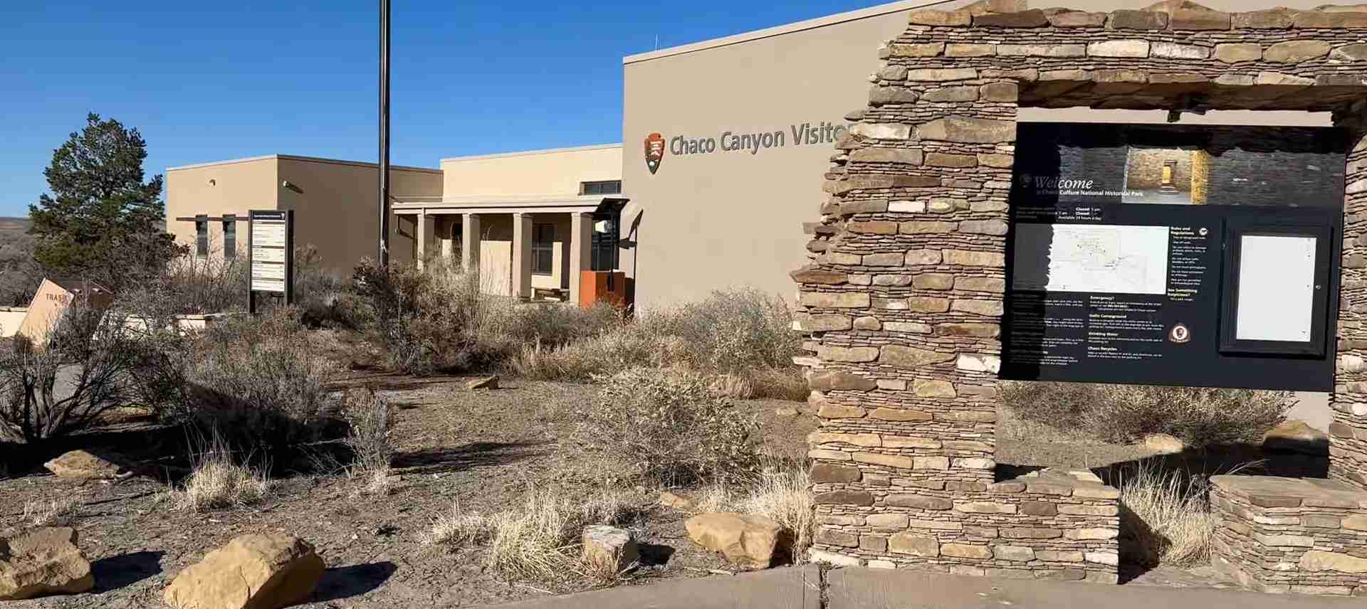
Chaco Culture National Historical Park: Complete UNESCO World Heritage Guide
Chaco Culture National Historical Park preserves the most extraordinary concentration of Ancestral Puebloan architecture in North America, a civilization that dominated the Four Corners region from AD 850 to 1250. This UNESCO World Heritage Site encompasses monumental great houses aligned with celestial precision, an extensive engineered road network spanning over 400 miles, and archaeological evidence of a complex society that created urban ceremonial centers unlike anything constructed before or since in the prehistoric Southwest.
Key Takeaways About Chaco Culture UNESCO World Heritage Site
- UNESCO Recognition and Protection: Designated a World Heritage Site in 1987, the property includes Chaco Culture National Historical Park, Aztec Ruins National Monument, and five additional archaeological areas managed by the Bureau of Land Management, collectively preserving the most significant Ancestral Puebloan cultural landscape in the United States.
- Architectural Achievement: The great houses of Chaco Canyon represent the largest buildings constructed in North America until the 19th century, with structures like Pueblo Bonito containing nearly 700 rooms and rising four to five stories, built using sophisticated masonry techniques and massive sandstone blocks quarried and transported from distant locations.
- Astronomical Sophistication: Chacoan builders aligned structures with extraordinary precision to solar and lunar cycles, including cardinal directions, solstice events, and lunar standstills, demonstrating astronomical knowledge that required generations of observation and sophisticated understanding of celestial mechanics.
- Ceremonial Road Network: Over 400 miles of engineered roads, often 30 feet wide, radiate from Chaco Canyon in remarkably straight lines regardless of terrain, serving ceremonial and symbolic purposes rather than purely utilitarian transport, with the Great North Road extending 35 miles northward to an enigmatic terminus in badlands canyon.
- Far-Reaching Trade Connections: Archaeological evidence reveals trade networks extending to Mesoamerica and the Pacific coast, with excavations uncovering cacao residue, macaw skeletons, turquoise workshops processing over 50,000 pieces, copper bells, Pacific seashells, and timber hauled from mountains 70 miles distant.
- Cultural Continuity and Abandonment: After flourishing for four centuries, Chacoan society declined following a catastrophic drought beginning in 1130, with inhabitants migrating primarily to the Rio Grande Valley and Hopi mesas by 1250, leaving architectural and spiritual legacies that modern Pueblo peoples still recognize as their ancestral heritage.
People Also Ask About Chaco Culture National Historical Park
What makes Chaco Culture a UNESCO World Heritage Site?
Chaco Culture earned UNESCO World Heritage designation in 1987 for preserving an ancient urban ceremonial center that represents exceptional architectural and astronomical achievement. The site demonstrates monumental public and ceremonial buildings with distinctive multi-story great house construction unlike anything built before or since in the prehistoric Southwest. The property encompasses extraordinary evidence of a complex pre-Columbian society that dominated the Four Corners region between AD 850 and 1250, exhibiting sophisticated engineering, astronomical knowledge, and social organization. The World Heritage designation recognizes not only Chaco Culture National Historical Park but also Aztec Ruins National Monument and five additional protected archaeological areas, collectively preserving the most comprehensive representation of Ancestral Puebloan culture. The site’s significance extends beyond architectural grandeur to encompass its elaborate road system, astronomical alignments, evidence of far-reaching trade networks, and continued spiritual importance to modern Pueblo peoples who maintain oral traditions of their historical migration from Chaco and their spiritual relationship to the land.
How did Ancestral Puebloans build such massive structures?
Ancestral Puebloans constructed Chaco’s great houses using core-and-veneer masonry techniques that employed massive sandstone blocks for outer walls filled with rubble cores, creating structures with walls thick enough to support multiple stories. Builders quarried sandstone from canyon cliffs using stone tools, shaping blocks into relatively uniform dimensions before transporting them to construction sites. The monumental scale required coordinated labor involving hundreds of workers, with Pueblo Bonito alone estimated to contain over 200,000 dressed stones. Timber beams supporting roofs and upper floors were hauled from mountain forests 50 to 70 miles distant, representing enormous logistical undertakings in a society without wheeled vehicles or draft animals. Construction occurred in stages over decades or centuries, with Pueblo Bonito evolving through multiple building phases from approximately AD 850 to 1150. The precision of stone placement, sophisticated architectural planning evident in symmetrical layouts, and astronomical alignments demonstrate remarkable engineering knowledge. Archaeological evidence suggests construction was carefully planned, with buildings designed as coherent wholes rather than incrementally expanded structures, indicating centralized architectural control and sophisticated understanding of structural engineering principles.
Why were Chacoan buildings aligned with astronomical events?
Chacoan structures exhibit deliberate astronomical alignments serving multiple cultural, ceremonial, and practical purposes central to Ancestral Puebloan worldview. The earliest great houses display south-southeast orientations linked to ancestral migration traditions and beliefs about origins, with this architectural tradition maintaining remarkable continuity from earlier pithouse villages. After AD 1100, builders shifted to precise cardinal north-south and east-west alignments, with structures like Pueblo Bonito featuring walls aligned within degrees of true cardinal directions achievable only through astronomical observation. Late Bonito Phase great houses constructed between AD 1100 and 1140 were positioned at specific locations functioning as solstice calendrical stations, allowing Chacoan elites to demonstrate astronomical knowledge and ritual power through public ceremonies aligned with celestial events. The famous Sun Dagger at Fajada Butte exemplifies this sophistication—three massive sandstone slabs positioned to allow noon sunlight to precisely bisect a spiral petroglyph at summer solstice and frame it at winter solstice. These alignments served agricultural timing for planting and harvest, marked ceremonial calendar events, reinforced social hierarchies through control of specialized knowledge, and connected Chacoan culture to broader cosmic order, transforming the landscape into an integrated astronomical observatory operating at regional scale.
What happened to the people who lived at Chaco Canyon?
The Chacoan world began its decline in the mid-12th century following environmental catastrophe and cultural transformation, culminating in complete abandonment by AD 1250. A prolonged drought commencing around 1130 and intensifying through the late 13th century severely impacted agricultural systems dependent on corn, beans, and squash cultivation using sophisticated but vulnerable irrigation methods. Deforestation caused by immense timber demands for great house construction exacerbated environmental stress, leading to erosion and resource depletion in an already marginal environment. Tree ring data indicates great house construction ceased around 1130, coinciding precisely with drought onset. Archaeological evidence shows deliberate sealing of great house doorways and burning of great kivas, suggesting spiritual acceptance of migration rather than sudden catastrophic flight. Chacoans migrated primarily to the Rio Grande Valley, the Hopi mesas in Arizona, and other surrounding communities with less marginal environments, carrying Chacoan architectural traditions and ceremonial practices to these new settlements. Modern Hopi and Pueblo peoples maintain oral traditions of historical migration from Chaco, considering the sites sacred ancestral homelands. The abandonment followed cultural patterns integral to Puebloan origin stories, in which migration represents spiritual journey rather than failure, with Chaco remaining a place of profound religious and cultural significance to descendant communities.
Extended multi-day tours – 5+ days
Featured Albuquerque Multi-Day Tour Packages
3 days
Albuquerque 3-Day Discovery Tour
- ✓ Comprehensive Albuquerque experience
- ✓ Expert local guides included
- ✓ All accommodation included
- ✓ Transportation provided

5 days
Albuquerque 5-Day Highlights Experience
- ✓ Comprehensive Albuquerque experience
- ✓ Expert local guides included
- ✓ All accommodation included
- ✓ Transportation provided
7 days
Albuquerque 7-Day Cultural Journey
- ✓ Comprehensive Albuquerque experience
- ✓ Expert local guides included
- ✓ All accommodation included
- ✓ Transportation provided
10 days
Albuquerque 10-Day Complete Adventure
- ✓ Comprehensive Albuquerque experience
- ✓ Expert local guides included
- ✓ All accommodation included
- ✓ Transportation provided
Multi-day tour packages powered by TourRadar. Prices and availability subject to change.
Introduction to Chaco Culture World Heritage Site
In the remote canyonlands of northwestern New Mexico, where the Colorado Plateau meets the San Juan Basin, the ruins of an extraordinary ancient civilization emerge from the desert landscape with commanding presence. Chaco Culture National Historical Park preserves the most significant concentration of Ancestral Puebloan archaeological sites in North America, a cultural complex that flourished between AD 850 and 1250 and left behind monumental architecture that continues to astound modern visitors and researchers. The great houses of Chaco Canyon—massive multi-story structures containing hundreds of rooms—represent engineering and architectural achievements unparalleled in the prehistoric Southwest, buildings whose scale was not matched anywhere in North America until the 19th century. These structures were not merely residential complexes but ceremonial centers, astronomical observatories, and symbols of power that anchored a cultural network extending across tens of thousands of square miles.
The significance of Chaco Culture extends far beyond impressive architecture. The site preserves evidence of sophisticated astronomical knowledge, with buildings and landscape features aligned to solar and lunar cycles with precision that required generations of careful observation. An extensive network of engineered roads radiates outward from the canyon, often maintaining remarkably straight trajectories regardless of terrain obstacles, suggesting purposes that transcend simple transportation. Archaeological excavations have revealed trade connections spanning from Mesoamerica to the Pacific coast, with luxury goods including macaw feathers, cacao, turquoise, and copper demonstrating the reach and influence of Chacoan society. The cultural landscape encompasses not only the great houses within Chaco Canyon itself but also outlier communities spread across the San Juan Basin, connected through architecture, roads, and shared ceremonial traditions.
UNESCO recognized this exceptional cultural heritage by designating Chaco Culture a World Heritage Site in 1987, placing it alongside such illustrious properties as Machu Picchu, the Pyramids of Giza, and the Grand Canyon. The World Heritage designation encompasses Chaco Culture National Historical Park in the canyon itself, Aztec Ruins National Monument to the north, and five additional protected archaeological areas, collectively preserving the most comprehensive representation of the Chaco Phenomenon. For modern Hopi and Pueblo peoples, these sites represent sacred ancestral homelands, with oral traditions maintaining detailed accounts of historical migrations from Chaco and spiritual relationships to the land. The archaeological record tells a story of remarkable cultural achievement, environmental adaptation, and eventual transformation, offering profound insights into human capacity for creating complex societies in challenging environments and the delicate balance between cultural ambition and ecological sustainability.
Historical Development of Chaco Canyon Civilization
The story of Chaco Canyon begins long before the monumental architecture that defines the site today. For over 2,000 years, Pueblo peoples occupied the vast region of the southwestern United States, with the San Juan Basin providing a challenging but viable homeland for farming communities. The specific canyon that would become Chaco’s ceremonial center lies at an elevation between 6,200 and 6,440 feet, bisected by the Chaco Wash, an arroyo that rarely holds water. The environment was marginal for agriculture even in optimal conditions, with limited water sources, cold winters, hot summers, and unpredictable precipitation patterns that made farming inherently risky. Despite these challenges, or perhaps because of them, this remote location became the spiritual and ceremonial heart of a cultural network that would influence the Four Corners region for centuries.
The transformation from scattered farming villages to monumental ceremonial center began around AD 850, when Ancestral Puebloans initiated construction of the first great houses. Three structures mark this early phase: Pueblo Bonito, Una Vida, and Peñasco Blanco. These initial buildings already displayed characteristics that would define Chacoan architecture—planned layouts, thick masonry walls, and orientations reflecting astronomical significance. Unlike the small pithouse villages typical of the period, which rarely exceeded ten rooms and used wooden posts with adobe construction, these great houses employed sandstone masonry and were designed from inception to support multiple stories and accommodate hundreds of rooms. What prompted this dramatic architectural shift remains one of Chaco archaeology’s enduring mysteries, with theories ranging from religious innovation to environmental pressures requiring new forms of social organization.
The period from AD 900 to 1020 witnessed steady expansion of Chacoan construction and the development of distinctive architectural traditions. Builders refined masonry techniques, developing the characteristic core-and-veneer construction method using shaped sandstone blocks for outer walls with rubble fill creating structural integrity. The earliest great houses exhibited south-southeast orientations, an architectural tradition maintaining remarkable continuity with much earlier Basketmaker III pithouse villages from AD 450 to 700. This SSE orientation likely connected to migration traditions and ancestor veneration, with buildings facing directions associated with cultural origins. During this formative period, Chacoans also began developing the sophisticated water management systems necessary for survival in the arid canyon, constructing canals, check dams, and collection basins to capture and direct the limited rainfall and occasional flood events that represented the canyon’s primary water sources.
The Bonito Phase, spanning approximately AD 1020 to 1100, represents Chaco’s cultural fluorescence and the period of most intensive construction activity. During these eight decades, Chacoans built the majority of great houses that define the canyon landscape today, dramatically expanded existing structures, and developed the road network connecting outlying communities to the ceremonial core. Pueblo Bonito underwent its most extensive building phases, ultimately containing nearly 700 rooms and rising to four or five stories in some sections. The architectural sophistication of this period is evident in precise cardinal alignments—Pueblo Bonito’s front wall and the wall dividing its plaza align east-west and north-south with remarkable accuracy, achievable only through astronomical observation. New great houses including Hungo Pavi, Pueblo Alto, and Chetro Ketl were constructed with planned layouts demonstrating centralized architectural control and sophisticated engineering knowledge. The scale of construction represents an extraordinary investment of labor in a society without wheeled vehicles, draft animals, or metal tools.
A significant shift occurred after AD 1100, marking the Late Bonito Phase that continued until approximately 1140. The great houses constructed during this final building period exhibit distinct characteristics: planned designs executed relatively quickly rather than through incremental expansion, precise alignments to solstitial events, and positions at locations functioning as horizon calendrical stations. Five principal in-canyon great houses built during this period were positioned to observe and mark solstice sunrise or sunset events, allowing public ceremonies demonstrating astronomical knowledge and ritual power. This shift may represent attempts to reinvigorate a cultural system showing signs of stress, with architectural innovation serving as demonstration of continued elite power and cosmic connection. The construction of these late great houses required sophisticated astronomical observation accumulated over generations, with builders selecting specific locations based on celestial alignments rather than other practical considerations.
The period after 1140 witnessed declining construction activity and the beginning of Chacoan transformation. Tree ring evidence indicates that great house construction essentially ceased around 1130, coinciding with the onset of a prolonged drought that would eventually contribute to the canyon’s abandonment. The fifty-year drought beginning in 1130 stressed agricultural systems already operating at the margins of viability. Corn, beans, and squash cultivation required predictable moisture from summer rains and winter snowpack, with sophisticated irrigation systems channeling water to fields. Extended drought rendered these systems inadequate, while deforestation resulting from immense timber consumption for construction eliminated the forest resources that had buffered earlier climate fluctuations. By 1200, the great houses stood largely empty, and by 1250, the canyon was essentially abandoned as a permanent residential center, though it retained ceremonial significance for migrating populations.
The abandonment of Chaco represents not catastrophic collapse but cultural transformation and adaptation. Archaeological evidence suggests deliberate closure rather than sudden flight—doorways were sealed, kivas burned in what appear to be ceremonial acts, and valuable materials were removed rather than abandoned. The Chacoan diaspora saw populations migrating primarily to regions with more reliable water sources: the Rio Grande Valley to the east, the Hopi mesas to the west, and other surrounding areas where Chacoan architectural and ceremonial traditions influenced local developments. Sites like Aztec Ruins to the north show clear Chacoan influence in the decades following the canyon’s decline, suggesting that while the ceremonial center was abandoned, the cultural traditions and knowledge systems persisted in descendant communities. Modern Pueblo peoples maintain oral traditions of these migrations, considering Chaco a place of origin and spiritual significance rather than a site of failure, integral to cultural identity and historical consciousness.
UNESCO World Heritage Designation and Significance
The path to UNESCO World Heritage recognition began with early 20th-century acknowledgment of Chaco Canyon’s exceptional archaeological significance. President Theodore Roosevelt designated Chaco Canyon a National Monument on March 11, 1907, providing federal protection for the remarkable ruins that had attracted scientific and public attention since the late 19th century. This initial designation protected a relatively modest area centered on the most prominent great houses. As archaeological understanding of the Chaco Phenomenon expanded through subsequent decades of research, it became clear that the cultural landscape extended far beyond the immediate canyon, encompassing outlier great houses, road systems, and associated communities spread across the San Juan Basin. Recognition of this broader cultural complex led to expansion and redesignation on December 19, 1980, when Congress created Chaco Culture National Historical Park, adding 13,000 acres to the protected area and acknowledging the site’s significance as representing an entire cultural system rather than isolated ruins.
UNESCO World Heritage designation came in 1987, recognizing Chaco Culture’s outstanding universal value and placing it among the world’s most significant cultural properties. The inscription acknowledged Chaco as a unique achievement in pre-Columbian North American culture, with monumental architecture and ceremonial centers representing exceptional evidence of complex social organization, astronomical knowledge, and architectural sophistication. The World Heritage property extends beyond the National Historical Park to include Aztec Ruins National Monument and five additional protected archaeological sites managed by the Bureau of Land Management, collectively preserving the most comprehensive representation of Chacoan cultural expression. This multi-site designation acknowledges that understanding Chaco requires examining not just the central canyon but the entire network of related communities, roads, and ceremonial landscapes that together constituted the Chaco Phenomenon.
The UNESCO designation specifically recognizes Chaco’s outstanding universal value under multiple criteria. The site demonstrates exceptional architectural and technological achievement, with great house construction representing the largest buildings in North America until the 19th century and exhibiting masonry techniques, planning sophistication, and structural engineering far advanced beyond contemporary Southwestern cultures. The astronomical alignments and ceremonial landscapes demonstrate remarkable scientific knowledge and cultural sophistication, with celestial observation and cosmic integration operating at scales unmatched by other ancient North American cultures. The road network represents unique engineering achievement, with over 400 miles of carefully constructed pathways maintained in straight lines regardless of topographic obstacles, suggesting purposes transcending mere transportation. The cultural landscape preserves exceptional evidence of Ancestral Puebloan worldview, with architecture, roads, and landscape modifications expressing cosmological beliefs and social organization in tangible form.
World Heritage designation brings international recognition and protective obligations. As a signatory to the UNESCO World Heritage Convention, the United States commits to protecting and preserving Chaco Culture for present and future generations, maintaining the site’s authenticity and integrity, and implementing management practices that safeguard its outstanding universal value. The National Park Service, in cooperation with the Bureau of Land Management and consultation with affiliated tribal nations, manages the property to balance preservation, research, and public access. This involves addressing threats including erosion caused by visitor traffic, vandalism and looting concerns, energy development pressures in surrounding areas, and the inherent fragility of thousand-year-old earthen and stone structures in an erosive environment. The closure of Fajada Butte to public access exemplifies protective measures implemented when visitor impact threatens archaeological resources, prioritizing long-term preservation over unrestricted access.
The World Heritage designation also acknowledges Chaco’s continued cultural significance for living communities. Modern Hopi and Pueblo peoples maintain profound spiritual and historical connections to Chaco, considering the sites sacred ancestral homelands integral to cultural identity. Tribal oral traditions preserve detailed knowledge of migrations from Chaco, the significance of specific structures and landscape features, and the spiritual relationships between place and people that transcend the archaeological past. These living traditions sometimes conflict with preservation approaches focused primarily on physical fabric, creating complex negotiations between Western archaeological management practices and Indigenous cultural protocols. The National Park Service has developed collaborative relationships with tribal representatives, seeking to incorporate traditional knowledge into interpretation and management while respecting the sacred nature of certain sites and ceremonies. This partnership recognizes that Chaco’s significance extends beyond archaeological research to encompass ongoing cultural and spiritual importance for descendant communities whose connection to the landscape predates scientific investigation by centuries.
Architectural Masterpieces: The Great Houses of Chaco Canyon
The great houses of Chaco Canyon represent the most spectacular architectural achievement of Ancestral Puebloan culture, massive multi-story structures that dominated the canyon landscape and served as ceremonial, administrative, and symbolic centers for the Chacoan world. These buildings employed core-and-veneer masonry construction, with outer walls built from carefully shaped sandstone blocks arranged in distinctive patterns and inner cores filled with rubble and mortar, creating structures with walls thick enough to support multiple stories. The largest great houses contained hundreds of rooms arranged in planned layouts exhibiting bilateral symmetry and careful attention to spatial organization. Unlike typical residential structures of the period, which grew incrementally through addition of rooms as families expanded, great houses were designed as coherent architectural wholes, with construction proceeding according to preconceived plans that governed room sizes, wall alignments, and spatial relationships.
Pueblo Bonito stands as the most extensively studied and architecturally impressive of all Chacoan great houses. Located in the heart of the canyon and aligned with its straight boundary running precisely east-west, Pueblo Bonito ultimately grew to encompass nearly 700 rooms and 40 kivas arranged in a distinctive D-shaped plan. The structure covers approximately two acres and in some sections rose four to five stories, representing the largest building in North America until surpassed by structures in the 19th century. Construction began around AD 850 and continued through multiple building stages until approximately 1150, with the structure evolving from an initial south-southeast orientation to achieve precise cardinal alignment in its final form. The front wall and the wall dividing the central plaza align east-west and north-south with remarkable accuracy, achievable only through astronomical observation, while the entire structure is positioned to align precisely with Chetro Ketl to the east. The northern roomblocks contained the largest rooms, many exceeding 25 square feet, while southern sections housed smaller rooms likely serving different functions in Chacoan ceremonial and administrative life.
Archaeological excavations at Pueblo Bonito have revealed extraordinary evidence of the structure’s role as a ceremonial and elite center rather than a conventional residential pueblo. One room contained more than 50,000 pieces of turquoise, representing the largest known concentration of this precious stone in the prehistoric Southwest. Another room held 4,000 pieces of jet and 14 macaw skeletons, with these exotic birds imported from Mesoamerica specifically for their brilliant feathers used in ceremonial contexts. Burial chambers contained high-status individuals accompanied by elaborate grave goods including carved wooden staffs, shell jewelry, turquoise artifacts, and ceramic vessels, while the overall scarcity of burials suggests the structure did not house a large permanent residential population. The presence of numerous great kivas—large circular ceremonial chambers—and the massive investment of construction labor indicate Pueblo Bonito functioned as a ceremonial nexus and elite residence rather than a typical pueblo housing extended family groups. The building’s astronomical alignments, including orientations allowing specific rooms to capture solstice sunlight, demonstrate integration of ceremonial calendar and architectural design.
Chetro Ketl, located approximately 1,500 feet east of Pueblo Bonito and precisely aligned along the east-west axis, represents another monumental achievement of Chacoan architecture. This great house contains approximately 500 rooms and 16 kivas, with construction occurring primarily during the 11th century. The structure exhibits exceptional masonry work, with exterior walls displaying the finest stone cutting and most regular coursing found anywhere in Chaco Canyon. The great kiva at Chetro Ketl measures over 62 feet in diameter, making it one of the largest ceremonial chambers in the canyon. The structure’s elevated plaza provided a commanding view across the canyon, and staircases carved into the canyon rim connected Chetro Ketl with Tsin Kletsin, a great house positioned on the mesa top above. These physical connections, combined with precise east-west alignment with Pueblo Bonito, suggest Chetro Ketl occupied a significant position in the ceremonial geography of central Chaco Canyon, participating in landscape-scale alignments that transformed the entire canyon into an integrated ceremonial landscape.
Pueblo Alto occupies a strategic position on the mesa top north of the central canyon, providing commanding views across the landscape and serving as a critical node in the road network. The Great North Road originates just east of Pueblo Alto before extending 35 miles northward into the San Juan Basin. The structure contains approximately 150 rooms and was constructed beginning around AD 1020 to 1040, exhibiting precise cardinal alignments and sophisticated architectural planning. Archaeological investigations have revealed massive middens containing extraordinary quantities of broken ceramic vessels, suggesting periodic large-scale feasting events or ceremonial vessel breakage rather than everyday domestic refuse. The quantities of ceramics far exceed what a resident population could generate through normal use, leading researchers to interpret Pueblo Alto as a ceremonial center hosting periodic gatherings drawing participants from across the Chacoan world. The structure’s position on the mesa top, combined with its connection to the Great North Road and intervisibility with other great houses, suggests it played a crucial role in communication, ceremony, and the symbolic landscape organization that characterized Chacoan culture.
The architectural sophistication of Chaco’s great houses extends beyond individual buildings to encompass landscape-scale planning and alignment. The great houses in central Chaco Canyon are positioned in relationships suggesting deliberate spatial organization rather than opportunistic placement. Pueblo Bonito and Chetro Ketl align precisely east-west, while Pueblo Alto, Tsin Kletsin, New Alto, and Casa Rinconada create north-south alignments across the canyon center. These alignments transform the canyon into a ceremonial landscape where architecture and natural features combine to create an integrated cosmological expression. The positioning of structures to serve as horizon calendrical stations allowed observers at specific great houses to track solstice events through sunrise or sunset alignments with natural landscape features, creating a canyon-wide astronomical observatory operating at regional scale. This landscape-level planning required centralized authority capable of coordinating construction across multiple sites over extended periods, suggesting sophisticated social organization and cultural institutions extending beyond individual communities.
Astronomical Alignments and Celestial Knowledge
Chacoan culture’s integration of astronomical observation with architecture and landscape organization represents one of its most remarkable achievements, demonstrating scientific knowledge and cultural sophistication rivaling ancient civilizations worldwide. The Ancestral Puebloans of Chaco Canyon possessed detailed understanding of solar and lunar cycles, using this knowledge to align buildings with celestial events, mark seasonal calendars for agricultural and ceremonial purposes, and express cosmological beliefs through monumental architecture. Three distinct astronomical traditions appear in Chacoan construction, each reflecting different cultural priorities and evolving over the centuries of canyon occupation. The south-southeast orientation tradition, the cardinal direction alignments, and the solstitial horizon calendar stations together demonstrate generations of careful celestial observation and the central role of astronomical knowledge in Chacoan society.
The earliest astronomical tradition, appearing in structures built before AD 1000 and continuing through the peak Bonito Phase construction from AD 1020 to 1100, involved south-southeast orientations ranging between 151 and 161 degrees. This architectural tradition maintains remarkable continuity with much earlier Basketmaker III pithouse villages from AD 450 to 700, where pit structures exhibited the same south-southeast facing through internal features including sipapus, hearths, deflector stones, and entrances. The persistence of this orientation across more than 600 years and its connection to earlier cultural traditions suggest deep cultural significance rather than astronomical precision to specific celestial events. Researchers interpret this SSE orientation as linked to ancestral migration traditions and cosmological beliefs about cultural origins, with buildings facing directions associated with the spiritual homeland from which Puebloan peoples understood themselves to have migrated. Pueblo Bonito’s earliest construction phases exhibit clear SSE orientation before later building stages reoriented portions of the structure to cardinal directions, demonstrating the coexistence of tradition and innovation in Chacoan architectural practice.
The development of precise cardinal direction alignments represents a second astronomical tradition that achieved prominence during the 11th century Chaco Fluorescence. Buildings constructed during this period exhibit north-south and east-west orientations accurate to within a few degrees of true cardinal directions, a level of precision achievable only through careful astronomical observation rather than casual landscape features. Hungo Pavi, with construction beginning between AD 990 and 1010, demonstrates cardinal alignment offset less than five degrees from true north-south. Pueblo Alto, built beginning AD 1020 to 1040, includes accurate east-west walls. Pueblo Bonito completed its staged transformation from SSE to precise north-south and east-west cardinal alignment sometime after AD 1070, with the final structure exhibiting the straight east-west front wall and north-south dividing wall that remain visible today. Casa Rinconada, the great kiva standing isolated south of the main canyon great houses, displays cardinal direction alignment with entrances on north and south sides, creating an architectural expression of cosmic order through geometric precision.
Achieving true cardinal alignments without modern instruments required sophisticated astronomical observation techniques. The most reliable method available to Ancestral Puebloans involved tracking the sun’s shadow at noon, when the sun crosses the celestial meridian and casts shadows pointing precisely north-south. Pueblo Bonito’s north-south dividing wall demonstrates this principle—at midday, the wall casts no shadow, indicating perfect north-south alignment. Alternative methods included observing sunrise or sunset positions at equinoxes, when the sun rises due east and sets due west, or tracking Polaris and the celestial north pole through nightly observations of stellar rotation. The accuracy of Chacoan cardinal alignments demonstrates that builders employed these techniques systematically, accumulating observations over extended periods to achieve precision that exceeded casual orientation and served as architectural demonstration of astronomical knowledge and cosmic understanding.
The third astronomical tradition emerged during the Late Bonito Phase from AD 1100 to 1140, when builders positioned new great houses at specific locations serving as solstitial horizon calendar stations. Five principal in-canyon great houses constructed during this period were positioned where natural landscape features on the horizon create alignments with sunrise or sunset at summer or winter solstice. The June solstice sunrise or December solstice sunrise alignments allowed observers standing at these structures to witness the sun rise at specific notches, peaks, or alignments with distant mountains, creating natural calendrical markers visible from architecturally significant locations. This shift from building orientations to observation point selection represents sophisticated understanding of landscape astronomy, requiring not only knowledge of solar cycles but also detailed familiarity with horizon topography and the ability to predict celestial events at specific landscape locations.
The Sun Dagger at Fajada Butte represents Chaco’s most famous astronomical feature, demonstrating the integration of natural rock formations with human modification to create precise calendrical markers. Three massive sandstone slabs lean against a cliff face 400 feet up the butte’s summit, positioned to allow sunlight to pass through gaps in carefully controlled patterns. At summer solstice noon, a dagger of light bisects a spiral petroglyph carved into the rock wall behind the slabs. At winter solstice noon, two light daggers frame the spiral precisely. The equinoxes create different light patterns, allowing the site to mark the four key solar calendar points throughout the year. The positioning of the three slabs appears deliberate rather than natural, with Chacoans likely adjusting naturally occurring rock formations to achieve the precise alignments. The site also tracked lunar cycles, with additional petroglyphs marking lunar standstill events occurring on an 18.6-year cycle. Tragically, the slabs shifted in 1989 due to natural erosion, disrupting the alignments and leading to closure of Fajada Butte to public access to prevent further damage.
Additional petroglyphs throughout Chaco Canyon demonstrate astronomical knowledge integrated into rock art. A panel near Peñasco Blanco depicts a star symbol adjacent to a crescent moon, interpreted by some researchers as recording the supernova of AD 1054 that created the Crab Nebula, an event also documented in Chinese, Japanese, and Arabic astronomical records. While this interpretation remains debated among archaeologists and modern Pueblo peoples, the presence of celestial symbols in rock art indicates that astronomical observation extended beyond practical calendrical functions to encompass cosmological and spiritual dimensions. The Pueblo Bonito petroglyph, showing a spiral with an arrow and a D-shape matching the building’s ground plan, creates a symbolic connection between architectural form and celestial observation, with the arrow pointing toward noon sun alignment. These petroglyphs transform the canyon landscape into an integrated symbolic system where architecture, rock art, and celestial events combine to express Chacoan cosmology.
The astronomical sophistication evident throughout Chaco Canyon required institutional knowledge transmission across generations. Achieving the precision of cardinal alignments, understanding solstitial cycles with sufficient accuracy to position buildings as horizon observatories, and maintaining knowledge of lunar standstill events visible only on 18.6-year cycles demanded long-term astronomical observation programs and cultural institutions ensuring knowledge preservation. This suggests the existence of specialized astronomical knowledge keepers, likely associated with ceremonial priesthoods, who accumulated observations, trained successors, and directed architectural projects requiring astronomical expertise. The integration of celestial knowledge with monumental architecture served multiple functions: marking agricultural calendars for planting and harvest, coordinating ceremonial events across the dispersed Chacoan world, demonstrating elite power through control of specialized knowledge, and expressing cosmological beliefs that connected earthly activities with cosmic order. The celestial alignments transformed Chaco Canyon into a sacred landscape where architecture mediated between human community and cosmic forces.
The Enigmatic Chacoan Road Network
One of the most puzzling features of Chacoan culture is the extensive network of engineered roads radiating outward from the canyon and connecting outlier communities across the San Juan Basin. Archaeological surveys using aerial photography, ground reconnaissance, and modern remote sensing technologies including LiDAR have documented over 400 miles of prehistoric roadways, many maintaining remarkably straight trajectories regardless of topographic obstacles. These roads typically measure 20 to 40 feet wide—extraordinary dimensions for a society that possessed neither wheeled vehicles nor draft animals. The roads employ sophisticated engineering, with builders clearing paths through rock-strewn terrain, cutting staircases into cliff faces where necessary, and using earthen ramps and stone berms to maintain straight courses across rugged landscapes. The effort invested in road construction far exceeds practical transportation needs, leading researchers to conclude that the road network served ceremonial, symbolic, and cosmographic purposes alongside any utilitarian functions.
The Great North Road represents the most extensively documented and enigmatic of all Chacoan roadways. Originating just east of Pueblo Alto on the mesa above the central canyon, this road extends approximately 35 miles northward toward Kutz Canyon near Twin Angels Pueblo outside modern Bloomfield, New Mexico. The road maintains its characteristic 30-foot width and remarkably straight trajectory across varied terrain, ascending and descending cliffs via carved staircases and continuing through areas offering no apparent economic or settlement destinations. Along its length, the Great North Road passes only small structures containing fewer than six rooms, far smaller than the outlier great houses found elsewhere in the Chacoan world. The road appears to terminate abruptly at the edge of Kutz Canyon in an isolated badlands landscape, leading some researchers to suggest it was never completed or that its original terminus has been lost to erosion. Archaeological investigations along the road have found limited ceramic evidence of trade with northern communities and an absence of features suggesting intensive use for economic transport, deepening the mystery of the road’s purpose.
The cosmographic interpretation of the Great North Road suggests it served ceremonial and symbolic functions more than practical transportation. The road runs within half a degree of true north from Chaco Canyon, an alignment achievable only through deliberate astronomical observation and suggesting symbolic connection to the cardinal directions that featured prominently in Chacoan architecture. The north held special significance in Puebloan cosmology and migration traditions, often associated with places of origin and spiritual power. The road may have served as a ceremonial pathway used for processions, pilgrimages, or ritual journeys connecting Chaco Canyon with sacred landscapes to the north. The presence of Pierre’s Ruins along the Great North Road provides suggestive evidence for ceremonial function—atop a high natural pinnacle at this site, archaeologists discovered a unique “housed kiva” aligned with the road’s centerline, with abundant evidence of fires whose smoke would have been visible for many miles, possibly serving communication or ceremonial signaling purposes.
Recent archaeological discoveries continue to reveal new dimensions of the road network. In January 2025, research published in the journal Antiquity documented a nearly four-mile road near the Gasco site, approximately 50 miles from the main canyon, identified through LiDAR remote sensing. This road connects natural springs with a rock semicircle interpreted as a possible roadside shrine and runs directly toward Mount Taylor’s horizon position at winter solstice sunrise. The road terminates at water sources and includes herradura features—horseshoe-shaped structures associated with Chacoan ceremonial sites—decorated with river pebbles, suggesting ritual connections between roads, water sources, sacred geography, and celestial events. This discovery exemplifies how the road network integrated practical resources with ceremonial landscapes, connecting communities not merely for economic exchange but to create symbolic relationships between settlements, water sources, sacred mountains, and cosmologically significant directions.
The South Road provides a contrasting example of road construction and use. Leaving Chaco Canyon through South Gap, this road extends toward outlying communities in the Red Mesa Valley to the south, passing through areas with greater settlement density than the northern route. Archaeological investigations along the South Road have revealed higher proportions of utilitarian ceramics and local wares compared to the Great North Road, suggesting more intensive use for everyday travel and economic activities. The road served as a main entry point to the canyon for travelers arriving from southern communities, facilitating trade in agricultural products, ceramics, and other goods. Yet even the South Road exhibits features suggesting ceremonial significance beyond simple transportation—its carefully engineered straight segments, construction across terrain where natural paths would have been easier, and connections to outlier great houses indicate that even roads serving utilitarian functions participated in the symbolic landscape organization characteristic of Chacoan culture.
Most Chacoan roads are actually short segments, typically extending only a few kilometers from associated great houses before becoming untraceable or terminating without reaching other settlements. This pattern appears throughout the Chacoan world, with outlier great houses featuring road segments that radiate outward in directions pointing toward notable landscape features, other great houses, or cosmologically significant directions without creating continuous connections. These short road segments appear to have functioned primarily as symbolic connections to places of importance rather than everyday transportation routes. The roads monumentalized landscape, creating visible demonstrations of cultural affiliation, social organization, and cosmic connection. The sheer width of these roads—30 feet or more in a society that moved goods by human carrying rather than vehicles—demonstrates that their construction served purposes beyond efficiency, creating ceremonial corridors that physically and symbolically connected communities to the Chacoan ceremonial center.
The roads required extraordinary labor investment for a society without draft animals or wheeled vehicles. Construction involved clearing paths through rock fields, excavating earth, cutting steps into cliff faces, building retaining walls and berms to maintain level surfaces, and maintaining straight alignments over long distances. The engineering demonstrates understanding of surveying techniques capable of establishing and maintaining sight lines across distances where terrain features would obscure direct views. Some researchers suggest that signal fires, aligned posts, or other markers were used to maintain straight trajectories during construction. The labor organization necessary for road building implies centralized authority capable of mobilizing workers, coordinating construction across dispersed locations, and maintaining shared understanding of the roads’ purposes and appropriate construction techniques. The roads physically manifested Chacoan social organization, transforming abstract relationships between communities into visible landscape features that could be walked, experienced, and understood as concrete expressions of cultural connection.
Modern tribal knowledge adds important perspectives to understanding Chacoan roads. Pueblo oral traditions maintain that the roads served ceremonial purposes, potentially used for processions, pilgrimages, or ritual journeys undertaken by religious societies. The roads may have connected communities for periodic ceremonies drawing participants from across the Chacoan world, with the broad pathways accommodating large groups traveling together for festivals, initiations, or other events requiring physical gathering at the canyon’s ceremonial centers. The alignment of some roads with celestial events, sacred mountains, or landscape features holding spiritual significance suggests that walking these paths may have constituted ritual acts, with the journey itself possessing religious meaning beyond simply reaching a destination. Tribal representatives emphasize that the roads connect to living cultural traditions, with modern Pueblo peoples maintaining spiritual relationships to the Chacoan landscape that give contemporary significance to ancient pathways. The roads remain part of an ongoing cultural geography rather than merely archaeological features, carrying meanings that extend beyond what archaeology alone can interpret.
Trade Networks and Regional Influence
Archaeological evidence reveals that Chaco Canyon served as the hub of extensive trade networks extending across the Southwest and into Mesoamerica, with luxury goods, raw materials, and utilitarian items moving through the canyon in quantities far exceeding local consumption needs. The great houses functioned as redistribution centers and storage facilities, with enormous quantities of trade goods accumulating in specific rooms that served as warehouses rather than living spaces. The sheer volume and diversity of traded materials demonstrate that Chaco’s influence extended far beyond the immediate canyon, with the ceremonial center drawing resources from hundreds of miles distant and serving as a nexus connecting diverse ecological zones and cultural regions. This trade network was not merely economic but deeply integrated with ceremonial and social functions, with many luxury goods serving primarily ritual purposes rather than practical use.
Turquoise represents the most abundant and significant trade commodity found at Chaco Canyon, with excavations revealing extraordinary concentrations far exceeding any practical use for personal adornment. The single room at Pueblo Bonito containing over 50,000 turquoise pieces represents the largest known prehistoric turquoise collection in North America. These turquoise artifacts include finished beads and pendants, partially worked materials, and raw stones, suggesting that Chaco Canyon housed turquoise workshops processing raw materials into finished objects for redistribution throughout the Chacoan world. The turquoise originated from sources in the Cerrillos Hills south of modern Santa Fe, approximately 100 miles from Chaco Canyon, requiring organized extraction, transport, and processing systems. The concentration of turquoise at great houses, particularly in association with high-status burials and ceremonial contexts, indicates that this precious stone served primarily ritual and prestige functions, with access to turquoise denoting social rank and ceremonial authority.
Exotic materials from Mesoamerica provide dramatic evidence of trade connections extending hundreds of miles southward into regions with entirely different cultural traditions and environmental conditions. Macaw skeletons found at Chaco Canyon, including 14 complete skeletons in a single room at Pueblo Bonito, demonstrate that these brilliant tropical birds were transported living from their native range in central and southern Mexico, a distance exceeding 1,000 miles. The macaws were not consumed as food but kept for their feathers, which held immense ceremonial value in both Mesoamerican and Southwestern cultures. The living birds represented extraordinary investments—they required specialized care, appropriate food, and warm temperatures through cold Chaco winters, indicating that Chacoan elites possessed both the resources and knowledge to maintain tropical species far from their native habitats. When the birds died, they were buried with ritual attention, often accompanied by other valuable grave goods, demonstrating their sacred status.
Perhaps even more remarkable is the archaeological evidence for cacao consumption at Chaco Canyon. Residue analysis of pottery fragments has identified traces of cacao, the tropical tree whose seeds are processed to create chocolate, on tall cylindrical jars resembling vessels used in Maya ceremonial contexts for consuming frothed chocolate beverages. Cacao trees grow only in tropical environments entirely absent from the American Southwest, requiring these precious seeds to be transported over 1,000 miles from Mesoamerican source areas. Among the Maya and other Mesoamerican cultures, cacao held sacred significance, with chocolate beverages consumed during elite rituals and religious ceremonies. The presence of cacao at Chaco demonstrates not merely the transport of exotic commodities but the transfer of ritual knowledge and ceremonial practices from Mesoamerica to the Southwest. The specific pottery forms associated with cacao residues suggest Chacoans adopted Mesoamerican preparation and consumption methods, incorporating foreign ritual traditions into their own ceremonial practices.
Timber represents the most voluminous trade commodity, with the great houses requiring an estimated 200,000 wooden beams for roof and floor construction. The canyon’s immediate environment lacks the forests necessary to provide this massive timber resource, forcing Chacoans to transport beams from mountain ranges 50 to 70 miles distant. Dendrochronological analysis of construction timbers reveals that different great houses used wood from different source areas, suggesting either that construction crews accessed different forests over time or that different communities contributed timber to canyon construction projects. The Chuska Mountains to the west provided ponderosa pine, while other source areas contributed fir, spruce, and other species preferred for different construction purposes. Transporting beams weighing hundreds of pounds across tens of miles without wheeled vehicles or draft animals required organized labor systems and represented enormous energy investments. The timber trade demonstrates that Chaco’s construction projects drew resources from across the region, with outlying communities either contributing materials as tribute or participating in cooperative building efforts that served broader cultural purposes.
Ceramic vessels provide detailed evidence of trade patterns through petrographic and compositional analysis. Archaeologists can determine where pottery was manufactured by analyzing clay composition and identifying distinctive mineral inclusions characteristic of specific geological source areas. Studies of Chacoan ceramics reveal that the great houses accumulated pottery manufactured across wide areas of the San Juan Basin, with some vessels originating 100 miles or more from the canyon. Particularly notable are painted pottery types showing stylistic connections to communities in the San Juan River valley to the north and the Rio Grande region to the east. The distribution patterns of pottery types suggest that ceramic vessels moved through trade networks alongside their contents—jars containing food staples, bowls holding prepared foods, or vessels carrying other commodities. The high percentages of decorated wares and imported pottery types associated with the Great North Road suggest that some road segments may have facilitated specialized trade in prestige ceramics used in ceremonial contexts.
The scale of periodic feasting evidenced in great house middens provides additional insight into Chaco’s role as a regional ceremonial center drawing participants and resources from distant communities. Archaeological investigations at Pueblo Alto have documented massive midden deposits containing extraordinary quantities of broken ceramic vessels—far more than a residential population could generate through normal domestic use. The ceramic breakage appears ceremonial rather than accidental, with whole vessels deliberately smashed during periodic events. Associated with these ceramics are food remains indicating large-scale consumption of foods including corn, beans, squash, and animal protein from domesticated turkeys and hunted game. The pattern suggests that outlying communities periodically gathered at Chaco Canyon for ceremonies involving communal feasting, bringing food resources, ceramic vessels, and other materials that were consumed, broken, and deposited as part of ritual activities. These periodic gatherings would have reinforced social connections, facilitated exchange of goods and information, and demonstrated the ceremonial authority of Chacoan leadership.
Outlier Communities and the Greater Chacoan World
Chaco Canyon did not exist in isolation but served as the ceremonial and symbolic center of a cultural network extending across tens of thousands of square miles of the San Juan Basin and beyond. Over 150 outlier communities have been identified as participating in the Chacoan system, recognized through architectural features including great houses built in Chacoan style, great kivas exceeding 100 square meters, and formal road segments connecting to the broader network. These outlier communities varied greatly in size, from small settlements with a single modest great house to substantial communities rivaling the canyon’s architectural achievements. The relationship between the central canyon and outlying settlements remains debated, with interpretations ranging from economic and political control to voluntary ceremonial affiliation, but the archaeological evidence clearly demonstrates shared architectural traditions, participation in trade networks, and cultural connections manifested through material culture and built environment.
Aztec Ruins National Monument, located approximately 56 miles north of Chaco Canyon near the modern town of Aztec, New Mexico, preserves the largest and most significant Chacoan outlier community. Despite its misleading name—early Anglo settlers incorrectly attributed the ruins to Aztec culture from central Mexico—this site represents classic Chacoan architecture and represents the northern extent of the culture’s influence. The West Ruin at Aztec contains approximately 400 rooms and was constructed primarily during the late 11th and early 12th centuries, contemporary with Chaco’s Late Bonito Phase. The building exhibits characteristic Chacoan features including planned layout, core-and-veneer masonry, great kivas, and astronomical alignments. The great kiva at Aztec has been reconstructed, allowing modern visitors to experience the interior space of these remarkable ceremonial structures—a circular chamber 41 feet in diameter with features including floor vaults, raised firebox, seating platforms, and a massive log roof supported by four massive pillars.
The construction and occupation sequence at Aztec Ruins provides important insights into cultural transitions during Chaco’s decline. While the initial construction exhibits pure Chacoan architectural style and likely occurred when the central canyon still functioned as the ceremonial hub, later occupation phases show influences from Mesa Verde culture to the north. After Chaco Canyon’s abandonment around 1200, Aztec appears to have served as a successor ceremonial center, with renovations and modifications reflecting different cultural priorities. This pattern suggests that the Chacoan cultural system did not simply collapse but transformed, with ceremonial authority and architectural traditions continuing at outlying locations even as the central canyon was depopulated. The inclusion of Aztec Ruins National Monument within the Chaco Culture World Heritage property recognizes this continuity and acknowledges that understanding the Chaco Phenomenon requires examining the entire network of related sites rather than focusing exclusively on the canyon itself.
Salmon Ruins, located near Bloomfield approximately 10 miles east of Aztec, represents another significant outlier community preserving exceptional Chacoan architecture. This great house contains over 300 rooms arranged in a massive C-shaped structure and was constructed beginning around AD 1088, during Chaco’s Late Bonito Phase. The building demonstrates sophisticated architectural planning and shares stylistic features with contemporary construction at the central canyon. Salmon Ruins occupies a strategic position near the San Juan River in an area with more reliable water and agricultural potential than Chaco Canyon itself, raising questions about why ceremonial authority remained centered in the resource-poor canyon rather than shifting to more favorable locations. The site has yielded important evidence about construction techniques, with detailed documentation of original roof timbers, floor features, and masonry patterns providing data for understanding Chacoan building practices.
The distribution of outlier great houses follows patterns suggesting deliberate spacing and strategic positioning rather than opportunistic placement wherever agricultural potential warranted settlement. Many outliers occupy elevated positions with broad viewsheds, allowing visual communication across long distances through signal fires or smoke signals. The spacing between major outliers often approximates regular intervals, suggesting territorial organization or the maximum distance communities could easily travel to participate in periodic ceremonies at regional centers. Some outliers cluster in areas of particular agricultural productivity or resource abundance, while others occupy locations that seem marginal from an economic perspective but may hold ceremonial or symbolic significance. The road segments associated with many outliers point toward Chaco Canyon, other outliers, or prominent landscape features, creating a network of symbolic connections that physically manifested social relationships and ceremonial affiliations.
The great kivas found at outlier sites provide architectural evidence for ceremonial participation in the broader Chacoan system. These large circular ceremonial structures typically measure 40 to 60 feet in diameter and feature standardized elements including floor vaults, raised fireboxes, seating platforms, sipapu features representing cosmological emergence points, and massive roof support systems. The construction of great kivas required substantial labor investment and specialized architectural knowledge, suggesting that outlier communities participated in ceremonial traditions shared across the Chacoan world. The great kivas likely hosted periodic ceremonies drawing participants from surrounding communities, creating local ceremonial centers that maintained connections to broader regional religious practices. The presence of great kivas at outliers indicates that ceremonial authority was distributed rather than entirely centralized at the canyon, with outlying great houses serving as regional nodes in a hierarchical ceremonial network.
The relationship between Chaco Canyon and its outliers continues to generate scholarly debate. Earlier interpretations envisioned a hierarchical political system with the canyon serving as a capital controlling tributary outliers through economic or political dominance. More recent perspectives emphasize ceremonial and ideological connections, suggesting that outliers participated voluntarily in a shared belief system that recognized the canyon’s ritual authority without necessarily submitting to political control. The lack of defensive architecture, the evidence for periodic gatherings rather than permanent administrative presence, and the distribution of luxury goods suggest ceremonial network rather than coercive empire. Tribal oral traditions emphasize the sacred nature of Chaco Canyon as a place of pilgrimage and ceremony, with communities traveling to participate in religious events that reinforced cultural identity and social bonds. This interpretation recognizes Chacoan culture as a complex phenomenon combining economic exchange, shared ceremonial traditions, social networks, and cosmological beliefs that created cultural cohesion without requiring centralized political institutions.
Environmental Context and Sustainability Challenges
Understanding Chaco Canyon’s remarkable cultural achievement requires examining the environmental context in which Ancestral Puebloans created their civilization. The canyon occupies one of the most challenging agricultural environments in the prehistoric Southwest, with elevation between 6,200 and 6,440 feet, cold winters, hot summers, and precipitation averaging less than 10 inches annually. The Chaco Wash, an arroyo bisecting the canyon, flows only intermittently following rainfall events, typically remaining dry for extended periods. The canyon’s main aquifers lie too deep for prehistoric access, with only limited springs providing reliable water sources. Agricultural production depended on summer monsoon rains and winter snowpack, with drought years threatening crop failure and starvation. That Chacoans not only survived but thrived in this marginal environment, creating monumental architecture and supporting periodic gatherings of hundreds or thousands of people, demonstrates extraordinary adaptation and resource management skills.
Chacoan farmers employed sophisticated water management strategies to maximize agricultural productivity in the arid environment. Archaeological evidence reveals extensive systems of canals, check dams, gridded gardens, and water diversion features designed to capture and direct ephemeral runoff to agricultural fields. During summer thunderstorms, water rushing down side canyons and mesa slopes could be channeled into specially prepared field systems where carefully constructed berms and terraces slowed water flow, allowing infiltration into soils and supporting crop growth. The rincons—gaps between southwestern cliff faces serving as side canyon entrances—played crucial roles in funneling storm water into the canyon and concentrating precipitation in specific areas where agricultural fields could benefit. Winter snowmelt from higher elevations provided additional moisture, with water management systems designed to capture and distribute this precious resource across maximum acreage.
The primary crops cultivated at Chaco included corn, beans, and squash—the agricultural trilogy that formed the subsistence base throughout the prehistoric Southwest. Corn varieties adapted to short growing seasons and drought stress provided the caloric foundation, while beans added essential proteins and squash supplied vitamins and variety. Domesticated turkeys provided both protein and feathers for ceremonial use, with archaeological evidence indicating that outlying communities raised turkeys in significant numbers. Wild resources supplemented cultivated foods, including hunted game such as rabbits, deer, and antelope, and gathered plant foods including pinyon nuts, various seeds, and seasonal fruits. The dietary evidence suggests that Chaco Canyon itself could not have produced sufficient agricultural surplus to support its monumental construction projects and periodic ceremonial gatherings without food imports from outlying communities with better agricultural conditions, indicating that the canyon’s role as ceremonial center depended on regional exchange systems bringing food resources to the ritual core.
Timber consumption created perhaps the most severe environmental impact of Chacoan construction. The great houses required an estimated 200,000 wooden beams for roof and floor supports, representing an immense forest harvest from mountain ranges 50 to 70 miles distant. Early construction drew upon relatively nearby forests, but as these resources became depleted, timber procurement extended to increasingly distant source areas. The Chuska Mountains to the west ultimately provided the majority of construction timber, with individual beams weighing hundreds of pounds requiring transport across rugged terrain without wheeled vehicles or draft animals. Dendrochronological studies document that some great houses used timbers harvested decades apart, suggesting intermittent construction campaigns as timber became available. The cumulative forest harvest transformed local woodland environments, with deforestation contributing to erosion and reducing the fuel wood and wild food resources available from nearby forests.
Climate variability profoundly influenced Chacoan cultural trajectory, with the civilization’s florescence occurring during a period of relatively favorable conditions and its decline coinciding with deteriorating climate. Paleoclimate reconstructions using tree ring data, lake sediments, and other proxy evidence reveal that the period from approximately AD 900 to 1130 witnessed relatively reliable precipitation supporting agricultural expansion, though with periodic drought episodes testing but not overwhelming Chacoan adaptive strategies. The Great Drought beginning around 1130 represented a climatic shift of different magnitude, with sustained moisture deficits lasting for decades. The fifty-year drought from 1130 to 1180 severely stressed agricultural systems already operating at the margins of viability. Crops failed more frequently, wild resources declined as vegetation responded to drought, and water sources became increasingly unreliable. The timing of great house construction cessation around 1130, precisely coinciding with drought onset, suggests immediate recognition that environmental conditions no longer supported continued architectural investment and ceremonial elaboration.
The combination of environmental degradation and climate deterioration created a sustainability crisis that Chacoan adaptive strategies could not overcome. Deforestation reduced the environmental buffering that forests provided, making the canyon more vulnerable to erosion and decreasing the wild food resources that supplemented agriculture. Soil depletion from intensive cultivation may have reduced agricultural productivity even when precipitation supported crop growth. The concentration of population and resources at the ceremonial center created vulnerabilities—if central canyon harvests failed, the entire ceremonial system depending on food imports from outliers faced collapse. Archaeological evidence suggests that violence increased during the Late Bonito Phase, with some human skeletal remains showing trauma consistent with conflict, possibly reflecting social stress as resources became increasingly scarce and competition for limited agricultural land intensified. These multiple stresses—environmental degradation, climate change, resource depletion, and potential social conflict—combined to make the canyon untenable as a permanent residential and ceremonial center.
The Chacoan response to environmental crisis was migration rather than technological innovation to overcome resource limitations. Beginning in the mid-12th century and culminating by 1250, Ancestral Puebloans abandoned Chaco Canyon and many outlier settlements, moving primarily to regions with more reliable water sources including the Rio Grande Valley, the Hopi mesas, and other areas in northern New Mexico and Arizona. The archaeological evidence for abandonment suggests deliberate closure rather than sudden catastrophic flight—doorways were sealed, kivas were burned in what appear to be ceremonial acts, and valuable materials were removed rather than abandoned. This pattern indicates that migration followed cultural protocols rather than desperate flight, consistent with Puebloan oral traditions in which migration represents a normal part of cultural life cycle, a spiritual journey guided by prophecy and religious instruction rather than simple environmental failure. From this perspective, Chaco Canyon served its cultural purpose and was ritually closed when that purpose was fulfilled, with the people carrying their traditions, knowledge, and cultural identity to new landscapes.
Modern Pueblo Connections and Living Heritage
Chaco Canyon is not merely an archaeological site representing a vanished civilization but a living ancestral homeland maintaining profound spiritual and cultural significance for modern Pueblo peoples and other Indigenous communities of the Southwest. The Hopi, Zuni, Acoma, Laguna, and various Rio Grande Pueblos maintain oral traditions identifying Chaco as a place of ancestral residence, with migration stories preserving detailed knowledge of the journey from the canyon to current pueblo lands. These traditions are not vague legends but specific historical accounts maintaining names of clans, locations of stops during migration, and spiritual teachings associated with Chaco Canyon. For descendant communities, the archaeological ruins represent the homes of their ancestors—the physical manifestation of oral histories that have been preserved and transmitted across more than 700 years since the canyon’s abandonment as a residential center.
Pueblo oral traditions regarding Chaco often emphasize its role as a ceremonial center where different clans and communities gathered for religious purposes rather than a permanent residential capital. Stories describe the canyon as a place of learning, where religious knowledge was taught and ceremonial practices developed that continue in modified form in modern pueblos. Some traditions characterize the canyon’s eventual abandonment as a necessary spiritual journey, with prophetic instructions directing migration to new lands where cultural traditions would continue. These oral accounts align with archaeological evidence showing that Chaco’s great houses contained relatively few burials and limited domestic refuse, suggesting periodic ceremonial use rather than dense permanent occupation. The integration of oral tradition and archaeological research provides richer understanding than either source alone could offer, with Indigenous knowledge adding cultural context and meaning to the material remains documented through excavation.
The spiritual significance of Chaco Canyon for modern Pueblo peoples creates complex dynamics in site management and public access. Many locations within the canyon hold sacred status for descendant communities, with certain structures, landscape features, and archaeological contexts continuing to serve religious purposes not appropriate for public tourism or scientific investigation. The Fajada Butte closure exemplifies protective measures implemented when visitor access threatens both physical preservation and cultural protocols—the Sun Dagger site holds particular spiritual significance, and unrestricted access contributed to erosion that damaged both the archaeological features and the sacred character of the location. Tribal representatives work closely with the National Park Service to identify areas requiring special protection, develop culturally appropriate interpretive materials, and ensure that park management respects Indigenous perspectives on the canyon’s meaning and use.
Contemporary Pueblo ceremonies maintain connections to Chacoan architectural and ceremonial traditions, with some religious practices preserving elements whose origins trace to the canyon period. The great kivas at modern pueblos continue architectural forms developed at Chaco, serving as ceremonial spaces for religious societies and community gatherings. Certain ceremonies involve references to Chaco Canyon as a place of origin or transformation in clan histories. Some religious societies make periodic pilgrimages to Chaco Canyon, conducting private ceremonies at locations holding significance in oral traditions. These contemporary practices demonstrate that Chaco represents living heritage rather than dead archaeology, with cultural continuity extending across centuries of change and adaptation. Park management policies recognize this living connection, accommodating ceremonial use by tribal members while balancing public access and preservation requirements.
The relationship between archaeological interpretation and Indigenous knowledge systems presents ongoing challenges and opportunities. Western archaeological approaches emphasize material evidence, scientific dating techniques, and hypothesis testing through excavation and analysis. Pueblo knowledge systems preserve information through oral tradition, religious instruction, and experiential learning tied to ceremonial participation. These different epistemologies sometimes reach different conclusions about what Chaco was, how it functioned, and what it means. Archaeological interpretations of the Sun Dagger as an astronomical observation device, for example, may conflict with or complement Indigenous understandings of the site’s spiritual purposes. Collaborative approaches that respect both scientific investigation and traditional knowledge can generate more complete understanding, with archaeologists bringing technical expertise and tribal knowledge keepers providing cultural context and meaning that archaeology alone cannot access.
Current threats to the Chaco landscape include energy development pressures in areas surrounding the National Historical Park. The San Juan Basin contains significant oil and gas resources, with extraction activities occurring within viewsheds of protected sites and potentially affecting underground water sources and the cultural landscape’s integrity. Indigenous communities and preservation advocates have expressed concerns that industrial development disrupts the sacred character of the broader Chacoan landscape, even when occurring outside park boundaries. The designation of a protection zone limiting new drilling within a 10-mile radius of the park represents partial response to these concerns, though debate continues about adequate protection for outlier sites, road segments, and the viewshed contributing to the cultural landscape’s integrity. These contemporary conflicts reflect broader questions about how to balance economic development, archaeological preservation, Indigenous cultural rights, and public access to heritage sites.
Education and interpretation efforts increasingly incorporate Indigenous perspectives alongside archaeological research. Park interpretive programs feature tribal representatives sharing oral traditions, cultural protocols, and contemporary Pueblo connections to Chacoan heritage. Educational materials acknowledge that scientific archaeology represents only one way of understanding Chaco, with descendant communities maintaining knowledge systems preserving different but equally valid information. This collaborative approach recognizes that Chaco Culture National Historical Park protects not merely architectural ruins but an ancestral homeland continuing to hold spiritual and cultural significance for living communities. The UNESCO World Heritage designation acknowledges this dual character—recognizing Chaco’s outstanding universal value for all humanity while respecting the particular cultural significance the sites hold for Pueblo peoples whose ancestors built the great houses and whose traditions maintain living connections to this remarkable landscape.
Visiting Chaco Culture National Historical Park
Accessing Chaco Culture National Historical Park requires commitment, as the site’s remote location and challenging road conditions ensure that visitors arrive with genuine interest in experiencing this extraordinary archaeological landscape. The park is located in northwestern New Mexico approximately 60 miles south of Farmington and 90 miles northwest of Albuquerque, but these straight-line distances understate the actual journey required. All routes to the park involve extensive travel on unpaved roads that become impassable during wet conditions, with the final 13 to 21 miles requiring careful navigation of rough dirt surfaces that can challenge vehicle suspensions and driver patience. This remoteness serves preservation purposes, limiting visitor numbers and ensuring that those who make the effort arrive prepared for an immersive educational experience rather than casual sightseeing.
The park maintains two primary access routes, both requiring attention to weather and road conditions. The southern route via County Road 7900 from Nageezi provides 21 miles of unpaved road, while the northern route via U.S. Highway 550 to County Road 7900 near Nageezi involves 13 miles of dirt road. Neither route is recommended for RVs larger than 30 feet, low-clearance vehicles, or any vehicles during or immediately following precipitation when clay road surfaces become slick and impassable. The National Park Service provides current road condition information through its website and phone line, and checking conditions before departure is essential. The remoteness means limited cell phone service throughout much of the journey and within the park itself, requiring visitors to plan accordingly with downloaded maps, adequate fuel, water, and emergency supplies.
The park’s visitor center provides essential orientation, with exhibits explaining Chacoan culture, architectural achievements, astronomical knowledge, and the relationship between archaeological research and Pueblo oral traditions. Rangers offer interpretive talks, answer questions, and provide hiking recommendations based on visitor interests and physical abilities. The bookstore carries publications ranging from general overviews to specialized archaeological reports, allowing visitors to deepen their understanding. The visitor center also screens an orientation film providing cultural and historical context that enhances appreciation of the ruins. Arriving at the visitor center before exploring the canyon sites allows visitors to frame what they will see with understanding of Chacoan civilization’s complexity and significance.
A nine-mile paved loop road accesses six major archaeological sites within the canyon, allowing visitors to experience different aspects of Chacoan architecture and settlement patterns. Pueblo Bonito, the largest and most studied great house, offers the most extensive ruins to explore, with visitors able to walk through ancient room blocks, see original roof timbers still in place after 900 years, observe kiva structures, and appreciate the building’s massive scale and sophisticated planning. The trail through Pueblo Bonito provides interpretive signs explaining architectural features, construction techniques, and astronomical alignments. Chetro Ketl, accessible via a short walk from the loop road, preserves exceptional masonry work and a great kiva, with the elevated plaza offering views across the canyon. Casa Rinconada, the isolated great kiva south of the main canyon complex, provides rare opportunity to descend into a fully excavated ceremonial chamber and experience the spatial qualities of these remarkable structures.
Additional sites along the loop road include Pueblo del Arroyo, Kin Kletso, and several smaller structures that collectively demonstrate the range of Chacoan architecture. Petroglyphs are accessible at several locations, including sites along the canyon’s north wall featuring spiral designs, anthropomorphic figures, and geometric patterns contemporary with great house occupation. The trails to these sites vary in length and difficulty, with most major great houses accessible via relatively short, level walks while backcountry sites require longer hikes with elevation gain. The Pueblo Alto Trail offers a more strenuous experience, ascending to the mesa top where Pueblo Alto provides panoramic canyon views and proximity to the Great North Road. This 5.5-mile loop trail crosses portions of the road where interpretive signs explain its construction and possible purposes, offering tangible connection to the mysterious Chacoan road network.
The park offers exceptional opportunities for experiencing the night sky, with minimal light pollution creating viewing conditions rare in modern America. The Chaco Night Sky Program operates from April through October, presenting astronomy programs, solar viewing during daytime, and telescope viewing of celestial objects after dark. These programs connect Chaco’s archaeological past with contemporary astronomy, demonstrating the celestial phenomena that Chacoan astronomers observed and explaining how modern scientific understanding illuminates ancient architectural alignments. The dark sky programs emphasize that Chacoans possessed genuine astronomical knowledge rather than superstition, with their observations requiring careful attention to celestial mechanics and their architectural applications demonstrating sophisticated understanding of solar and lunar cycles. Viewing the night sky from within the canyon where Ancestral Puebloans made these same observations creates powerful connections across time.
Gallo Campground within the park provides overnight accommodations for visitors wishing to spend multiple days exploring the archaeological sites and experiencing the canyon’s remote character. The campground operates year-round with 49 individual sites offering basic amenities but no hookups or showers, emphasizing primitive camping in keeping with the park’s undeveloped character. Reservations are required and should be made well in advance during peak visitation seasons from spring through fall. Camping allows visitors to experience the canyon during different times of day, including sunrise and sunset when angled light emphasizes architectural details and the desert landscape displays its most dramatic colors. The campground’s remote location and minimal light pollution provide exceptional stargazing opportunities for those unable to attend formal night sky programs.
Visitor preparation should include awareness that the park offers minimal services and the surrounding region provides limited amenities. The nearest towns with full services—Farmington, Bloomfield, and Cuba—require substantial driving on unpaved roads to reach. Visitors should bring adequate water, sun protection, appropriate clothing for desert conditions that can vary dramatically between day and night and across seasons, and any food or supplies needed for their visit. Summer temperatures can exceed 90 degrees Fahrenheit with intense sun exposure, while winter brings cold temperatures, occasional snow, and very limited services as the visitor center operates on reduced schedules. Spring and fall offer the most comfortable weather for hiking and exploring, though even these seasons can experience rapid weather changes typical of high-desert environments. The park’s remoteness and austere environment remind visitors that Chaco Canyon has always been a challenging landscape, adding authenticity to understanding how Ancestral Puebloans created their remarkable civilization in this demanding environment.
Archaeological Research and Conservation
Archaeological investigation of Chaco Canyon spans more than a century, evolving from early excavations focused on artifact recovery to sophisticated multidisciplinary research addressing questions of social organization, environmental adaptation, astronomical knowledge, and cultural continuity. The earliest documented observations of the ruins came from U.S. military expeditions in the mid-19th century, with Lieutenant James Simpson conducting surveys in 1849 that produced the first detailed descriptions and maps of the major great houses. Richard Wetherill, the rancher and amateur archaeologist famous for documenting Mesa Verde cliff dwellings, moved to Chaco Canyon in 1896 and began excavations at Pueblo Bonito in cooperation with the Hyde Expedition sponsored by the American Museum of Natural History. These early investigations recovered thousands of artifacts, many of which remain in museum collections today, though excavation methods and documentation fell short of modern archaeological standards.
The establishment of Chaco Canyon as a National Monument in 1907 brought federal oversight to archaeological research and preservation, though excavation and stabilization efforts continued under various institutions. The National Geographic Society sponsored excavations during the 1920s and 1930s that systematically explored several major great houses, producing detailed architectural documentation and recovering extensive artifact collections. University of New Mexico researchers conducted influential studies beginning in the 1930s and continuing through subsequent decades, developing chronologies through ceramic analysis and tree ring dating, documenting architectural variation across sites, and formulating theories about Chacoan social organization and regional influence. The National Park Service assumed primary responsibility for Chaco archaeology after World War II, conducting both research excavations and extensive stabilization projects to arrest deterioration of exposed walls and protect excavated structures from erosion.
The Chaco Project, a comprehensive research program conducted from 1971 to 1982, represents the most intensive archaeological investigation undertaken at the canyon. This multidisciplinary research effort brought together specialists in archaeology, architecture, astronomy, paleoenvironment, ceramics, skeletal biology, and other fields to address fundamental questions about Chacoan culture. The project documented architectural details of major great houses through precise mapping and analysis, investigated road systems through aerial photography and ground surveys, conducted excavations at selected sites to understand construction sequences and use patterns, and collected environmental data illuminating climate conditions and resource availability during Chaco’s occupation. The Chaco Project publications, running to multiple volumes, provide the foundation for contemporary understanding of Chacoan civilization and continue to serve as essential references for researchers worldwide.
Modern archaeological research emphasizes non-invasive techniques that minimize disturbance to the irreplaceable archaeological record. Remote sensing technologies including ground-penetrating radar, magnetometry, and LiDAR allow researchers to detect buried structures and landscape modifications without excavation. Aerial photography and satellite imagery continue to reveal previously unknown road segments and outlier sites across the broader Chacoan landscape. Advanced analytical techniques applied to previously collected materials generate new insights—residue analysis identifying cacao and other organic materials on pottery fragments, isotopic studies determining where individuals were born and raised based on skeletal chemistry, and DNA analysis of skeletal remains exploring biological relationships among individuals buried at different sites. These approaches allow continued advancement of knowledge while preserving unexcavated archaeological deposits for future investigation with technologies not yet developed.
Conservation and stabilization represent ongoing challenges in protecting Chaco’s architectural heritage. The great houses are constructed from sandstone blocks and earthen mortars that erode under natural weathering, with wind, rain, freezing temperatures, and thermal expansion causing progressive deterioration. Stabilization efforts focus on preventing catastrophic collapse while maintaining the ruins’ authentic character rather than attempting reconstruction that would compromise archaeological integrity. Park conservators monitor wall conditions, install drainage systems to divert water away from vulnerable structures, carefully repoint failing mortar joints using compatible materials, and stabilize walls showing signs of dangerous movement. These interventions require careful judgment to provide necessary protection without altering the ruins’ appearance or introducing incompatible modern materials. The goal is arrested decay rather than perfect preservation, accepting that some deterioration will continue while preventing loss of significant architectural features.
Visitor impact creates additional conservation challenges, particularly at the most popular great houses where foot traffic concentrates on fragile surfaces. Pueblo Bonito alone receives tens of thousands of visitors annually, with cumulative impacts from trampling, touching walls, climbing on structures, and inadvertent artifact disturbance. Park management has implemented protective measures including designated trails that channel visitor movement along paths least likely to damage archaeological features, barriers preventing access to particularly fragile areas, and regular monitoring of high-use zones to detect emerging impacts requiring intervention. The closure of Fajada Butte to public access represents the most restrictive protective measure, implemented after visitor traffic contributed to erosion that shifted the rock slabs crucial to the Sun Dagger’s astronomical alignments. These decisions balance public access with preservation obligations, recognizing that the park exists both to serve contemporary visitors and to protect resources for future generations.
Climate change presents emerging challenges for Chaco Canyon’s preservation. Increased frequency of intense precipitation events can cause rapid erosion of exposed walls and archaeological deposits, with sudden floods washing through the canyon with destructive force. Extended droughts dry soils and mortars, making them more vulnerable to wind erosion and structural failure. Temperature fluctuations exacerbate freeze-thaw cycles that break down sandstone and mortar. These climate impacts compound normal deterioration processes, potentially accelerating damage to structures that have survived for centuries. Conservation planning must increasingly account for climate scenarios that may differ significantly from historical patterns, developing adaptive strategies that can respond to changing conditions while maintaining fundamental preservation principles. The irony that climate change contributed to both Chaco’s ancient abandonment and threatens its ruins today underscores the enduring challenges of environmental change for cultural heritage.
Frequently Asked Questions About Chaco Culture UNESCO Site
When was Chaco Culture designated a UNESCO World Heritage Site?
Chaco Culture was designated a UNESCO World Heritage Site in 1987, following the expansion and redesignation of the original Chaco Canyon National Monument as Chaco Culture National Historical Park in 1980. The World Heritage property encompasses not only the National Historical Park but also Aztec Ruins National Monument and five additional protected archaeological areas managed by the Bureau of Land Management, collectively preserving the most comprehensive representation of Chacoan culture across the San Juan Basin. The designation recognizes Chaco’s outstanding universal value for its exceptional architectural achievement, monumental ceremonial buildings, sophisticated astronomical knowledge, and unique evidence of pre-Columbian cultural complexity in North America. UNESCO acknowledged Chaco as representing an ancient urban ceremonial center unlike anything constructed before or since in the prehistoric Southwest, with cultural significance extending beyond regional importance to merit protection as heritage of all humanity. The 1987 designation placed Chaco alongside such world-renowned sites as Machu Picchu, the Pyramids of Giza, and other properties representing humanity’s most exceptional cultural and natural achievements.
How long did the Chacoan civilization last?
The Chacoan civilization flourished for approximately four centuries, with the period from AD 850 to 1250 encompassing the construction, occupation, and eventual abandonment of the great houses and ceremonial centers. Construction of the first great houses including Pueblo Bonito, Una Vida, and Peñasco Blanco began around AD 850, marking the transformation from scattered farming villages to monumental ceremonial architecture. The period from AD 900 to 1020 witnessed steady expansion and refinement of architectural traditions, while the Bonito Phase from AD 1020 to 1100 represents the culture’s florescence with the most intensive construction activity and development of the far-flung road network connecting outlier communities. The Late Bonito Phase from AD 1100 to 1140 saw construction of great houses with sophisticated solstitial alignments and astronomical observation capabilities. Construction essentially ceased around 1130, coinciding with the onset of a catastrophic fifty-year drought, and by 1200 the great houses stood largely empty. Complete abandonment of the canyon as a residential center occurred by AD 1250, though the sites retained ceremonial significance for migrating populations and their descendants. The entire sequence from initial great house construction to final abandonment spans approximately 400 years, with the period of maximum cultural florescence and construction activity concentrated in the two centuries from AD 1020 to 1200.
Can visitors enter the great house structures?
Visitors can walk through ground-level portions of several great houses via designated trails that provide access while protecting fragile architectural features and archaeological deposits. At Pueblo Bonito, the main trail winds through ancient room blocks, allowing close examination of original masonry walls, doorways still capped with massive wooden lintels after 900 years, kiva structures, and the building’s impressive scale. The trail is carefully designed to channel visitor movement along routes minimizing impact on vulnerable surfaces while maximizing interpretive opportunities. Chetro Ketl offers similar access through ground-level rooms and around the great kiva, with visitors able to observe exceptional stone cutting and wall construction techniques. Casa Rinconada provides the unique experience of descending into a fully excavated great kiva, experiencing the ceremonial chamber’s spatial qualities and architectural features including floor vaults, seating platforms, and the central fire pit. Access to upper stories and certain fragile areas is restricted to prevent damage and ensure visitor safety, with barriers directing traffic away from particularly vulnerable features. Touching walls is discouraged to prevent cumulative damage from oils and abrasion. The trails balance preservation and access, allowing meaningful engagement with Chacoan architecture while protecting irreplaceable cultural resources. Backcountry sites require hiking to reach and may offer less developed access, with visitors expected to observe Leave No Trace principles and avoid disturbing archaeological features.
What is the best time of year to visit Chaco Canyon?
Spring and fall offer the most comfortable conditions for visiting Chaco Canyon, with moderate temperatures facilitating hiking and outdoor exploration while avoiding the extremes of summer heat and winter cold. April through May and September through October typically provide daytime temperatures in the 60s to 70s Fahrenheit, cool evenings perfect for campground stays, and generally stable weather minimizing road closure risks from precipitation. These shoulder seasons also see fewer visitors than summer months, allowing more solitary experiences of the ruins and better opportunities for photography without crowds. Summer from June through August brings hot temperatures often exceeding 90 degrees with intense sun exposure at the canyon’s 6,200-foot elevation, though afternoon thunderstorms provide dramatic skies and occasionally demonstrate the water management systems ancient Chacoans constructed to capture runoff. The Chaco Night Sky Program operates from April through October, providing astronomy programs that connect celestial observation with Chacoan astronomical knowledge. Winter visits from November through March require preparation for cold temperatures, possible snow, and limited visitor services as the park operates on reduced schedules, though winter light can create exceptional conditions for photographing the ruins and visitor numbers drop dramatically. Road conditions pose the most significant seasonal variable—the unpaved access roads become impassable during and immediately following precipitation, with spring snowmelt and summer monsoons creating periodic access challenges that make fall the most reliably accessible season.
Are there guided tours available at Chaco Canyon?
Chaco Culture National Historical Park currently offers ranger-led interpretive programs rather than formal guided tours of the ruins, with visitors encouraged to explore the sites via self-guided trails enhanced by interpretive signage. Rangers present talks at the visitor center and various archaeological sites during peak visitation seasons from May through October, providing cultural context, explaining architectural features and astronomical alignments, and answering questions about Chacoan civilization. The Chaco Night Sky Program from April through October offers guided astronomy programs including solar viewing, constellation identification, and telescope observations connecting contemporary astronomy with ancient Chacoan celestial knowledge. These ranger programs are free with park admission and provide opportunities for direct engagement with knowledgeable staff who can explain both archaeological research and Indigenous perspectives on the sites. Self-guided trails at major great houses feature interpretive signs explaining what visitors see, with trail guides available at the visitor center providing additional information for those who prefer structured self-paced exploration. Private tour companies based in Albuquerque, Santa Fe, and regional towns occasionally offer guided day trips to Chaco Canyon, though the remote location and road access challenges make such tours relatively uncommon. For visitors seeking guided experiences, the ranger programs combined with thorough preparation through visitor center exhibits, orientation films, and available publications provide comprehensive interpretive resources supporting meaningful engagement with this extraordinary cultural landscape.
How did Chacoans transport massive timbers without wheeled vehicles?
Ancestral Puebloans transported construction timbers weighing hundreds of pounds across distances of 50 to 70 miles using human labor alone, without wheeled vehicles, draft animals, or metal tools. The beams required for great house construction came from mountain forests including the Chuska Mountains to the west and other ranges surrounding the San Juan Basin, with ponderosa pine, fir, and spruce cut using stone axes and transported to the canyon through organized labor systems. Researchers estimate that moving a single large beam might require a team of 10 to 20 people carrying the log on their shoulders, with longer beams necessitating larger crews working in coordinated rhythm to maintain balance and momentum. The journey from mountain forests to canyon construction sites might take several days or longer, requiring way stations where crews could rest and potentially transfer loads to fresh workers. Some evidence suggests timbers may have been floated down rivers during high water periods, though the intermittent nature of Southwestern waterways would have made this method unreliable. The sheer number of beams required—an estimated 200,000 across all great houses—represents millions of person-hours of labor, with timber procurement requiring as much or more effort than the actual construction. This immense investment demonstrates the organizational capacity of Chacoan society, with centralized authority capable of mobilizing labor forces, coordinating multi-year timber procurement campaigns, and maintaining sufficient food supplies to support workers engaged in non-subsistence activities. The timber transport achievement remains one of Chaco’s most impressive logistical accomplishments, demonstrating sophisticated planning and social organization operating at scales unmatched elsewhere in the prehistoric Southwest.
What happened to artifacts excavated from Chaco Canyon?
Artifacts excavated from Chaco Canyon during more than a century of archaeological investigation are housed in various museum collections across the United States, with the largest collections held by the American Museum of Natural History in New York, the National Park Service museum collections in New Mexico, and the University of New Mexico. The early Hyde Expedition excavations from 1896 to 1900 sent thousands of artifacts to the American Museum of Natural History, where they formed the foundation of that institution’s Southwestern archaeology collections and continue to provide research material for scholars studying Chacoan material culture. Subsequent excavations by the National Geographic Society, University of New Mexico, and National Park Service generated additional collections distributed among various institutions based on sponsorship arrangements and curatorial agreements. The Chaco Collection maintained by the park itself contains approximately 1.1 million artifacts from over 120 sites in and around Chaco Canyon, representing extraordinary research potential because most materials were systematically collected and documented, allowing detailed analysis of spatial patterning, temporal changes, and cultural practices. Modern curation standards emphasize that artifacts from Chaco Canyon represent cultural heritage belonging ultimately to descendant Pueblo communities, with Native American Graves Protection and Repatriation Act requirements mandating consultation with affiliated tribes regarding culturally sensitive materials and facilitating repatriation of sacred objects and ancestral remains. The park works collaboratively with tribal representatives to ensure that collections management respects both scientific research needs and cultural protocols, balancing preservation of irreplaceable research materials with acknowledgment that these objects represent the heritage of living communities maintaining cultural connections to Chacoan ancestors.
Are there other UNESCO World Heritage Sites related to Ancestral Puebloan culture?
Mesa Verde National Park in southwestern Colorado represents the other major UNESCO World Heritage Site protecting Ancestral Puebloan cultural heritage, designated in 1978 for its exceptional preservation of cliff dwellings and archaeological sites spanning seven centuries of continuous occupation. Mesa Verde and Chaco Culture together represent complementary aspects of Ancestral Puebloan civilization, with Mesa Verde preserving the largest concentration of cliff dwellings in North America while Chaco showcases monumental great house architecture and ceremonial centers. The two sites reflect different environmental contexts, architectural traditions, and settlement patterns, though cultural connections existed between the regions during periods of overlap. Mesa Verde’s occupation extended from approximately AD 550 to 1300, with the famous cliff dwellings constructed primarily during the 13th century, making the final Mesa Verde occupation contemporary with Chaco’s abandonment and migration period. Archaeological evidence suggests some Chacoan populations migrated to the Mesa Verde region following the canyon’s decline, contributing to cultural developments during Mesa Verde’s late period. While Mesa Verde and Chaco Culture represent the only UNESCO World Heritage Sites focused specifically on Ancestral Puebloan culture, numerous other protected areas preserve related archaeological resources, including Bandelier National Monument, Canyon de Chelly National Monument, Wupatki National Monument, and many others. These sites collectively preserve the archaeological legacy of Ancestral Puebloan peoples across the Four Corners region and demonstrate the cultural complexity, architectural achievements, and environmental adaptations of these remarkable societies that flourished in the American Southwest for more than a millennium before European contact.
Can visitors see astronomical alignments at Chaco Canyon?
Visitors can observe several astronomical alignments at Chaco Canyon during specific times of year, though the most famous Sun Dagger site at Fajada Butte is closed to protect the fragile petroglyph panels and partially damaged alignments. Casa Rinconada, the great kiva south of the main canyon complex, features north-south oriented entrances aligned with cardinal directions, demonstrating Chacoan astronomical precision in ceremonial architecture. The kiva also includes a window in the northeast wall that admits sunlight illuminating a specific niche at summer solstice sunrise, creating a dramatic demonstration of intentional celestial alignment integrated into architectural design. At Pueblo Bonito, the east-west front wall and north-south dividing wall create cardinal alignments visible to careful observers, with the north-south wall casting no shadow at solar noon when the sun crosses the meridian directly overhead. Visitors present at sunrise or sunset during equinoxes can observe the sun rising due east or setting due west, aligning with architectural features oriented to cardinal directions. The solstices require specific positioning to observe horizon alignments with distant landscape features, with some Late Bonito Phase great houses positioned where sunrise or sunset at solstices aligns with prominent peaks or notches visible on the horizon. The Chaco Night Sky Program enhances understanding of astronomical alignments by explaining celestial mechanics, demonstrating how Ancestral Puebloans would have tracked solar and lunar cycles, and showing participants the dark skies that ancient astronomers observed without light pollution. While not all alignments are readily visible to casual visitors, those who visit during astronomically significant times and participate in ranger programs gain appreciation for the sophisticated celestial knowledge integrated throughout Chacoan architecture and landscape organization.
Is Chaco Canyon still considered sacred by Native American communities?
Chaco Canyon maintains profound sacred significance for modern Pueblo peoples including the Hopi, Zuni, Acoma, Laguna, and various Rio Grande Pueblos, who recognize the sites as ancestral homelands integral to cultural identity and spiritual practice. Oral traditions preserved across generations maintain detailed knowledge of clan migrations from Chaco Canyon, the spiritual significance of specific structures and landscape features, and the religious protocols appropriate for interacting with these sacred places. The sites are not merely historical ruins but living components of ongoing cultural and spiritual traditions, with certain locations continuing to serve ceremonial purposes through periodic pilgrimages and religious observances conducted by tribal members. Many structures and landscape features are understood to possess spiritual power requiring respectful treatment and appropriate cultural protocols, with some areas considered so sacred that access should be restricted to properly authorized individuals participating in traditional religious practices. These contemporary spiritual connections create important considerations for park management, requiring balance between public access for educational purposes and protection of sacred sites from inappropriate use or exposure. Tribal representatives work collaboratively with the National Park Service to identify areas requiring special protection, develop culturally appropriate interpretive materials that respect sacred knowledge while educating visitors about Chacoan culture, and ensure that management decisions honor both preservation requirements and cultural protocols. Some ceremonies and religious knowledge associated with Chaco remain private, appropriate only for initiated members of specific religious societies, with tribal communities asserting the right to maintain confidentiality regarding sacred practices even as they share general cultural information with the public. This recognition of Chaco’s continuing sacred character represents important acknowledgment that the canyon’s significance extends beyond archaeological interest to encompass living religious traditions connecting modern communities to ancestral landscapes across centuries of cultural continuity.