
Albania UNESCO World Heritage Sites: Complete Guide to All Properties
Albania safeguards four UNESCO World Heritage Sites spanning from ancient archaeological ruins to primeval forests and transnational lake regions, each representing exceptional cultural traditions, architectural achievements, or ecological significance. These properties reflect Albania’s position at the crossroads of Mediterranean, Balkan, and Ottoman civilizations while showcasing pristine natural landscapes that have evolved since the last Ice Age.
Key Takeaways About Albania’s UNESCO Heritage
- Total Count: Albania protects 4 inscribed UNESCO World Heritage Sites comprising 2 cultural properties, 1 natural property, and 1 mixed natural-cultural property, with an additional 4 sites on the tentative list awaiting future consideration.
- First Inscription: Butrint became Albania’s inaugural UNESCO site in 1992, recognized for its exceptional testimony to vanished Mediterranean civilizations spanning 2,500 years from Greek colonization through Ottoman occupation.
- Ottoman Architecture: The Historic Centres of Berat and Gjirokastra represent rare surviving examples of Ottoman-era urban architecture, with Gjirokastra inscribed in 2005 and Berat added as an extension in 2008.
- Transnational Sites: Two of Albania’s four properties are transnational: the Ancient and Primeval Beech Forests span 18 European countries, while the Ohrid Region is shared with North Macedonia across one of Europe’s oldest lakes.
- Natural Heritage: Albania’s participation in the Ancient and Primeval Beech Forests property began in 2017 with the inclusion of Gashi River and Rrajcë wilderness areas, protecting postglacial beech expansion ecosystems in remote mountain valleys.
- Recent Expansion: The Natural and Cultural Heritage of the Ohrid Region, originally inscribed for North Macedonia in 1979, extended into Albanian territory in 2019, recognizing the lake’s million-year ecological continuity and shared cultural landscape.
People Also Ask About Albania UNESCO Sites
How many UNESCO World Heritage Sites does Albania have?
Albania has 4 inscribed UNESCO World Heritage Sites as of 2025. These comprise Butrint (cultural, inscribed 1992), the Historic Centres of Berat and Gjirokastra (cultural, inscribed 2005-2008), the Ancient and Primeval Beech Forests of the Carpathians and Other Regions of Europe (natural, Albania joined 2017), and the Natural and Cultural Heritage of the Ohrid Region (mixed, extended to Albania 2019). Albania also maintains 4 additional sites on its tentative list including the Amphitheatre of Durrës, Royal Tombs of Selca e Poshtme, Ancient City of Apollonia, and Castle of Bashtova.
What was Albania’s first UNESCO World Heritage Site?
Butrint became Albania’s first UNESCO World Heritage Site in 1992, inscribed under cultural criterion iii as a unique testimony to Mediterranean civilizations that disappeared. The ancient city, located near Saranda in southern Albania, was further expanded in 1999 to include additional archaeological areas. Butrint appeared on the List of World Heritage in Danger from 1997 to 2005 due to management concerns before being removed following implementation of protective measures. The site represents over 2,500 years of continuous occupation by Greek, Roman, Byzantine, Venetian, and Ottoman cultures.
Which Albanian cities have UNESCO recognition?
Berat and Gjirokastra are the two Albanian cities with UNESCO World Heritage recognition, jointly inscribed as the Historic Centres of Berat and Gjirokastra. Gjirokastra received inscription in 2005, while Berat was added as a site extension in 2008. Both cities are inscribed under cultural criteria iii and iv as rare examples of Ottoman-period architectural character. Berat, known as the “City of a Thousand Windows,” features a 13th-century castle and numerous Byzantine churches, while Gjirokastra showcases distinctive two-story tower houses developed in the 17th century along with its imposing hilltop fortress.
Are any Albanian UNESCO sites transnational?
Two of Albania’s four UNESCO sites are transnational properties. The Ancient and Primeval Beech Forests of the Carpathians and Other Regions of Europe spans 18 countries across the continent including Albania, Austria, Belgium, Bosnia and Herzegovina, Bulgaria, Croatia, Czechia, France, Germany, Italy, North Macedonia, Poland, Romania, Slovakia, Slovenia, Spain, Switzerland, and Ukraine. The Natural and Cultural Heritage of the Ohrid Region is shared between Albania and North Macedonia, with the Albanian portion added in 2019 to the property originally inscribed for North Macedonia in 1979. These transnational inscriptions recognize heritage that transcends national boundaries.
Extended multi-day tours – 5+ days
Featured Albania Multi-Day Tour Packages
3 days
Albania 3-Day Discovery Tour
- ✓ Comprehensive Albania experience
- ✓ Expert local guides included
- ✓ All accommodation included
- ✓ Transportation provided
5 days
Albania 5-Day Highlights Experience
- ✓ Comprehensive Albania experience
- ✓ Expert local guides included
- ✓ All accommodation included
- ✓ Transportation provided
7 days
Albania 7-Day Cultural Journey
- ✓ Comprehensive Albania experience
- ✓ Expert local guides included
- ✓ All accommodation included
- ✓ Transportation provided
10 days
Albania 10-Day Complete Adventure
- ✓ Comprehensive Albania experience
- ✓ Expert local guides included
- ✓ All accommodation included
- ✓ Transportation provided
Multi-day tour packages powered by TourRadar. Prices and availability subject to change.
Introduction: Albania’s Journey to World Heritage Recognition
Albania ratified the UNESCO World Heritage Convention on July 10, 1989, joining the international community in protecting cultural and natural heritage of outstanding universal value. Since that milestone, the country has successfully inscribed four properties that collectively represent Albania’s rich archaeological legacy, distinctive architectural traditions, and pristine natural environments. These sites attract scholars, conservationists, and travelers seeking to understand how civilizations have shaped Albania’s landscape while nature has preserved primeval ecosystems largely untouched by modern development.
The diversity of Albania’s UNESCO portfolio reflects both its geographic position and historical trajectory. Situated along the Adriatic and Ionian coasts, Albania served as a crossroads where Mediterranean maritime cultures encountered Balkan mountain societies. Greek colonists established trading cities, Roman legions built amphitheaters and forums, Byzantine architects erected basilicas and fortifications, Venetian merchants constructed defensive towers, and Ottoman administrators developed distinctive urban centers. This layered history remains legible in archaeological sites and historic townscapes that UNESCO now protects.
Albania’s natural heritage contributes equally to its UNESCO recognition. The country’s mountainous terrain harbors ancient beech forests representing postglacial ecological processes, while Lake Ohrid on the North Macedonian border contains exceptional biodiversity in one of Europe’s oldest and deepest lakes. These natural sites demonstrate Albania’s commitment to environmental conservation alongside cultural preservation, recognizing that heritage encompasses both human achievement and the ecosystems within which civilizations developed.
The inscription timeline reveals Albania’s methodical approach to World Heritage nomination. Butrint led in 1992 as the country’s first site, followed by Gjirokastra in 2005 and Berat’s addition in 2008. The transnational beech forest property incorporated Albanian components in 2017, while the Ohrid Region extension arrived in 2019. This phased strategy allowed Albanian authorities to develop management expertise and conservation infrastructure while building international partnerships for transnational sites. Four additional properties await on the tentative list, suggesting continued expansion of Albania’s World Heritage presence.
Butrint: Albania’s Inaugural UNESCO Archaeological Treasure
Butrint stands as Albania’s first and most extensively studied UNESCO World Heritage Site, inscribed in 1992 and expanded in 1999 to encompass 29 square kilometers of archaeological remains surrounded by Mediterranean wetlands. Located in Vlorë County near the coastal town of Saranda, approximately 20 kilometers from the Greek border, Butrint occupies a peninsula between Lake Butrint and the Vivari Channel connecting to the Ionian Sea. The site earned inscription under cultural criterion iii for representing a unique testimony to vanished cultural traditions and civilizations.
Archaeological evidence documents occupation from at least the 10th century BC through the Ottoman period, creating an unparalleled stratigraphic record of Mediterranean urban development. The Chaonian Greek tribe established the initial settlement, which Greek colonists from Corfu transformed into a thriving polis by the 6th century BC. Roman conquest in the 2nd century BC initiated major urban expansion including construction of the amphitheater, forum, and aqueduct system. Byzantine control from the 6th century AD brought Christian basilicas and fortifications, while brief Venetian rule in the medieval period added defensive towers. Ottoman administration from the 15th to early 20th centuries marked the final occupation phase before the site’s abandonment.
The archaeological landscape preserves monumental structures from each civilization. The 3rd century BC Greek theater, accommodating approximately 1,500 spectators, demonstrates classical performance architecture with panoramic views across the Vivari Channel. Roman engineers later modified the theater for gladiatorial contests by adding protective walls. The 6th-century Byzantine baptistery showcases extraordinary mosaic floors featuring geometric patterns and animal motifs, considered among the finest paleochristian mosaics in the Balkans. The adjacent basilica, also from the Byzantine period, illustrates the architectural transition from classical to early Christian religious spaces. Medieval fortifications include the triangular castle crowning the acropolis and the Venetian tower guarding the Lake Gate entrance.
Butrint’s exceptional preservation stems from its remote location and the protective wetland environment that discouraged modern development. The site remained largely abandoned after the Ottoman period, with vegetation covering ruins until systematic excavations began in the 1920s under Italian archaeologist Luigi Maria Ugolini. Albanian archaeologist Hasan Ceka continued research through much of the 20th century, establishing Butrint’s significance for understanding Mediterranean urbanism. The wetlands surrounding the archaeological remains gained additional protection in 2003 through Ramsar Convention designation, recognizing the area’s importance for migratory birds and endemic species.
UNESCO placed Butrint on the List of World Heritage in Danger from 1997 to 2005 due to concerns about inadequate site management, illegal construction near the protected zone, and pressure from tourism development along Albania’s southern coast. The endangered listing prompted international assistance and the establishment of more rigorous management protocols. Following implementation of a comprehensive conservation plan, buffer zone enforcement, and creation of the Butrint National Park authority, UNESCO removed the site from the danger list in 2005. The episode demonstrated both the challenges of protecting archaeological heritage in a developing country and the effectiveness of international cooperation in addressing conservation threats.
The archaeological site operates as a national park managed by the Albanian-American Foundation for Cultural Heritage. Visitors follow marked pathways through chronologically arranged ruins, beginning at the lower city near the Lake Gate and ascending through successive occupation layers to the Venetian castle. Interpretation signage provides context for major structures, while the on-site museum displays artifacts including pottery, sculpture, and coins spanning the site’s occupation. The walking circuit typically requires two to three hours to complete. The surrounding wetlands offer opportunities for birdwatching, with species including Dalmatian pelicans, herons, and various waterfowl utilizing the protected marshlands and lake waters.
Historic Centres of Berat and Gjirokastra: Ottoman Urban Heritage
The Historic Centres of Berat and Gjirokastra constitute Albania’s second UNESCO cultural property, inscribed under criteria iii and iv as rare surviving examples of Ottoman-period urban architecture and planning. Gjirokastra received initial inscription in 2005, with Berat added as a site extension in 2008, recognizing both cities’ exceptional preservation of traditional Ottoman townscapes featuring distinctive residential architecture, religious buildings, and defensive fortifications. Located in southern Albania approximately 120 kilometers apart, these cities developed as administrative and commercial centers during four centuries of Ottoman rule from the 15th through early 20th centuries.
Berat: The City of a Thousand Windows
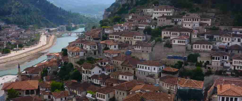
Berat, situated in central Albania along the Osum River approximately 120 kilometers south of Tirana, bears the evocative nickname “City of a Thousand Windows” for the characteristic white Ottoman houses whose large windows dominate the historic quarters. Archaeological evidence indicates settlement from at least the 4th century BC, when Illyrian tribes established a hilltop fortress. The site gained strategic importance under Roman and Byzantine control due to its commanding position above the river valley, with the castle (Kala) constructed primarily in the 13th century during Byzantine rule, though incorporating elements from the 4th century BC Illyrian fortifications.
The Ottoman conquest in 1417 transformed Berat into a significant provincial center. Ottoman administrators and merchants developed the historic quarters of Mangalem and Gorica on opposite banks of the Osum River, connected by an Ottoman-era stone bridge. The characteristic residential architecture features large multi-story houses built into the steep hillside, their facades covered with white plaster and dominated by banks of windows allowing natural light into the interior rooms. Ground floors typically contained workshops or storage areas, with family living spaces on upper floors accessed by exterior staircases. This distinctive building type, developed during the 17th and 18th centuries, adapted Mediterranean architectural traditions to the specific topography and social organization of Ottoman provincial cities.
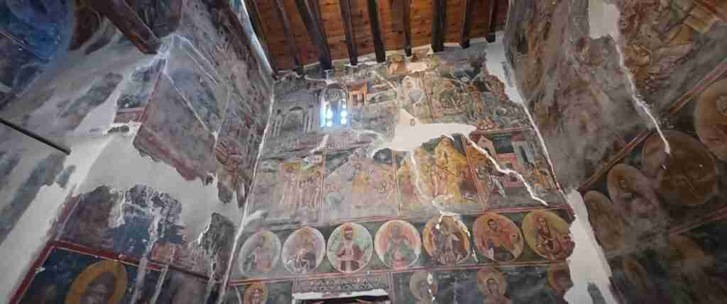
Religious architecture demonstrates the coexistence of Muslim and Christian communities under Ottoman administration. The citadel area preserves numerous Byzantine churches dating primarily from the 13th century, including the Church of St. Mary of Blachernae and the Church of the Holy Trinity, both featuring preserved frescoes. The Red Mosque, constructed in the 15th century, and the Lead Mosque from the 16th century represent early Ottoman religious architecture. The Bachelors’ Mosque and King’s Mosque, both from the 18th century, demonstrate later Ottoman architectural developments. This concentration of religious buildings from both traditions illustrates the millet system through which Ottoman authorities organized society by religious community rather than ethnicity.
The Onufri Museum, housed within the Church of St. Mary’s Dormition inside the castle, preserves the largest collection of works by 16th-century icon painter Onufri, considered the master of post-Byzantine Albanian religious art. Onufri developed a distinctive style characterized by vivid red pigment, now known as “Onufri red,” created from a unique formula that has preserved its brilliance through five centuries. The museum collection includes icons, religious manuscripts, and liturgical objects from churches throughout the Berat region, documenting the vitality of Orthodox Christian culture during the Ottoman period.
Berat’s historic center comprises approximately 220 hectares including the castle district, Mangalem and Gorica quarters, and the traditional bridge. The castle area remains partially inhabited, with approximately 100 families living within the fortification walls among the historic churches and houses. Conservation efforts focus on maintaining traditional construction techniques using local stone and lime plaster while carefully integrating modern utilities required for contemporary habitation. The city’s designation as a museum-city by the Albanian government in 1961 provided early legal protection, establishing precedent for the later UNESCO inscription.
Gjirokastra: The Stone City
Gjirokastra, located in southern Albania in the Drino River valley approximately 230 kilometers south of Tirana and 55 kilometers from the Greek border, earned recognition as the “Stone City” for its distinctive architecture featuring towers, houses, and paving constructed from local grey limestone. The town developed on the steep western slope of the Gjerë mountain, with the imposing castle crowning the summit at 336 meters elevation. Historical records document settlement from at least the 12th century, though the site likely hosted earlier fortifications controlling the mountain pass between coastal Albania and interior Greece.
Ottoman control from the early 15th century through 1912 shaped Gjirokastra’s development as a regional administrative and commercial center. The distinctive tower houses (kullë) that characterize Gjirokastra’s architecture emerged during the 17th century, representing a sophisticated adaptation to the steep terrain, local building materials, and social organization. These fortified residences typically feature stone construction on massive foundations carved into the hillside, with the ground floor used for livestock and storage, intermediate floors for household activities, and top floors reserved for guest reception in elaborate chambers with carved wood ceilings and decorative stonework. External walls incorporate gun ports for defense, reflecting the semi-autonomous status of powerful families during late Ottoman administration.
The architectural sophistication of Gjirokastra’s tower houses demonstrates advanced engineering and craftsmanship. Builders used local limestone throughout, including roof tiles (an unusual application of stone for roofing in Balkan architecture), creating the uniform grey townscape visible from the valley below. Interior spaces feature elaborate carved wooden ceilings, built-in cupboards, and decorative plasterwork. The most impressive houses contain large reception halls (odë) with multiple windows providing panoramic valley views, cushioned seating platforms around the perimeter, and ornamental wooden ceilings featuring geometric or floral motifs. These spaces served for entertaining guests and conducting business, essential functions in the Ottoman social structure where hospitality demonstrated family prestige.
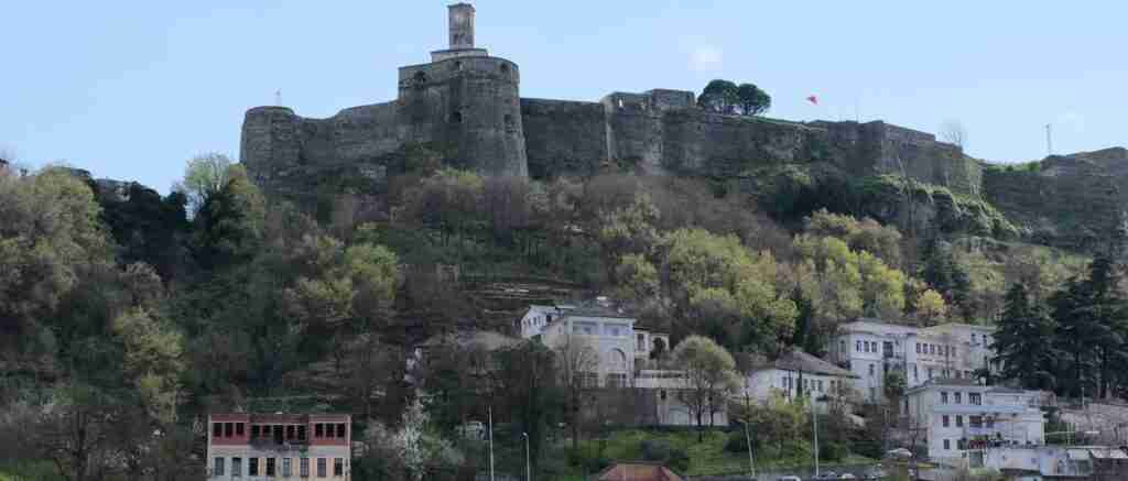
The castle dominates Gjirokastra’s skyline, with origins in the 12th century though substantially rebuilt and expanded during Ottoman rule. The fortress served military and administrative functions, housing the local garrison and government offices. Following Albanian independence in 1912, authorities converted portions of the castle into a prison, a function it maintained through the communist era until 1968. The structure now operates as a museum displaying historical artifacts, weapons collections, and exhibitions about Gjirokastra’s history. The castle’s clock tower, a prominent landmark visible throughout the town, was rebuilt in 1812 after earthquake damage destroyed the original Ottoman construction.
The old bazaar preserves the traditional commercial heart of Ottoman Gjirokastra, with narrow lanes lined by workshops and merchant houses featuring stone-arched ground floors supporting residential spaces above. Artisan workshops continue traditional crafts including metalworking, woodcarving, and textile production. The bazaar demonstrates the spatial organization typical of Ottoman commercial districts, with different crafts occupying designated areas. The 18th-century Bazaar Mosque serves the Muslim community, while the Church of Sotira and the Church of St. Michael represent Christian religious architecture from the same period.
Gjirokastra’s protected area encompasses approximately 200 hectares including the castle, old bazaar, and historic residential quarters extending down the mountainside. The town maintains active residential use, with many historic houses inhabited by descendants of original Ottoman-era families. Conservation challenges include maintaining stone structures against weather erosion, preventing inappropriate modern alterations, and addressing the departure of younger residents seeking economic opportunities in larger cities. The Albanian government designated Gjirokastra a museum-city in 1961, establishing legal protection later reinforced by the UNESCO inscription.
Ancient and Primeval Beech Forests: Postglacial Natural Heritage
Albania’s participation in the Ancient and Primeval Beech Forests of the Carpathians and Other Regions of Europe, a transnational UNESCO World Heritage Site spanning 18 countries, began in 2017 with inscription of two distinct forest areas: the Gashi River component in northern Albania and the Rrajcë component in the center-east. This natural property, originally established in 2007 and progressively expanded through 2021, protects exceptional examples of postglacial beech forest expansion across diverse European environments, demonstrating the evolutionary adaptation and ecological dominance of European beech (Fagus sylvatica) since the last Ice Age ended approximately 11,000 years ago.
The Gashi River component occupies a remote valley in Albania’s Tropojë District within the Valbonë Valley National Park, directly bordering Montenegro in the Albanian Alps (Bjeshkët e Nemuna). This wilderness area protects approximately 1,000 hectares of virgin beech forest that has never experienced human exploitation, representing one of the few remaining unlogged forest stands in the Balkans. The topography ranges from steep valley walls to gentler slopes, with elevations spanning 800 to 1,800 meters. The isolation of this region, with difficult access requiring multi-hour hikes from the nearest villages, preserved the forest from logging that eliminated most low-elevation old-growth forests elsewhere in Europe during industrial development.
The forest ecosystem demonstrates classic beech dominance patterns, with Fagus sylvatica forming nearly pure stands across most of the component. The canopy reaches heights exceeding 40 meters, with individual specimens aged over 500 years documented in the core protected area. The forest structure includes all age classes from seedlings to ancient veterans, dead standing timber, and extensive coarse woody debris providing habitat for specialized decomposer organisms. This structural complexity, largely absent from managed forests harvested on rotation cycles, supports exceptional biodiversity including rare fungi, lichens, insects, and cavity-nesting birds dependent on old-growth conditions.
The Rrajcë component lies within the Shebenik-Jabllanicë National Park in eastern Albania near the North Macedonian border, protecting approximately 1,350 hectares of beech-dominated forest at elevations between 1,520 and 2,200 meters. This higher-elevation site demonstrates beech’s adaptation to subalpine conditions, with tree line formations where beech gives way to alpine meadows. The forests here show natural disturbance patterns including avalanche tracks and wind-throw gaps that create the mosaic of forest ages and successional stages characteristic of unmanaged mountain forests. Limestone geology influences soil chemistry and the associated plant communities, with numerous endemic Balkan species occurring in the understory.
The ecological significance of these Albanian components relates to their position in the southern Balkans, a region that served as a glacial refugium during Ice Age climatic maxima. Genetic studies indicate that beech populations surviving in Mediterranean refugia, including Albania, provided source populations for the northward expansion that eventually covered much of temperate Europe as glaciers retreated. The Albanian forests thus represent ancestral beech genetics and demonstrate adaptation to warmer, drier conditions than populations further north, information increasingly relevant for understanding how beech forests may respond to contemporary climate change.
Both Albanian components harbor significant wildlife populations including brown bears, grey wolves, Balkan lynx, and wild boar. The forests provide critical habitat for rare birds including white-backed woodpeckers, three-toed woodpeckers, and various owls dependent on large dead trees for nesting cavities. The invertebrate fauna includes numerous endemic beetles, mollusks, and other species restricted to undisturbed old-growth conditions. The pristine streams draining these forests support native Balkan trout populations threatened elsewhere by habitat degradation and introduced species.
Management of the Albanian beech forest components falls under national park authorities, with the Valbonë Valley National Park established in 1996 and Shebenik-Jabllanicë National Park created in 2008. UNESCO inscription strengthened protection by highlighting international significance and attracting conservation funding. The primary threats include illegal logging on park peripheries, potential infrastructure development including roads and ski facilities, and grazing pressure from domestic livestock in high-elevation areas. Climate change poses long-term risks through altered precipitation patterns and temperature increases that may favor other species over beech, particularly at lower elevations where beech currently dominates.
Access to both forest components requires significant effort, reflecting their wilderness character. The Gashi River area involves hiking from Valbonë village, with trails passing through traditional mountain settlements before reaching the virgin forest. The remoteness that protected these forests from exploitation also limits visitor numbers, helping preserve the wilderness qualities that justify UNESCO recognition. The Rrajcë component sits within slightly more accessible terrain but still requires mountain hiking through rugged landscapes. Both sites attract ecologists, forestry researchers, and nature enthusiasts seeking to experience primeval forest conditions largely vanished from Western Europe.
Natural and Cultural Heritage of the Ohrid Region: Transboundary Lake Ecosystem
The Natural and Cultural Heritage of the Ohrid Region, originally inscribed for North Macedonia in 1979 as one of UNESCO’s early mixed (natural and cultural) properties, extended into Albanian territory in 2019 following years of transnational cooperation between the two countries. This expansion recognized Albania’s portion of Lake Ohrid and its surrounding landscape as integral components of a heritage system encompassing one of Europe’s oldest and deepest lakes, with exceptional endemic biodiversity resulting from over one million years of evolutionary isolation and continuous cultural occupation dating to Neolithic times.
Lake Ohrid occupies a tectonic depression straddling the Albania-North Macedonia border at 695 meters elevation, with maximum depths exceeding 280 meters. The lake formed between 2 and 5 million years ago during the Pliocene epoch, making it among Europe’s most ancient lakes alongside Lake Prespa and Lake Garda. This exceptional age allowed development of unique endemic species found nowhere else on Earth. Scientists have documented over 200 endemic species including fish, mollusks, crustaceans, and sponges that evolved in situ through the lake’s long isolation. Endemic fish include the Ohrid trout (Salmo letnica) and several species of Ponto-Caspian gobies adapted to the lake’s specific conditions.
The Albanian portion of the lake encompasses the southwestern shores and watershed including the city of Pogradec, traditional lakeside villages, and surrounding mountains that provide critical habitat for terrestrial species. The landscape demonstrates millennia of human interaction with the lake ecosystem, from Neolithic pile-dwelling settlements documented through underwater archaeology to Byzantine monasteries perched on promontories overlooking the water. The cultural landscape reflects sustainable resource use patterns where communities derived livelihoods from fishing, reed harvesting, and agriculture while maintaining the ecological integrity that supports the lake’s endemic biodiversity.
The Monastery of St. Naum, located on the North Macedonian shore but culturally connected to Albanian communities, exemplifies the religious architecture and artistic traditions that developed around the lake. The monastery complex, founded in the 10th century, features Byzantine frescoes and architectural elements that influenced religious buildings throughout the region. Pogradec on the Albanian shore developed as a fishing settlement and later administrative center, with traditional stone houses and narrow streets characteristic of lakeside Balkan towns. The architecture demonstrates adaptation to the lakeside environment, with structures oriented to maximize lake views and breezes while providing protection from winter winds descending from surrounding mountains.
The endemic biodiversity represents the property’s outstanding universal value from a natural heritage perspective. The lake’s mollusks include numerous species of endemic snails and mussels found in specific depth zones and substrate types. The Ohrid trout, once commercially harvested in significant quantities, faces population decline due to overfishing, habitat degradation, and competition from introduced species. Conservation efforts focus on establishing protected fishing zones, regulating harvest, and captive breeding programs to supplement wild populations. The lake’s endemic algae, particularly deepwater species adapted to low light conditions, demonstrate evolutionary adaptation to the lake’s specific optical properties.
Water quality concerns threaten the lake’s ecological integrity. Agricultural runoff introduces nutrients promoting algal growth and eutrophication, while inadequate wastewater treatment from surrounding settlements discharges pollutants directly into the lake. Urban development along lakeshores has destroyed natural buffer zones and increased surface runoff. These pressures prompted UNESCO to consider placing the property on the List of World Heritage in Danger, though this designation was postponed in 2025 contingent on implementation of corrective measures including upgraded wastewater infrastructure, buffer zone enforcement, and sustainable tourism management strategies.
A 2017 transboundary agreement between Albania and North Macedonia established coordinated management mechanisms for the shared heritage property. The framework includes joint monitoring programs for water quality and endemic species populations, coordinated tourism development policies, and shared research initiatives. UNESCO and European Union programs provide technical assistance and funding for conservation projects benefiting both countries. The transnational approach recognizes that effective heritage protection requires cooperation across political boundaries for ecosystems that function as integrated units regardless of national borders.
The Albanian portion of the Ohrid Region offers diverse visitor experiences. Pogradec serves as the main gateway, with accommodations, restaurants, and tourism services concentrated in the city. The lakefront promenade provides public access to the shoreline, while traditional restaurants serve local specialties including Ohrid trout and other lake fish prepared according to regional recipes. The Drilon National Park, located just south of Pogradec, protects spring-fed wetlands and riparian forests providing habitat for migratory birds and endemic species. Hiking trails in the surrounding Mokra Mountains offer panoramic views across the lake into North Macedonia and provide access to traditional mountain villages maintaining pastoral lifestyles.
Tentative List Sites Awaiting UNESCO Consideration
Albania maintains four properties on its UNESCO Tentative List, representing potential future World Heritage nominations pending preparation of complete nomination dossiers and meeting inscription requirements. These sites span Roman architecture, Illyrian archaeology, Greek colonial cities, and medieval fortifications, indicating the breadth of Albania’s heritage beyond currently inscribed properties. Tentative List inclusion represents the first formal step toward nomination, allowing international review of potential outstanding universal value and providing a framework for developing management and conservation plans required for full inscription.
Amphitheatre of Durrës
The Roman Amphitheatre of Durrës, added to Albania’s Tentative List in 1996, represents the largest Roman amphitheater in the Balkans and one of the largest throughout the Roman Empire, with capacity for approximately 15,000 to 20,000 spectators. Located in the modern city of Durrës along Albania’s Adriatic coast, the amphitheater was constructed during the early 2nd century AD under Emperor Trajan, reflecting the city’s importance as a major Roman port and provincial capital. The structure demonstrates sophisticated Roman engineering including underground service corridors, sophisticated drainage systems, and impressive masonry work utilizing local limestone.
Archaeological excavations beginning in the 1960s revealed exceptional preservation of the arena floor, seating sections, and underground chambers despite centuries of abandonment and overlay by medieval and modern construction. The site gained additional significance through discovery of an early Christian chapel built within the amphitheater during the late Roman period, featuring rare mosaic floors with Christian iconography suggesting the structure’s conversion to religious use as gladiatorial contests declined during Christianity’s rise. The chapel mosaics represent some of the finest early Christian art in the Balkans, with preservation quality comparable to more famous sites in Ravenna and Rome.
The amphitheater faces conservation challenges from urban encroachment, with modern buildings constructed directly adjacent to and even upon portions of the ancient structure. The proximity of the contemporary city complicates archaeological investigation and limits the establishment of protective buffer zones. Water infiltration from aging urban infrastructure causes ongoing damage to ancient masonry, requiring continuous conservation interventions. Despite these challenges, the amphitheater’s scale, preservation, and the exceptional chapel mosaaic justify its position on the Tentative List as Albania works toward developing a comprehensive nomination dossier addressing management and protection requirements.
Royal Tombs of Selca e Poshtme
The Illyrian Royal Tombs of Selca e Poshtme, listed on the Tentative List since 1996, represent exceptional examples of monumental Illyrian funerary architecture dating from the 3rd to 1st centuries BC. Located near Pogradec in the Korçë region of southeastern Albania, the tombs are carved into limestone cliffs overlooking Lake Ohrid, combining natural landscape drama with architectural sophistication. The site comprises multiple rock-cut chamber tombs featuring elaborate facade treatments, including false columns, pediments, and decorative elements demonstrating Illyrian adoption of Greek architectural vocabulary while maintaining distinct regional characteristics.
The tombs likely served as burial chambers for Illyrian tribal leaders and aristocracy who controlled the territory during the period preceding Roman conquest. The architectural treatment, particularly the monumental facades, indicates significant resources devoted to memorial architecture, suggesting these individuals held substantial political and economic power. The largest tomb, known as the “Monumental Tomb,” features an imposing facade with four engaged columns supporting a pediment, carved entirely from the living rock face. Interior chambers include carved benches where bodies were placed, and niches that likely held grave goods and offerings.
The tombs demonstrate cultural exchange between Illyrian societies and Greek colonies along the Adriatic coast. The architectural elements, while clearly inspired by Greek temple architecture, display Illyrian interpretations and adaptations that create a distinctive regional style. This cultural synthesis illustrates the complexity of pre-Roman Balkans, where indigenous Illyrian tribes interacted with Greek colonists, adopting certain cultural elements while maintaining distinct identities. The site thus offers insights into cultural dynamics in a frontier zone between Mediterranean and inland Balkan societies.
Conservation concerns include natural weathering of the limestone facades, vegetation growth in carved surfaces causing mechanical damage, and historical vandalism that has damaged decorative elements on some tombs. The remote location has both protected the site from intensive development pressure and limited resources available for conservation and site management. Inscription as a UNESCO World Heritage Site would bring international attention and funding to address conservation needs while establishing management structures to protect the tombs for future generations.
Ancient City of Apollonia
The Ancient City of Apollonia, added to the Tentative List in 2014, ranks among Albania’s most significant archaeological sites, representing a major Greek colonial city that flourished for nearly a millennium from its founding in the 6th century BC through the Byzantine period. Located in Fier County approximately 12 kilometers from the Adriatic coast, Apollonia was established by Greek colonists from Corfu and Corinth, rapidly developing into one of the most important cities on the eastern Adriatic due to its strategic position controlling maritime trade routes and inland communications.
The archaeological remains cover approximately 137 hectares, with systematic excavations revealing monumental architecture including temples, a bouleuterion (council house), theater, library, gymnasium, and extensive residential areas. The ruins demonstrate sophisticated urban planning with orthogonal street layouts, centralized public spaces, and infrastructure including water supply systems and defensive walls. The Library of Apollonia, identified through inscriptions and architectural analysis, represents one of the few scientifically documented ancient libraries outside major centers like Alexandria and Pergamon, indicating Apollonia’s role as a cultural and educational center.
Historical accounts document Apollonia’s significance during the Roman period, when the city served as an important military and administrative base. Julius Caesar used Apollonia as a staging area during his campaigns in the Balkans, and Octavian (later Emperor Augustus) studied at Apollonia’s schools before ascending to power, suggesting the city’s reputation as an educational center extended to Rome’s elite. The city maintained prosperity through the early Byzantine period before gradual abandonment following changes in the Adriatic coastline that eliminated maritime access and shifted trade routes away from the site.
The on-site Archaeological Museum, housed in the Byzantine monastery of St. Mary within the archaeological park, displays artifacts from excavations including sculpture, pottery, mosaics, and inscriptions documenting Apollonia’s history. The museum building itself represents Byzantine monastic architecture, with the church featuring preserved frescoes and architectural elements from the 13th century when Orthodox monasticism flourished in the region. The combination of Greek, Roman, and Byzantine remains within a single managed site demonstrates the cultural continuity and transformation across ancient Mediterranean history.
Apollonia’s nomination potential rests on its exceptional preservation, the completeness of the urban plan, and its significance for understanding Greek colonization processes and the cultural exchanges between Greek colonists and indigenous Illyrian populations. The site offers opportunities for comparative study with other colonial foundations in the Mediterranean, contributing to understanding how Greek culture spread beyond the Aegean homeland. Protection challenges include agricultural encroachment, looting of archaeological materials, and the need for comprehensive site management integrating conservation, research, and appropriate visitor access.
Castle of Bashtova
The Castle of Bashtova, added to Albania’s Tentative List in 2017, represents unique medieval military architecture dating from the 15th century. Located in Tirana County approximately 5 kilometers from the mouth of the Shkumbin River, the fortress was constructed by Venetian engineers to protect maritime trade routes and control river access to interior Albania. The circular castle design, relatively rare in Balkan fortifications, reflects Venetian military architecture adapted to specific defensive requirements in a coastal wetland environment.
The fortress features a circular curtain wall with cylindrical towers at regular intervals, a design optimized for artillery defense during the transition from medieval to early modern warfare. The central courtyard contained barracks, storage facilities, and a well providing water during siege conditions. The walls, constructed from dressed stone with rubble fill, reach heights of approximately 15 meters with wall thicknesses exceeding 3 meters, sufficient to withstand cannon bombardment with artillery technology available during the castle’s active period. Gun ports and machicolations allowed defenders to direct crossfire against attackers approaching the walls.
Historical records indicate the Ottomans captured the castle in the early 16th century, incorporating it into their defensive network along Albania’s coast. Ottoman engineers made modifications including the addition of artillery platforms suited to larger cannons developed during the 16th century. The castle remained in military use through the 18th century before gradual abandonment as military technologies advanced and strategic priorities shifted. The structure’s preservation owes partly to its relative isolation in wetland terrain that discouraged conversion to other uses.
The castle’s outstanding universal value derives from its representation of transitional military architecture, the exceptional preservation of circular plan fortifications, and its documentation of Venetian-Ottoman military competition in the Balkans during a critical period of European history. The structure demonstrates how European powers competed for control of strategic locations even in peripheral regions, and how military engineering adapted to changing warfare technologies. Conservation priorities include stabilizing weathered masonry, controlling vegetation growth damaging walls, and addressing flooding issues in the low-lying site.
Planning Your Visit to Albania’s UNESCO Sites
Albania’s four inscribed UNESCO World Heritage Sites and four tentative list properties occupy locations distributed across the country from the northern Albanian Alps to the southern Ionian coast, requiring strategic planning for visitors seeking to experience multiple sites during a single trip. The sites range from easily accessible urban heritage in Berat and Gjirokastra to remote wilderness areas requiring serious mountain hiking for the primeval beech forests. Understanding the geographic distribution, seasonal access variations, and site-specific visiting requirements enables travelers to design itineraries matching their interests, physical capabilities, and available time.
Geographic Distribution and Access Routes
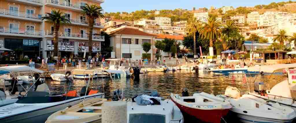
Butrint occupies Albania’s extreme south near Saranda, approximately 285 kilometers south of Tirana via the SH8 coastal highway. The archaeological site lies 18 kilometers south of Saranda with regular minibus service during tourist season and taxi availability year-round. Visitors typically combine Butrint with beach destinations along the Albanian Riviera, making the site easily integrated into southern coastal itineraries. The proximity to the Greek border facilitates access for travelers entering Albania from Corfu via the ferry to Saranda.
Berat and Gjirokastra both occupy southern Albania but on interior routes rather than coastal highways. Berat sits 122 kilometers south of Tirana accessed via the SH7 highway through central Albania, with bus service from Tirana requiring approximately 2.5 to 3 hours. Gjirokastra lies further south near the Greek border, approximately 230 kilometers from Tirana along routes passing through mountainous terrain. The cities can be visited in combination, with the distance between them approximately 120 kilometers requiring 2.5 to 3 hours driving time via mountain roads. Both cities offer accommodation, dining, and tourism services supporting multi-day visits.
The Natural and Cultural Heritage of the Ohrid Region is accessed via Pogradec in southeastern Albania, approximately 140 kilometers from Tirana. The drive requires 2.5 to 3 hours through mountainous terrain, with bus service available from Tirana and from North Macedonia via the border crossing near Sveti Naum Monastery. Pogradec serves as the base for exploring the Albanian lakeshore and surrounding protected areas. Visitors crossing into North Macedonia to see the Ohrid town (the original core of the UNESCO property) face straightforward border formalities, with most visitors allowed visa-free entry for tourism purposes.
The Ancient and Primeval Beech Forests components require the most challenging access. The Gashi River component in Valbonë Valley National Park is reached via the town of Bajram Curri in northern Albania, approximately 290 kilometers from Tirana. From Bajram Curri, travelers drive to Valbonë village then hike for several hours to reach the virgin forest. The remote location and lack of marked trails mean most visitors hire local guides. The Rrajcë component in Shebenik-Jabllanicë National Park requires access through the town of Librazhd in central-eastern Albania, followed by challenging mountain driving and hiking. These wilderness areas attract primarily nature enthusiasts, researchers, and experienced hikers rather than general tourists.
Seasonal Considerations and Climate
Albania’s UNESCO sites span diverse climate zones from Mediterranean coastal areas to high mountain regions, creating significant seasonal variation in visiting conditions. Spring (April through June) and autumn (September through October) provide optimal weather for most sites, with moderate temperatures, less rainfall than winter months, and manageable tourist crowds compared to peak summer. These shoulder seasons offer advantages particularly for sites requiring extended outdoor time like Butrint’s archaeological walks and the urban exploration needed to appreciate Berat and Gjirokastra.
Summer (July through August) brings high temperatures exceeding 30°C in southern Albania, making archaeological site visits during midday uncomfortable. Coastal Saranda and the Albanian Riviera experience peak tourism during summer months, resulting in higher prices, crowded attractions, and advance booking requirements for quality accommodations. However, summer provides the most reliable weather for mountain access to the beech forests, as snowmelt opens high-elevation trails and reduced precipitation facilitates river crossings and backcountry travel.
Winter (November through March) presents challenges for Albanian heritage tourism. Coastal and low-elevation sites like Butrint, Berat, and Gjirokastra remain accessible, though reduced daylight hours limit time available for site visits and some services operate on reduced schedules. The mountain beech forest components become largely inaccessible during winter due to snow accumulation, extremely cold temperatures, and hazardous trail conditions. Lake Ohrid experiences winter storms and freezing conditions, though the region’s natural beauty during snow months attracts photographers and visitors seeking off-season tranquility.
Spring weather brings wildflowers and bird migrations, enhancing the natural beauty of Butrint’s wetlands and the forests surrounding Lake Ohrid. Autumn foliage creates spectacular displays in the beech forests, though accessing the remote wilderness components requires extended planning. Autumn also coincides with harvest seasons in agricultural regions, offering opportunities to experience traditional rural culture in villages near heritage sites. Visitors should monitor weather forecasts and road conditions, particularly when planning trips to remote or high-elevation sites where conditions can change rapidly.
Combining Multiple Sites in Albania Itineraries
Travelers seeking to visit multiple UNESCO sites can design itineraries based on geographic clusters and available time. A southern Albania focus combines Butrint with Gjirokastra in a natural progression along the interior-to-coast axis. Visitors can stay in Gjirokastra (2-3 nights exploring the old town) then proceed to the coast, visiting Butrint as a day trip from Saranda before continuing along the Albanian Riviera. This itinerary requires approximately 5-7 days including travel time from Tirana.
A central Albania circuit links Berat with Apollonia (tentative list), both accessible from the city of Fier. Travelers can base in Berat (2-3 nights) to thoroughly explore the historic center, then make a day trip to Apollonia archaeological site, returning to Tirana or continuing to Gjirokastra for southern heritage sites. This circuit appeals to visitors particularly interested in Ottoman architecture (Berat) and classical Greek archaeology (Apollonia), providing contrasting periods and architectural traditions within a compact geographic area.
Lake Ohrid combinations naturally link the Natural and Cultural Heritage of the Ohrid Region with potential excursions into North Macedonia. Visitors based in Pogradec can explore the Albanian lakeshore and Drilon wetlands, then cross into North Macedonia to see Ohrid town’s medieval churches and lakeside monasteries. This transnational approach provides comprehensive experience of the joint UNESCO property, though requiring border crossing logistics and potentially separate visa considerations depending on visitor nationality.
Comprehensive Albania heritage tours encompassing all major sites require minimum 10-14 days, allowing thorough exploration without excessive rushing. Such itineraries typically follow a Tirana-Berat-Gjirokastra-Saranda-Butrint progression through central and southern Albania, with possible Lake Ohrid extension before returning north. Travelers seeking to include the beech forest wilderness components should add at least 3-4 additional days for mountain access, recognizing these sites appeal primarily to nature enthusiasts willing to undertake challenging backcountry hiking.
Conservation Challenges and Heritage Management
Albania’s UNESCO World Heritage Sites face diverse conservation challenges reflecting the country’s developmental trajectory from communist isolation through post-1990 democratic transition to contemporary European integration. Each site confronts specific threats based on its characteristics, location, and exposure to development pressures, requiring tailored management approaches while implementing the universal principles established through UNESCO’s World Heritage Convention. The Albanian government, international conservation organizations, and local communities collaborate on protection strategies balancing heritage preservation with economic development and contemporary needs.
Urban Development Pressure on Historic Centers
Berat and Gjirokastra face ongoing pressure from urban development as Albania’s economy grows and resident expectations for modern amenities increase. The historic houses protecting under UNESCO inscription require maintenance using traditional construction techniques and materials, which costs significantly more than modern alternatives and requires specialized craftspeople whose numbers decline as younger generations pursue different careers. Property owners sometimes make unauthorized alterations introducing incompatible materials like concrete, aluminum window frames, or modern roofing that compromise architectural integrity while improving thermal performance and maintenance requirements.
Tourism development creates economic incentives for converting historic houses into guesthouses, restaurants, and shops. While this generates revenue supporting conservation, it risks transforming living historic centers into commercial tourism zones where resident communities decline. The balance between tourism-driven economic benefits and maintaining authentic residential character represents a fundamental tension in heritage management. Albanian authorities implement regulations requiring permits for alterations in protected zones, though enforcement remains inconsistent due to limited resources and political pressure to support economic development.
Infrastructure modernization poses additional challenges. Installing utilities including water, sewage, electricity, and internet in historic districts requires excavation potentially disturbing archaeological deposits and damaging historic fabric. Roads must accommodate modern vehicles while preserving historic paving and traditional street patterns. Earthquake risks in seismically active Albania require structural reinforcement of vulnerable historic buildings, interventions that must balance safety requirements against heritage preservation principles. These competing demands require sophisticated planning integrating contemporary needs with conservation objectives.
Archaeological Site Protection and Looting
Butrint and tentative list sites like Apollonia face threats from unauthorized excavation, artifact looting, and trafficking of archaeological materials. Albania’s relative poverty compared to Western European countries creates economic incentives for illegal artifact trade, with objects from Albanian sites appearing in international markets despite efforts to restrict exports and repatriate looted materials. Archaeological sites in remote locations face particular vulnerability, as limited guard presence and surveillance enable unauthorized metal detecting and excavation.
Agricultural activities near archaeological sites cause damage through deep plowing that disturbs subsurface archaeological deposits, application of fertilizers and pesticides altering soil chemistry, and installation of irrigation systems requiring trenching. Expanding urban development around sites like the Durrës Amphitheater has destroyed portions of archaeological contexts before investigation could document them. Buffer zones intended to protect sites from adjacent impacts often face pressure from development interests seeking to maximize land use in valuable locations near heritage properties.
Climate change introduces new risks for archaeological sites through increased rainfall intensity causing erosion, changing water tables affecting preservation conditions for organic materials, and extreme weather events damaging standing structures. The wetlands surrounding Butrint, which contributed to preservation by discouraging development, now face changes in hydrology potentially affecting archaeological deposits. Rising sea levels threaten coastal archaeological sites with inundation and saltwater intrusion degrading preservation environments. These challenges require long-term monitoring and adaptive management strategies responding to evolving conditions.
Natural Heritage Threats and Forest Protection
The Albanian beech forest components face threats from illegal logging, particularly in peripheral buffer zones where enforcement proves challenging in remote mountain terrain. While the core virgin forest areas receive highest protection, surrounding forests experience cutting pressure from rural communities dependent on wood for fuel and construction. Creating economic alternatives to resource extraction requires long-term investment in rural development, ecotourism, and employment opportunities maintaining local support for conservation without imposing unsustainable restrictions on resource-dependent communities.
Climate change poses existential questions for beech forests as warming temperatures potentially shift the species’ optimal range to higher elevations and more northern latitudes. The Albanian beech forests, at the southern edge of the species’ range, may experience stress from drought, pest outbreaks, and competition from species better adapted to warmer conditions. Long-term monitoring of forest health, regeneration patterns, and species composition provides early warning of ecological changes requiring management responses.
Infrastructure development threatens wilderness values even absent direct forest clearing. Proposals for mountain roads, ski facilities, hydroelectric projects, and mining concessions create fragmentation risks and introduce human activities incompatible with wilderness character. Albanian authorities must balance development aspirations for economic benefits against heritage protection obligations under UNESCO inscription. These debates engage local communities, conservation organizations, tourism interests, and international bodies with stakes in heritage preservation outcomes.
Lake Ohrid Water Quality and Transboundary Cooperation
The Natural and Cultural Heritage of the Ohrid Region confronts serious water quality degradation from eutrophication, pollution, and habitat destruction affecting the endemic biodiversity that justifies UNESCO recognition. Agricultural intensification in the watershed increases nutrient runoff promoting algal growth, while inadequate wastewater treatment from Pogradec and surrounding settlements discharges insufficiently treated sewage into the lake. Urban development along lakeshores destroys natural buffer zones and increases stormwater runoff carrying pollutants and sediment.
Overfishing threatens endemic fish populations, particularly the Ohrid trout, through both legal harvest exceeding sustainable levels and illegal fishing using banned methods. Introduction of non-native species creates competition and predation pressure on endemic forms evolved without such threats. Establishing effective fisheries management requires coordination between Albanian and North Macedonian authorities along with enforcement mechanisms adequate to control illegal activities across the transboundary lake.
Tourism development along lakeshores generates economic benefits while creating environmental pressures. Accommodations, restaurants, and recreational facilities consume water resources, generate wastewater, and create demand for shoreline development destroying natural habitats. Balancing tourism growth against ecological carrying capacity requires comprehensive planning and zoning regulations, areas where both countries face technical capacity and political will challenges. The 2017 transboundary management agreement establishes frameworks for cooperation, though implementation requires sustained commitment and adequate funding.
Albania’s Heritage in Balkan and Mediterranean Context
Albania’s UNESCO World Heritage Sites occupy distinctive positions within broader Balkan and Mediterranean heritage landscapes, representing cultural and natural patterns that extend across national boundaries while retaining specific characteristics shaped by Albania’s particular historical trajectory and geographic circumstances. Understanding these sites within regional contexts illuminates their significance beyond national heritage while revealing Albania’s contributions to shared Mediterranean and European cultural development.
Mediterranean Archaeological Heritage
Butrint and Apollonia belong to networks of classical Mediterranean cities founded during Greek expansion from the 8th through 4th centuries BC. These colonial cities established by Greek seafarers created interconnected urban cultures spanning from the western Mediterranean coasts of Spain and southern France through southern Italy and Sicily to the Adriatic and Black Sea shores. The Albanian sites provide insights into colonization processes, cultural exchanges between Greek colonists and indigenous populations, and the adaptation of Greek political and architectural models to peripheral locations.
The transition from Greek polis to Roman provincial city, documented at both Butrint and Apollonia, illustrates transformations affecting the entire eastern Mediterranean as Roman power supplanted Greek hegemonies. The continuity of urban settlement through Byzantine and later periods demonstrates Mediterranean cities’ resilience through political changes, religious transformations from paganism to Christianity, and economic shifts from Classical trade patterns to medieval systems. Albanian archaeological sites thus contribute to understanding long-duration Mediterranean urbanism extending from antiquity through the Ottoman period.
Comparative analysis with other Mediterranean colonial cities reveals both common patterns and Albanian specificities. The scale and preservation of Butrint’s archaeological record compares favorably with better-known sites like Ephesus, Delos, or Syracuse, while Albania’s relative under-development until recent decades meant less modern impact on ancient remains. The combination of Greek, Roman, Byzantine, Venetian, and Ottoman layers creates particularly complex stratigraphic sequences documenting the full span of Mediterranean cultural history in single locations.
Ottoman Urban Heritage in the Balkans
Berat and Gjirokastra represent the most complete surviving examples of Ottoman provincial town architecture in the Balkans, comparable to UNESCO sites like the Old Town of Mostar in Bosnia and Herzegovina or the Historic City of Ohrid in North Macedonia. Ottoman urbanism developed distinctive characteristics adapted to Balkan topography and incorporating local building traditions within Islamic social and architectural frameworks. The Albanian cities demonstrate how Ottoman administrative and cultural systems shaped urban form through organization by religious communities, development of commercial bazaars, construction of religious architecture serving both Muslim and Christian populations, and adaptation of residential architecture to mountainous terrain.
The preservation of Berat and Gjirokastra contrasts with losses in other Albanian cities and throughout the Balkans. Tirana’s Ottoman center largely disappeared through mid-20th century modernization driven by communist development policies emphasizing new construction over historic preservation. Similar destruction occurred in Skopje following the 1963 earthquake and subsequent rebuilding, in Pristina, and in numerous other Balkan cities where Ottoman heritage was systematically eliminated through nationalist ideologies emphasizing pre-Ottoman or post-Ottoman identities. The survival of Berat and Gjirokastra thus represents fortuitous preservation of architectural traditions largely vanished elsewhere.
The tower houses of Gjirokastra relate to defensive residential architecture found in other mountainous Balkan regions including northern Greece, Macedonia, and Montenegro, where social organization based on extended families and clans, combined with security concerns during periods of weak central authority, produced fortified residential compounds. The specific architectural expression in Gjirokastra, particularly the sophisticated stonework and the scale of major houses, represents an apex of this building tradition. Comparative study with tower house traditions in other regions illuminates how similar social conditions produced varied architectural responses based on available materials, economic resources, and cultural preferences.
European Natural Heritage and Beech Forest Ecology
Albania’s participation in the Ancient and Primeval Beech Forests property situates the country within European conservation efforts protecting representative examples of natural ecosystems largely vanished through agricultural clearing and intensive forest management. The transnational scope of this UNESCO site, spanning 18 countries from Spain to Ukraine, represents recognition that ecological processes transcend political boundaries and that conservation requires international cooperation protecting networks of sites rather than isolated reserves.
The beech forests demonstrate biogeographic patterns resulting from the last Ice Age, when glaciers covering northern and central Europe compressed plant and animal populations into southern refugia including the Mediterranean peninsulas. As climates warmed and glaciers retreated, species expanded northward from these refugia, with genetic analysis revealing Albania and the southern Balkans as source regions for recolonization. The Albanian beech forest components thus protect ancestral populations whose genetic diversity contributed to forest ecosystems across temperate Europe.
Albania’s virgin forests provide reference conditions for understanding natural forest dynamics absent human management. Most European forests have experienced centuries or millennia of human use including grazing, selective cutting, coppicing, and plantation forestry, eliminating old-growth characteristics and the ecological processes dependent on dead wood, canopy gaps, and age structure complexity. The Albanian wilderness areas offer opportunities for scientific research informing forest ecology and conservation biology while serving as experiential destinations where visitors can understand how primeval European forests appeared before human transformation.
Digital Resources and Further Research
Understanding Albania’s UNESCO World Heritage Sites benefits from consulting diverse information sources including official documentation, scholarly research, conservation reports, and traveler accounts. The UNESCO World Heritage Centre maintains comprehensive online resources for each inscribed property, providing access to nomination documents, periodic reports, State of Conservation updates, and management plans. These technical documents offer detailed information about outstanding universal value, inscription criteria, boundaries, and conservation challenges unavailable in general tourist literature.
Albanian governmental agencies including the Ministry of Culture and the National Institute of Cultural Heritage publish reports and studies about heritage sites, though materials are often available primarily in Albanian language limiting accessibility for international audiences. International conservation organizations including ICOMOS (International Council on Monuments and Sites), IUCN (International Union for Conservation of Nature), and various European Union heritage programs publish assessment missions, technical assistance reports, and monitoring studies providing external perspectives on conservation status and management effectiveness.
Academic research contributes specialized knowledge about individual sites and broader heritage themes. Archaeological journals publish excavation reports and artifact studies from Butrint and Apollonia, while architectural history literature analyzes Ottoman urban development in Berat and Gjirokastra. Ecological research on the beech forests appears in forestry and conservation biology journals, documenting biodiversity, forest dynamics, and climate responses. University departments in Albania and internationally conduct ongoing research generating new knowledge about heritage properties.
Travel literature and photography provide accessible introductions to heritage sites for general audiences. Guidebooks including Bradt’s Albania, Lonely Planet’s Western Balkans, and specialized heritage travel guides offer practical information combined with cultural and historical context. Photo essays and documentary films showcase visual aspects of sites while conveying sense of place difficult to communicate through text alone. Social media platforms and travel blogs provide contemporary visitor perspectives, practical tips, and visual documentation useful for trip planning.
Maps and geographic information systems enable spatial understanding of heritage landscapes. Google Maps and OpenStreetMap provide basic geographic orientation, while specialized archaeological and ecological mapping projects visualize site distributions, topography, and landscape contexts. The UNESCO World Heritage Centre’s interactive map plots all inscribed properties globally, facilitating discovery of sites and understanding of geographic patterns in heritage distribution.
Frequently Asked Questions About Albania UNESCO Sites
Which Albanian UNESCO site should I visit first?
Butrint represents the most accessible introduction to Albania’s UNESCO heritage for most international visitors, combining exceptional archaeological significance, natural beauty in the surrounding wetlands, and convenient location near Saranda’s tourism infrastructure. The site offers clearly marked pathways with interpretation signage, an on-site museum, and the ability to complete visits in 2-4 hours making it suitable for diverse visitor capabilities. The dramatic setting between Lake Butrint and the Vivari Channel, combined with visible remains from multiple civilizations, provides immediately impressive experiences without requiring specialized archaeological knowledge to appreciate the site’s significance.
Berat offers an alternative first experience for visitors particularly interested in Ottoman architecture and living historic cities. Unlike the archaeological remains at Butrint, Berat maintains active residential neighborhoods within the UNESCO-protected historic center, allowing visitors to experience heritage sites as functioning communities rather than open-air museums. The combination of the castle district, Byzantine churches, Ottoman mosques, and traditional houses creates a walkable urban environment with diverse architectural and cultural elements concentrated in a compact area. Berat’s location makes it a convenient stopover between Tirana and southern Albania, fitting naturally into many itineraries.
Can I visit Albania’s beech forests without a guide?
Visiting the Gashi River and Rrajcë beech forest components without professional guides is inadvisable except for experienced wilderness travelers with mountain navigation skills, appropriate equipment, and self-sufficiency for multi-day backcountry travel. Neither forest component features marked trails, maintained facilities, or regular ranger presence that would support independent exploration. The terrain includes steep mountain slopes, river crossings, and dense forest where visibility is limited and orientation becomes challenging without GPS navigation and topographic map reading skills.
Local guides provide essential services including navigation through unmarked terrain, identification of the UNESCO component boundaries within larger forest landscapes, interpretation of ecological features, and emergency support if weather changes or accidents occur. Guide services can be arranged through national park offices in Valbonë for the Gashi River component and through contacts in Librazhd for the Rrajcë area. Guided visits typically require full-day commitments and sometimes overnight camping depending on specific destinations and visitor interests. The guide costs, while adding to overall trip expenses, provide insurance against the significant risks of wilderness travel in remote unfamiliar terrain.
Are there entrance fees for Albania’s UNESCO sites?
Entrance fees vary significantly among Albania’s UNESCO sites. Butrint Archaeological Park charges approximately 1,000 Albanian Lek for international adult visitors (roughly 10 USD or 9 EUR), with reduced rates for Albanian citizens and students with valid identification. The fee includes access to all archaeological areas and the on-site museum. Berat and Gjirokastra, as living historic cities, do not charge entrance fees for access to public streets and neighborhoods within the UNESCO zones, though individual museums and attractions like Berat Castle’s Onufri Museum and Gjirokastra Castle charge separate admission of approximately 400-500 Lek per site.
The Natural and Cultural Heritage of the Ohrid Region does not charge fees for access to lakeshores, public spaces in Pogradec, or hiking in surrounding mountains. The Drilon National Park near Pogradec charges nominal entry fees of approximately 100-200 Lek for access to developed walking trails and visitor facilities. The beech forest wilderness components in Valbonë and Shebenik-Jabllanicë National Parks do not currently charge entrance fees, though visitors may incur costs for required guides and any overnight camping permits if those systems are implemented.
Visitors should carry Albanian Lek for site fees and small purchases, as card acceptance remains limited particularly at archaeological sites and national parks. ATMs are available in cities including Saranda, Berat, Gjirokastra, and Pogradec but may be absent in remote areas near wilderness sites. Current fee schedules and payment methods should be verified before visits as Albanian authorities periodically adjust admission policies and payment systems.
How much time should I allocate for each UNESCO site?
Time requirements vary dramatically based on visitor interests and site characteristics. Butrint merits 2-4 hours for most visitors following the marked archaeological circuit, examining major monuments, and visiting the museum. Enthusiasts of classical archaeology or photography may extend visits to half-day or full-day excursions exploring less-trafficked areas and enjoying the natural surroundings. Combining Butrint with nearby beaches or the Blue Eye spring creates satisfying full-day itineraries from Saranda.
Berat requires minimum full-day visits to meaningfully experience the castle district, museum, and historic neighborhoods. Two-day stays allow more thorough exploration including visits to churches outside the main tourist routes, photography during optimal morning and evening light, and simply wandering traditional neighborhoods without time pressure. Gjirokastra similarly benefits from overnight stays, with the old town’s vertical topography creating significant walking effort that spreading across two days makes more comfortable. Combined visits to both cities require four to five days total including travel time between them.
Lake Ohrid in Albania merits 2-3 days for exploring Pogradec, the Albanian lakeshore, Drilon National Park, and potentially day trips into North Macedonia to see Ohrid town and St. Naum Monastery. The area offers relaxed waterfront ambiance suited to slower-paced travel rather than rushed sightseeing. The beech forest wilderness components require minimum full-day commitments and often 2-3 days including approach hikes, time in the virgin forests, and return journeys. These visits appeal primarily to dedicated nature enthusiasts willing to invest substantial time for wilderness experiences.
What language resources exist for non-Albanian speakers at heritage sites?
English interpretation materials have expanded significantly at Albania’s major UNESCO sites in recent years as international tourism increases. Butrint features English signage at major monuments, English-language maps, and English descriptions in the museum. Berat and Gjirokastra offer English interpretation in castle museums and major religious sites, though residential neighborhoods typically lack English signage since they function as living communities rather than curated museum spaces. Local guides offering English-language tours can be arranged through hotels and tourism offices in both cities.
The Lake Ohrid region in Albania has limited English interpretation compared to sites receiving longer tourism exposure. Pogradec tourism offices may provide English-speaking staff, though expectations should be modest compared to more developed destinations. North Macedonian Ohrid offers more extensive English resources given its longer international tourism history. The beech forest wilderness sites essentially lack interpretation infrastructure beyond basic trail markers, making English-speaking guides particularly valuable for understanding ecological features and conservation significance.
Multi-lingual guidebooks and audio guides available for purchase or rent at major sites supplement on-site interpretation. Smartphone applications including Google Translate with camera translation can assist with reading Albanian signage, though unreliable internet connectivity in some areas limits real-time translation capabilities. Learning basic Albanian greetings and phrases enhances interactions with local residents, particularly in heritage cities where many inhabitants speak only Albanian or limited English concentrated in tourism-related contexts.
Are Albania’s UNESCO sites accessible for visitors with mobility limitations?
Accessibility varies significantly among Albania’s heritage sites, with most presenting challenges for visitors with substantial mobility limitations. Butrint’s archaeological park includes steep terrain, uneven ancient paving, and stairs between different elevation levels. While the lower portions near the entrance including the theater and some Roman structures are relatively accessible, reaching the upper castle and exploring the full site requires navigating rough terrain and elevation changes. Wheelchair access is effectively impossible for most of the site given the ancient landscape and conservation restrictions preventing path modifications.
Berat and Gjirokastra present substantial accessibility challenges due to steep terrain, cobblestone streets, and historic architecture without modern accessibility features. Berat’s castle district requires steep uphill walking on irregular stone paths, while Gjirokastra’s vertical townscape creates similar challenges. Some museums and religious sites have entrance steps lacking ramps or elevators. Visitors with limited mobility can experience portions of both cities including level sections of historic neighborhoods and some lower-elevation cultural institutions, though the most iconic views and castle areas remain difficult to access.
Lake Ohrid’s Albanian shore includes level lakefront promenades in Pogradec suitable for wheelchair users and those with limited mobility, offering scenic views and access to waterfront restaurants and parks. The wilderness beech forest components are completely inaccessible for anyone unable to undertake strenuous mountain hiking over rough unmarked terrain. These realities reflect the fundamental tension between heritage preservation maintaining historic character and contemporary accessibility standards, with Albanian authorities facing limited resources for accessibility improvements that must not compromise heritage values.
How does Albania’s UNESCO heritage compare to neighboring countries?
Albania’s four inscribed UNESCO sites place it in the lower-middle range among Balkan countries. Greece leads the region with 19 World Heritage Sites, followed by Croatia with 10, Serbia with 5, Bosnia and Herzegovina with 4, North Macedonia with 3, Montenegro with 4, and Kosovo with 1 proposed extension pending recognition issues. However, site counts alone provide incomplete comparisons since criteria, size, and management quality vary substantially. Albania’s portfolio includes culturally significant properties like Butrint and architecturally exceptional Ottoman cities while contributing to important transnational natural and mixed sites.
The quality and preservation of Albania’s UNESCO sites equal or exceed many neighboring properties. Butrint’s archaeological completeness and multi-period occupation compares favorably with classical sites throughout the Mediterranean. Berat and Gjirokastra represent perhaps the finest surviving Ottoman provincial town architecture in the Balkans, with preservation integrity superior to similar centers that experienced greater modern development. Albania’s late UNESCO engagement beginning in the 1990s after decades of communist isolation meant both challenges from limited conservation infrastructure and benefits from avoiding tourism-driven development that compromised some sites elsewhere.
Albania’s tentative list indicates future expansion potential, with strong candidates including Apollonia (comparable in significance to inscribed Greek colonial cities in Italy and Sicily), the Durrës Amphitheater (the largest Roman amphitheater in the Balkans), and the Illyrian Royal Tombs (unique monumental funerary architecture). These properties could significantly strengthen Albania’s World Heritage portfolio, potentially doubling the country’s inscribed sites within a decade if nomination preparations advance successfully.
What photography policies exist at Albania’s heritage sites?
Photography for personal non-commercial use is generally permitted at Albania’s UNESCO sites without special permissions or fees beyond standard entrance admission. Visitors can photograph archaeological remains at Butrint, architectural features in Berat and Gjirokastra, and natural landscapes throughout heritage properties. Standard courtesies apply including respecting privacy when photographing inhabited areas, avoiding disturbing ongoing conservation work, and not photographing military or security installations that may exist near some heritage sites.
Commercial photography intended for publication, advertising, or professional portfolios may require advance permissions from site management authorities. Policies vary among sites, with some requiring permits and fees for commercial shoots while others handle requests case-by-case. Using drones for aerial photography faces restrictions due to Albanian aviation regulations and specific prohibitions at some archaeological sites where overflights could disturb wildlife or violate conservation protocols. Photographers seeking drone imagery should contact relevant authorities well before planned visits to determine requirements and obtain necessary authorizations.
Interior photography in museums and religious buildings sometimes faces restrictions, particularly for flash photography that can damage sensitive paintings and textiles. Orthodox churches often prohibit photography during services out of respect for worship. Photographers should ask permission before photographing individuals, particularly in residential neighborhoods of heritage cities where residents deserve privacy despite living in UNESCO-protected areas. Sensitivity and common courtesy ensure photography enriches visits without creating conflicts with local communities or conservation objectives.
Can I combine Albania UNESCO sites with heritage sites in neighboring countries?
Albania’s UNESCO properties integrate naturally into broader Balkan heritage itineraries given the region’s compact geography and cultural connections. The Natural and Cultural Heritage of the Ohrid Region explicitly links Albanian and North Macedonian territory, with the most convenient access involving visits to both countries. Travelers can base in either Pogradec (Albania) or Ohrid (North Macedonia), making day trips across the border to experience both portions of the transnational property. The border crossing at Sveti Naum operates efficiently for tourists holding passports from most countries with visa-free access to both nations.
Greek heritage sites including Dodona sanctuary, Ioannina, and Corfu lie close to Albania’s southern border, creating potential combinations with Butrint and the Albanian Riviera. Ferry connections between Corfu and Saranda facilitate multi-country itineraries, while land crossings near Kakavia allow driving itineraries linking Albanian and Greek heritage sites. The archaeological character of sites on both sides of the border creates thematic coherence, with Greek sanctuaries and Albanian colonial cities representing interconnected ancient Mediterranean cultural systems.
Montenegro’s UNESCO sites including the Natural and Culturo-Historical Region of Kotor and Durmitor National Park lie within reasonable distance from northern Albania. The Albanian beech forests in Valbonë share boundaries with Montenegrin protected areas, creating opportunities for transnational nature-based itineraries. Visitors crossing between countries should verify visa requirements based on their nationality, as visa policies differ between Albania and some neighbors. Most Western passport holders enjoy visa-free access throughout the Western Balkans under common regional agreements facilitating tourism.
What role does Albania’s communist history play in heritage site interpretation?
Albania’s communist period under Enver Hoxha from 1944 to 1991 significantly impacted heritage sites through both preservation and neglect. The regime declared certain historic centers including Berat and Gjirokastra as “museum cities” in 1961, providing legal protection against demolition and establishing precedents for conservation later reinforced by UNESCO inscription. However, communist ideology that emphasized industrialization and class struggle over cultural heritage meant limited resources allocated to conservation, resulting in deterioration of many monuments despite nominal protection status.
Archaeological research at sites like Butrint continued during the communist era, though international collaboration ceased as Albania pursued isolationist policies breaking even with other communist countries. Albanian archaeologists maintained excavations and site management with minimal resources, preserving sites from looting or destruction while generating knowledge about antiquity. The reopening of Albania after 1991 brought international partnerships and funding that dramatically accelerated conservation and research, though decades of isolation meant catching up to global conservation standards.
Contemporary heritage interpretation at UNESCO sites generally avoids overt political themes, focusing on archaeology, architecture, and cultural history rather than 20th-century political events. However, visitors to Albania encounter communist-era heritage throughout the country in forms including bunkers, propaganda murals, and distinctive architectural monuments like Tirana’s Pyramid. Understanding this recent history provides context for the challenges Albanian heritage managers faced in preserving medieval and ancient sites with limited resources during decades of international isolation. The communist period represents another layer in Albania’s complex history, contributing to rather than negating the significance of earlier heritage the country now protects.