
Whistler Best Tours & Walking Routes 2026: Complete Travel Guide
Whistler offers exceptional touring and hiking experiences across 8,171 acres of mountain terrain, from gentle lakeside loops accessible within minutes of the village to challenging alpine traverses requiring gondola access and full-day commitment. The resort’s comprehensive lift infrastructure, including the record-breaking PEAK 2 PEAK Gondola spanning Whistler and Blackcomb mountains, opens extraordinary trail networks that would otherwise require technical mountaineering skills to access, while guided tours provide intimate encounters with the region’s 60+ resident black bears and reveal hidden backcountry ecosystems most visitors never discover.
Key Takeaways
- Alpine Access Strategy 2026: Summer sightseeing tickets cost $63 CAD ($46 USD) for adults and provide access to Whistler and Blackcomb gondolas plus the PEAK 2 PEAK Gondola, unlocking world-class alpine hiking trails like the High Note Trail and Musical Bumps that deliver stunning views of Garibaldi Provincial Park, Black Tusk, and Cheakamus Lake without requiring technical climbing skills or backcountry experience.
- Bear Viewing Tours 2026: Guided bear viewing excursions cost $199 CAD ($145 USD) per adult for 2.5-hour tours, offering the highest probability of wildlife encounters during morning departures when bears actively forage across Whistler and Blackcomb mountains’ extensive habitat network supporting over 60 black bears and cubs.
- Trail Difficulty Spectrum: Whistler’s hiking options span from the flat, family-friendly Lost Lake loop requiring only 75 minutes for the 5-kilometer circuit to the grueling Wedgemount Lake trail gaining 1,200 meters of elevation over 7 kilometers, demanding advanced fitness and full-day commitment with rewards of turquoise glacial waters and dramatic alpine amphitheater views.
- Village Walking Routes: The iconic Whistler Train Wreck trail provides an easy 3-kilometer round trip accessible by village shuttle or car, featuring a suspension bridge over the Cheakamus River and graffiti-covered boxcars from a 1950s derailment, making it Whistler’s most photographed easy trail and ideal for families or visitors seeking minimal elevation gain.
- Guided Tour Value 2026: Comprehensive full-day tours from Vancouver to Whistler including Sea to Sky Highway transportation, Shannon Falls stop, Sea to Sky Gondola ride, and village exploration time range $150-200 CAD ($110-145 USD) per person, delivering superior value versus independent rental car costs exceeding $100 CAD daily plus fuel and insurance while expert guides provide historical context and maximize limited time.
- Seasonal Timing Optimization: Mid-July through early September represents peak alpine hiking season when snowmelt exposes high-elevation trails, wildflowers blanket alpine meadows in vibrant displays, and stable weather patterns maximize trail accessibility, while shoulder seasons of late May through June and September through October offer solitude and dramatic autumn colors but require flexibility for weather-related closures.
People Also Ask About Whistler Tours & Hiking 2026
What are the best guided tours in Whistler for 2026?
The premier guided tour experiences in Whistler for 2026 include bear viewing safaris at $199 CAD ($145 USD) for 2.5-hour excursions through backcountry habitats, full-day Sea to Sky tours from Vancouver combining highway scenery with Shannon Falls and gondola access for approximately $175 CAD ($128 USD), and specialized backcountry skiing packages starting at $475 CAD ($347 USD) per person per night with ACMG-certified guides. Bear tours offer morning, afternoon, and evening departure options, with morning tours providing the highest wildlife encounter probability as bears actively forage during cooler daylight hours. Vancouver-based tours eliminate driving concerns on the challenging Sea to Sky Highway while providing expert commentary on geology, indigenous history, and regional ecology. Backcountry tours through operations like Callaghan Country include accommodation at remote lodges, professional avalanche safety instruction, and access to pristine powder skiing terrain inaccessible to day visitors.
Can you hike in Whistler without buying a gondola ticket in 2026?
Whistler offers excellent hiking options requiring no gondola access or ticket purchases. The Lost Lake trail system delivers 5 kilometers of well-maintained loops accessible via a 10-minute walk from Whistler Village on Lorimer Road, providing lakeside scenery and forested paths with minimal elevation gain. The Whistler Train Wreck trail reaches the famous derailed boxcars in 1.5 kilometers of flat terrain, accessed from Legacy Way via Jane Lakes Road with seasonal village shuttle service. Cheakamus Lake trail offers a longer 8-kilometer round trip through old-growth coastal rainforest leading to a stunning glacial lake, requiring only a vehicle to reach the trailhead off Highway 99. The Valley Trail network connects the entire resort community via paved pathways ideal for walking, running, or cycling without elevation challenges. However, Whistler’s most spectacular alpine terrain—including the High Note Trail, Musical Bumps, and access to Garibaldi Provincial Park viewpoints—requires gondola-assisted access, making the $63 CAD ($46 USD) summer sightseeing ticket essential for serious mountain hiking enthusiasts.
How difficult are Whistler’s hiking trails for beginners in 2026?
Whistler provides a comprehensive spectrum of beginner-accessible trails alongside its challenging alpine routes. Lost Lake represents the ideal beginner option with its flat 5-kilometer loop gaining only 50 meters of elevation over 75 minutes, featuring wide, well-maintained paths suitable for all fitness levels and ages. The Train Wreck trail offers similar accessibility with its 3-kilometer round trip on minimal-grade terrain, though tree roots and occasional muddy sections require basic hiking footwear rather than running shoes. Rainbow Falls trail provides a moderate step up with approximately 1 hour of hiking gaining modest elevation to reach the waterfall viewpoint, suitable for beginners comfortable with uphill sections and uneven natural surfaces. The Alpine Walk Trail accessed via Blackcomb gondola represents the gentlest alpine experience at just 0.9 miles with paved sections and minimal grade changes, perfect for families wanting mountaintop scenery without technical hiking challenges. Beginners should avoid trails requiring scrambling skills like Panorama Ridge, extreme endurance like Wedgemount Lake, or advanced route-finding abilities like the Spearhead Traverse without upgrading to intermediate or advanced skill levels first.
Are Whistler bear viewing tours worth the cost in 2026?
Bear viewing tours justify their $199 CAD ($145 USD) adult cost through several factors independent travelers cannot replicate. Professional guides possess intimate knowledge of bear movement patterns, seasonal feeding behaviors, and the maze of backcountry roads accessing active territories across Whistler and Blackcomb mountains’ 60+ bear population, dramatically increasing encounter probability versus random hiking. Tours operate in comfortable 4×4 vehicles equipped with safety protocols and communication systems, providing secure wildlife observation platforms while maintaining proper distance that protects both bears and visitors. Expert naturalists deliver ecological education about bear behavior, habitat requirements, hibernation patterns, and conservation challenges that transforms encounters from simple sightings into comprehensive learning experiences. The 2.5-hour duration allows exploration of multiple habitat zones as bears move between valley-bottom feeding areas and higher elevation alpine meadows throughout the summer progression. Tours include pickup from Whistler accommodations, eliminating navigation concerns on unfamiliar mountain roads where getting lost consumes valuable search time. While hiking independently offers bear encounter possibilities, the specialized knowledge, optimized timing, and professional guidance delivered by dedicated bear tours create substantially higher-value experiences for the single visit most travelers make to Whistler.
Extended multi-day tours – 5+ days
Featured Whistler Multi-Day Tour Packages
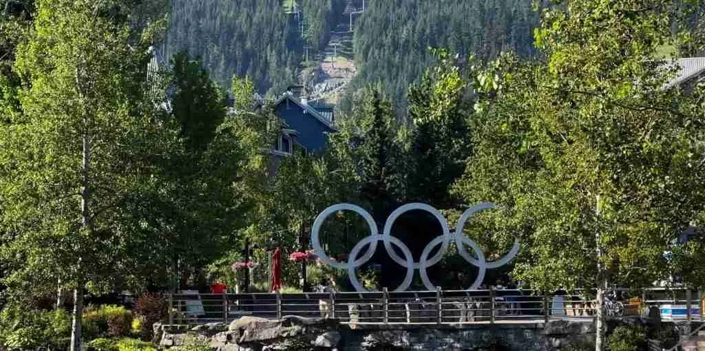
3 days
Whistler 3-Day Discovery Tour
- ✓ Comprehensive Whistler experience
- ✓ Expert local guides included
- ✓ All accommodation included
- ✓ Transportation provided
5 days
Whistler 5-Day Highlights Experience
- ✓ Comprehensive Whistler experience
- ✓ Expert local guides included
- ✓ All accommodation included
- ✓ Transportation provided
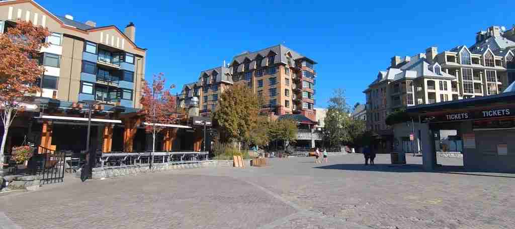
7 days
Whistler 7-Day Cultural Journey
- ✓ Comprehensive Whistler experience
- ✓ Expert local guides included
- ✓ All accommodation included
- ✓ Transportation provided
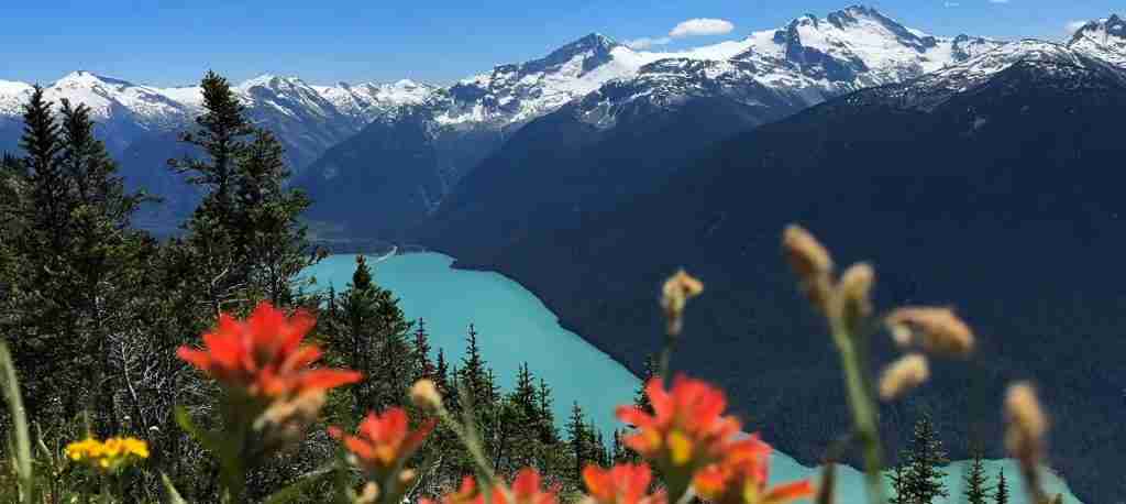
10 days
Whistler 10-Day Complete Adventure
- ✓ Comprehensive Whistler experience
- ✓ Expert local guides included
- ✓ All accommodation included
- ✓ Transportation provided
Multi-day tour packages powered by TourRadar. Prices and availability subject to change.
Introduction to Whistler’s Touring and Hiking Landscape
Whistler’s dual-mountain resort system creates extraordinary touring and hiking opportunities through the largest ski area in North America spanning 8,171 acres across Whistler and Blackcomb mountains. The PEAK 2 PEAK Gondola, holding Guinness World Records for the longest free-span gondola at 3.03 kilometers and highest point above ground at 436 meters, fundamentally transforms summer hiking access by connecting the two mountains in an 11-minute crossing that opens alpine trail networks previously requiring overnight backpacking trips or technical mountaineering approaches. This infrastructure allows day hikers to access world-class alpine terrain in Garibaldi Provincial Park, witness glacial features and volcanic geology, and traverse above-treeline meadows typically reserved for experienced backcountry travelers.
The resort community sits at 675 meters elevation in a valley carved by Fitzsimmons Creek, surrounded by Coast Mountain peaks rising to over 2,440 meters. This dramatic topography creates distinct hiking zones: valley-bottom trails through old-growth coastal rainforest accessible by foot from the village, mid-mountain routes reaching subalpine environments via short drives to trailheads along Highway 99, and full alpine experiences above 1,800 meters requiring gondola-assisted access. Each zone offers fundamentally different experiences, from gentle lakeside loops suitable for all fitness levels to challenging summit ascents demanding technical skills and mountain safety knowledge.
Whistler’s location 125 kilometers north of Vancouver along the Sea to Sky Highway positions it as both a standalone destination and a popular day trip from British Columbia’s largest metropolitan area. This accessibility drives year-round tourism that peaks during summer months when snow clears from high-elevation trails, typically from mid-July through early September. The resort’s 2010 Winter Olympics legacy includes world-class infrastructure, comprehensive trail networks, and professional guiding services that elevate the hiking and touring experience far beyond wilderness areas lacking similar development.
The region’s indigenous Squamish and Lil’wat First Nations peoples have inhabited these mountains for thousands of years, with the Resort Municipality of Whistler acknowledging this history through various cultural interpretive programs and place names. Modern Whistler began as a logging camp in the 1960s before transforming into a ski resort, with summer tourism gradually developing as infrastructure expanded. Today’s hiking and touring options reflect this evolution, combining natural alpine beauty with engineered access systems that democratize mountain experiences for visitors of all abilities.
Whistler’s climate features wet, mild winters and relatively dry summers, though mountain weather remains notoriously unpredictable even during peak season. Summer temperatures in the valley typically range from 15-25°C (59-77°F), while alpine zones remain 5-10 degrees cooler with persistent wind exposure. Afternoon thunderstorms develop regularly, making early morning starts essential for alpine hiking safety. The coastal rainforest environment receives substantial precipitation, creating lush vegetation and numerous waterfalls while requiring rain gear preparedness year-round.
Essential Alpine Access Options for 2026
Whistler’s alpine hiking terrain remains inaccessible without utilizing the resort’s gondola and chairlift infrastructure, making summer sightseeing tickets the gateway to the region’s most spectacular trails. Summer sightseeing access in 2026 costs $63 CAD ($46 USD) for adults, $54 CAD ($39 USD) for teens ages 13-18, and $32 CAD ($23 USD) for children ages 7-12, with children under 7 accessing lifts free when supervised (check official Whistler Blackcomb website for current rates as seasonal pricing varies). This single ticket provides unlimited gondola rides on both Whistler and Blackcomb mountains plus the PEAK 2 PEAK connector for the entire operating day, typically 10:00 AM to 5:00 PM during summer months. The ticket eliminates the need to purchase separate access for each mountain, creating exceptional value for hikers planning to explore multiple trail networks.
The Whistler Village Gondola ascends 1,160 vertical meters from the village base at 675 meters to the Roundhouse Lodge at 1,835 meters in approximately 25 minutes, delivering hikers to the departure point for the High Note Trail, Musical Bumps, and various other alpine routes. The Peak Express chairlift continues another 185 vertical meters to Whistler Mountain’s 2,020-meter summit, where the highest-elevation trailheads begin. On Blackcomb Mountain, the Blackcomb Gondola rises from Blackcomb Base to Rendezvous Lodge at 1,860 meters, providing access to the Overlord-Decker trail system and alpine hiking networks on that peak. The PEAK 2 PEAK Gondola connecting the two mountains operates continuously, allowing hikers to create loop routes combining trails on both peaks or simply experience the engineering marvel of crossing the valley suspended 436 meters above the forest floor.
Summer gondola operations typically run from mid-June through early October, with precise opening and closing dates depending on snowmelt and early-season snowfall patterns. Operating hours generally span 10:00 AM to 5:00 PM daily, though these hours may extend during peak summer weeks and contract during shoulder seasons. Hikers planning full-day alpine excursions should ride the first gondola of the day to maximize trail time before mandatory return by the final descent typically scheduled between 4:30 PM and 5:00 PM. Missing the last gondola necessitates hiking down via valley trails—a 6-8 kilometer descent losing 1,200 meters of elevation that transforms a pleasant day into an exhausting ordeal.
Advanced online ticket purchases through the Whistler Blackcomb website occasionally offer modest discounts compared to same-day window rates, particularly during promotional periods. Multi-day sightseeing passes provide incremental savings for visitors planning extended hiking programs. Gondola tickets are non-refundable, making weather monitoring essential before purchase, as alpine conditions can deteriorate rapidly with fog, rain, or unseasonable snow rendering trails dangerous or invisible even when lifts operate. Guest services at the base gondola stations provide current mountain weather reports and trail condition updates to inform hiking decisions before ascending.
Premier Guided Tour Experiences in Whistler 2026
Whistler’s guided tour industry delivers specialized access to wildlife, backcountry terrain, and cultural experiences that independent exploration cannot match. Tours range from 2.5-hour wildlife safaris to multi-day backcountry adventures, each designed to maximize visitor experiences through expert knowledge and optimized logistics.
Bear Viewing Safari Tours
Bear viewing tours represent Whistler’s signature guided wildlife experience, with multiple operators accessing the extensive black bear populations inhabiting Whistler and Blackcomb mountains. Whistler Photo Safaris charges $199 CAD ($145 USD) per adult and $139 CAD ($102 USD) for children under 12 for 2.5-hour excursions through Whistler Olympic Park and backcountry road networks (check official websites for current rates as pricing varies seasonally). Tours operate in comfortable 4×4 vehicles accommodating 4-6 guests plus guide, accessing restricted roads through active bear territories where feeding sites, daybeds, and hibernation dens cluster.
Morning tours departing between 7:00 AM and 9:00 AM provide the highest bear encounter probability as animals actively forage during cooler morning temperatures before retreating to shaded resting areas during afternoon heat. Evening tours around 5:00 PM capture bears emerging from midday rest for evening feeding, with the added benefit of golden-hour lighting for photography. Afternoon tours offer the lowest encounter rates but remain popular for visitors with morning commitments.
Professional naturalist guides possess intimate knowledge of individual bears’ territories, seasonal movement patterns, and current food source locations—information updated daily through guide networks and field observations. Tours emphasize bear behavior education, explaining feeding strategies, hibernation requirements, cub-rearing challenges, and human-wildlife coexistence protocols that protect both species. Guests remain in vehicles during bear observations, maintaining safe distances while guides maneuver for optimal viewing and photography angles. Tours include pickup and return to Whistler accommodations, eliminating parking and navigation concerns.
Bear sightings are not guaranteed despite high success rates, as wild animal behavior depends on weather, food availability, other bears, and human activity levels. Operators emphasize this uncertainty while noting that Whistler’s 60+ bear population and expert guide knowledge combine to produce sighting rates exceeding 85% across summer season. Alternative wildlife frequently observed includes black-tailed deer, coyotes, raptors including red-tailed hawks and owls, hoary marmots, and various forest birds.
Sea to Sky Corridor Tours from Vancouver
Full-day guided tours from Vancouver to Whistler eliminate driving stress on the challenging Sea to Sky Highway while maximizing sightseeing opportunities through strategic stops and expert commentary. Landsea Tours and similar operators charge approximately $175 CAD ($128 USD) per adult for comprehensive packages including hotel pickup in Vancouver, luxury coach transportation, Shannon Falls access, Sea to Sky Gondola admission, and 2-3 hours of free time in Whistler Village (verify current pricing on official booking platforms as rates vary by season and operator).
Tours depart Vancouver hotels between 8:00 AM and 9:00 AM, reaching Whistler by 11:30 AM after stops at key Sea to Sky Highway viewpoints. Shannon Falls, British Columbia’s third-highest waterfall at 335 meters, provides a 15-20 minute photo stop where guests walk the short trail to viewing platforms at the cascade’s base. The Sea to Sky Gondola in Squamish ascends 885 meters up Mount Habrich, delivering panoramic views of Howe Sound and surrounding peaks. The summit features walking trails, suspension bridges, and interpretive displays about Coast Salish First Nations and regional ecology.
Whistler Village free time allows independent exploration of shops, restaurants, and nearby trails like the easy Lost Lake loop or Train Wreck route. Tours provide village maps and local recommendations but do not include guided walking within Whistler itself. Departure from Whistler typically occurs between 3:00 PM and 4:00 PM, arriving back in Vancouver by 6:30 PM after downtown hotel drop-offs.
These tours deliver superior value versus independent travel for visitors lacking rental cars or uncomfortable with mountain highway driving, which features numerous switchbacks, steep grades, and weather-dependent hazards. Rental car costs exceed $100 CAD daily plus fuel and insurance, while parking in Whistler costs $15-30 CAD for full-day village lots. Professional guides provide historical context about indigenous peoples, logging industry heritage, 2010 Olympics legacy, and geological formation of the Coast Mountains that transforms simple sightseeing into comprehensive regional education.
Backcountry Skiing and Alpine Touring Packages
Callaghan Country operates guided backcountry skiing and touring packages from their remote lodges, with all-inclusive tours starting at $475 CAD ($347 USD) per person per night including accommodation, meals, and ACMG-certified guide services. Multi-day packages range from 2-night weekend getaways to week-long expeditions, all based from Journeyman Lodge or similar backcountry facilities accessible only via snow cat or ski touring approach. Tours include avalanche safety instruction, equipment rental if needed, and access to pristine powder skiing terrain never groomed or tracked by resort operations.
These specialized tours cater to intermediate-to-advanced skiers and snowboarders seeking wilderness experiences beyond resort boundaries. Summer versions transition to alpine hiking and peak-bagging expeditions using the same lodge infrastructure. Minimum group sizes typically require 3-6 participants, with private guide options available at premium rates. All tours emphasize skill development, safety education, and low-impact wilderness ethics alongside recreational enjoyment.
Specialty Photography and Cultural Tours
Specialized operators offer photography-focused tours combining wildlife observation with professional instruction, typically charging $225-275 CAD ($165-200 USD) for half-day excursions. These tours emphasize camera settings, composition techniques, and wildlife photography ethics while accessing the same bear habitat areas as standard wildlife tours. Cultural tours featuring Squamish and Lil’wat First Nations storytelling, traditional plant knowledge, and indigenous perspectives on the landscape typically cost $125-175 CAD ($91-128 USD) for 2-3 hour experiences, often incorporating short nature walks with interpretive stops.
Essential Village and Valley Trail Networks
Whistler’s valley-bottom trail system provides exceptional hiking opportunities accessible without gondola tickets or vehicular transportation from the village core. These routes deliver diverse experiences from lakeside strolls to river canyon explorations while requiring minimal elevation gain, making them ideal for families, casual hikers, and visitors seeking gentle exercise between other activities.
Lost Lake Park Loop Trail
Lost Lake represents Whistler’s premier easy-access hiking destination, offering a 5-kilometer loop trail around the lake plus extensive connector paths through surrounding forest. The trailhead sits just 10 minutes walking from Whistler Village via Lorimer Road near the intersection with Blackcomb Way, making it accessible without driving. The loop gains only 50 meters elevation over its circuit, featuring well-maintained dirt and gravel paths suitable for running shoes, though hiking boots provide superior ankle support on root-crossed sections.
The route circumnavigates Lost Lake clockwise or counterclockwise in approximately 75 minutes at moderate pace, passing through dense coastal hemlock and cedar forest interspersed with lakeside clearings offering mountain views. The west shore provides the most dramatic vistas of Whistler and Blackcomb peaks reflected in calm morning waters, while the east shore features quieter forest environments favored by local dog walkers and trail runners. Swimming beaches along the south shore attract summer crowds during afternoon heat, with dock jumping popular among youth visitors.
Trail intersections connect the main lake loop to the Valley Trail network, allowing extensions to other village areas or longer forest explorations. Signage clearly marks all junctions with distances and estimated times. The trail remains accessible year-round, transitioning to cross-country ski and snowshoe routes during winter when the lake freezes and snow covers the paths. Summer weekends see heavy use, making weekday mornings or evenings preferable for solitude seekers.
Whistler Train Wreck Trail
The Train Wreck trail has evolved into Whistler’s most photographed easy hike, leading to boxcars from a 1950s derailment now covered in vibrant graffiti art. The trailhead sits on Jane Lakes Road off Legacy Way, accessible via seasonal shuttle bus routes 10 or 20 from the village or short drive from central Whistler. Total round-trip distance measures 3 kilometers over predominantly flat terrain requiring approximately 1 hour total including site exploration time.
The trail crosses the Cheakamus River via a suspension bridge approximately 500 meters from the trailhead, providing the route’s scenic highlight as turquoise glacial waters flow through a boulder-strewn canyon beneath the swaying bridge. Beyond the crossing, the path enters forest characterized by massive nurse logs, sword ferns, and moss-draped bigleaf maples typical of coastal temperate rainforest ecosystems. The wreck site appears suddenly as hikers round a bend, with seven boxcars scattered across the forest floor in various states of decay, all covered in colorful spray-painted art ranging from simple tags to elaborate murals.
The site’s artistic and historical interest makes it exceptionally popular with families and casual visitors seeking unique photo opportunities without challenging hiking demands. Mountain bike trails intersect the walking route at multiple points, requiring awareness of approaching cyclists though most riders travel slowly through the congested wreck area. Root systems and occasional mud sections necessitate watching foot placement despite the trail’s overall easy rating. Winter snowshoeing transforms the experience, with snow-covered boxcars creating dramatic monochrome contrasts against graffiti colors.
Valley Trail Paved System
Whistler’s Valley Trail network comprises over 40 kilometers of paved, multi-use pathways connecting the entire resort community from Function Junction in the south through Whistler Village to Emerald Estates in the north. The trails accommodate walkers, runners, cyclists, and in-line skaters, with separate lanes designated where width permits. Gentle grades and smooth surfaces make the network accessible for strollers, wheelchairs, and mobility devices, creating Whistler’s most inclusive recreation infrastructure.
Key sections link practical destinations like grocery stores, accommodations, and recreational facilities while passing through riparian zones along Fitzsimmons Creek, across wetland boardwalks, and through forest corridors. Interpretive signs provide ecological and cultural information at strategic locations. The Village to Lost Lake section covers approximately 2 kilometers each way, while longer routes extend to more distant neighborhoods for visitors seeking extended walking or running workouts without vehicular traffic concerns.
The Valley Trail operates year-round with winter snow clearing prioritized on main routes though some sections remain snow-covered or icy during cold periods. Summer cyclists travel at high speeds on certain segments, requiring pedestrians to maintain awareness and utilize designated walking lanes where provided. Trail maps available at information centers and online detail the full network with distances, connections, and points of interest.
Cheakamus Lake Trail
Cheakamus Lake trail offers a longer valley walk reaching a stunning glacial lake through old-growth forest. The trailhead requires driving or cycling approximately 8 kilometers south of Whistler Village to the Cheakamus Lake parking area off Highway 99, where daily parking fees apply. The trail measures 8 kilometers round trip with minimal elevation gain of approximately 100 meters spread gradually over the route, making it accessible to most fitness levels despite the distance.
The wide, well-maintained gravel path traverses mature coastal rainforest dominated by western hemlock, western red cedar, and Douglas fir trees, some exceeding 500 years in age. The trail crosses several small creeks via footbridges and passes through areas where selective logging and natural fire events created openings now filled with regenerating forest and berry-producing shrubs. Wildlife including black bears, deer, and various bird species inhabit the valley, though encounters remain relatively rare given the trail’s popularity and noise levels from hikers.
Cheakamus Lake emerges after approximately 4 kilometers of hiking, its turquoise waters colored by glacial flour suspended in meltwater from Castle Towers Glacier upstream. The lake stretches 3 kilometers in length, surrounded by peaks including Castle Towers Mountain and Armchair Glacier. The maintained trail ends at the lake’s north shore where picnic areas and primitive campsites serve backpackers continuing to Singing Pass or Helm Creek camping areas deeper in Garibaldi Provincial Park. Most day hikers spend 30-60 minutes at the lake before returning via the same route, creating total trip times of 3-4 hours including breaks.
The trail remains accessible from late May through October depending on snowpack, with peak wildflower displays occurring in July. Winter access requires snowshoes or backcountry skis, transforming the route into a challenging 8-kilometer approach through deep, ungroomed snow. The Cheakamus Lake trail serves as the gateway to longer backcountry routes including the Helm Creek approach to Black Tusk and Panorama Ridge, both requiring overnight camping and advanced mountain skills.
Iconic Alpine Hiking Trails Requiring Gondola Access 2026
Whistler’s most spectacular hiking terrain exists above treeline in alpine zones accessible only via gondola-assisted ascents. These trails deliver world-class mountain scenery, intimate access to Garibaldi Provincial Park geology, and exposure to alpine ecosystems flourishing above 1,800 meters elevation. All routes described require purchase of summer sightseeing tickets and operate only during snow-free periods typically from mid-July through late September.
High Note Trail on Whistler Mountain
The High Note Trail ranks among British Columbia’s finest alpine day hikes, traversing the western flank of Whistler Mountain with continuous views of Garibaldi Provincial Park’s volcanic peaks, glaciated valleys, and emerald lakes. The trail begins behind the Inukshuk stone marker at the top of the Peak Express chairlift at 2,020 meters elevation, accessed via the Whistler Village Gondola followed by the Peak chairlift. Total trail distance measures 11 kilometers one-way to the Roundhouse Lodge, losing approximately 300 meters elevation while following the mountainside contour through alpine meadows, across talus slopes, and past numerous scenic viewpoints.
The route crosses into Garibaldi Provincial Park after 500 meters, marked by a rope boundary. The trail descends moderately through rocky terrain requiring attention to foot placement on loose gravel and exposed rock sections. A brief technical section approximately 2 kilometers from the trailhead demands pulling onto a rock ledge and descending via a metal walkway while holding a fixed rope—manageable for most hikers but potentially challenging for those with height anxiety or limited upper body strength. Beyond this obstacle, the trail mellows into a spectacular traverse along grassy mountainsides carpeted with wildflowers during late July and early August.
The Cheakamus Lake Lookout appears approximately 30 minutes from the trailhead, providing the first panoramic view of the turquoise glacial lake 1,000 meters below and Black Tusk’s distinctive volcanic plug across the valley. Continuing along the traverse, hikers pass beneath ridgelines where hoary marmots whistle alarm calls and occasionally spot mountain goats on distant cliff faces. The Half Note Trail junction offers a shorter bailout option descending steeply back to an access road leading to the gondola, reducing total hiking time by approximately 1 hour but missing the trail’s most scenic sections.
The final kilometers roll gently through continued alpine terrain before entering subalpine forest zones as elevation drops toward the Roundhouse. The last section follows ski runs and access roads, less scenic than earlier portions but providing easier footing. Total hiking time ranges from 3.5 to 5 hours depending on pace and photo stop frequency. Hikers should carry water as no reliable sources exist along the exposed alpine traverse, and weather gear remains essential as conditions change rapidly above treeline.
Musical Bumps Circuit
The Musical Bumps trail creates a spectacular alpine ridge traverse connecting a series of named summits: Flute Peak, Oboe Summit, Piccolo Summit, and the unnamed musical variations composing this thematic naming scheme. The route begins at the Roundhouse Lodge after riding the Whistler Village Gondola, heading north into Singing Pass valley before ascending to the ridge system. Total loop distance measures approximately 19 kilometers with 305 meters of cumulative elevation gain, requiring 7-9 hours of hiking time making it a full-day commitment.
The trail initially descends through subalpine meadows toward Harmony Lake, passing tarns and creeks fed by lingering snowfields. The ascent to Flute Peak begins approximately 4 kilometers from the Roundhouse, climbing through heather and alpine wildflower meadows where black bears occasionally forage in late summer. The ridge crest delivers 360-degree views encompassing Garibaldi Provincial Park to the east, the Coast Mountains extending north and south, and glimpses of Howe Sound to the southwest.
Each musical “bump” provides distinct perspectives, with the route rolling along the ridge top through continued alpine terrain. The tundra-like environment features low-growing plants adapted to extreme wind exposure, temperature fluctuations, and short growing seasons. July and August bring peak wildflower displays when Indian paintbrush, lupine, and alpine aster create vivid color contrasts against rocky terrain and remnant snow patches. The exposed nature of the ridge demands careful weather monitoring as lightning danger increases dramatically during afternoon thunderstorms common in Whistler’s summer climate.
The trail eventually descends toward Singing Pass, offering options to continue down the Singing Pass Trail all the way to Whistler Village—a 21-kilometer descent losing 1,450 meters of elevation over approximately 6-7 hours of downhill hiking that punishes knees and tests endurance. Most day hikers prefer returning via the same ridge route to the Roundhouse for gondola descent, though this involves re-ascending the “bumps” and extends total trip time to a full alpine day. Strong hikers sometimes combine the Musical Bumps with the High Note Trail, creating an epic traverse covering much of Whistler Mountain’s accessible alpine terrain.
Overlord-Decker Trail Loop on Blackcomb Mountain
Blackcomb Mountain’s premier alpine hiking experience follows the Overlord-Decker Loop, a 1.8-kilometer circuit gaining minimal elevation while delivering dramatic views of the Overlord Glacier, ancient mountain peaks, and the Decker Tarn glacial lake. Access requires riding the Blackcomb Gondola to Rendezvous Lodge, then following signed trails east into Garibaldi Provincial Park. The relatively short distance and modest elevation change make this route accessible to casual hikers seeking alpine scenery without the endurance demands of longer trails, though the remote setting and potential weather changes still require proper preparation.
The clockwise route direction provides optimal scenic progression, climbing gradually into Garibaldi Provincial Park with expanding views of the Fitzsimmons Valley and surrounding peaks. The Overlord Glacier dominates the southern horizon, its ice flows and crevasse patterns clearly visible from the trail. The Decker Tarn appears nestled in a rocky cirque, its frigid waters fed directly by glacial meltwater. The trail circumnavigates the tarn through boulder fields and alpine vegetation before completing the loop back to the main trail system serving Rendezvous Lodge.
Total hiking time ranges from 45 minutes to 75 minutes depending on photo stops and pace, making this route ideal for families with children or visitors with limited time wanting alpine exposure without full-day commitments. The trail can be combined with other Blackcomb hiking options including the Decker Lake trail extending deeper into the backcountry or the PEAK 2 PEAK Gondola ride to Whistler Mountain for multi-mountain hiking programs. Afternoon thunderstorms pose particular danger on this exposed route, making morning starts essential for safety.
Blackcomb Ascent Trail
The Blackcomb Ascent Trail represents Whistler’s most challenging single ascent option, climbing directly from Whistler Valley to Rendezvous Lodge via a steep, relentless uphill grind gaining 1,200 meters over 6.1 kilometers. The trail consists of three connected segments: Little Burn gaining 74 meters over 0.8 kilometers, Big Burn ascending 494 meters over 2.2 kilometers, and Heartburn climbing the final 607 meters over 3.1 kilometers. Trailhead access from Whistler Village via short walk or free village shuttle, with return via Blackcomb Gondola descent included in summer sightseeing ticket price.
Hikers tackle this route for fitness training, personal challenge, and the satisfaction of ascending via leg power rather than mechanical lift. The trail traverses coastal rainforest characterized by old-growth western hemlock and cedar, with steepness varying but persistently uphill without meaningful flat sections for recovery. The climb typically requires 2.5 to 4 hours depending on fitness level, with many hikers stopping multiple times for rest and hydration. The gondola descent eliminates the knee-punishing downhill that would otherwise extend total trip time while reducing injury risk.
Morning starts avoid the heat and humidity that amplify difficulty on this shadeless climb through dense forest. Water sources along the route are unreliable, necessitating carrying sufficient hydration for the entire ascent—typically 2-3 liters per person on warm days. Many visitors complete the Blackcomb Ascent early in their Whistler stay to establish fitness for subsequent hiking objectives, viewing it as a rite of passage and personal mountaineering accomplishment even without technical skills or summiting objectives.
Challenging Full-Day Backcountry Routes for Experienced Hikers
Whistler’s most spectacular and challenging hiking objectives extend deep into Garibaldi Provincial Park backcountry, requiring advanced fitness, mountain safety skills, and full-day commitments. These routes attract serious hikers seeking dramatic alpine landscapes and solitude away from gondola-accessed crowds. All require early starts, emergency preparedness, and flexibility to retreat if weather deteriorates.
Wedgemount Lake Trail
Wedgemount Lake trail ranks among British Columbia’s most challenging and rewarding day hikes, climbing 1,200 meters over 7 kilometers to reach a stunning turquoise glacial lake nestled in a dramatic cirque surrounded by Wedgemount Glacier and towering peaks. The trailhead sits approximately 16 kilometers north of Whistler Village off Highway 99 on Wedgemount Creek Forest Service Road, requiring high-clearance vehicle for the rough 5-kilometer access road to the parking area.
The trail ascends relentlessly through dense forest with minimal flat sections, gaining vertical at rates that quickly elevate heart rate and test leg muscles. No technical sections require scrambling or special equipment, but the sustained grade and accumulated elevation gain classify this as an expert-only route. Hikers typically require 3-4 hours to reach the lake, covering the 7 kilometers at slow pace with frequent rest stops necessitated by the grueling climb. The forest eventually yields to subalpine meadows, then full alpine terrain as the lake appears suddenly after a final steep push.
Wedgemount Lake occupies a spectacular setting at 1,865 meters elevation, its waters fed directly by Wedgemount Glacier hanging above the lake’s far shore. Icebergs calved from the glacier occasionally float in the lake during summer months, creating dramatic azure and white compositions against surrounding granite peaks. The cirque walls amplify wind that funnels across the exposed lake basin, making warm clothing essential even on sunny days. Primitive camping area above the lake serves backpackers staying overnight, while day hikers typically spend 1-2 hours at the lake before beginning the knee-punishing descent requiring 2-3 hours return time.
Total round-trip time spans 6-8 hours for strong hikers, extending to 9-10 hours for those requiring more rest breaks. The trail typically becomes snow-free by mid-July, with optimal conditions lasting through September before early season snowfall returns. The challenging nature limits crowds compared to easier alpine routes, though weekends still see substantial traffic from experienced hikers drawn by the lake’s reputation as one of the region’s most beautiful destinations.
Garibaldi Lake via Taylor Meadows
The Garibaldi Lake trail provides access to the park’s namesake lake, an immense turquoise water body stretching 9 kilometers in length beneath Black Tusk’s distinctive volcanic plug. The trailhead sits approximately 40 kilometers south of Whistler off Highway 99 near Rubble Creek, serving as the primary access point for the entire Garibaldi Lake region. The standard approach covers 9 kilometers each way to the lake with 850 meters of elevation gain, requiring 6-8 hours round trip for most hikers though many extend this to overnight trips camping at established sites near the lake shore.
The trail climbs steadily through old-growth forest transitioning to subalpine meadows at Taylor Meadows, a scenic clearing approximately 6 kilometers from the trailhead where backcountry campground serves overnight visitors. Beyond Taylor Meadows, the route continues through alpine terrain before arriving at Garibaldi Lake’s dramatic setting. The lake’s intense turquoise color derives from glacial flour—fine rock particles ground by glaciers upstream and suspended in the water, scattering blue wavelengths while absorbing other colors.
Black Tusk rises prominently beyond the lake’s north shore, its dark volcanic rock contrasting sharply against surrounding lighter granite peaks. The mountain’s formation represents the eroded remnant of a volcanic vent that was active during recent geological periods, creating the distinctive jagged profile visible for dozens of kilometers. Many hikers extend their Garibaldi Lake visit to include the Black Tusk summit climb, an additional 5-6 hour round trip from the lake gaining 850 meters via steep, exposed scrambling terrain requiring gloves, helmet, and comfort with exposure.
Garibaldi Lake attracts substantial crowds during summer weekends, with the parking area regularly filling by 7:00 AM forcing late arrivals to park along the highway and walk additional distance to the trailhead. Midweek visits provide relative solitude and more reliable parking access. The trail typically opens by late June depending on snowpack, with peak conditions lasting through September. Camping reservations for backcountry sites must be secured well in advance through BC Parks reservation system during summer months.
Panorama Ridge
Panorama Ridge extends beyond Garibaldi Lake, climbing an additional 885 meters and 6 kilometers beyond the lake to reach a spectacular ridgetop viewpoint overlooking the entire Garibaldi region. The combined route measures 30 kilometers round trip with 1,735 meters of total elevation gain, representing one of the area’s most challenging but rewarding day hikes. Most hikers require 10-12 hours for the complete round trip, making dawn starts mandatory to ensure descent before darkness.
The ridge approach ascends relentlessly from Garibaldi Lake through alpine meadows carpeted with wildflowers in July, transitioning to barren talus slopes and rocky terrain near the summit. The final push to the ridgetop tests determination as legs weaken from accumulated mileage and elevation gain. The summit viewpoint delivers panoramic vistas encompassing Garibaldi Lake directly below, Black Tusk across the valley, Helm Lake to the north, and the sprawling Coast Mountains extending in all directions. The Sphinx Glacier and various other ice masses appear as white ribbons flowing down distant peaks.
Weather monitoring becomes critical on Panorama Ridge as exposure to lightning increases substantially on the bare ridgetop with no escape routes available. Afternoon thunderstorms developing over the Coast Mountains can arrive with minimal warning, making early morning summit attempts essential for safety. Many experienced hikers overnight at Garibaldi Lake campground before tackling Panorama Ridge at dawn, allowing summit arrival by late morning and retreat before afternoon weather deteriorates.
The route requires no technical climbing skills but demands excellent physical conditioning, mountain navigation abilities using map and compass or GPS, and judgment to turn back if conditions deteriorate. The long distance and accumulated elevation gain make this route suitable only for hikers with proven endurance from previous challenging mountain objectives. Despite the difficulty, Panorama Ridge attracts substantial traffic during peak summer weekends as its reputation as the region’s premier viewpoint draws hikers from across North America.
Seasonal Considerations and Trail Planning for 2026
Whistler’s dramatic elevation range from 675-meter valley floor to 2,440-meter peaks creates significant seasonal variation in trail accessibility and hiking conditions. Understanding these patterns allows visitors to optimize timing for desired trail experiences and realistic planning around weather constraints.
Peak Alpine Hiking Season: Mid-July Through Early September
The optimal window for high-elevation alpine trails spans approximately 8-10 weeks from mid-July through early September when snowmelt exposes trails, wildflowers peak, and weather patterns stabilize into more predictable summer conditions. July brings peak wildflower displays in alpine meadows, with Indian paintbrush, lupine, and mountain heather creating vibrant color blankets against rocky terrain and remnant snowfields. The High Note Trail, Musical Bumps, and other alpine routes become fully accessible without snow travel skills or equipment, allowing standard hiking boots and summer clothing systems to suffice.
August delivers the most stable weather patterns of the hiking season, with reduced precipitation probability and warmer overnight temperatures compared to shoulder months. The trade-off involves increased visitor numbers on popular trails as families with school-age children visit during summer vacation periods. Alpine lakes reach their peak warmth—relatively speaking, as water temperatures rarely exceed 10°C even in late summer—making brief swimming or wading marginally less shocking than earlier season’s frigid waters.
Early September transitions into autumn with spectacular fall color displays as subalpine meadows transition from green to golden yellow and russet tones. Crowds diminish substantially after the Labour Day holiday as children return to school and tourist numbers drop. Early season snowfall becomes increasingly probable, potentially closing high-elevation trails unexpectedly though valley routes typically remain accessible. Daylight duration decreases noticeably, reducing available hiking hours and requiring earlier starts for long alpine objectives.
Shoulder Season Opportunities: May Through June and Late September Through October
Spring and fall shoulder seasons deliver solitude and unique scenic conditions but demand flexibility as weather and trail conditions vary dramatically week to week. Late May through June allows access to valley and low-elevation trails while alpine zones remain deeply snow-covered. The Cheakamus Lake, Lost Lake, and Train Wreck trails become fully accessible, often with rushing waterfalls and streams at peak flow from snowmelt. Valley wildflowers bloom earlier than alpine species, creating sequential flower displays from low to high elevations across the season.
Late September through October brings autumn color to valleys and subalpine zones, with bigleaf maple, cottonwood, and various berry bushes transforming forest landscapes. Alpine larch, though not abundant in the Whistler area compared to more inland regions, displays brilliant golden foliage before dropping needles. Weather becomes increasingly variable with autumn storm systems bringing rain to valleys and snow to high peaks. The first substantial snowfall typically occurs in early October, potentially persisting through winter and effectively ending the alpine hiking season.
Shoulder season visitors should monitor trail reports carefully before attempting longer hikes, as residual snow on alpine routes can render trails impassable or dangerous without mountaineering equipment. Local hiking groups and Whistler Blackcomb’s website provide current trail condition reports updated regularly by mountain safety staff and guides. Flexibility to substitute lower-elevation objectives when alpine conditions deteriorate enhances shoulder season hiking success.
Winter and Spring Conditions: November Through April
Winter transforms Whistler’s hiking trails into snow-covered routes accessible only via snowshoes or cross-country skis. Lost Lake becomes the hub of the Nordic ski network with groomed trails radiating through surrounding forest. The Train Wreck trail remains popular with snowshoers seeking winter access to the iconic site. Alpine trails become entirely inaccessible without specialized winter mountaineering equipment, avalanche safety training, and substantial experience in winter mountain travel.
The Whistler Olympic Park in the Callaghan Valley, approximately 30 minutes south of Whistler Village, provides the region’s premier cross-country skiing venue with extensive groomed trail networks serving skate and classic skiing styles. These trails substitute for summer hiking during winter months, providing aerobic exercise in spectacular mountain settings. Guided snowshoe tours operate throughout winter, offering accessible mountain experiences without requiring downhill skiing skills or expensive lift tickets.
Spring arrives gradually in Whistler, with valley snowpack typically melting through April and May while alpine zones retain deep snow into July. April and May represent the most challenging months for hikers as valley trails transition between snow-covered and muddy conditions without offering appealing hiking experiences. Most visitors focus on skiing during this period rather than attempting hiking objectives.
Essential Hiking Gear and Preparation Requirements for 2026
Proper equipment and preparation determine hiking success and safety in Whistler’s unpredictable mountain environment. The following represents essential gear and knowledge for various trail difficulty levels, allowing appropriate packing decisions based on planned routes.
Footwear and Clothing Systems
Hiking boots with ankle support and aggressive tread patterns provide essential stability and traction on Whistler’s rocky, root-crossed trails. Valley routes like Lost Lake tolerate running shoes or trail runners, but alpine trails demand proper hiking boots protecting ankles from rolling injuries on uneven terrain. Waterproof or water-resistant boots prevent soaked feet when crossing streams, traversing wet meadows, or hiking during rain—common conditions throughout the season.
Layered clothing systems allow temperature regulation across dramatic elevation changes and weather variations. Base layers should wick moisture, mid-layers provide insulation, and outer shells block wind and rain. Synthetic or merino wool materials dry quickly and maintain insulating properties when wet, unlike cotton which absorbs moisture and accelerates hypothermia. Alpine trails require bringing extra layers even on seemingly perfect weather days as conditions deteriorate rapidly above treeline. Full rain gear including jacket and pants remains essential equipment year-round in coastal British Columbia’s wet climate.
Navigation and Communication Tools
Detailed trail maps and compass or GPS device provide essential navigation backup if hikers become disoriented in fog, heavy rain, or when trails become obscured by late-season snow. Popular trails feature excellent signage and well-worn tread, but backcountry routes require competent navigation skills. Smartphone mapping applications function well when cell coverage exists, but battery conservation becomes critical on long alpine days. Downloading offline maps before departure ensures access when cellular connectivity disappears.
Cell phone coverage exists throughout Whistler Village and gondola terminals but becomes spotty on remote trails and disappears entirely in deep valleys or behind ridgelines. Satellite communication devices provide reliable emergency contact capability in backcountry areas, though most day hikers on established routes manage without this specialized equipment. Whistler Mountain safety patrols monitor alpine areas accessible by gondola, providing rapid response to emergencies on routes like High Note Trail and Musical Bumps.
Food, Water, and Emergency Supplies
Water requirements vary dramatically with temperature, humidity, elevation gain, and individual physiology, but most hikers need 2-3 liters for full-day alpine excursions. Alpine trails lack reliable water sources despite crossing streams and tarns, as giardia and other waterborne pathogens contaminate untreated water throughout the backcountry. Water filtration systems allow refilling from streams if necessary, but carrying sufficient clean water eliminates this time-consuming step and associated health risks.
High-calorie snacks provide energy for sustained climbing on long alpine approaches. Nuts, dried fruit, energy bars, and chocolate deliver dense calories in lightweight packages. Many hikers bring sandwiches or wraps for lunch breaks at scenic viewpoints. Food requirements increase substantially with cold weather and long distances as the body burns more calories maintaining temperature and fueling movement.
Emergency supplies including first aid kit, emergency shelter or space blanket, fire-starting materials, and headlamp represent essential safety equipment for any hike extending beyond short valley walks. Ankle sprains, minor cuts, blisters, and exhaustion occur regularly on hiking trails, making basic first aid capability important. The headlamp allows safe descent if delays extend hiking beyond daylight hours, a real possibility on long routes like Panorama Ridge or Musical Bumps where underestimating required time leaves hikers scrambling to reach trailheads before darkness.
Bear Safety Equipment and Protocols
Black bears inhabit all of Whistler’s trail systems, making bear spray and knowledge of bear encounter protocols essential for all hikers. Bear spray provides effective deterrent during aggressive bear encounters though proper use requires understanding deployment distance, wind direction considerations, and avoidance of accidental self-contamination. Carrying spray on hip belt or chest harness allows rapid access rather than buried in backpack where it becomes useless during surprise encounters.
Making noise while hiking—through conversation, singing, or periodic calls of “hey bear”—alerts bears to human presence and prevents surprise encounters that trigger defensive responses. Bears naturally avoid humans when given opportunity to detect and retreat before close proximity develops. Solo hikers face elevated risk as single humans produce less noise than groups, making bells, periodic calls, or increased vigilance essential. Food storage in bear-proof containers or hanging food bags prevents attracting bears to camping areas, though day hikers can manage with keeping food secured in backpacks when not actively eating.
Guided Hiking Services and Private Tour Options for 2026
Professional guided hiking services deliver enhanced mountain experiences through expert route knowledge, safety management, and educational interpretation that independent hiking cannot match. Multiple guide companies operate in Whistler, offering options from introductory valley walks to challenging alpine ascents and multi-day backcountry expeditions.
Private Alpine Hiking Guides
Whistler Blackcomb operates a professional guiding service offering private alpine hiking tours customized to client fitness levels, interests, and time availability. Rates typically range $450-650 CAD ($329-475 USD) for half-day private guiding accommodating 1-4 guests, with full-day rates reaching $800-1,100 CAD ($585-805 USD) depending on group size and route complexity. These guides hold ACMG (Association of Canadian Mountain Guides) or similar professional certifications, providing comprehensive liability insurance, emergency medical training, and intimate knowledge of Whistler and Blackcomb mountains’ trail networks.
Private guiding allows flexible itinerary adjustments based on weather, client energy levels, and emerging interests during the hike. Guides assess client fitness during initial trail sections and modify route plans to optimize experience rather than rigidly following predetermined plans inappropriate for actual abilities. Educational components include alpine ecology, glacial geology, plant identification, wildlife behavior, and mountain safety principles delivered conversationally throughout the hike. Guides carry comprehensive first aid equipment, communication devices, and emergency supplies exceeding standard hiker requirements.
Booking private guides becomes essential for groups with varying fitness levels, families with children requiring slower pace and frequent breaks, or visitors seeking specialized photography instruction, wildflower identification expertise, or indigenous cultural perspectives on the landscape. The personalized attention and flexible pacing justify the substantial cost for many visitors, particularly those with limited mountain experience seeking confidence and safety on challenging alpine terrain.
Group Guided Hikes
Regularly scheduled group guided hikes operate daily throughout summer season, offering more economical options compared to private guiding while maintaining professional leadership and safety oversight. Typical group hikes cost $95-145 CAD ($70-106 USD) per person for half-day tours, including popular routes like High Note Trail or Overlord-Decker Loop. Full-day adventures to destinations like Garibaldi Lake or Panorama Ridge range $195-275 CAD ($143-201 USD) per person with group sizes capped at 8-12 participants to maintain manageable pace and minimize environmental impact.
Group tours provide social experiences appealing to solo travelers seeking companionship on mountain trails. Guides set moderate pace accommodating the group’s average fitness level, though inevitably some participants find the speed too fast while others would prefer moving more quickly. Most guide companies segregate tours by difficulty level—introductory, intermediate, and advanced—helping ensure reasonable fitness matching within groups. Transportation from Whistler Village to trailheads typically includes in tour pricing, eliminating parking and vehicle access concerns.
Educational interpretation remains excellent on group tours as guides deliver the same expertise and knowledge as private services while reaching larger audiences. The group setting sometimes enhances learning as participants’ questions prompt explanations benefiting all members. Wildlife encounter protocols become more manageable with guided groups as professional leadership prevents dangerous situations where inexperienced hikers approach bears too closely or make poor decisions during surprise encounters.
Multi-Day Backcountry Hiking Packages
Specialized guide services operate multi-day hiking trips accessing remote areas of Garibaldi Provincial Park and the Coast Mountains beyond day-hiking range from Whistler. Callaghan Country and similar operators offer 3-5 day backcountry hiking expeditions ranging $1,200-2,500 CAD ($876-1,825 USD) per person including all meals, backcountry accommodation, guides, and transportation from Whistler. These trips utilize remote lodges or hut systems eliminating the need for participants to carry camping equipment, allowing focus on hiking rather than heavy backpack hauling.
Routes explore pristine alpine terrain rarely visited by casual hikers, including approaches to remote glaciers, volcanic peaks, and high alpine lake systems. Guides provide comprehensive mountain safety instruction, navigation training, and wilderness ethics education while managing all logistics, meal preparation, and route-finding responsibilities. Group sizes typically range 6-10 participants, creating intimate mountain experiences and cohesive group dynamics during extended backcountry time.
These expeditions suit experienced hikers seeking extended mountain immersion without technical climbing objectives or extreme elevation gains. Daily hiking distances moderate compared to single-day marathons like Panorama Ridge, as multi-day itineraries distribute mileage across several days rather than exhausting participants on massive single-day pushes. Evening hours at remote lodges allow relaxation, stargazing, and social connection that day hiking never provides.
Family-Friendly Hiking Options in Whistler 2026
Whistler provides numerous hiking options suitable for families with children, ranging from stroller-accessible paved paths to gentle forest trails that engage young hikers without overwhelming their endurance or patience. Success with family hiking requires matching trail difficulty to children’s actual abilities rather than parental aspirations, allowing positive experiences that build enthusiasm for future outdoor adventures.
Lost Lake Loop for Families
Lost Lake’s 5-kilometer loop represents the ideal family hiking destination with its flat terrain, reliable trail conditions, and numerous interest points maintaining children’s engagement. The trail offers swimming beaches where families can break hiking for water play during warm summer afternoons, transforming the outing from pure hiking into a multi-activity park day. Wildlife observations including ducks, herons, and occasional deer provide natural entertainment. The circuit’s multiple access points allow shortening distance if children tire, with parking areas at both the main Lost Lake entrance and Nordic day lodge providing bailout options.
Picnic tables scattered around the lake enable lunch stops in scenic settings, while outhouses at several locations address the inevitable bathroom needs that arise with young children. The trail’s popularity ensures families rarely hike in isolation, providing security and opportunities for children to interact with other young hikers. Many Whistler families hike Lost Lake multiple times weekly during summer, treating it as a neighborhood park rather than special destination, which speaks to its accessibility and appeal for casual family recreation.
Train Wreck Trail Adventure
The Train Wreck trail’s combination of suspension bridge excitement, historical intrigue from the boxcar wreck, and vibrant graffiti art maintains children’s interest throughout the 3-kilometer round trip. The relatively short distance suits attention spans and endurance levels of children as young as 5-6 years when properly prepared with encouragement and snacks. The suspension bridge crossing provides memorable thrill without serious danger, as the structure remains stable and features sturdy railings preventing accidental falls into the river below.
The graffiti-covered boxcars scattered through the forest create an outdoor museum effect, with children exploring the various cars and discovering new artistic details on each visit. Parents should supervise climbing activities as rusted metal edges and unstable structures pose injury risks, but the site’s general accessibility makes it manageable for family groups. The trail’s flat terrain eliminates the exhaustion and complaints that plague family attempts at elevation-gaining hikes, keeping the experience positive and building confidence for future outdoor adventures.
Valley Trail Easy Family Walking
Whistler’s paved Valley Trail system provides the most accessible family hiking option, allowing strollers, young children on bikes with training wheels, and mixed-ability groups to move together without anyone struggling with difficult terrain. The Village to Lost Lake section creates an ideal family walk combining transportation efficiency with scenic forest and creek environments. Short distances between points of interest prevent restlessness, while playgrounds strategically located along certain sections provide activity breaks that reset children’s willingness to continue walking.
Parents can design Valley Trail loops returning to vehicle starting points or use the free village shuttle system to create one-way routes where arrival at a distant trailhead allows bus return to parking areas. The paved surface eliminates tripping hazards that plague young children on root-crossed forest trails, though parents still must watch for fast-moving cyclists requiring children to stay to the side of shared pathways. The accessibility makes Valley Trail walking practical for grandparents and extended family members joining vacation hiking without possessing fitness for mountain trails.
Alpine Gondola Sightseeing Without Hiking
Families with very young children or those seeking alpine environments without hiking commitment can purchase gondola tickets purely for sightseeing and summit exploration. The Roundhouse Lodge at the top of Whistler Village Gondola features interpretive displays, restaurants, observation decks, and short walking paths requiring minimal distance from the building. Children enjoy the gondola ride itself as much as hiking, making the mechanical ascent a primary attraction rather than simply trail access transportation. The PEAK 2 PEAK Gondola crossing to Blackcomb creates an adventure without any walking beyond building-to-building transfers.
The Alpine Walk Trail on Blackcomb, accessible via Blackcomb Gondola, measures only 0.9 miles with paved sections and gentle grades, making it manageable for families with young children while still providing genuine alpine exposure and mountain views. The short distance means even slow-moving families complete the circuit in 30-45 minutes, preventing exhaustion and complaints while still delivering the satisfaction of alpine hiking accomplishment. These options prove particularly valuable during poor weather when extended hiking becomes unappealing but families still want outdoor experiences beyond village-bound activities.
Photography Considerations for Whistler Trails in 2026
Whistler’s dramatic mountain landscapes, diverse ecosystems, and excellent trail infrastructure create exceptional photography opportunities across all skill levels from smartphone snapshots to professional landscape work. Understanding lighting conditions, seasonal variations, and specific location opportunities allows photographers to maximize creative results during limited mountain time.
Optimal Lighting and Weather Conditions
The golden hours surrounding sunrise and sunset deliver the most dramatic lighting on Whistler’s mountains, with warm tones highlighting rock formations, glaciers, and alpine vegetation. Summer sunrise occurs around 5:30 AM, making early gondola access impossible for photographing morning alpenglow on peaks from high-elevation viewpoints. However, the first gondola around 10:00 AM still provides good morning light on alpine trails before harsh midday sun creates excessive contrast. Evening golden hour light beginning around 7:00 PM illuminates peaks beautifully, though photographers must manage return to gondola stations before closing times around 5:00 PM, creating conflicts between ideal light and operational schedules.
Overcast days often produce superior photography results on forest trails compared to sunny conditions, as diffused light eliminates harsh shadows and highlights that overwhelm camera sensors’ dynamic range. Waterfalls and streams photograph particularly well under cloud cover, with mist and spray creating atmospheric conditions impossible to replicate in harsh sun. Alpine photography benefits from mixed cloud conditions creating dramatic sky elements and defined light beams, while completely clear skies often appear flat and uninteresting despite excellent visibility.
Prime Photography Locations by Trail
The High Note Trail delivers continuous photography opportunities from the initial Cheakamus Lake overlook through the entire alpine traverse, with Black Tusk providing a distinctive subject appearing prominently in countless frames. The technical section requiring rope assistance poses camera safety concerns as hands must secure position rather than protect equipment, making this brief segment the only location where cameras should remain secured in backpacks. Wildflower meadows in late July create vibrant foreground elements complementing distant peak compositions.
Panorama Ridge produces 360-degree photographic coverage from its summit viewpoint, though the long approach and high elevation demands carrying minimal camera equipment to manage weight. Serious landscape photographers typically pack a single camera body with versatile zoom lens rather than multiple bodies and primes that become unbearable burdens after 15 kilometers and 1,700 meters of climbing. The summit’s exposure to weather requires protective rain covers and lens cloths for managing condensation and precipitation on equipment.
Train Wreck trail’s graffiti-covered boxcars create unique urban art subjects in wilderness settings, though achieving original compositions proves challenging given the thousands of photographs captured at this heavily visited location. Creative photographers explore unusual angles, macro details of graffiti artwork, and early morning or evening visits when crowds thin and light angles create fresh perspectives on overly familiar subjects. The Cheakamus River suspension bridge offers dynamic compositions combining human elements with rushing glacial water.
Wildlife Photography Ethics and Techniques
Wildlife photography in Whistler requires telephoto lenses in the 200-400mm range minimum to maintain safe distances from bears and other animals while capturing frame-filling images. Approaching wildlife for photography violates park regulations and creates dangerous situations for both animals and humans. Hikers should never pursue animals, make noise to attract their attention, or position between mothers and offspring regardless of photographic opportunities.
Bear viewing tours provide the safest and most productive wildlife photography opportunities, as professional guides position vehicles for optimal photography angles while maintaining safe distances. The vehicle serves as both photography blind and safety barrier, allowing animals to behave naturally without human presence triggering alert responses or retreat. Early morning tours deliver best light on bears’ coats and fewer harsh shadows compared to midday excursions, while evening tours capitalize on golden hour warmth though light levels may drop below ideal camera settings before tours conclude.
Birds including gray jays, Clark’s nutcrackers, and various raptors approach hikers on alpine trails seeking food handouts, creating close photography opportunities but also ethical dilemmas. Feeding wildlife remains illegal and ecologically destructive, habituating animals to human food sources and creating dangerous aggressive behaviors. Photographers should resist the temptation to bait birds with food for photographs, instead waiting patiently for natural approaches and behaviors that produce authentic wildlife images reflecting actual ecological relationships.
Weather Patterns and Trail Safety Protocols 2026
Whistler’s mountain environment generates unpredictable and potentially dangerous weather conditions that demand respect and preparation from all trail users. Understanding common patterns, recognizing warning signs, and implementing proper safety protocols prevents most weather-related emergencies while allowing informed risk management decisions.
Afternoon Thunderstorm Patterns
Summer afternoon thunderstorms develop regularly over the Coast Mountains as daytime heating creates convective lifting and unstable atmospheric conditions. Storms typically form between 2:00 PM and 5:00 PM, with the highest probability during July and August. Morning starts for alpine hiking provide safety margins by allowing return to lower elevations or gondola descent before storms arrive, while afternoon alpine hiking exposes hikers to substantially elevated lightning risk on exposed ridges and summits.
Warning signs of developing thunderstorms include building cumulus clouds, increasing wind, sudden temperature drops, and that distinctive smell of approaching rain. Hikers above treeline should retreat to lower elevations immediately when storms threaten rather than waiting for rain or lightning to begin. Lightning strike victims on mountain trails face extremely delayed rescue response times, with evacuation requiring hours even when emergency services respond immediately. The combination of exposure and slow rescue makes lightning the most serious weather threat hikers face in Whistler’s alpine zones.
Hypothermia Risk Management
Hypothermia develops when core body temperature drops below safe levels, a condition that can occur even at moderate temperatures when wet clothing, wind exposure, and exhaustion combine. Whistler’s coastal climate brings substantial rain throughout the hiking season, with full-day alpine excursions almost guaranteed to encounter some precipitation. Wet cotton clothing accelerates heat loss, making synthetic or wool materials essential for base and mid layers that maintain insulating properties when soaked.
Early hypothermia symptoms include uncontrollable shivering, mental confusion, loss of coordination, and altered decision-making ability. Hiking partners must monitor each other for these signs as victims lose awareness of their deteriorating condition. Treatment requires stopping activity immediately, donating dry clothing from other party members, consuming warm fluids and high-calorie foods, and considering evacuation if symptoms persist. Prevention through proper layering systems, maintaining dry reserves of clothing in waterproof bags, and managing exertion levels to avoid excessive sweating proves far more effective than treating hypothermia after onset.
Navigation in Reduced Visibility
Fog and low clouds frequently obscure alpine trails even when valley conditions appear clear, creating navigation challenges on routes where trail tread becomes difficult to follow in reduced visibility. GPS devices and compass skills become essential rather than optional on longer alpine routes like Musical Bumps or High Note Trail where losing the trail means wandering across unmarked rocky terrain with cliff hazards. Downloading offline maps before departure provides backup when cell service disappears and battery reserves dwindle.
Groups should stay together in fog rather than allowing separation where members lose visual contact. Establishing turnaround times before departing ensures groups retreat before darkness compounds navigation difficulties, though many hikers rationalize continuing past sensible turnaround times because visible progress seems tantalizingly close to objectives. Professional guides enforce strict turnaround times regardless of proximity to destinations, understanding that most mountain accidents occur during exhausted descents in deteriorating conditions rather than fresh morning ascents.
Environmental Stewardship and Leave No Trace Principles
Whistler’s trail systems experience intense visitor pressure, with popular routes like Train Wreck and Lost Lake hosting thousands of hikers weekly during summer peaks. This concentrated use creates environmental impacts ranging from trail erosion and vegetation damage to wildlife disturbance and waste accumulation. Practicing Leave No Trace principles helps preserve trail quality and wilderness character for future visitors while protecting the ecosystems supporting Whistler’s renowned biodiversity.
Trail Etiquette and Erosion Prevention
Staying on established trail tread prevents vegetation damage and soil erosion that expands trail width through braiding and shortcutting. Muddy sections tempt hikers to walk around puddles, but this behavior creates ever-wider trails as subsequent visitors follow suit. Walking through mud rather than around maintains trail corridor integrity, with hiking boots designed to handle wet conditions that runners or trail shoes cannot. Cutting switchbacks causes severe erosion on steep sections, concentrating water flow and washing soil downslope in patterns requiring costly trail maintenance or complete reconstruction.
Uphill hikers possess right-of-way over descending hikers on narrow trails, though this convention often gets reversed by tired uphill hikers grateful for rest breaks while yielding to descending parties. Mountain bikers must yield to hikers and equestrians, though Whistler’s separate bike trail networks minimize conflicts compared to shared-use systems elsewhere. Groups should minimize their trail footprint by hiking single file on narrow sections rather than spreading across wider areas where multiple parallel treads develop.
Waste Management and Sanitation
Pack it in, pack it out remains the fundamental principle for all trail waste including food wrappers, orange peels, banana peels, and apple cores. Organic waste does decompose but attracts animals to trails and requires months or years to break down in cold mountain environments, creating unsightly debris piles at popular rest stops. Toilet paper and human waste present particular challenges on trails lacking facilities, with proper protocols requiring burying solid waste 20 centimeters deep in catholes located 70 meters from trails and water sources. Used toilet paper should be packed out in sealed bags rather than buried or burned, as incomplete decomposition or fire risks outweigh the inconvenience of carrying waste.
Popular trails like High Note and Musical Bumps experience human waste problems from unprepared hikers who fail to plan for bathroom needs during full-day excursions. The alpine environment’s thin soils, cold temperatures, and high visitor density make proper waste management critically important for water quality and aesthetic preservation. Carrying lightweight trowels and waste disposal bags represents minimum preparedness for responsible alpine hiking.
Wildlife Respect and Disturbance Prevention
Maintaining distance from wildlife, never feeding animals, and keeping dogs leashed on trails where permitted protects both animals and visitors while preserving natural behaviors. Bears that become habituated to human food through intentional or accidental feeding develop aggressive behaviors requiring their destruction by conservation officers. The popular refrain “a fed bear is a dead bear” emphasizes this direct connection between irresponsible human behavior and wildlife mortality. Storing food securely in backpacks when not actively eating, minimizing food odors, and never leaving food unattended prevents wildlife from associating humans with easy meals.
Dogs on trails create significant disturbance to wildlife, with even well-trained animals triggering alert responses and retreat behaviors that disrupt feeding, resting, and reproduction. Many Whistler trails prohibit dogs entirely, while others require leashing at all times. Owners who allow off-leash dogs despite regulations create conflicts with other trail users and risk dangerous encounters when dogs approach bears or other wildlife. Responsible pet owners either leave dogs home for hiking excursions or strictly observe leash requirements on permitted trails.
Accommodations and Base Locations for Hiking Access 2026
Strategic accommodation selection in Whistler enhances hiking access and efficiency, with location decisions affecting daily logistics, gondola proximity, and ability to start early for alpine objectives. Whistler’s accommodation options span from budget-conscious hostels to luxury resort properties, all clustered in locations providing reasonable access to major trailheads and lift infrastructure.
Whistler Village Accommodations
Central Whistler Village locations provide optimal hiking access, with accommodations ranging from $150-300 CAD ($110-220 USD) nightly for standard hotel rooms during summer season to $400-800 CAD ($293-585 USD) for upscale properties (rates vary significantly by booking timing and seasonal demand—check current prices on booking platforms). Village locations allow walking to both Whistler Village Gondola and Blackcomb Gondola within 5-10 minutes, eliminating vehicle requirements for gondola-accessed alpine trails. The village’s central position also provides walkable access to Lost Lake trailhead, Valley Trail system, and free shuttle connections to more distant trailheads.
Village accommodations include the full spectrum of lodging types: traditional hotels, condominium-style properties with kitchens reducing meal costs, and luxury resort properties offering amenities like pools, fitness centers, and spa services. The concentration of restaurants, grocery stores, outdoor equipment shops, and visitor services makes village locations most convenient for visitors without rental vehicles. However, summer weekends bring substantial crowds and higher prices compared to less central locations.
Creekside and Function Junction Alternatives
Creekside Village sits approximately 6 kilometers south of main village, offering quieter environments and often 20-30% lower accommodation costs at $120-220 CAD ($88-161 USD) nightly for standard properties. The Creekside Gondola provides direct alpine access without traveling to main village, though overall trail variety from Whistler Mountain exceeds Creekside-accessible options. Free shuttle buses connect Creekside to main village every 15-20 minutes during summer season, making car-free access practical though less convenient than village-based accommodations.
Function Junction neighborhood caters primarily to locals and workers rather than tourists, with few hotels but numerous vacation rental properties providing economical options for groups or families. Distances from gondolas increase to 10-15 minute drives, making rental vehicles practical necessities from Function Junction bases. The trade-off involves lower accommodation costs and proximity to grocery stores and authentic local restaurants versus sacrificing immediate trail access and walkable convenience.
Backcountry and Remote Lodge Options
Garibaldi Provincial Park backcountry camping provides the most immersive hiking experience, with established campgrounds at Garibaldi Lake, Taylor Meadows, and other locations serving backpackers on multi-day expeditions. Camping permits require advance booking through BC Parks reservation system, with sites costing $10 CAD ($7 USD) per person nightly and selling out quickly for summer weekends. Backcountry camping demands carrying tents, sleeping bags, food, and cooking equipment, substantially increasing pack weight and hiking difficulty.
Remote lodge options like Callaghan Country’s Journeyman Lodge or similarly positioned backcountry properties eliminate camping equipment requirements while providing hut-style accommodations in spectacular wilderness settings. These lodges serve primarily as bases for guided backcountry skiing and hiking packages rather than offering independent bookings, with rates bundled into comprehensive tour pricing starting around $475 CAD ($347 USD) per person per night including all meals and guide services.
Transportation and Trail Access Logistics 2026
Reaching Whistler and navigating between various trailheads requires planning around the resort’s geographic layout and available transportation options. Decisions about rental vehicles versus public transit significantly impact hiking flexibility and total trip costs.
Getting to Whistler from Vancouver
The Sea to Sky Highway (Highway 99) connects Vancouver to Whistler via a spectacular 125-kilometer mountain route requiring 2-2.5 hours driving time depending on traffic and weather. Rental car costs range $60-120 CAD ($44-88 USD) daily depending on vehicle class and insurance selections, with fuel costs adding approximately $20-30 CAD ($15-22 USD) for the round trip. The highway features numerous switchbacks, steep grades, and limited passing opportunities, demanding careful attention particularly during adverse weather conditions. Summer traffic peaks on Friday afternoons and Sunday evenings as weekend travelers commute to and from Whistler.
YVR Skylynx provides direct shuttle service from Vancouver International Airport to Whistler, with tickets costing $75-95 CAD ($55-69 USD) one-way depending on booking timing. Buses operate multiple daily departures with comfortable coaches featuring onboard restrooms and WiFi. The service eliminates driving stress and allows passengers to enjoy scenic views rather than focusing on highway navigation. Return scheduling requires advance booking, creating less flexibility compared to rental vehicles but substantial savings when comparing costs including parking fees.
Greyhound-style intercity bus services also connect Vancouver to Whistler at lower price points around $35-50 CAD ($26-37 USD) one-way, though less frequent schedules and fewer amenities make these options less popular with tourists prioritizing comfort and convenience. Some adventure tour companies include Whistler transportation as part of multi-day tour packages, bundling hiking guides, accommodations, and transport into comprehensive programs.
Local Transportation Within Whistler
Whistler’s free public transit system operates multiple bus routes connecting village areas, major hotels, and select trailheads throughout the resort municipality. Buses run approximately every 15-20 minutes during summer season with extended intervals during early morning and evening hours. Route 10 serves Lost Lake and Cheakamus Lake trailhead areas, while Route 20 provides connections to Rainbow Park and Function Junction. The system functions adequately for gondola access and valley trail hiking but limits access to more remote trailheads requiring personal vehicles.
Rental vehicles provide maximum flexibility for accessing distant trailheads like Garibaldi Lake, Wedgemount Lake, and various Forest Service roads leading to backcountry access points. However, village parking costs $15-30 CAD ($11-22 USD) daily depending on location and duration, with free parking limited to peripheral areas requiring substantial walking distances. Many accommodations include parking, though some charge additional nightly fees $10-25 CAD ($7-18 USD). Visitors planning intensive hiking programs accessing multiple trailheads daily often find rental vehicles justified despite costs, while those focusing primarily on gondola-accessed alpine trails manage successfully with free transit and walking.
Trailhead Parking and Access Considerations
Popular trailheads like Garibaldi Lake fill completely by 7:00 AM during summer weekends, forcing late arrivals to park along Highway 99 shoulders and walk additional distances to trailheads. BC Parks does not operate reservation systems for parking, creating competitive morning rushes on sunny summer weekends. Midweek visits substantially improve parking availability while also reducing trail crowding. Valley trailheads like Lost Lake and Train Wreck provide adequate parking during most conditions, though summer afternoon periods see lots fill to capacity requiring overflow to street parking in nearby residential areas.
Remote Forest Service trailheads accessing backcountry areas often require high-clearance vehicles due to rough access roads with significant potholes, washboard surfaces, and occasional stream crossings. Standard rental sedans risk underbody damage on these roads, making crossover SUVs or trucks preferable for serious backcountry access. The Wedgemount Lake access road represents the prime example of challenging conditions where standard vehicles frequently suffer damage despite careful driving.
Frequently Asked Questions About Whistler Tours & Hiking 2026
Do I need to book tours and gondola tickets in advance for Whistler in 2026?
Advanced booking provides significant advantages for popular experiences though some options remain available for same-day purchase. Bear viewing tours typically operate with small group sizes of 4-6 guests, selling out several days or weeks in advance during peak summer periods of July and August. Booking these specialized tours immediately after confirming Whistler travel dates ensures availability and preferred departure times. Gondola sightseeing tickets rarely sell out as lift capacity handles thousands of visitors daily, making same-day purchase at the base practical though modest online discounts sometimes reward advance purchases.
Guided hiking tours with professional services book up 1-2 weeks in advance for popular routes during peak season, while less-traveled routes or shoulder season dates remain available closer to departure. Private guide services require advance booking to ensure guide availability matching preferred dates and routes. Accommodation reservations should be secured months in advance for summer visits, particularly if targeting specific properties or village locations offering optimal hiking access. Backcountry camping permits at Garibaldi Lake and other high-demand sites sell out the moment reservations open in spring, requiring diligent monitoring of BC Parks booking system.
What physical fitness level do I need for Whistler alpine hiking in 2026?
Whistler’s alpine hiking demands range from minimal fitness for gondola-accessed viewpoints to elite endurance for routes like Panorama Ridge or Wedgemount Lake. The High Note Trail, representing Whistler’s most accessible quality alpine experience, requires moderate fitness allowing comfortable hiking of 11 kilometers over 3-4 hours on varied terrain including rocky sections and brief scrambling. Visitors who regularly walk 5-8 kilometers and occasionally climb stairs or hills typically manage this route successfully, though alpine elevation and exposure challenges sea-level residents more than expected.
The Musical Bumps demands substantially higher fitness given its 19-kilometer distance and full-day duration, requiring proven endurance from previous long hiking experiences. Individuals comfortable with 15+ kilometer day hikes at home typically adapt successfully to Musical Bumps challenges, though alpine elevation, variable weather, and accumulated fatigue test even experienced hikers. Wedgemount Lake and Panorama Ridge attract only serious hikers with documented abilities on similar challenging objectives, as attempting these routes without appropriate fitness creates dangerous situations requiring rescue or causing injury.
Valley trails like Lost Lake and Train Wreck accommodate virtually all fitness levels short of severe mobility limitations, making them ideal for families, older visitors, or those uncertain about their mountain hiking capabilities. The gondola sightseeing option provides alpine exposure without hiking requirements beyond short walks around summit lodge areas, serving visitors unable to hike but wanting mountain experiences. Honest self-assessment prevents suffering, disappointment, and potential emergencies from attempting routes exceeding actual capabilities.
When is the absolute best time to visit Whistler for hiking in 2026?
Late July through mid-August represents the optimal window for comprehensive Whistler hiking, combining peak alpine trail accessibility, prime wildflower displays, most stable weather patterns, and warmest temperatures. This 3-4 week period sees the highest visitor concentrations and accommodation costs, but delivers the most reliable conditions for enjoying Whistler’s full trail spectrum from valley walks to challenging alpine traverses. Alpine meadows explode with colorful wildflower blooms during this period, creating photographic opportunities and scenic beauty impossible earlier or later in the season.
Early September provides exceptional value for visitors accepting modest weather uncertainty, with substantially reduced crowds, lower accommodation rates, and spectacular autumn colors beginning in subalpine zones. The trade-off involves increased probability of rainy periods and potential early-season snowfall closing high-elevation trails unexpectedly, requiring flexible itineraries and backup plans for valley hiking if alpine conditions deteriorate. Early September suits experienced hikers comfortable adapting to changing conditions more than first-time visitors expecting guaranteed access to specific trails.
Late May through June allows hiking on valley and low-elevation trails while avoiding summer crowds and peak-season prices. However, this timing sacrifices alpine access as high-elevation trails remain deeply snow-covered and dangerous without winter mountaineering equipment. Visitors prioritizing solitude over alpine scenery find shoulder season timing rewarding, particularly for exploring Whistler’s excellent valley trail networks without competing for parking or tolerating congested paths.
Can I hike independently in Whistler or do I need guided tours in 2026?
Independent hiking succeeds excellently on Whistler’s well-maintained, clearly marked trail systems for hikers possessing basic mountain safety knowledge, navigation skills, and appropriate equipment. Valley trails like Lost Lake and Train Wreck require minimal expertise beyond following obvious paths and exercising common sense about weather and wildlife. Gondola-accessed alpine trails demand more substantial skills including weather assessment, navigation in variable visibility, bear encounter protocols, and recognition of personal limits requiring turnaround before objectives complete.
Guided tours deliver superior value for several visitor categories: those lacking mountain experience seeking safety and education, families with children requiring expert supervision, photographers wanting guide knowledge of optimal locations and timing, and visitors seeking wildlife encounters that guides dramatically increase through specialized habitat knowledge. The educational component of professional guiding transforms hiking from simple exercise into comprehensive mountain ecology lessons, often justifying costs through enhanced understanding and appreciation of alpine environments.
Backcountry routes beyond established trails, winter skiing and snowshoeing objectives, and technical scrambling routes all benefit substantially from professional guiding or require it outright for visitors lacking advanced skills. The decision between independent and guided hiking ultimately depends on personal experience levels, comfort with mountain environments, and priorities regarding education versus autonomy during outdoor recreation.
What happens if weather turns bad during my Whistler hiking trip in 2026?
Weather flexibility separates successful Whistler hiking experiences from frustrating disappointments, as mountain conditions change rapidly and unpredictably even during summer season. Carrying comprehensive rain gear including waterproof jacket and pants allows continuing hikes through moderate precipitation that drives unprepared hikers back to trailheads. However, severe weather including thunderstorms, heavy rain, or unexpected snow requires immediate retreat to lower elevations, with no shame in abandoning objectives when conditions deteriorate dangerously.
Multi-day visits allow schedule adjustments moving alpine objectives to clear weather days while reserving valley hikes and village activities for rainy periods. Single-day visitors facing bad weather can substitute gondola sightseeing, spa visits, shopping, or Whistler’s numerous indoor attractions for hiking plans, though this obviously disappoints those specifically visiting for mountain trails. Travel insurance rarely covers disappointment from weather-related activity cancellations, making multi-day visits essential for visitors unwilling to accept potential weather impacts on single-day hiking plans.
Morning weather often differs substantially from afternoon conditions, with clear mornings followed by afternoon deterioration representing the most common summer pattern. Starting hikes early maximizes probability of completing objectives before weather forces retreat, while afternoon starts walk directly into developing storms. Monitoring weather forecasts provides general guidance but cannot predict specific timing or severity of mountain weather systems that develop locally through complex atmospheric interactions with topography. Accepting this uncertainty as inherent to mountain recreation prevents frustration when perfect forecasts prove inaccurate on the ground.
Are Whistler trails wheelchair or stroller accessible in 2026?
Whistler’s Valley Trail paved system provides the resort’s only truly accessible hiking option for wheelchairs, mobility devices, and jogging strollers. The smooth asphalt surfaces and gentle grades accommodate most wheeled equipment, with specific sections varying in accessibility based on maintenance conditions and seasonal factors like ice or debris. The route from village center to Lost Lake manages well for standard wheelchairs and mobility scooters, though distance of approximately 2 kilometers each way demands adequate battery range for powered devices or strong pushing assistance for manual chairs.
All natural surface trails including Lost Lake loop, Train Wreck, and alpine routes remain inaccessible for wheelchairs due to roots, rocks, stairs, uneven surfaces, and grades exceeding accessibility standards. Rugged jogging strollers with large pneumatic tires manage valley trails like Lost Lake loop’s wide, relatively smooth sections, though parents should expect challenging pushing on rougher segments and may need carrying smaller children on more technical portions. Mountain gondolas accommodate wheelchairs in certain cars though advance notification to lift operations ensures appropriate accommodations including wider doors and boarding assistance.
The Roundhouse Lodge and summit facilities feature wheelchair-accessible entrances, restrooms, and viewing platforms, allowing mobility-limited visitors to experience alpine environments via gondola access even without hiking capability. Short accessible paths around lodge buildings provide limited mountain walking for wheelchair users wanting outdoor time beyond pure sightseeing. Whistler’s accessibility services contact information available through visitor centers helps mobility-limited visitors plan appropriate activities and ensures necessary accommodations.
How should I prepare for wildlife encounters on Whistler trails in 2026?
Bear encounters represent the primary wildlife safety concern on Whistler trails, requiring knowledge of proper protocols and carrying appropriate equipment. Bear spray provides the most effective deterrent during aggressive encounters, with canister sizes of 225-260 grams offering sufficient spray volume for multiple bursts if needed. Carry spray in immediately accessible locations—hip belt holsters or chest strap mounts—rather than buried in backpacks where it becomes useless during sudden encounters. Practice deploying spray before hiking to understand operation, range limits around 7-10 meters, and effects of wind on spray patterns.
Making noise while hiking remains the most effective encounter prevention strategy, as bears naturally avoid humans when given opportunity to detect presence from distance. Group hiking produces more noise than solo travel, making solo hikers particularly vulnerable to surprise encounters. Periodic calls of “hey bear” or other loud vocalizations alert bears to human presence on trails where visibility limits and wind direction prevent bears from detecting hikers through smell or hearing. Never approach bears for photography or wildlife observation regardless of how calm animals appear—maintaining minimum distances of 100 meters for bears and 30 meters for other wildlife protects both species.
Understanding bear body language and behavior helps hikers respond appropriately during encounters. Bears standing on hind legs are not threatening but attempting to identify hikers through improved sight and scent detection. Calm, slow backing away while speaking in low tones allows bears to retreat without feeling cornered or threatened. Running triggers chase instincts in predators and can transform non-threatening encounters into charges. If a bear charges, deploying bear spray at approximately 7 meters distance creates a deterrent barrier, with aim directed toward the ground in front of the bear creating a cloud the animal must pass through rather than attempting direct facial spray from distance.
What should I do if I get injured or lost on a Whistler trail in 2026?
Immediate injury assessment determines appropriate response ranging from self-rescue with minor first aid to emergency services activation for serious trauma. Most trail injuries involve sprains, minor cuts, blisters, and exhaustion—manageable conditions through basic first aid and slow evacuation assisted by hiking partners or other trail users. Carrying comprehensive first aid kits including elastic bandages, wound dressings, pain relievers, and blister treatments allows managing common injuries until reaching trailhead and professional medical care.
Serious injuries including suspected fractures, severe bleeding, head trauma, or environmental emergencies like hypothermia or heat stroke require immediate emergency services contact through 911 on cell phones where coverage exists. Gondola-accessed alpine trails on Whistler and Blackcomb mountains receive regular patrols by mountain safety staff monitoring for injured hikers and providing immediate response with rescue equipment, medical supplies, and communication links to emergency services. Backcountry trails outside the resort boundary rely on Search and Rescue volunteers requiring substantially longer response times measured in hours rather than minutes.
Lost hikers should stop moving immediately upon recognizing disorientation, as continued wandering increases distance from last known position and makes rescue more difficult. Retracing steps to the last recognized location often succeeds when visibility allows identifying landmarks. GPS devices and downloaded offline maps provide most reliable navigation backup, though conserving battery by limiting unnecessary device use extends emergency utility. Creating visible signals through bright clothing items hung from trees, constructing rock cairns, or making noise attracts other hikers or search teams. Nighttime presents particular dangers for lost hikers, making preparation to survive overnight essential including emergency blanket or bivy sack, flashlight, food, and water.
Can I bring my dog hiking in Whistler in 2026?
Dog regulations vary dramatically across Whistler’s trail systems, with many routes prohibiting dogs entirely while others permit leashed dogs only. Garibaldi Provincial Park trails including Garibaldi Lake, Panorama Ridge, and all alpine routes accessed via park trailheads prohibit dogs completely, with violators facing substantial fines if caught by park rangers. The regulation protects wildlife from disturbance and prevents conflicts with bears where dogs create dangerous encounters by challenging animals then retreating to owners, effectively baiting bears toward people.
Valley trails including Lost Lake, Valley Trail system, and Train Wreck allow leashed dogs, though owners must maintain control at all times and pack out all dog waste. Off-leash violations occur regularly despite regulations, creating conflicts with other trail users and wildlife disturbance. Many Whistler residents bring dogs to trails daily, making canine encounters frequent on permitted routes. Aggressive dogs or those lacking reliable recall create dangerous situations, particularly during bear encounters where unleashed dogs may provoke charges or lead bears toward humans.
Dog-owning visitors planning Whistler hiking trips should research specific trail regulations before bringing pets, as many premier hiking objectives remain completely off-limits to canines. Kenneling services and dog daycare facilities in Whistler accommodate visitors wanting to hike restricted trails without leaving dogs confined in accommodations all day. The restriction frustrations some dog owners but reflects legitimate wildlife protection concerns and safety considerations in areas with high bear populations and concentrated human use.
What are the most common mistakes visitors make when hiking in Whistler in 2026?
Underestimating required time represents the most frequent planning error, with optimistic hikers estimating 3-hour trail completions that actually require 5-6 hours for their actual pace, fitness level, and photo-stop frequency. This miscalculation forces rushed returns to meet gondola closing times, rushed descents that increase injury risk, or occasionally strands hikers after final gondola descents forcing difficult valley trail evacuations. Always pad estimated times by 25-50% beyond guidebook suggestions when assessing feasibility, particularly for first-time visitors unfamiliar with mountain hiking’s demands at elevation.
Inadequate water carrying creates frequent dehydration problems, with hikers bringing single small bottles insufficient for full-day alpine excursions under sun exposure and exertion. Mountain environments accelerate dehydration through dry air, altitude effects, and sustained physical effort, requiring 2-3 liters minimum per person for full-day hikes. Counting on refilling from streams creates contamination risks and time delays filtering water, making carrying sufficient clean water from trailhead the reliable strategy.
Cotton clothing remains surprisingly common despite wet coastal climate and hypothermia risks. First-time mountain hikers often wear cotton t-shirts and jeans, materials that lose all insulating properties when wet and accelerate dangerous heat loss. Synthetic or merino wool base layers cost more than cotton but provide essential safety margins in Whistler’s unpredictable weather. Inadequate layers for alpine temperature changes leave hikers shivering at windswept summits despite warm valley starts, while excessive layers cause overheating and exhaustion from sweat-soaked clothing.
Ignoring weather forecasts and afternoon thunderstorm patterns leads hikers onto exposed alpine ridges during the most dangerous afternoon lightning periods. Morning alpine starts maximize safety margins but many visitors sleep late, enjoy leisurely breakfasts, then begin hikes during midday periods walking directly into developing weather rather than completing routes before storms arrive. Bear safety violations including approaching wildlife for photography, leaving food unattended, or hiking alone without bear spray create unnecessary risks in Whistler’s bear-dense environment where encounters occur regularly but rarely result in injuries when proper protocols are followed.