
High Tatras Hiking Guide: Best Trails & Routes
The High Tatras stand as Central Europe’s premier alpine hiking destination, offering over 600 kilometers of marked trails traversing dramatic peaks, glacial lakes, and pristine mountain valleys across the Slovakia-Poland border. This compact range delivers authentic alpine experiences with well-maintained infrastructure, color-coded trail systems, and accessibility that makes high-mountain adventure achievable for hikers of all experience levels.
Key Takeaways
- The High Tatras feature over 600 kilometers of color-coded trails (red for major routes, blue for intermediate, green for local, yellow for connections) spanning easy lakeside walks to challenging summit ascents
- Classic routes include Rysy (Poland’s highest peak accessible from Slovakia), Kriváň (Slovakia’s symbolic mountain), and the 42-kilometer Tatranská Magistrala multi-day traverse
- Hiking seasons run mid-June through mid-October with trails closed November 1 to June 15 for winter protection and avalanche safety
- Tatra Electric Railway and cable car systems provide convenient trailhead access throughout the range, eliminating vehicle requirements for most routes
- Mountain refuges (chaty) offer meals, overnight accommodation, and emergency shelter along major trails at elevations up to 2000 meters
- Trail regulations prohibit off-trail hiking except with certified guides, and many high peaks require professional mountain guide accompaniment for summit attempts
People Also Ask About High Tatras Hiking
What makes the High Tatras different from the Alps for hiking?
The High Tatras deliver authentic alpine character in a more compact, accessible format than traditional Alpine ranges. While peaks reach only 2655 meters compared to 4000+ meter Alps summits, the Tatras exhibit true alpine features including glacial cirques, permanent snowfields in sheltered locations, rocky ridgelines, and alpine zone flora and fauna. The range compresses dramatic elevation changes within short horizontal distances—base valleys sit around 800 meters while peaks tower 1800+ meters above, creating visual impact rivaling much higher mountains. Trail networks are equally comprehensive as Alps routes but significantly less crowded, offering wilderness solitude increasingly rare in Western European mountains. Infrastructure including mountain huts, cable cars, and marked trails provides full-service mountain experiences without requiring technical climbing skills for most routes.
Do I need hiking experience to explore High Tatras trails?
The High Tatras accommodate hikers from complete beginners to experienced mountaineers through diverse trail difficulty levels. Easy routes including Štrbské Pleso lake circuit, Popradské Pleso approach, and Hrebienok waterfall trail require minimal fitness and no technical skills, suitable for families with young children. Moderate trails like Slavkovský štít, Kôprovský štít, and valley traverses demand good fitness and mountain hiking experience but involve no technical climbing. Challenging routes including Rysy, Kriváň, and Bystrá Lavká pass incorporate steep terrain, chains and ladders for exposed sections, and significant elevation gain requiring excellent fitness and comfort with heights. Beginners should start with easy trails building experience before attempting moderate routes, while challenging peaks require thorough preparation and honest assessment of capabilities. Many hikers successfully explore the region without previous mountain experience by selecting appropriate routes and allowing adequate time for acclimatization.
What is the Tatranská Magistrala and how difficult is it?
The Tatranská Magistrala is a 42-kilometer marked trail traversing the High Tatras along red-blazed routes from Podbanské in the west to Ždiar or Veľké Biele Pleso in the east. This classic multi-day trek passes through diverse mountain environments including coniferous forests, alpine meadows, high passes, and rocky ridgelines while connecting major valleys and peaks. The route traditionally requires 3-4 days with overnight stays at mountain huts (Chata pod Soliskom, Téryho chata, Zamkovského chata, and others) though strong hikers complete it in 2 days. Difficulty ranges from moderate to challenging with daily elevation gains of 800-1400 meters, total climbing approximately 4800 meters over the full traverse. Technical sections include chains, ladders, and exposed ridges requiring sure footing and comfort with heights. The Magistrala represents the High Tatras’ signature long-distance route, providing comprehensive mountain experience showcasing the range’s finest scenery and diverse ecosystems in a single continuous trek.
Can I hike High Tatras peaks without a guide?
Many High Tatras peaks are accessible without guides via marked trails including Slavkovský štít, Kôprovský štít, Predné Solisko, and Kriváň. However, the highest peaks including Gerlachovský štít (2655 m, Slovakia’s tallest) and Lomnický štít (2634 m) legally require certified mountain guide accompaniment under national park regulations. This restriction protects both hikers and the mountain environment in technical terrain where accidents occur more frequently. Guides can be arranged through mountain guide offices in Starý Smokovec, Tatranská Lomnica, and Štrbské Pleso, typically costing €200-300 for small groups on standard routes. Off-trail hiking is also prohibited without guide accompaniment throughout Tatra National Park, restricting independent exploration to the extensive marked trail network. These regulations balance public access with conservation priorities and safety concerns in heavily visited alpine environments where rescue operations strain resources.
Extended multi-day tours – 5+ days
Featured Tatra Mountains Multi-Day Tour Packages

8 days
Hiking in the Polish Carpathians
- ✓ Comprehensive Tatra Mountains tour
- ✓ Expert local guides included
- ✓ All accommodation arranged
- ✓ Transportation provided

4 days
Observing susliks at Muránská plain and Visiting High Tatras National Park
- ✓ Comprehensive Tatra Mountains tour
- ✓ Expert local guides included
- ✓ All accommodation arranged
- ✓ Transportation provided
4 days
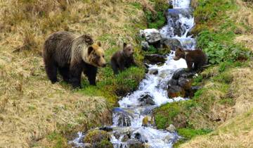
Bear watching hiking tour
- ✓ Comprehensive Tatra Mountains tour
- ✓ Expert local guides included
- ✓ All accommodation arranged
- ✓ Transportation provided
25 days
Eastern European Escapade & Splendours of Europe
- ✓ Comprehensive Tatra Mountains tour
- ✓ Expert local guides included
- ✓ All accommodation arranged
- ✓ Transportation provided
Multi-day tour packages powered by TourRadar. Prices and availability subject to change.
Introduction to High Tatras Hiking
Stretching approximately 50 kilometers along the Slovakia-Poland border, the High Tatras form the northernmost alpine range of the Carpathian Mountain system. Despite modest elevation by global standards—the highest peak Gerlachovský štít reaches 2655 meters—these mountains exhibit dramatic alpine character with 29 peaks exceeding 2500 meters, sheer rock walls rising directly from valley floors, and extensive glacial features including over 100 mountain lakes (pleso in Slovak).
The range’s geological foundation consists primarily of granite cores surrounded by limestone and dolomite periphery, creating distinctive twin-peak formations and vertical relief uncommon in lower mountains. Glaciation during Pleistocene epochs carved the characteristic U-shaped valleys, cirques, and hanging valleys that define High Tatras topography. Permanent snowfields persist in sheltered north-facing cirques though no true glaciers remain since their disappearance in the early 20th century.
Flora and fauna exhibit vertical zonation typical of mountain environments. Lower valleys (800-1500 m) support mixed forests of spruce, beech, and fir providing habitat for red deer, wild boar, and diverse bird communities. Subalpine zone (1500-1800 m) features stunted spruce and dwarf pine scrub sheltering chamois, marmots, and specialized alpine birds. Alpine zone (1800+ m) consists of grasses, sedges, and specialized flowering plants adapted to harsh conditions including endemic species found nowhere else. This biodiversity receives protection through Tatra National Park established 1949 (Slovakia) and 1954 (Poland), jointly designated UNESCO Biosphere Reserve in 1992.
Hiking infrastructure developed extensively throughout the 20th century now encompasses over 600 kilometers of marked, maintained trails color-coded by difficulty and importance. Red trails denote major routes including the Tatranská Magistrala traverse. Blue trails mark intermediate routes through valleys and to secondary peaks. Green trails indicate local connections, and yellow trails provide shortcuts and alternative route options. Trail intersections feature comprehensive signage indicating destinations, distances, and estimated hiking times enabling confident navigation even for visitors unfamiliar with the region.
Understanding Trail Classifications and Difficulty Levels
High Tatras trails employ color-coding systems that indicate route importance and general character rather than strict difficulty ratings. Red trails encompass major routes including long-distance traverses, principal valley approaches, and popular peak ascents. These routes receive most intensive maintenance and clearest signage but difficulty varies enormously—the Tatranská Magistrala red route includes both gentle valley sections and challenging high passes. Blue trails typically represent intermediate difficulty with moderate elevation gain and valley or ridge traverses. Green trails mark shorter local routes often easiest overall difficulty. Yellow trails provide connections between main routes with highly variable character.
Actual difficulty assessment requires examining specific route characteristics beyond color coding. Key factors include total distance (ranging from 2-kilometer family strolls to 20+ kilometer mountain marathons), cumulative elevation gain (from 200 meters on easy trails to 1400+ meters on peak ascents), terrain type (smooth paths versus rocky scrambling), technical features (chains, ladders, or exposed sections), and altitude (effects increase above 2000 meters). Standard hiking time estimates appear on trail signs but assume moderate pace—faster hikers complete routes quicker while families or cautious hikers require additional time.
Easy trails suitable for families and casual hikers include circuits around major lakes (Štrbské Pleso, Popradské Pleso), waterfall approaches (Hrebienok, Skok), and gentle valley walks with minimal elevation change. These routes feature wide, smooth paths, comprehensive facilities, and escape options for turning back if conditions deteriorate or fatigue sets in. Moderate trails demand good fitness and some mountain experience but remain accessible to recreational hikers including Slavkovský štít, Kôprovský štít, and various valley traverses incorporating moderate elevation gain over 4-7 hour durations.
Challenging trails require excellent fitness, mountain hiking experience, and comfort with exposure including Rysy summit, Kriváň ascent, Bystrá Lavká pass crossing, and multi-day Tatranská Magistrala traverse. These routes incorporate steep, rocky terrain, sections with chains and ladders, and total elevation gains exceeding 1000 meters. Weather vulnerability increases on high peaks where storms develop rapidly and escape routes become limited. Proper preparation including physical conditioning, appropriate equipment, weather monitoring, and honest capability assessment becomes essential for safe, enjoyable experiences on demanding routes.
Essential Trail Vocabulary and Navigation
Understanding key Slovak and Polish terminology aids trail navigation and map interpretation throughout the High Tatras. “Štít” (Slovak) or “szczyt” (Polish) means peak or summit—Gerlachovský štít translates to Gerlach Peak. “Pleso” indicates mountain lake, almost always of glacial origin. “Dolina” means valley, typically applied to major glacial valleys carved during Ice Ages. “Sedlo” refers to mountain passes or saddles connecting valleys or providing access to ridgelines. “Chata” designates mountain hut or refuge offering meals and accommodation.
“Vodopád” means waterfall, common features in steep-gradient High Tatras streams. “Potok” indicates stream or creek, while “rieka” means river though true rivers rarely exist at high elevations. Directional terms include “horný” (upper) and “dolný” (lower) distinguishing features at different elevations—Dolné Kôprovské Sedlo versus Horné Kôprovské Sedlo. Color terms appear in lake names: “zelené” (green), “biele” (white), “čierne” (black) describing water color variations depending on depth, mineral content, and algae presence.
Trail marking follows consistent standards with painted blazes on rocks, trees, and posts at regular intervals. Red blazes indicate primary routes, blue marks intermediate trails, green shows local paths, and yellow denotes connections. Standard trail signs at intersections display destinations with distances in kilometers and estimated hiking times in hours and minutes. These estimates assume moderate pace—experienced hikers often complete routes faster while less fit visitors require additional time. Arrows indicate direction, and trail closures or warnings appear on prominent notices at trailheads and major junctions.
Map reading skills enhance navigation confidence though well-marked trails reduce orientation challenges compared to wilderness areas. Topographic maps scaled 1:25,000 or 1:50,000 show terrain detail, trail locations, and facilities. Digital mapping applications including Maps.me, Mapy.cz, and specialized hiking apps provide GPS-enabled navigation though cellular coverage becomes spotty in remote valleys. Always carry paper maps as backup and familiarize yourself with route profiles before departure, noting key junctions, potential bailout points, and estimated time requirements for planning safe return before nightfall.
Classic High Tatras Summit Routes
Rysy Summit via Slovakia
Rysy (2503 m) straddles the Slovakia-Poland border, with three distinct summits of which the northwestern peak (2499 m) represents Poland’s highest point. The standard Slovak approach from Popradské Pleso trailhead involves 12.5 kilometers one-way with 1300 meters elevation gain requiring 5-6 hours ascent and 3-4 hours descent. The route follows blue blazes through Velká Studená Valley to Chata pod Rysmi mountain hut (2250 m), then red blazes for final steep section incorporating chains and metal ladders on exposed rock faces.
Trail character transitions from gentle valley approach through forests and meadows to increasingly rocky terrain above treeline. The final push from Chata pod Rysmi ascends steep scree and rock requiring scrambling skills and comfort with significant exposure—vertical drops of hundreds of meters flank narrow ridge sections. Fixed chains assist passage through most technical sections but demand sure footing and steady nerves. Summit panoramas encompass nearly 100 Tatra peaks and 12 glacial lakes, rewarding the strenuous ascent with exceptional 360-degree alpine vistas.
Optimal timing involves early morning starts (6-7 AM) allowing summit achievement before afternoon thunderstorm development typical during summer months. Crowds concentrate on this iconic peak, especially weekends, with summit platforms accommodating perhaps 20-30 people comfortably—arrive early or late to avoid peak congestion. Weather windows are critical as clouds, wind, or precipitation create dangerous conditions on exposed upper sections. Many hikers overnight at Chata pod Rysmi enabling dawn summit attempts with afternoon descent or continue to Polish side exploring Morskie Oko approaches.
Kriváň Ascent
Kriváň (2494 m) holds special significance as Slovakia’s national mountain, appearing on Euro coins and serving as powerful cultural symbol despite falling short of being the highest peak. The standard route from Tri Studničky parking area covers 15.4 kilometers round-trip with 1400 meters elevation gain requiring 7-9 hours total. Green blazes lead through forests to alpine zone, then increasingly steep rocky terrain to Krivánsky Žľab, the notoriously challenging final section ascending 200 vertical meters through loose scree and rock.
The Krivánsky Žľab section demands scrambling ability and confidence on unstable surfaces where each step must be tested before committing weight. Rockfall hazard exists when other hikers are above—maintain spacing and move deliberately to minimize loose rock dislodgement. Beyond this section, easier but still steep terrain leads to the distinctive curved summit ridge (kriváň means curved or crooked) with wooden cross marking the top. Summit views encompass the entire High Tatras range, valleys stretching toward Poprad, and on clear days, Low Tatras visible to the south.
Alternative descent routes provide loop options including traverse to Jamské Pleso lake then return via red trail, adding 1-2 hours but offering varied scenery and reduced knee impact compared to retracing ascent steps. August weekends see hundreds of hikers attempting Kriváň, creating trail congestion and erosion concerns—consider weekday visits or shoulder season timing for more solitary experiences. Many Slovak families make Kriváň ascent a coming-of-age achievement with patriotic significance beyond pure mountaineering accomplishment.
Slavkovský štít Approach
Slavkovský štít (2452 m) ranks among the most accessible High Tatras peaks above 2400 meters, following a single continuous route from Starý Smokovec valley town. The 15-kilometer round-trip with 1450 meters elevation gain requires 7-8 hours total, departing directly from town without requiring cable car access. Red and blue blazes lead through mixed forests, cross Malý Studený Valley, and ascend progressively steeper slopes to exposed rocky summit.
This route’s appeal lies in its straightforward character without technical sections—properly equipped hikers with good fitness but limited scrambling experience successfully complete the ascent. Trail conditions vary from smooth forest paths to rocky alpine terrain, but no sections require hands-on scrambling or fixed protection. Weather exposure increases significantly above treeline (approximately 1600 m) where wind and potential thunderstorms present primary hazards. Summit plateau provides 360-degree panoramas including Lomnický štít, Gerlachovský štít, and valleys extending toward Poland.
Solo hikers appreciate Slavkovský štít’s moderate challenge and reliable trail finding reducing risks associated with getting lost or requiring technical skills beyond their experience. Groups with varied fitness levels may split at Hrebienok junction where stronger hikers continue to summit while others explore lower-elevation alternatives rejoining at predetermined times. Winter ski touring also utilizes this route though avalanche assessment expertise becomes essential for safe winter travel.
Best Valley and Lake Hikes
Zelené Pleso Circuit via Cable Car
This exceptional route combines cable car efficiency with spectacular high-mountain scenery, starting from Tatranská Lomnica with gondola ascent to Skalnaté Pleso (1751 m). From the upper station, trails access Zelené Pleso (Green Lake, 1551 m) via steep descent incorporating chains through rocky sections. The glacial lake sits in a dramatic cirque surrounded by towering granite walls, with mountain refuge providing meals and refreshments beside pristine waters.
Multiple loop options exist including return via same route (shortest, 3-4 hours total), extended circuit to Veľké Biele Pleso then descent to Tatranská Lomnica (6-7 hours, more challenging), or summit attempt on Vel’ká Svišt’ovka (2037 m) from Skalnaté Pleso before descending to the lake (5-6 hours, moderate-challenging). The Vel’ká Svišt’ovka option adds 286 meters elevation gain to an already substantial descent/ascent profile but rewards effort with exceptional summit panoramas before lunch at the lakeside refuge.
This route showcases classic High Tatras landscape features including cable car engineering marvels, diverse vegetation zones from subalpine scrub to true alpine environments, glacial landforms, and wildlife habitat where chamois and marmots frequently appear. Photography opportunities abound with dramatic lighting on granite faces, reflections in lake surfaces, and foreground wildflowers framing mountain backdrops. The combination of mechanical uplift and varied terrain makes this among the most efficient high-impact mountain experiences achievable in a single day.
Popradské Pleso and Symbolic Cemetery
Popradské Pleso (1494 m) is a pristine glacial lake accessible via easy-moderate 5.5-kilometer approach from Popradské Pleso Railway station gaining 450 meters elevation. Blue-marked trail ascends through coniferous forests with moderate but sustained gradient requiring 1.5-2 hours to lakeside facilities including Hotel Popradské Pleso and mountain refuge. The scenic lake occupies a high valley basin surrounded by rocky peaks, offering classic alpine scenery with minimal technical difficulty.
The Tatranský Symbolický Cintorín (Tatra Symbolic Cemetery) sits adjacent to the lake, commemorating mountaineers and guides who perished in these mountains since the 19th century. Memorial plaques mounted on boulders honor victims of avalanches, falls, hypothermia, and other mountain hazards that continue claiming lives despite modern equipment and forecasting. This sobering reminder of mountain dangers provides context for the respect and preparation required for safe High Tatras exploration.
Extended routes continue from Popradské Pleso to Veľké Hincovo Pleso (1945 m, Slovakia’s deepest mountain lake at 54 meters) adding 3-4 hours and 450 meters elevation gain. This extension accesses more remote terrain with reduced crowds and intensified alpine character. Strong hikers combine both lakes in single 8-10 hour expeditions from railway starting points, though most visitors focus on Popradské Pleso alone as satisfying day hike with option to overnight at Hotel Popradské Pleso for dawn photography or early-start extension hikes.
Furkotská and Mlynická Valleys Loop
This challenging but spectacular circuit from Štrbské Pleso traverses two parallel valleys connected via Bystrá Lavká pass (2314 m), creating 15.9-kilometer loop with 1400 meters cumulative elevation gain requiring 6.5-7.5 hours. The route passes Skok waterfall (25 meters high, most impressive during snowmelt in June-July), climbs through Mlynická Valley to the rocky pass featuring chains and mild scrambling, then descends Furkotská Valley past multiple glacial lakes (Vyšné Furkotské Pleso, Nižné Furkotské Pleso).
Direction matters significantly—counterclockwise (Mlynická ascent, Furkotská descent) presents steeper initial climbing but easier technical sections and better pass approach visibility. Clockwise direction reverses this profile. Most hikers prefer counterclockwise despite steeper start, finding the pass crossing less intimidating when ascending rather than descending the chain-protected section. Weather monitoring is crucial as the high pass offers no escape routes once committed—afternoon thunderstorms create dangerous exposure to lightning and hypothermia risk.
This loop ranks among the High Tatras’ finest single-day circuits, showcasing diverse mountain scenery including waterfalls, multiple glacial lakes, high alpine pass, and varied vegetation zones. Wildlife sightings are common with chamois on rocky slopes, marmots in meadows, and golden eagles soaring overhead. The route’s length and elevation gain demand good fitness and mountain experience but reward preparation with comprehensive High Tatras experience encompassing the range’s most characteristic features in efficient single-day package.
Multi-Day Tatranská Magistrala Traverse
The Tatranská Magistrala represents the High Tatras’ premier long-distance route, traversing 42 kilometers of red-blazed trail from Podbanské in the Western Tatras to Ždiar or Veľké Biele Pleso in the Belianske Tatras. The classic 3-4 day itinerary connects major valleys, crosses high passes, and visits iconic lakes while staying in mountain refuges offering meals and overnight accommodation. Total elevation gain approaches 4800 meters with daily stages varying 800-1400 meters ascent depending on specific routing choices.
Standard routing begins Podbanské ascending to Chata pod Soliskom (1840 m), the first refuge positioned below Predné Solisko peak. Day two crosses Bystrá Lavká pass (2314 m) descending to Téryho chata (2015 m) via Mlynická or Furkotská valleys. Day three traverses to Zamkovského chata (1475 m) through Velká Studená Valley passing multiple waterfalls and tarns. Day four concludes at Veľké Biele Pleso with option to continue to Ždiar village or finish at Tatranská Lomnica depending on preferred endpoint.
Mountain refuge accommodations range from basic dormitory beds (€15-25 per night) to semi-private rooms (€25-40 per person) with communal bathrooms and simple washing facilities. All refuges serve meals including breakfast (€8-12), packed lunches (€8-10), and substantial dinners (€12-18) utilizing local ingredients where possible. Advance reservations are strongly recommended, especially during peak summer months (July-August) when refuges fill completely. Book 2-3 months ahead for popular dates ensuring guaranteed accommodation along the route.
Weather window requirements span 3-4 consecutive days of reasonably stable conditions—attempting the Magistrala during unsettled periods risks dangerous exposure on high passes with limited escape options. Late June through early September provides most reliable weather though afternoon thunderstorm potential remains throughout summer. Early September often delivers finest conditions combining stable weather, autumn colors, fewer crowds, and reduced afternoon storm probability. Snow lingers on high passes into late June some years while early October occasionally brings first winter storms closing high-elevation routes prematurely.
Family-Friendly Hiking Options
The High Tatras accommodate family hiking through numerous easy trails suitable for children ages 5-12 with basic fitness and hiking experience. Štrbské Pleso lake circuit (3.2 km, flat, 45 minutes) provides scenic introduction to alpine environments with comprehensive facilities, benches for rests, and escape options at any point. The paved path circles the glacial lake at 1346 meters elevation, passing information panels explaining local ecology and geology while offering mountain panoramas across the water.
Hrebienok waterfall trail from Starý Smokovec combines gentle forest approach with spectacular cascades tumbling through rocky gorge. The 6.6-kilometer round-trip with 350 meters elevation gain requires 2.5-3 hours including exploration time at the waterfall viewpoints and Hrebienok alpine meadow. Funicular railway provides uplift option reducing walking to waterfall exploration only (30 minutes round-trip from upper station). This flexibility allows adaptation to children’s energy levels and weather conditions while ensuring positive mountain experiences building confidence for future hikes.
Jamské Pleso approach from Tri Studničky parking offers flat valley trail through flower-filled meadows reaching pristine glacial lake in 4 kilometers (2 hours round-trip). The shaded forest path remains cool during summer heat, crosses streams on wooden bridges, and provides multiple rest spots with views toward surrounding peaks. Lake shore exploration adds interest with rock-skipping opportunities, picnic locations, and wildlife spotting possibilities including ground squirrels and diverse bird species. This trail demonstrates that alpine beauty doesn’t require summit ascents or technical challenges.
For families with teenagers possessing good fitness, moderate routes including Slavkovský štít, Popradské Pleso, or Skalnaté Pleso to Zelené Pleso offer stepping stones toward more challenging mountain experiences. Ensure children are properly equipped with sturdy footwear, layered clothing, adequate food and water, and understand mountain safety basics including staying together, following trail markings, and respecting weather warnings. Building gradually from easy to moderate routes develops skills and confidence supporting safe progression to challenging terrain as young hikers mature.
Wildlife Observation While Hiking
The High Tatras support remarkable wildlife diversity with mammals ranging from brown bears and wolves to endemic Tatra chamois and alpine marmots. While large predators remain elusive requiring specialized viewing expeditions, other species appear regularly to observant hikers. Tatra chamois (Rupicapra rupicapra tatrica), a critically endangered endemic subspecies numbering approximately 1000 individuals, inhabit rocky slopes and cliff faces above 1800 meters. Morning and evening provide optimal viewing as chamois descend to alpine meadows for feeding, though midday finds them resting on precipitous ledges inaccessible to predators.
Alpine marmots populate meadows and talus fields between 1600-2400 meters, particularly abundant near mountain refuges including Téryho chata, Zamkovského chata, and Chata pod Rysmi. These charismatic rodents are highly social, living in family colonies with sophisticated alarm call systems warning of approaching predators. Distinctive whistling pierces mountain silence when marmots detect hikers, followed by rapid retreat to burrow systems. Patient observation from respectful distances allows watching resumed surface activity and natural behaviors including feeding, play, and social grooming.
Red deer inhabit lower elevation forests and valley bottoms, with autumn rutting season (September-October) producing spectacular displays as stags compete for breeding rights. Thunderous bellowing echoes through valleys during dawn and dusk when deer are most active. Roe deer appear in forest margins and clearings, smaller and more solitary than red deer. Both species are wary requiring quiet, patient approaches for successful observation. Early morning hikers encounter deer before human activity drives them to daytime resting locations.
Birdlife encompasses over 110 species including golden eagles soaring on thermals above ridgelines, wallcreepers displaying distinctive wing patterns on cliff faces, and diverse forest songbirds in valley woodlands. Specialized alpine species including alpine accentor, water pipit, and snowfinch inhabit environments above treeline. Spring and early summer provide peak activity as breeding birds sing territorial songs and raise young. Autumn migration brings additional species passing through mountain corridors between breeding grounds and wintering areas.
Mountain Safety and Emergency Procedures
Mountain environments present inherent hazards requiring preparation, appropriate equipment, and sound decision-making for safe travel. Weather volatility represents the primary concern—conditions change rapidly with afternoon thunderstorms developing frequently during summer months. Morning starts provide safest timing, allowing summit achievement and descent before typical storm initiation periods (1-4 PM). Monitor forecasts via tanap.org or local sources but recognize that mountain weather defies precise prediction requiring flexibility and conservative decision-making.
Lightning poses severe danger on exposed ridges and summits where humans become tallest objects during electrical storms. If caught in lightning proximity, descend immediately from exposed positions, avoid metal fixtures including chains and cables, stay away from solitary trees, and crouch low if escape isn’t possible. Count seconds between lightning flash and thunder, dividing by three to estimate distance in kilometers—when this number reaches five or less, danger is immediate requiring fastest possible descent to safer terrain.
Injury scenarios including ankle sprains, knee injuries, and falls require self-rescue capabilities or emergency assistance. Carry basic first aid including bandages, pain relievers, and blister treatment. Mobile phone coverage exists in major valleys and many ridge locations enabling emergency calls to 112 (universal European emergency number) or direct mountain rescue (Horská záchranná služba) coordination. However, remote locations lack coverage necessitating contingency planning including hiking with partners, informing others of planned routes and return times, and carrying emergency shelter and extra food for potential overnight bivouacs.
Navigation errors account for many incidents requiring rescue operations. While well-marked trails reduce orientation challenges, fog, darkness, or snow obscure trail markings creating disorientation risk. Carry detailed maps, compass, and charged mobile devices with downloaded offline maps. Learn basic map reading and compass navigation providing backup when electronic devices fail or conditions prevent trail visibility. Starting hikes early provides buffer time allowing route completion before nightfall—headlamps extend safe travel only marginally and should represent emergency equipment rather than planned sunset hiking strategy.
Seasonal Hiking Considerations
Official hiking season operates mid-June through mid-October corresponding with trail opening dates following winter closure. November 1 through June 15 sees most trails closed for winter protection, avalanche safety, and wildlife habitat protection during sensitive denning and breeding periods. Specific opening dates vary by elevation and exposure with lower trails sometimes accessible earlier while high passes remain snow-covered into July.
Early season (June-early July) presents challenges and opportunities. Snowfields persist on high passes and north-facing slopes requiring ice axe and crampons for safe crossing, though experienced mountaineers equipped appropriately access terrain unavailable later. Stream crossings run high from snowmelt creating ford difficulties or impassable conditions. Wildflower displays peak during this period with alpine meadows exploding in color as snow recedes. Crowds remain minimal before European summer holidays begin late July, providing solitary experiences on typically busy trails.
Peak summer (mid-July through August) delivers most stable weather with warmest temperatures, longest daylight hours, and fully accessible trail networks. However, popularity increases correspondingly with weekends seeing hundreds of hikers on classic routes like Rysy and Kriváň. Afternoon thunderstorm frequency peaks during this period requiring early morning starts and flexible attitudes toward turnarounds if weather deteriorates. Accommodation and cable cars operate full schedules eliminating concerns about limited services affecting logistics.
Autumn (September-October) provides perhaps ideal hiking conditions combining stable weather windows, autumn foliage color, reduced crowds post-Labor Day, and wildlife activity as animals prepare for winter. Cooler temperatures make sustained uphill hiking more comfortable while requiring additional clothing layers for summit stops. Days shorten noticeably through September into October, necessitating earlier starts to ensure daylight completion. First winter storms can arrive unexpectedly late September or early October, closing trails prematurely—monitor conditions closely and maintain flexible itineraries allowing route modifications based on current weather.
Mountain Hut System and Overnight Options
Mountain refuges (chaty) scattered throughout the High Tatras provide meals, overnight accommodation, and emergency shelter for hikers. These facilities range from basic unheated structures offering simple dormitory beds to full-service establishments with semi-private rooms, hot showers, and comprehensive dining. Most operate June through late September with a few extending into October depending on weather. Winter openings are very limited except near ski resorts maintaining year-round operation.
Accommodation types include open dormitories (matracové ložiská) with mattress pads in communal rooms sleeping 10-40 people (€15-20 per person), regular dormitories with beds sleeping 4-8 per room (€20-30 per person), and semi-private rooms with 2-4 beds (€30-50 per person). Bedding is typically provided though sleeping bag liners are recommended for hygiene. Bathroom facilities are communal with basic washing stations—hot showers exist at larger refuges for additional fees (€2-5). Generator or solar power provides limited electricity primarily for lighting and kitchen operations.
Meal services include breakfast buffets or set menus (€8-12), packed lunches for trail days (€8-10), and hearty dinners featuring Slovak specialties including goulash, dumplings, and sheep cheese dishes (€12-18). Refuges maintain stocked bars offering beer, wine, spirits, and soft drinks at prices reflecting remote locations and pack-in logistics. Some facilities sell basic supplies like chocolate, trail snacks, and hygiene items but selections are minimal—carry all necessary personal items rather than depending on refuge stocks.
Reservations are essential during peak season (July-August) when refuges fill completely weeks or months in advance. Book directly via refuge websites or phone contacts listed on tanap.org, providing specific dates, number of people, and accommodation preferences. Cancellation policies vary but typically allow refunds with several days’ notice. Walk-up accommodation becomes possible during shoulder seasons or weekday periods but represents gamble that could derail multi-day trek plans if refuges are full. Emergency shelter provisions exist but shouldn’t be relied upon for planned stays.
Transportation and Trailhead Access
The Tatra Electric Railway (Tatranská elektrická železnica, TEŽ) provides primary transportation throughout the Slovak High Tatras connecting valley towns from Poprad to Štrbské Pleso. Three distinct lines (blue, red, green) interconnect at key junctions enabling comprehensive access to major trailheads, mountain towns, and tourist facilities. Trains operate approximately hourly from early morning (5-6 AM) through late evening (10-11 PM) with increased frequency during peak summer periods. Day passes (€8-10) allow unlimited travel, representing economical option for hikers accessing multiple trailheads or exploring different valley areas.
Cable cars and gondola lifts provide mechanical access to high-elevation starting points, dramatically reducing approach hiking and enabling rapid access to alpine zones. The Tatranská Lomnica to Skalnaté Pleso gondola rises from 850 m to 1751 m in 15 minutes (€16 one-way, €20 round-trip), providing direct access to Zelené Pleso trails and Vel’ká Svišt’ovka routes. Štrbské Pleso to Chata pod Soliskom cable car eliminates 500 meters climbing (€12 one-way, €15 round-trip). These lifts operate June-September plus limited winter seasons, with exact dates varying annually based on snow conditions and maintenance schedules.
Personal vehicles offer flexibility for accessing remote trailheads and exploring beyond railway-served areas. Parking exists at major access points including Tri Studničky (Kriváň trailhead), Tatranská Lomnica, Starý Smokovec, and Štrbské Pleso. However, lots fill early during peak season—arrival before 8 AM virtually guarantees parking while 10 AM frequently finds lots full with overflow parking prohibited due to narrow mountain roads. Parking fees range €5-10 per day depending on location. Consider railway transportation during high season avoiding parking frustrations and contributing to sustainable access limiting road traffic in national park zones.
Cross-border hiking between Slovakia and Poland requires passport or national ID cards as international frontier traverses occur on several routes including Rysy summit. Border posts no longer exist following Schengen Area implementation but legal requirements for identification remain. Polish access via Zakopane provides alternative approaches to northern High Tatras routes, though most classic trails concentrate on the Slovak side where higher peaks and more extensive infrastructure exist.
Equipment and Gear Recommendations
Footwear represents the single most important equipment decision for High Tatras hiking. Sturdy hiking boots with ankle support, aggressive tread, and waterproof construction suit the majority of trails where rocky terrain, potentially muddy conditions, and stream crossings create demands beyond trail running shoe capabilities. Breaking in new boots before extended mountain hiking prevents blisters and hot spots during critical routes. For easy, well-maintained trails in dry conditions, trail runners provide adequate protection with reduced weight and increased comfort on long approaches.
Clothing systems should follow layering principles allowing adaptation to changing mountain conditions. Base layers that wick moisture away from skin (merino wool or synthetic, never cotton) provide foundation. Mid-layers offer insulation through fleece, synthetic, or lightweight down depending on temperature expectations. Outer shell protection against wind and rain is mandatory—Gore-Tex or equivalent waterproof-breathable fabrics in both jacket and pants ensure protection during inevitable precipitation. Pack extra warm layer even on warm morning starts as summit temperatures drop 10-15°C below valley conditions and weather deteriorates unpredictably.
Navigation tools include detailed topographic maps (1:25,000 or 1:50,000 scale), compass, and charged mobile devices with downloaded offline maps. While trail marking is generally excellent, fog, darkness, or snow can obscure blazes creating disorientation risk. GPS-enabled apps like Maps.me, Mapy.cz, or specialized hiking platforms provide real-time position verification though battery conservation becomes critical during multi-day trips. Paper maps remain essential backup when electronics fail or conditions prevent screen visibility.
Safety and emergency equipment encompasses first aid kit (bandages, pain relievers, blister treatment, personal medications), headlamp with extra batteries, emergency shelter (space blanket or bivy sack), firestarter, whistle for signaling, and sufficient food and water with margin for unexpected delays. Trekking poles assist balance on steep descents, reduce knee strain during sustained downhills, and provide bear deterrent functionality in unlikely close encounters. Sun protection including sunglasses, sunscreen, and hat prevents burns at altitude where UV intensity increases. Mobile phones enable emergency calls in most areas though coverage gaps exist in remote valleys.
Trail Etiquette and Leave No Trace Principles
High Tatras hiking regulations prohibit off-trail travel except under certified guide supervision, protecting sensitive alpine vegetation requiring decades for recovery from trampling damage. Stay on marked trails even when muddy or snow-covered rather than creating parallel tracks widening erosion impact. Switchback shortcutting accelerates soil erosion and damages fragile plant communities—follow trails completely including all zigzag sections designed to minimize grade and environmental impact.
Waste management requires packing out all trash including food wrappers, tissues, and biodegradable items like fruit peels and cores. While organic waste eventually decomposes, the process takes months in cool alpine environments attracting wildlife and creating unsightly litter in the interim. Use established toilet facilities at trailheads, mountain refuges, and designated sites. In emergencies requiring backcountry sanitation, dig cat holes 15+ centimeters deep at least 60 meters from water sources, trails, and campsites. Pack out toilet paper or burn it completely rather than leaving partially burned fragments visible along trails.
Wildlife observation maintains respectful distances avoiding stress or behavioral disruption. Never feed animals directly or indirectly through food scraps, as habituation to human provisions creates dangerous situations requiring animal removal. Observe nesting birds from distance sufficient to prevent flushing parents from nests exposing eggs or chicks to predators and weather. Report all bear sightings to park authorities contributing to population monitoring and safety management. Photograph wildlife using telephoto lenses rather than approaching for closer shots disturbing natural behaviors.
Group hiking balances social enjoyment with environmental consideration. Large groups (10+ people) create trail crowding, noise impacts on wildlife and other visitors, and increased erosion and vegetation damage. Consider splitting larger parties into smaller subgroups hiking separated by time and space. Maintain reasonable voice levels appreciating mountain silence rather than broadcasting conversations audible hundreds of meters away. Yield trail to uphill hikers who face greater physical demands and momentum interruption costs. Greet passing hikers with standard Slovak “Ahoj” or “Dobrý deň” acknowledging shared mountain experiences.
Photography Tips for High Tatras Landscapes
High Tatras landscape photography benefits from wide-angle lenses (16-35mm full-frame equivalent) capturing sweeping mountain vistas, glacial lakes with peak reflections, and dramatic valley perspectives. Telephoto lenses (70-200mm or longer) isolate distant peaks, compress depth creating layered mountain scenes, and photograph wildlife from respectful distances. Standard zoom lenses (24-70mm) provide versatility for general hiking photography balancing weight considerations against focal length flexibility.
Golden hour lighting (first hour after sunrise, last hour before sunset) delivers warm color temperatures enhancing rock faces, emphasizing texture through low-angle illumination, and creating dramatic shadows defining three-dimensional landscape forms. Morning light typically offers clearer atmospheric conditions than evening as valley haze accumulates throughout the day. However, afternoon lighting provides warmth absent in cooler morning tones. Weather-related lighting including storm approaching, cloud breaks spotlighting peaks, and post-storm clearing produces dramatic moods transcending perfect blue-sky conditions.
Composition techniques specific to mountain landscapes include using foreground elements (wildflowers, rocks, alpine vegetation) creating depth and scale reference for distant peaks appearing closer and more imposing. Leading lines from trails, stream courses, or ridgelines draw viewer eyes into scenes establishing visual flow. Include sky proportionally—rule of thirds suggests dedicating two-thirds to landscape, one-third to sky for landscapes, or reversing ratio when dramatic clouds dominate. Reflections in glacial lakes double visual impact when winds calm creating mirror surfaces best achieved during morning or evening stable atmospheric periods.
Technical settings for sharp landscape images employ small apertures (f/11 to f/16) maximizing depth of field from foreground to background elements. Tripods enable slower shutter speeds at small apertures maintaining low ISO for minimal noise and maximum dynamic range. Polarizing filters enhance sky saturation, reduce reflections, and increase color saturation in vegetation and rock. Graduated neutral density filters balance exposure between bright skies and darker foregrounds, though modern camera dynamic range and post-processing increasingly replicate this function digitally.
Best Hiking Maps and Digital Resources
The definitive printed map for High Tatras hiking is the VKU (Vojenský Kartografický Ústav, Military Cartographic Institute) Vysoké Tatry map at 1:25,000 scale showing comprehensive trail networks, terrain contours, elevation points, refuges, and facilities. This waterproof, tear-resistant map covers the entire Slovak High Tatras with sufficient detail for confident navigation on any marked trail. Purchase at tourist information centers in Tatranská Lomnica, Starý Smokovec, and Štrbské Pleso or online through Slovak outdoor retailers with international shipping.
Digital mapping platforms provide GPS-enabled navigation with real-time position tracking. Mapy.cz offers excellent Czech and Slovak coverage with detailed topographic information, trail marking, and facility locations. The platform works offline with pre-downloaded map regions, essential given spotty cellular coverage in mountain valleys. Maps.me provides worldwide offline mapping including comprehensive High Tatras trail coverage with user-contributed trail conditions, photos, and tips. Both applications are free with optional premium features for enhanced functionality.
AllTrails features extensive user-generated trail descriptions, photos, and recent condition reports for High Tatras routes. While coverage focuses primarily on popular trails, the community-contributed condition updates provide valuable real-time information about snow levels, stream crossings, and trail hazards that official sources update less frequently. Downloading tracks enables offline GPS navigation though map detail doesn’t match dedicated topographic platforms.
Official Tatra National Park website (tanap.org) provides authoritative information on trail closures, weather forecasts specific to mountain areas, refuge contact details and operational status, and regulations affecting hiking activities. English language sections cover essential information though Slovak language pages contain more comprehensive detail. Check this resource before finalizing hiking plans ensuring routes are open and conditions are suitable for planned activities.
Cultural and Historical Context
The High Tatras have attracted mountaineers, scientists, and tourists since the 19th century when European alpine tourism expanded from Western Alps to Eastern European ranges. Early explorers documented flora, fauna, and geology while establishing first ascent records on major peaks. The development of mountain huts, marked trails, and guidebooks transformed remote wilderness into accessible recreation destination while maintaining wilderness character through careful management and conservation-focused development.
Traditional Górale culture developed in mountain valleys surrounding the Tatras, with distinctive customs, architecture, and economic activities based on seasonal pastoralism. Wooden houses with characteristic decorative elements, sheep cheese (bryndza) production, and folk traditions persist in villages including Ždiar and Zuberec. Understanding this cultural heritage enriches hiking experiences beyond pure physical accomplishment, connecting contemporary outdoor recreation to centuries of human interaction with mountain landscapes.
National identity significance varies between Slovakia and Poland regarding the High Tatras. For Slovakia, these mountains represent the nation’s tallest peaks and most dramatic natural landscapes, appearing on currency and serving as powerful symbols of national character. Kriváň specifically holds sacred status linked to 19th-century national awakening movements. Poland claims Rysy as its highest peak, though the majority of High Tatras terrain lies in Slovakia. This shared natural heritage contributes to bilateral cooperation on conservation and tourism management initiatives.
Environmental protection evolved from early 20th-century conservation advocacy to formal national park designation (1949 Slovakia, 1954 Poland) and eventually UNESCO Biosphere Reserve status (1992). Current management balances recreation access with ecosystem protection, implementing regulations like trail restrictions, permit requirements for certain peaks, and seasonal closures protecting sensitive areas. Hikers contribute to conservation success by following regulations, practicing leave-no-trace principles, and supporting park protection initiatives through visitor fees and voluntary contributions.
Frequently Asked Questions
When are High Tatras hiking trails open?
Official hiking season runs from mid-June through mid-October, with trails closed November 1 through June 15 for winter protection, avalanche safety, and wildlife habitat conservation. Specific opening dates vary by elevation and exposure—lower trails sometimes accessible earlier while high passes remain snow-covered into early July. Check tanap.org for current trail status and seasonal opening announcements. Some valleys remain accessible year-round for cross-country skiing and snowshoeing though summer hiking trails are officially closed and avalanche hazard assessment expertise becomes essential for safe winter travel.
Do I need to pay entrance fees for Tatra National Park?
No entrance fees or permits are required for hiking on marked trails within Tatra National Park Slovakia. The park operates under free public access principles funded through national government support rather than visitor fees. However, parking at trailheads costs €5-10 per day, cable car and gondola rides require ticket purchases (€12-25 depending on route), and mountain refuge accommodations and meals involve standard commercial pricing. Polish Tatra National Park charges small entrance fees (approximately €2-3 per person) collected at major access points.
Can I wild camp in the High Tatras?
Wild camping is strictly prohibited throughout Tatra National Park Slovakia under national park regulations protecting sensitive alpine ecosystems. Overnight stays are only permitted at designated mountain refuges (chaty) offering commercial accommodation. Violations can result in significant fines. Emergency bivouacs are tolerated when weather or injury prevents safe descent, but deliberately planning to wild camp violates regulations. Polish Tatra National Park maintains similar restrictions. Plan itineraries using mountain refuge accommodations, which provide excellent infrastructure for multi-day treks while supporting conservation-focused park management.
What is the best time of day to start High Tatras summit hikes?
Early morning starts (6-7 AM) provide optimal timing for summit ascents, allowing achievement of high elevations before afternoon thunderstorm development typical during summer months. Morning atmospheric conditions are generally clearer with better visibility and photography lighting. Starting early provides buffer time for route completion before nightfall, essential safety margin if pace proves slower than expected or unexpected challenges arise. Popular routes like Rysy and Kriváň see hundreds of hikers on summer weekends—early starts avoid crowds and secure parking at trailheads that fill by 9-10 AM.
How difficult is High Tatras hiking compared to the Alps?
High Tatras hiking difficulty ranges from easy family walks to challenging alpine routes comparable to moderate-difficulty Alps trails. While maximum elevations are lower (2655 m versus 4000+ m Alps peaks), the Tatras compress similar elevation gain into shorter horizontal distances creating steep, sustained climbing. Technical sections on routes like Rysy, Kriváň, and Bystrá Lavká pass require scrambling ability and comfort with exposure similar to via ferrata routes in Alps. However, the Tatras lack true glaciated terrain and extreme altitude effects present on higher Alps peaks. Overall, fit hikers with Alps experience find High Tatras very accessible while those new to alpine hiking discover authentic mountain challenges in more forgiving scale.
What wildlife hazards exist while hiking the High Tatras?
Brown bears inhabit the High Tatras though encounters on marked trails are extremely rare as bears generally avoid human activity. Make noise on approach hikes alerting bears to your presence, avoiding surprising them at close range. Never approach bears even if they appear habituated, store food in sealed containers, and pack out all trash preventing food conditioning. Ticks carrying Lyme disease and tick-borne encephalitis are present in forests and meadows June-September—use insect repellent, wear long pants, and conduct thorough body checks after hiking. Vipers occur in rocky, sunny locations though bites are rare and seldom life-threatening. General mountain hazards including weather, lightning, rockfall, and trail injuries present greater statistical risks than wildlife encounters.
Can I hike High Tatras trails alone safely?
Solo hiking is legal and common on High Tatras marked trails, though safety considerations require careful assessment. Well-marked popular routes including Štrbské Pleso circuits, Popradské Pleso approaches, and major summit trails see numerous other hikers providing implicit safety through nearby assistance if problems arise. Remote valley trails and off-season hiking present greater risks from limited other users and potential hours before assistance arrives if injury occurs. Solo hikers should inform others of planned routes and return times, carry emergency equipment including first aid and shelter, possess solid navigation skills, and maintain conservative decision-making regarding weather and route difficulty. Many experienced mountain travelers prefer solo hiking for personal challenge and solitude but recognize increased self-reliance requirements.
What High Tatras routes are suitable for trail running?
Many High Tatras trails accommodate trail running for fit runners comfortable with mountain terrain. Valley approaches including routes to Popradské Pleso, Štrbské Pleso circuits, and forest sections provide smooth, runnable surfaces ideal for mountain running. More technical summit routes like Rysy, Kriváň, and Slavkovský štít are runnable on descent for experienced mountain runners though ascent sections are typically hiked due to steep grades and rocky terrain. Tatra trail running races occur annually showcasing range’s running potential. However, steep grades, rocky surfaces, and elevation gain make High Tatras significantly more challenging than lowland trail running requiring specific mountain running fitness and technical comfort navigating uneven terrain at speed.
How crowded are High Tatras hiking trails?
Crowd levels vary dramatically by season, day of week, and specific trail. Peak summer weekends (late July-August) on popular routes including Rysy, Kriváň, and major cable car accessed trails see hundreds of hikers creating traffic jams on narrow sections and crowded summits. Midweek summer hiking reduces crowds substantially with many trails feeling relatively uncrowded despite peak season timing. Shoulder season months (June, September-October) and less popular routes maintain peaceful character even weekends. Strategic planning targeting weekday hiking, early morning starts, and lesser-known alternatives to classic summit routes provides solitude even during high season periods. Overall, High Tatras are significantly less crowded than comparable Alps locations though popular routes experience heavy use during peak periods.
What rescue services exist if I have problems while hiking?
Mountain rescue (Horská záchranná služba, HZS) provides professional emergency response throughout the High Tatras accessible via universal European emergency number 112 or direct contact through mountain refuges. Rescue teams are highly trained, well-equipped, and experienced in High Tatras terrain. However, response times in remote valleys can extend several hours requiring self-sufficiency in first aid and emergency shelter. Rescue operations may involve significant costs for non-EU visitors without reciprocal emergency services agreements—comprehensive travel insurance including mountain rescue and medical evacuation is strongly recommended. Prevention through proper preparation, conservative decision-making, and hiking within capabilities represents best approach to mountain safety rather than reliance on rescue services.