
Peloponnese Without the Crowds: A Curated Guide to Greece’s Best-Kept Cultural Secret
The Peloponnese is the peninsula that changed the world — birthplace of the Olympic Games, cradle of Mycenaean civilisation, heartland of Byzantine art, and stage for some of antiquity’s most consequential events — yet it receives only a fraction of the visitors who funnel through Athens or scatter across the Aegean islands. This guide cuts past the postcard circuit to reveal the landscapes, ruins, medieval cities, and living traditions that make the southern peninsula the most rewarding corner of Greece for the traveller willing to steer their own course.
Key Takeaways
- Four UNESCO World Heritage Sites in one peninsula: Olympia, Mystras, the Sanctuary of Asklepios at Epidaurus, and the Temple of Apollo Epicurius at Bassae all sit within the Peloponnese, yet visitor numbers at each remain a fraction of what comparable sites in Italy or France attract.
- Mystras is the most underrated archaeological site in Greece: The Byzantine ghost city near Sparta preserves 13th–15th century frescoes of extraordinary quality in situ, in church after church, with almost no queues and no guided-tour crowds.
- The Mani Peninsula is culturally unlike anywhere else in Europe: Its medieval tower-house villages, stark limestone landscapes, and fiercely independent cultural identity survived Ottoman domination largely intact, producing an atmosphere that feels genuinely remote even today.
- Nafplio is Greece’s most elegant small city: The former first capital of the modern Greek state packs Venetian architecture, two superb fortresses, a fine archaeological museum, and an unhurried café culture into a walkable old town of exceptional beauty.
- A hire car is the key to unlocking the Peloponnese: The peninsula’s greatest rewards — mountain villages, coastal hideaways, isolated temples — are inaccessible by tour bus and only adequately served by public transport in the main corridors. Self-drive travel transforms the experience entirely.
- The interior is almost entirely undiscovered: Arcadia’s gorges, Byzantine monasteries, and silversmithing villages attract a trickle of visitors compared to the coastal sites, offering cultural depth and dramatic landscape in equal measure with virtually no competition for your attention.
People Also Ask About the Peloponnese
What makes the Peloponnese different from other parts of Greece?
The Peloponnese is the only part of Greece that encompasses every major layer of Greek history — Mycenaean Bronze Age palaces, classical temples, Hellenistic theatres, Roman cities, Byzantine ghost towns, Frankish castles, Venetian fortresses, and Ottoman mosques — in a single land-connected region. Unlike the islands, which offer a narrower palette of experience, or Athens, which is dominated by a single iconic hilltop, the Peloponnese rewards slow travel across dramatically varied terrain: coastal plains, mountain gorges, fertile valleys, and a jagged southern coastline that fingers into three peninsulas. Its cultural density per kilometre is unmatched in Greece, and tourism infrastructure remains light enough that genuine discovery still feels possible.
Which sites in the Peloponnese have UNESCO World Heritage status?
The Peloponnese is home to four UNESCO World Heritage Sites. Ancient Olympia, in the western Peloponnese, was inscribed as the birthplace of the Olympic Games and the religious sanctuary of Zeus, containing the remains of the Temple of Zeus and the original stadium. The Byzantine city of Mystras, near Sparta in Laconia, was inscribed for its extraordinary collection of medieval palaces, churches, and fortifications. The Sanctuary of Asklepios at Epidaurus, in the Argolid, was inscribed for the Theatre of Epidaurus and the ancient healing complex surrounding it. The Temple of Apollo Epicurius at Bassae, isolated in the mountains of Arcadia, was inscribed as one of the earliest examples of the Corinthian order and a masterwork of classical architecture.
What is the most underrated place to visit in the Peloponnese?
Mystras consistently surprises visitors who have not encountered it before. Set on the slope of Mount Taygetos above modern Sparta, this deserted medieval city was the last significant Byzantine capital before the fall of Constantinople and produced some of the most accomplished fresco painting of the 14th and 15th centuries. Churches including the Pantanassa, the Perivleptos, and the Metropolis retain their painted interiors almost intact, with barely a handful of other visitors present on most mornings. Alongside Mystras, the deep Mani village of Vathia and the cliff-girt medieval town of Monemvasia rank among Greece’s most compelling experiences — both almost entirely absent from mainstream travel itineraries.
How do you travel around the Peloponnese independently?
A hire car is the single most effective way to explore the Peloponnese. The peninsula’s road network connects all major sites and most villages; driving distances between key destinations are manageable — Nafplio to Epidaurus takes under an hour, Nafplio to Mystras under two hours. The national coach network (KTEL) links major towns and some archaeological sites, but schedules are infrequent and services to the Mani, Bassae, and interior Arcadia are minimal. The Proastiakos suburban railway connects Athens to Corinth, and a scenic narrow-gauge line once ran further south but has ceased regular operation. For maximum flexibility across the varied terrain of the peninsula, hire a car at Athens airport or in Nafplio for the duration of your stay.
Extended multi-day tours – 5+ days
Featured Peloponnese Islands Multi-Day Tour Packages
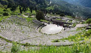
3 days
Epidaurus, Mycenae, Olympia and Delphi Three Days Tour from Athens
- ✓ Comprehensive Peloponnese Islands tour
- ✓ Expert local guides included
- ✓ All accommodation arranged
- ✓ Transportation provided
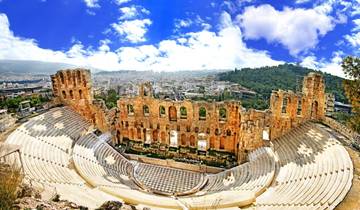
5 days
Athens, Delphi & Greek Islands By Cruise – 5 Days
- ✓ Comprehensive Peloponnese Islands tour
- ✓ Expert local guides included
- ✓ All accommodation arranged
- ✓ Transportation provided
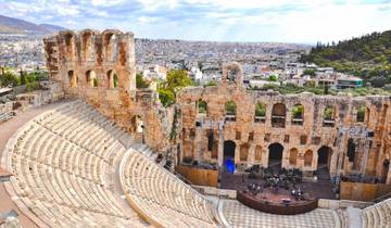
5 days
Discovery of Athens, Argolis & Delphi – 5 Days
- ✓ Comprehensive Peloponnese Islands tour
- ✓ Expert local guides included
- ✓ All accommodation arranged
- ✓ Transportation provided
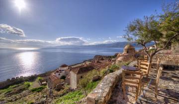
8 days
Paradisial Peloponnese | Semi-Private 8-Day Guided Tour
- ✓ Comprehensive Peloponnese Islands tour
- ✓ Expert local guides included
- ✓ All accommodation arranged
- ✓ Transportation provided
Multi-day tour packages powered by TourRadar. Prices and availability subject to change.
Introduction: Why the Peloponnese Remains Greece’s Most Underestimated Region
There is something almost perverse about the Peloponnese’s position in the imagination of travellers. This is the peninsula where Agamemnon ruled at Mycenae, where the first Olympic Games were held at Olympia in 776 BC, where Sparta produced its warrior culture, where Byzantine civilisation made its last stand at Mystras, and where the modern Greek state was born after the War of Independence of the 1820s. Its coastline is studded with Venetian fortresses. Its mountains hide monasteries carved into cliff faces. Its villages produce olive oil, wine, and cheeses of extraordinary quality. And yet the Peloponnese remains the Greece that most visitors overlook.
The explanation is partly geographic. Separated from the Greek mainland by the narrow Corinth Canal since 1893, and before that by the shallow isthmus that ancient Greeks crossed on the paved Diolkos trackway, the Peloponnese sits just far enough off the beaten path that travellers on limited time choose Athens and the islands instead. The famous Greek island infrastructure — the ferry network, the whitewashed villages, the sunset-watching industry — has no equivalent here. What the Peloponnese offers instead is something rarer: depth.
The peninsula divides into distinct regional personalities. The Argolid in the northeast is the most visited corner, anchored by the elegant town of Nafplio and the great Bronze Age sites of Mycenae and Tiryns, along with the theatrical perfection of Epidaurus. To the west lies the lush valley of the Eurotas and the UNESCO city of Mystras. The deep south fractures into three fingers — the Mani at the centre, Laconia to the east with Monemvasia on its coast, and the more gentle Messinian peninsula to the west with the Bay of Navarino. Inland, Arcadia lives up to its mythological reputation as a place of wild, beautiful landscape, with the Lousios Gorge slicing through its heart and mountain villages perched on limestone ridges. The northwest holds Olympia, set in a broad agricultural valley that still grows olives and grapes in the shadow of ancient altars.
Each of these regions deserves more than a day-trip. The traveller who allocates ten days to the Peloponnese and moves through it unhurriedly — stopping in villages, eating in local tavernas, visiting sites at opening time before tour buses arrive — will find that this corner of Greece consistently exceeds expectation. What follows is a curated journey through its most compelling places, with particular attention to the experiences that lie beyond the standard circuit.
Mystras: The Byzantine Ghost City That Time Forgot
Mystras is the single greatest archaeological surprise in Greece for visitors who encounter it without preparation. Set on the steep slope of Mount Taygetos three kilometres northwest of modern Sparta, this fortified Byzantine city was founded by the Frankish prince Guillaume II de Villehardouin in 1249 and became the capital of the Despotate of the Morea — effectively the last cultural flowering of Byzantine civilisation — from the 14th century until its surrender to the Ottomans in 1460. It was abandoned in the 19th century when the town of Sparta was re-established on the plain below, and the ruins it left behind constitute one of the most complete medieval ghost cities in Europe.
What makes Mystras exceptional is not the architecture alone, though the layered remains of palaces, monasteries, churches, towers, and domestic buildings are genuinely impressive. It is the frescoes. In church after church, on walls and vaults and apses, the painted programmes of the 14th and 15th centuries survive in a state of relative preservation that would be remarkable anywhere. At Mystras, with almost no climate control, no visitor management infrastructure, and light filtering through the original windows onto surfaces that have stood untouched for six centuries, encountering these images — the elongated saints, the gold-haloed Christs, the luminous Virgins — has an immediacy that no museum reproduction can replicate.
The Painted Churches of Mystras
The Metropolis, the oldest church in Mystras and the place where the last Byzantine emperor Constantine XI Palaiologos was crowned in 1449, contains frescoes across multiple campaigns of decoration. Its small museum preserves carved marble fragments and the double-headed eagle floor slab that marks the spot of the coronation. The Perivleptos Monastery, tucked into a rock ledge in the lower town, has the most complete decorative programme: its barrel vault retains a painted Heaven of extraordinary vibrancy, with a Christ Pantocrator at the apex surrounded by ranks of saints and prophets in deep blues, ochres, and vermilions. The Pantanassa Convent, still inhabited by a small community of nuns, is the only active religious institution within the ruined city. Its frescoes from the 15th century show the influence of Italian Renaissance painting beginning to permeate Byzantine tradition — elongated figures with an unusual naturalism, architectural backgrounds of perspectival complexity — and the church’s exterior, with its Gothic rose window set in a Byzantine-style campanile, embodies the cultural hybridity that defined the late Despotate period.
The Palace of the Despots
The Palace of the Despots occupies the upper town, a complex of halls, ceremonial rooms, and residential wings built across multiple centuries beginning in the 13th. The largest hall, the Palatial Hall added in the early 15th century, is one of the most significant secular Gothic structures in Greece, with a row of pointed-arch windows across its facade that look out over the valley of the Eurotas far below. The restoration work ongoing in the palace has rendered some areas inaccessible at various periods, but the scale of the complex — and the view it commands — communicates clearly the ambition of the Despot’s court that held this hilltop while Constantinople was already crumbling.
Practical Notes for Visiting Mystras
Mystras has two entrance gates — the lower gate near the Metropolis and the upper gate near the castle — and the site slopes steeply enough that the conventional wisdom is to enter at the upper gate, walk down through the palace and upper town, and exit through the lower gate. The site is large enough and the paths uneven enough that comfortable footwear is essential; the surface is mostly cobblestone and bare rock. Visit as early as possible. By mid-morning in season, small guided groups begin arriving; the site in the first hour after opening belongs almost entirely to independent visitors.
Ancient Olympia: Sacred Ground Beyond the Tourist Trail
Ancient Olympia is one of the most famous archaeological sites in the world, and that fame brings consequences. In peak summer, organised tours from Katakolon cruise port descend on the site in waves, compressing the experience into a hurried circuit. The solution is timing: arrive at the site when it opens, ideally on a day when no cruise ships are docked at Katakolon, and the sanctuary of Zeus reveals itself at something approaching its true scale and gravitas.
The site sits at the junction of the Alpheios and Kladeos rivers in the western Peloponnese, sheltered in a broad, green valley that would have seemed genuinely sacred to the ancient Greeks — lush with plane trees and pines, with the ancient mound of Kronos Hill rising behind the Altis precinct. The Games held here every four years from 776 BC until their suppression by the Christian emperor Theodosius I in 393 AD were not athletic entertainment in the modern sense. They were a religious festival in honour of Zeus, surrounded by sacrifices, processions, and political diplomacy, with pan-Hellenic significance that temporarily suspended warfare between rival city-states.
The Altis and the Temple of Zeus
The sacred precinct of the Altis centres on the Temple of Zeus, built between 472 and 456 BC and considered by ancient Greeks among the finest buildings of the classical world. The temple itself no longer stands — an earthquake in the 6th century AD brought its columns down like dominoes, and they lie where they fell, a forest of enormous drum sections laid end to end across the grass. The sheer diameter of these drums — each over two metres wide, and there are seventeen per column — conveys the scale of the original structure more powerfully than any reconstruction drawing. Inside the cella stood one of the Seven Wonders of the Ancient World: the chryselephantine statue of Zeus by Pheidias, approximately twelve metres high. The statue is gone, destroyed in antiquity, but Pheidias’s workshop has been excavated immediately east of the temple and is visitable. Among its finds: a small cup with the inscription “I belong to Pheidias” in Greek.
The Archaeological Museum of Olympia
The museum at Olympia is among the finest in Greece and deserves more time than most visitors give it. Its centrepiece is the sculptural programme from the Temple of Zeus — the east pediment depicting the chariot race between Pelops and Oenomaus, the west pediment showing the battle between Lapiths and Centaurs, and the twelve metopes depicting the Labours of Hercules. These are original 5th-century BC sculptures, still bearing traces of their original painted surfaces under ultraviolet light, and their quality is equal to anything in the Athenian Acropolis Museum or the British Museum. The museum also holds the Hermes of Praxiteles, a marble original of the 4th century BC found in the Heraion and one of the most celebrated sculptures of antiquity. The terracotta head of the cult statue of Hera, the bronze head of a boxer, and the hundreds of dedicatory bronzes — tripods, figurines, weapons — dedicated at Olympia over twelve centuries of use speak to the site’s accumulated sacred charge.
The Stadium and the Valley of the Alpheios
The stadium at Olympia is entered through the original stone-vaulted tunnel, the krypte, that athletes and officials used in antiquity. The experience of walking through that tunnel and emerging into the stadium — its starting and finishing stones still in place, the embankments that held 45,000 spectators still rising on either side — is one of the most powerful encounters with antiquity available anywhere in Greece. Beyond the official site, the valley of the Alpheios offers walking trails through riverside vegetation to the Hill of Kronos, which gives excellent views over the Altis and the surrounding landscape, and to the scattered remains of the gymnasium, palaestra, and the Greek and Roman baths that served the athletes and pilgrims.
Nafplio: Greece’s First Capital and Most Elegant Town
Nafplio holds a unique position in modern Greek history: it was the first capital of the newly independent Greek state from 1828 to 1834, before the capital was moved to Athens. In those six years it served as the stage for the turbulent politics of the early republic, including the assassination of the first president, Ioannis Kapodistrias, on the steps of the Church of Agios Spyridon in 1831. The history hangs lightly now over a town that has evolved into one of the most gracious places in Greece to simply be — eating, drinking, walking the harbour, and using it as a base for the extraordinary concentration of sites in the surrounding Argolid.
The old town occupies a small peninsula projecting into the Argolic Gulf. Its street grid is largely Venetian — the Venetians held the town from 1388 to 1540 and again from 1686 to 1715 — with neoclassical buildings added during the capital period overlaying the earlier fabric. The result is an architectural harmony unusual in Greece, with ochre-and-terracotta facades, arched doorways, balconies dripping with bougainvillea, and a series of small plateia that function as outdoor living rooms for the townspeople.
Palamidi Fortress
The Palamidi fortress crowns the rock above the town at 216 metres, reached by either 999 steps (the traditional count, though estimates vary) or a winding road from the eastern edge of the old town. Built by the Venetians between 1711 and 1714 and completed just two years before the Ottomans retook it without a fight in 1715, Palamidi is an outstanding example of Venetian military engineering: a series of self-contained bastions spread across the summit plateau, each capable of independent defence, connected by curtain walls and linked by internal stairways cut into the rock. The view from the summit encompasses the entire Argolic Gulf, the hills of the Argolid, and — on clear days — the distant mountains of the central Peloponnese. Climb in the early morning and the entire fortress belongs to you for the first hour.
The Archaeological Museum and the Town’s Layers
The Archaeological Museum of Nafplio occupies the Venetian arsenal on Syntagma Square, a building of institutional solidity whose thick-walled rooms now house finds from Neolithic, Mycenaean, Geometric, and classical sites across the Argolid. Its most singular exhibit is the only surviving complete Mycenaean suit of armour, the Dendra panoply, dating to the 15th century BC: a full set of bronze plate armour found in a chamber tomb at Dendra near Midea, assembled and displayed in a posture of extraordinary presence. The museum’s collection of Mycenaean pottery, Neolithic terracottas, and bronze weapons is of high quality and requires no specialist knowledge to appreciate.
The town rewards the kind of aimless walking that reveals cities incrementally. The covered market, the Venetian fountain on the main square, the mosques converted into secular buildings, the early 19th-century buildings associated with the capital years, and the Ottoman tower that stands incongruously in one of the side streets all speak to Nafplio’s layered history. Walk the waterfront promenade in the late afternoon and the town exhibits the easy sociability that makes it such a natural base for a Peloponnese stay.
The Sanctuary of Asklepios at Epidaurus: Perfect Acoustics and Sacred Healing
Epidaurus is famous for its theatre — the best-preserved ancient theatre in the world, with acoustics so precise that a coin dropped on the orchestra floor is audible in the uppermost tier of seats. But the site is far more than a theatrical landmark. The Sanctuary of Asklepios at Epidaurus was the most important healing sanctuary in the ancient Greek world, drawing pilgrims from across the Mediterranean to seek cures through ritual incubation, bathing, exercise, and the interpretive power of the god of medicine’s priests. The full sanctuary complex — temple, tholos rotunda, abaton incubation hall, stadium, gymnasium, and the banqueting facilities for thousands of pilgrims — extends well beyond the theatre into the surrounding valley.
The Theatre of Epidaurus
The theatre was built in the 4th century BC, almost certainly by the architect Polykleitos the Younger, and enlarged in the 2nd century BC to its current capacity of approximately 14,000 spectators in 55 tiers. Its preservation owes partly to the fact that it was buried under sediment for centuries and only excavated in the late 19th century, which protected the limestone seats from both human spoliation and weathering. Standing in the orchestra circle and speaking in a normal voice is a genuine acoustic experiment: the geometry of the theatron amplifies and clarifies sound without echo or distortion across the full auditorium. The phenomenon is not folklore — acoustic engineers have studied the theatre and attributed its quality to the mathematical precision of the seating geometry and to the limestone’s sound-filtering properties that suppress low-frequency noise. Each summer the Athens and Epidaurus Festival brings performances of ancient drama to the theatre under the open sky, and attending a production here — in the original building, with the stars overhead and the cicadas momentarily silent — is one of the great experiences available in Greece.
The Tholos of Epidaurus
The tholos, a circular building with concentric colonnades built in the mid-4th century BC, is one of the most enigmatic structures in ancient Greece. Its purpose remains debated — theories range from a treasury to a labyrinthine pit used in healing ritual, possibly housing sacred snakes — but its architectural ambition is clear. The building’s architect, Polykleitos the Younger, worked on it for decades and used it as a showcase for technical experimentation: the innermost colonnade was built in the Corinthian order, one of its earliest appearances in Greek architecture. The tholos has been partially reconstructed to show its design, and its carved details — acanthus capitals, coffered ceilings, marble floor — can be studied in the excellent on-site museum.
The Museum at Epidaurus
The site museum houses the architectural fragments from the sanctuary’s major buildings, including restored sections of the tholos ceiling and carved capitals from the Temple of Asklepios. More evocative, perhaps, are the inscribed stelae recording miraculous cures attributed to the god: stone tablets on which the sanctuary’s priests catalogued the ailments pilgrims arrived with and the treatments and outcomes that followed. The cases are vivid — paralysis cured overnight during ritual sleep, a woman pregnant for five years finally delivering after incubation in the abaton — and read as a window into both ancient medicine and ancient belief simultaneously.
The Mani Peninsula: Europe’s Last Frontier
The Mani is the central of the three southern peninsulas of the Peloponnese, and it is unlike anywhere else in Europe. For centuries, the Maniots — descendants of ancient Spartans in their own estimation, though historians are more cautious — maintained an independence so fierce that neither Byzantine emperor, Frankish prince, nor Ottoman sultan successfully subjugated them. They governed themselves by clan, built tower houses to defend against both external enemies and rival families, and developed a culture of vendetta, honour, lamentation, and hard subsistence that shaped their settlements as visibly as any external architectural influence. The result is a landscape that looks, in its extreme southern reaches, genuinely unlike anything else: a bare limestone peninsula with no trees, towers rising from every village, and the sea present on all sides in a particular shade of deep blue.
The Deep Mani: Towers, Villages, and the Edge of Greece
The Deep Mani (Exo Mani begins north of Areopolis; the Mesa Mani extends from Areopolis to Cape Tenaro at the peninsula’s tip) is the defining Mani experience. The villages of Vathia, Kitta, Nomia, Lagia, and a dozen others cluster on the ridges of the bare limestone, their tower houses — some reaching eight storeys — competing in height as they once competed in firepower. Vathia, visible from the road on its exposed ridge, is the most photographed Mani village: a cluster of towers in varying states of preservation against a sky that seems impossibly blue. Most of its houses are empty or converted to holiday accommodation. Walking through Vathia in the early morning, before the tourist minibuses from Gytheio arrive, gives access to an atmospheric ruin that wears its abandonment with genuine dignity.
Cape Tenaro (ancient Tainaron) at the peninsula’s southernmost point was, in Greek mythology, one of the entrances to the Underworld. Menelaos is said to have sailed from here with Paris on the voyage that led to the Trojan War; Herakles descended into Hades through this cape to capture Cerberus. The actual cape is reached by a rough path past the remains of a Roman harbour settlement and a Byzantine chapel built inside the remains of a Poseidon temple, ending at a lighthouse on a spit of grey rock surrounded by open water. It is the southernmost point of the Greek mainland and, at 36 degrees north latitude, the most southerly point in mainland Europe outside the Iberian Peninsula. Standing here, with the Mediterranean stretching uninterrupted to the African coast, the sense of arrival at an edge is genuine.
Areopolis and the Gateway to the Deep Mani
Areopolis, named for Ares the god of war in recognition of the region’s martial reputation, is the largest settlement in the Deep Mani and the natural base for exploring it. The town is itself a good example of Mani architecture in miniature: a grid of stone streets, tower houses along the main plateia, a cathedral of Agios Taxiarchis with relief carvings mixing Byzantine iconographic tradition with folk imagery of extraordinary energy — soldiers, animals, and saints rendered in a naive but powerful style. The towers along the main street have been converted to accommodation and shops while retaining their form, giving Areopolis an odd functional medievalism. The caves of Diros, accessible by boat through a flooded subterranean river system, lie a few kilometres south of Areopolis and constitute one of the great geological spectacles of Greece: a cave system of stalactites and stalagmites reflected in still underground water, toured by flat-bottomed boat for nearly a kilometre.
The Exo Mani: Churches, Olives, and Byzantine Frescoes
The outer Mani, between Kalamata and Areopolis, is greener and less severe than the deep south, its lower slopes covered in olive groves, its villages less dramatically fortified, its pace more relaxed. What it shares with the deeper peninsula is an extraordinary concentration of small Byzantine churches, often unlocked, often frescoed, dating from the 10th to the 14th centuries. The Peloponnese as a whole has hundreds of Byzantine village churches of this type — the local preservation society has catalogued well over a thousand — but the outer Mani’s examples are particularly well-maintained and frequently signposted. Stopping at a roadside chapel, finding it unlocked, and entering to find the vault covered in medieval painted saints is a common experience in this part of the peninsula that requires no planning and no crowds.
Monemvasia: The Medieval City on Its Rock
Monemvasia translates as “single entrance” — the narrow causeway connecting its massive rock to the Laconian coast is the only access point, which is why the fortified city on and around the rock withstood sieges that defeated almost everything else in medieval Greece. First settled in the 6th century AD by mainland Greeks fleeing Slavic incursions, Monemvasia grew into an important Byzantine port, producing a sweet wine — Malmsey, mentioned by Shakespeare in Richard III — that was traded across Europe. The Venetians, Ottomans, and Byzantines fought over it repeatedly. Today, the lower town within the rock’s walls is a small, inhabited medieval city, its Byzantine and Venetian buildings restored and converted to accommodation, restaurants, and a handful of shops selling local wine and honey, while the upper town above the walls is a more extensive ruin open to walkers.
The Lower Town of Monemvasia
Walking through the single gate into the lower town of Monemvasia is one of the most atmospheric arrivals in Greece. The cobbled main street winds between buildings of golden limestone, passing restored Byzantine houses, a Venetian loggia, a mosque converted to an exhibition space, and the Cathedral of Christos Elkomenos — a 13th-century Byzantine church whose icon of Christ in chains is one of the most venerated in the region. The lower town is small enough to explore completely in two hours and varied enough to reward a longer stay. The seaward walls drop sheer into deep water; swimming from the rocks below the walls in the afternoon light, with the medieval skyline above, is among the more surreal pleasures available in the Peloponnese.
The Upper Town and Agia Sofia
A steep path from the lower town climbs to the upper city, once the more densely inhabited part of Monemvasia before its gradual abandonment. The ruins here are more extensive and less restored than the lower town, with collapsed walls, overgrown courtyards, and the occasional intact cistern giving a powerful impression of the city’s former size. At the highest point of the upper town, commanding views in every direction, the 12th-century Church of Agia Sofia stands alone and intact: a domed Byzantine church set on the cliff edge, its design reminiscent of the Daphni monastery near Athens, its position on the rock’s summit giving it the quality of an apparition. The view from the church’s terrace — down onto the lower town’s rooftops, across to the Laconian coast, and out to open sea — justifies the climb entirely.
The Temple of Apollo Epicurius at Bassae: A Mountain Pilgrimage
Bassae is the most isolated of the Peloponnese’s major ancient sites, and that isolation is part of its meaning. The Temple of Apollo Epicurius sits at 1,131 metres above sea level in the mountains of Arcadia, on a ridge above a valley named Bassae, accessible by a mountain road from Andritsaina that winds through oak and fir forest before emerging onto a bare plateau where the temple stands inside a large protective tent. The tent, erected in the 1980s to protect the structure during ongoing conservation work, is an aesthetically unfortunate but practically essential solution: the marble of the temple’s cella walls was deteriorating rapidly under the combination of mountain weather and frost. Under the tent, the temple retains its character entirely.
Apollo Epicurius and the Architecture of the Temple
The temple was designed by Iktinos — the same architect credited with the Parthenon — and built in the second half of the 5th century BC by the people of Phigalia in gratitude for Apollo’s protection during a plague, according to Pausanias. It is oriented roughly north-south rather than the conventional east-west, an anomaly scholars have debated for centuries without definitive resolution. Its architectural significance is enormous: it contains the earliest known use of the Corinthian capital in Greek architecture, in the engaged column that stood at the centre of the cella, and its interior colonnade arrangement — with Ionic columns placed transversely to the main axis rather than running along it — is unlike any other surviving Greek temple. The temple’s carved frieze, removed by the British during the early 19th century, is now in the British Museum; the absence of the frieze is regularly cited as one of the more significant depletions of Greek architectural heritage.
The Experience of Bassae
Bassae rewards the journey with an encounter that is genuinely different from the better-known sites. Visitor numbers are low enough that the temple can often be studied in near-solitude. The mountain landscape surrounding it — distant peaks, forested valleys, complete absence of modern development — corresponds closely to the original sacred context in which the temple was built. Ancient Greeks chose their sanctuary sites with deliberate attention to landscape: the relationship between building and terrain was part of the temple’s religious meaning. At Bassae, that relationship survives intact in a way that Olympia, surrounded by its modern village and car parks, cannot quite replicate. The drive through Arcadia to reach it — passing through Andritsaina, a mountain town of Ottoman-era wooden buildings and a famous 18th-century library — is itself a destination.
Ancient Corinth and the Acrocorinth
Ancient Corinth occupies a position in Greek history disproportionate to the modest scale of its surviving ruins. It was one of the wealthiest cities of classical Greece, controlling the Isthmus of Corinth and therefore the trade between the Ionian and Aegean seas, and its commercial sophistication gave it a cosmopolitan, morally complex reputation that Paul of Tarsus addressed directly in two of his most famous epistles. The Roman colony established by Julius Caesar in 44 BC overlies much of the earlier Greek city, and it is largely Roman Corinth that archaeologists have uncovered since the late 19th century: the forum, the lechaion road, the covered shops (tabernae), and the remains of public buildings that reflect the city’s status as the capital of the Roman province of Achaia.
The Temple of Apollo and the Archaeological Site
Seven columns of the Archaic Temple of Apollo, built around 540 BC and among the oldest surviving Doric columns in Greece, still stand above the Roman forum. Their scale — each monolithic column stands over six metres high and more than 1.8 metres in diameter — and their position above the excavated Roman streets give the site its defining image. The archaeological museum at Ancient Corinth is excellent, containing sculpture, mosaics, and finds from both the Greek and Roman cities, including the striking mosaic floor from the Roman villa known as the House of Dionysos and a series of painted terracotta roof tiles from the Archaic period that retain their original polychrome decoration.
The Acrocorinth
Rising 575 metres above the ancient city on a sheer-sided rock, the Acrocorinth is one of the great natural fortresses of the ancient Mediterranean, and one of the most stratified in terms of human occupation. The Archaic Greeks used it as a sanctuary of Aphrodite, served according to ancient sources by temple prostitutes — a claim scholars now treat with considerable scepticism. Macedonians, Romans, Byzantines, Franks, Venetians, and Ottomans all recognised its strategic value and left their building traces: the current fortification walls are a palimpsest of all these periods, with Byzantine towers reinforced by Frankish stonework capped by Ottoman additions. The summit plateau is large enough to have contained a city, and the ruins of cisterns, walls, towers, and a mosque that has been partially converted back to a church give the site a disorienting layering. The view from the summit is extraordinary: north to the Gulf of Corinth, east across the Saronic Gulf toward Athens, south across the Argolid toward Mycenae, west toward the mountains of the western Peloponnese. On a clear winter day, the panorama extends to Parnassus.
The Corinth Canal
The Corinth Canal, cutting through the isthmus to connect the Gulf of Corinth with the Saronic Gulf, is one of the great engineering achievements of the 19th century, completed in 1893 after eleven years of construction. It is four miles long, 24 metres wide at water level, and 90 metres deep in its central section, with sheer walls of white limestone rising from the water. Its scale is best appreciated from the road bridge over its narrowest point, which gives a vertiginous view straight down into the channel. In antiquity, the Diolkos — a paved slipway used to haul ships on wheeled cradles across the four-mile isthmus to avoid the dangerous voyage around the Peloponnese — served the same purpose, and sections of it are still visible near the western end of the canal. The canal itself is navigable for small and medium vessels, and cruise ships do occasionally transit it, a spectacular passage watched from the bridges by crowds who gather specifically for the spectacle.
Arcadia: The Mythic Interior
Arcadia is Greece’s most mythologised interior landscape. From the Renaissance pastoral tradition that identified it as a paradise of innocent nature, to the ancient Greek belief that it was the home of Pan and the oldest inhabited land on earth (its people, the Arkades, were said to predate the moon), Arcadia has accumulated a symbolic weight that its actual geography of mountain ranges, oak and fir forests, deep gorges, and stone villages simultaneously supports and quietly subverts. The reality is better than the myth: a region of exceptional natural beauty, genuine cultural depth, and almost no tourist infrastructure, where the traveller with a hire car and sufficient time can wander for days without encountering another foreigner.
The Lousios Gorge
The Lousios Gorge, cut by the Lousios river through the central Arcadian mountains, is one of the most dramatic landscapes in Greece and the location of several monasteries of extraordinary character. The river drops 400 metres over approximately 25 kilometres, cutting a gorge 300 metres deep in places, with sheer limestone walls clothed in plane trees and fir. Two monasteries cling to cliff faces above the gorge: the Nea Moni of Philosophou, a 17th-century foundation built on a narrow ledge with its church walls formed partly by the cliff face itself, and the Palaia Moni of Philosophou, older and more ruined, accessible only by a steep path. The ancient site of Gortys, a sanctuary of Asklepios that predates Epidaurus in some traditions and contains the remains of a round tholos temple, stands in the gorge floor near a Roman bath complex. Walking the gorge trail from Dimitsana to Stemnitsa, approximately nine kilometres, passes all of these sites and ranks among the finest day walks in the Peloponnese.
Dimitsana and Stemnitsa
Dimitsana and Stemnitsa, the two principal villages of the upper Lousios valley, represent traditional Arcadian mountain life at its most intact. Dimitsana was the site of a gunpowder mill that supplied the Greek forces during the War of Independence — an open-air museum at the edge of the village reconstructs the hydraulic mills, tanneries, and powder works that made it strategically significant. Its library, founded in the 18th century by a local bishop, contains a collection of rare manuscripts and early printed books housed in a neoclassical building that would not be out of place in Athens. Stemnitsa, five kilometres south, is the capital of a silversmithing tradition that has produced goldsmiths and jewellers since at least the Byzantine period. The town’s small folklore museum preserves tools, costumes, and examples of local metalwork, and several workshops still operate.
Ancient Mantineia and the Arcadian Plain
The ancient city of Mantineia, on the broad agricultural plain north of Tripolis, was the site of two of the most consequential battles of classical Greek history: Mantineia in 418 BC, where Sparta defeated an Argive-Athenian coalition, and the Battle of Mantineia in 362 BC, where the Theban general Epaminondas won a decisive victory but was fatally wounded, ending the brief period of Theban hegemony. The archaeological remains are modest but evocative — the circuit of the city walls, roughly circular and still standing to considerable height in places, encloses a large field of wildflowers and grazing sheep through which excavated remains protrude. The site is unfenced and free to enter, visited almost exclusively by specialists. Beside it stands a small early 20th-century church built by a Greek-American benefactor in a fantasy Byzantine-classical style that is architecturally peculiar and emotionally direct in the way of outsider buildings.
The Argolid: Mycenae, Tiryns, and the Bronze Age
The Argolid contains the greatest concentration of Bronze Age remains in Greece outside of Crete. Mycenae and Tiryns, both UNESCO World Heritage Sites, dominated the eastern Mediterranean during the Late Bronze Age (1600–1100 BC) and produced the material culture — gold masks, palace frescoes, shaft grave wealth — that gave the Homeric poems their physical setting. Both sites are well known and regularly visited, but they reward careful attention in ways that the hurried tour-bus visit obscures.
Mycenae: The Lion Gate and the Shaft Graves
Mycenae commands a ridge between two peaks on the edge of the Argive plain, its citadel walls built of stone blocks so large that later Greeks, unable to imagine human workers moving them, attributed the construction to the Cyclopes. The Lion Gate — the main entrance to the citadel, with its carved lintel relief of two lions flanking a column that is one of the earliest large-scale sculptural works in Europe — retains a power that no photograph prepares you for. Within the citadel, the grave circle that Schliemann excavated in 1876, finding the gold masks that he telegraphed to the Greek king as proof that he had “gazed upon the face of Agamemnon,” is a depression in the earth ringed by stone stelae. The treasure itself is in Athens, in the National Archaeological Museum, but the site conveys its significance through sheer physical presence: this is where the ruling dynasty of the most powerful Bronze Age state in mainland Greece buried its dead in the 16th century BC.
Tiryns and the Walls of the Cyclopes
Tiryns, on the Argive plain below Nafplio, is consistently undervisited relative to its importance and fascination. Its citadel walls are the most impressive surviving example of Cyclopean masonry in Greece — stone blocks weighing up to fifteen tonnes fitted together without mortar, with covered galleries tunnelled through the wall thickness that are still intact and walkable. Heinrich Schliemann, who excavated Tiryns between 1876 and 1885, found the palace’s megaron hall with a circular hearth and remnants of fresco decoration comparable to that at Knossos. The fresco fragments are now in the Nafplio museum. The site today stands in a flat field surrounded by orange groves, with almost no visitor infrastructure and often only a handful of visitors at any given time, giving it a quality of unmediated encounter with the Bronze Age that the better-resourced Mycenae cannot quite achieve.
The Laconian Coast: Gytheio, Leonidio, and Elafonisos
The Laconian coast runs south from Sparta’s river valley to the cape of Maleas, with a character defined by the contrast between the wild mountain interior and the intensely blue sea. It is one of the least developed coastlines in Greece proper, its small towns and villages connected by roads that climb and descend dramatically between headlands.
Gytheio: The Port Town and Cranae Island
Gytheio is the port town of Laconia, connected to the Mani peninsula to the west and to the valley of Sparta to the north. It is a genuinely pleasant working town with a 19th-century neoclassical waterfront, a harbour full of fishing boats, and a handful of good fish tavernas that make it a natural stopping point between the Mani and the north. Just off the harbour, connected by a short causeway, lies the islet of Cranae — in mythology the place where Paris and Helen spent their first night after eloping from Sparta. A lighthouse and an 18th-century tower house stand on the islet now, and walking around its perimeter path takes twenty minutes and offers good views back to the town.
Leonidio and the Tsakonian Culture
Leonidio, on the eastern Laconian coast below the massive red cliffs of the Parnonas massif, is the centre of the Tsakonian-speaking community — the last group of Greeks who speak a dialect descended directly from ancient Doric Greek rather than from the Byzantine koine that underlies modern Greek. Tsakonian is a language of extraordinary historical interest: it preserves phonological and lexical features that disappeared from all other Greek dialects during the Hellenistic period and is now spoken by only a few hundred people, almost all elderly. The town below the cliffs is pleasant and unhurried, with a folk museum documenting Tsakonian culture and costume, and the rocky coastline below it is dramatic and largely undeveloped.
Elafonisos: The Island of Simos Beach
The island of Elafonisos, separated from the southeastern Laconian coast by a shallow channel crossed in minutes by a small ferry, is famous among Greek travellers for Simos Beach: a double bay of pale sand backed by dunes and juniper trees that is considered by many Greeks to be among the finest beaches in the entire country. The water is extremely clear and shallow, the colour ranging from turquoise to deep blue depending on time of day and light angle, and the beach’s orientation means it catches light throughout the afternoon. The island village has tavernas and simple accommodation; the ferry from the mainland runs frequently in summer and occasionally in winter. Visiting on a weekday in late September, after the peak season, gives access to a beach of considerable beauty with almost no company.
Pylos, Nestor’s Palace, and the Bay of Navarino
The western coast of the Peloponnese, the Messinian shore, holds several sites of historical depth that are visited less than their significance warrants. Pylos sits on the edge of the Bay of Navarino, one of the finest natural harbours in the Mediterranean, where in 1827 a combined British, French, and Russian fleet destroyed the Ottoman-Egyptian fleet in the Battle of Navarino, effectively deciding Greek independence. The bay is enclosed by the long island of Sphakteria, famous from a different battle — in 425 BC, Athenian forces trapped a Spartan hoplite force on the island during the Peloponnesian War, forcing an unprecedented surrender that shocked the Greek world.
The Palace of Nestor
A few kilometres northeast of Pylos, the Palace of Nestor is the best-preserved Bronze Age Mycenaean palace in Greece. Unlike Mycenae, which sits dramatically on a citadel, and Tiryns, which is defined by its walls, Nestor’s palace is notable for its internal arrangements: the plan of the megaron hall, its flanking storerooms, its administrative archives (including Linear B tablets that were being fired, inadvertently, when the palace burned around 1180 BC), and its bathroom with a painted terracotta bathtub still in situ. The site is covered by a modern protective roof, which helps preservation and somewhat compromises atmosphere, but the quality of the interpretive information and the physical remains together provide a vivid picture of Mycenaean palace life. The associated museum in Chora is outstanding, recently renovated, and contains the palace’s Linear B tablets, gold and ivory finds, and a section on the history of decipherment that is one of the most intellectually engaging exhibits in any Greek regional museum.
Food, Wine, and Living Culture in the Peloponnese
The Peloponnese produces some of Greece’s finest agricultural products, and eating here is an integral part of understanding the region. The connection between landscape, climate, and food culture is direct and tasted in every meal.
Kalamata Olives and Laconian Olive Oil
The Kalamata olive — dark-purple, almond-shaped, cured in brine or red wine vinegar — takes its name from the city on the Messenian coast and is grown throughout the southwestern Peloponnese. The olive groves are everywhere: ancient trees with hollowed trunks, new plantings of more productive varieties, the nets laid under them each autumn for harvest. Laconian olive oil, from the Mani and the southern Peloponnese, is produced primarily from the Koroneiki variety and carries a Protected Designation of Origin; it is intensely flavoured, peppery, and high in polyphenols. In local tavernas and supermarkets, buying oil pressed from identifiable local estates gives a direct connection to one of the region’s defining products.
The Wines of Nemea and Mantinia
The Peloponnese is the most important wine-producing region in Greece. The Nemea PDO, in the northeastern Peloponnese southwest of Corinth, produces red wines from the Agiorgitiko grape — a variety capable of producing everything from light, fruity reds to deep, age-worthy bottles of genuine complexity. The estate wineries of the Nemea valley, most of which receive visitors for tastings, include some of the most respected producers in Greece, and a wine tour through the valley during harvest (September-October) is a rewarding addition to an Argolid itinerary. The Mantinia PDO, in the high-altitude basin around Tripolis, produces white and rosé wines from the Moschofilero grape — aromatic, high-acid, with distinctive floral and citrus character — that pair particularly well with the seafood of the Laconian coast.
Local Specialities and Taverna Culture
The Peloponnese has its own culinary identity distinct from Athens or the islands. In Mani, pork products — spiced sausages, cured cuts hung in the open air, pork cooked with orange peel — dominate in ways that reflect the peninsula’s isolation from Ottoman food culture. In the Argolid, the proximity of the sea means seafood is central: fresh grilled fish, seafood pasta, and sea urchin roe served simply on bread are standard in coastal tavernas. The interior of Arcadia and Laconia produces lamb and kid cooked on the spit or braised with wild herbs, and a range of wild greens (horta) — boiled or sautéed with olive oil and lemon — that appear as accompaniments in almost every meal. Eating in a village taverna in the Mani or Arcadia, where the menu is determined by what the kitchen has rather than what a printed card offers, and the clientele is entirely local, is an experience that situates the food in its cultural context in a way no urban restaurant can replicate.
Photography and Visual Storytelling in the Peloponnese
The Peloponnese is among the most photographically rewarding regions in the Mediterranean, with a density of visual subjects — ancient ruins in landscape settings, Byzantine frescoes in natural light, medieval tower villages against limestone hills, coastal fortresses above blue water — that rewards dedicated attention.
The Light of the Peloponnese
The quality of light on the Greek mainland differs from that of the islands: warmer, less bleached, with longer golden hours at dawn and dusk that are particularly flattering to stone architecture. The best light at Mystras falls in the two hours after sunrise, when raking light catches the textures of the ruined walls and the painted surfaces of the churches are illuminated without the harsh shadows of midday. At Monemvasia, the early morning light from the east catches the town’s golden stone and gives the lower town’s narrow streets a luminosity that disappears by mid-morning. At the Temple of Bassae, afternoon light under the protective tent creates a dramatic chiaroscuro effect on the Doric columns that photographs very differently from the flat overcast light of the mountain mornings.
Interior Photography in the Byzantine Churches
Photographing the frescoes of Mystras and the Byzantine village churches requires sensitivity to low light conditions and to the fragility of what is being documented. No flash photography is permitted inside Mystras’s churches, and even where flash is technically allowed elsewhere, the damage caused by repeated illumination of aged painted surfaces is well documented. A camera capable of performing well at ISO 3200-6400, and a steady hand or compact tripod where permitted, makes the difference between a record shot and an image that does justice to the quality of medieval painting. Visiting churches early in the day, before tour groups arrive, gives longer windows of exclusive access and, in morning light from east-facing windows, sometimes the closest equivalent to the lighting conditions the original artists worked under.
The Mani Landscape
The visual character of the deep Mani — the bare limestone ridges, the towers, the absence of trees, the particular blue of the sea — is most powerfully rendered in the bright midday light that photographers conventionally avoid. The harshness of the noon sun suits the harshness of the landscape; the towers of Vathia photographed against a cloudless sky in June have an appropriately uncompromising quality. Dawn and dusk in the Mani, when the towers cast long shadows and the sea changes colour, add a different dimension — more melancholy, more Romantic in the 19th-century sense — and the presence of both qualities in one location makes it genuinely versatile for extended photographic work.
Practical Guidance for Independent Exploration
The Peloponnese is straightforward to travel independently provided you approach it with the right tools and realistic expectations about its infrastructure.
Getting Around
A hire car is the single most important practical decision for a Peloponnese trip. Pick it up at Athens airport on arrival, drive across the Corinth Bridge (or through the channel in the event of roadworks), and you immediately have access to the full peninsula. Petrol stations are present in all towns and most large villages; in the deep Mani, carry a full tank. Road surfaces across the main routes are good; on mountain roads to Bassae, Arcadian villages, and cape roads in the Mani they become narrow and switchback-heavy. The GPS coverage is reliable on all major roads. Parking at archaeological sites is free and straightforward outside peak summer. If you are based in Nafplio and plan day trips within the Argolid — Mycenae, Epidaurus, Tiryns, the Argolid coast — public buses from Nafplio’s bus station serve all these destinations adequately, though services to some sites are once or twice daily and require planning.
When to Visit
The Peloponnese divides clearly into seasons. May and June offer the combination of warm temperatures, long days, spring wildflowers, and relatively manageable visitor numbers that make them the most pleasurable months for archaeological sites and walking. July and August are hot — particularly in the lowland sites like Ancient Corinth and Olympia, where shade is limited — and bring the highest visitor numbers, though even at peak the Peloponnese is quieter than Athens or the famous Aegean islands. September is excellent: sea temperatures at their warmest, summer crowds receding, harvest season under way in the olive groves and vineyards. October and November are cooler and sometimes rainy but offer remarkable atmospheric conditions at the ruined sites — mist in the valleys below Mystras, dramatic skies over the Mani — and zero crowds at almost every destination. The Epidaurus Festival performances take place in July and August; advance booking for these is advisable.
Where to Base Yourself
The choice of base depends on which part of the Peloponnese you prioritise. Nafplio is the finest base for the Argolid — Mycenae, Tiryns, Epidaurus — and offers the best accommodation range, restaurant quality, and evening atmosphere in the peninsula. For the Mani, Areopolis and the tower house hotels around it place you in the middle of the deep peninsula, though Gytheio to the east is also viable. For Mystras and the Laconian interior, the modern city of Sparta is functional if unglamorous; there is a limited but improving choice of accommodation in the Mystras village itself, directly below the site. For Arcadia, Stemnitsa and Dimitsana both have small hotels or guesthouses of good quality that serve the gorge-walking and village-exploring circuit. For the western Peloponnese, the town of Kyparissia or the resort area around Pylos are the practical options for Bassae and Nestor’s Palace access.
Timing Site Visits
All major archaeological sites in the Peloponnese open at 8:00 AM in summer (often 9:00 AM in the off-season). Arriving at opening time at Mystras, Olympia, and the Mani tower villages invariably provides the best experience: morning light, cool temperatures, and a window before organised groups arrive. Midday at major sites in July and August is genuinely uncomfortable and aesthetically compromised by harsh light and maximum visitor density. The smaller sites — Tiryns, Mantineia, Bassae, Geraki, the village Byzantine churches — operate without tour groups at any time of year, making them immune to the timing pressure that applies to the headline destinations.
Frequently Asked Questions About the Peloponnese
How many days do you need to do justice to the Peloponnese?
A minimum of seven days with a hire car allows you to cover the major sites — Nafplio, Mycenae, Epidaurus, Mystras, the Mani, and either Olympia or Monemvasia — at a pace that allows each site genuine time. Ten days is better and allows Bassae, Arcadia, and the Laconian coast to be added without rushing. A two-week itinerary permits a thorough circuit including the western coast, the Corinthia, and a return via the Saronic coast. The Peloponnese is consistently underestimated in terms of depth: travellers who allocate one or two days discover too late that it requires multiples of that.
Is the Peloponnese suitable for first-time visitors to Greece?
The Peloponnese is an excellent choice for first-time visitors who want more than the standard Athens-and-islands circuit. Nafplio in particular is widely regarded as one of the most welcoming and liveable towns in Greece, with a well-developed hospitality infrastructure, English widely spoken, and a range of accommodation from budget to boutique. The major archaeological sites all have visitor facilities and signage in Greek and English. The challenge for first-timers is self-organisation: the peninsula requires hire car, advance planning for accommodation in smaller villages, and some flexibility regarding opening hours and seasonal services. None of these challenges is prohibitive; they simply require more preparation than a package holiday to a major island.
Can you visit the Peloponnese as a day trip from Athens?
Ancient Corinth is reachable as a day trip from Athens — it is 80 kilometres from the city centre and accessible by train to the modern town of Corinth followed by a short taxi. Mycenae and Epidaurus are technically reachable on a very long day trip, and organised tours do offer this. However, the day-trip model does a disservice to the Peloponnese: it compresses an experience that rewards slow travel into a rushed circuit, removes the option of morning arrival at sites before tour groups, and eliminates the pleasure of evenings in Nafplio. A minimum of two nights in the peninsula is strongly advisable over any day-trip approach.
Are there beaches in the Peloponnese worth visiting?
The Peloponnese has several beaches that compete with the Aegean islands in quality. Simos on Elafonisos is among the finest in Greece by any measure. Stoupa and Kardamyli on the outer Mani coast offer good sand beaches backed by mountains with excellent taverna infrastructure. The Voidokilia Beach near Pylos, a perfectly circular bay enclosed by dunes and a medieval castle, is one of the most visually striking beach settings in Greece. The Laconian coast between Gytheio and Monemvasia has a series of less-known pebble and sand beaches of clear water and minimal development. Swimming in the Peloponnese is excellent, and the combination of beach and cultural site available here — Monemvasia for the morning, a swim on the Laconian coast for the afternoon — is the most satisfying version of a Greek holiday.
What is the best way to experience the Byzantine heritage of the Peloponnese?
Start at Mystras, which is the centrepiece of Byzantine heritage in the peninsula and one of the outstanding medieval sites in Europe. Combine it with the small Byzantine churches scattered through the Mani — the outer Mani between Kalamata and Areopolis has the highest density — and with Monemvasia, which is itself a Byzantine foundation with late Byzantine and Venetian architecture in its lower town. For scholarly depth, the Byzantine and Christian Museum in Athens (technically outside the Peloponnese but relevant to the whole period) provides the contextual framework that makes Mystras fully intelligible. The museums at Mystras and Sparta both have good collections of Byzantine sculpture and architectural fragments.
How physically demanding is visiting the Peloponnese?
Most archaeological sites involve walking on uneven terrain — cobblestones, bare rock, dirt paths — that requires comfortable, closed-toe shoes rather than sandals. Mystras involves a steep hillside path between sections of the site and becomes slippery in wet weather. Climbing to Palamidi fortress in Nafplio means ascending roughly 900 steps; the road is an alternative. The Lousios Gorge walking trail requires moderate fitness for the full 9-kilometre route but can be shortened from either end. Cape Tenaro requires a flat 45-minute walk on a clear path. Bassae is reached easily by car and requires only a short walk to the site entrance. Travellers with limited mobility can access the ground-level sections of most major sites; complete access to multi-level sites like Mystras or Acrocorinth involves significant terrain challenges.
What should visitors know about the Mani before they go?
The Mani has its own character and pace that rewards preparation. Accommodation in the deep Mani is limited and should be booked well in advance in summer — the number of habitable tower house conversions and small hotels is small relative to demand. Services (petrol stations, ATMs, pharmacies) are concentrated in Areopolis and Gytheio; in the villages between Areopolis and Cape Tenaro they are sparse. The landscape is genuinely stark and can feel isolating to visitors expecting the sociable bustle of a Greek resort. The stone towers and empty village streets are deeply atmospheric in the early morning and evening but feel correspondingly ghostly at midday in high summer. Take water, sun protection, and a flexible approach to scheduling — some of the best experiences in the Mani are unplanned encounters with unlocked churches, fishermen’s harbours, and the views from unmarked headlands.
Is Greek archaeological site photography generally permitted?
Personal photography for non-commercial purposes is permitted at all major Greek archaeological sites. Flash photography is prohibited inside churches and roofed museums throughout Greece, including the churches at Mystras. Video filming for personal use is permitted without additional fees. Commercial photography and film production require advance permission from the Central Archaeological Council. Photography at Olympia’s museum is permitted in most galleries but not everywhere — signage indicates restrictions. At smaller churches and monasteries, asking permission before photographing interiors is the appropriate approach, particularly where religious services are ongoing or where the site is under active conservation.
How does the Peloponnese compare to Crete for a cultural trip?
Crete and the Peloponnese offer complementary rather than competing cultural experiences. Crete’s primary cultural draw is Minoan civilisation and the palace sites — Knossos, Phaistos, Malia, Zakros — which have no equivalent in the Peloponnese. The Peloponnese offers instead the full depth of mainland Greek history from Mycenaean through classical, Hellenistic, Roman, Byzantine, Venetian, and Ottoman periods, with UNESCO sites of equivalent importance to Crete’s Minoan heritage. The landscapes are different: Crete is larger, with a more developed tourist infrastructure and greater variety of beach environments. The Peloponnese has a more authentic rural character in its interior and is less touristically saturated across most of its extent. Travellers who have visited Crete and found its more-visited sites busy will often find the Peloponnese a revelatory contrast.
What is the most common mistake visitors make in the Peloponnese?
Underestimating distances and the time required to travel between sites. The Peloponnese looks compact on a map but its mountain roads, the quality of which varies considerably, mean that 60 kilometres can take 90 minutes. Visitors who plan to cover Mycenae, Epidaurus, Nafplio, Mystras, the Mani, and Olympia in five days consistently find themselves driving rather than stopping, arriving at sites in the midday heat, and missing the atmospheric early morning and late afternoon hours that make visits memorable. Build fewer sites and more margin time into each day. The Peloponnese rewards the traveller who pauses.